Greene County is a county located in the U.S. state of Arkansas. As of the 2020 census, the population was 45,736. The county seat is Paragould, which sits atop Crowley’s Ridge.
Greene County is included in Jonesboro–Paragould Combined Statistical Area.
| Name: | Greene County |
|---|---|
| FIPS code: | 05-055 |
| State: | Arkansas |
| Founded: | November 5, 1833 |
| Named for: | Nathanael Greene |
| Seat: | Paragould |
| Largest city: | Paragould |
| Total Area: | 580 sq mi (1,500 km²) |
| Land Area: | 578 sq mi (1,500 km²) |
| Total Population: | 45,736 |
| Population Density: | 79/sq mi (30/km²) |
| Time zone: | UTC−6 (Central) |
| Summer Time Zone (DST): | UTC−5 (CDT) |
| Website: | county.arkansas.gov/greene/ |
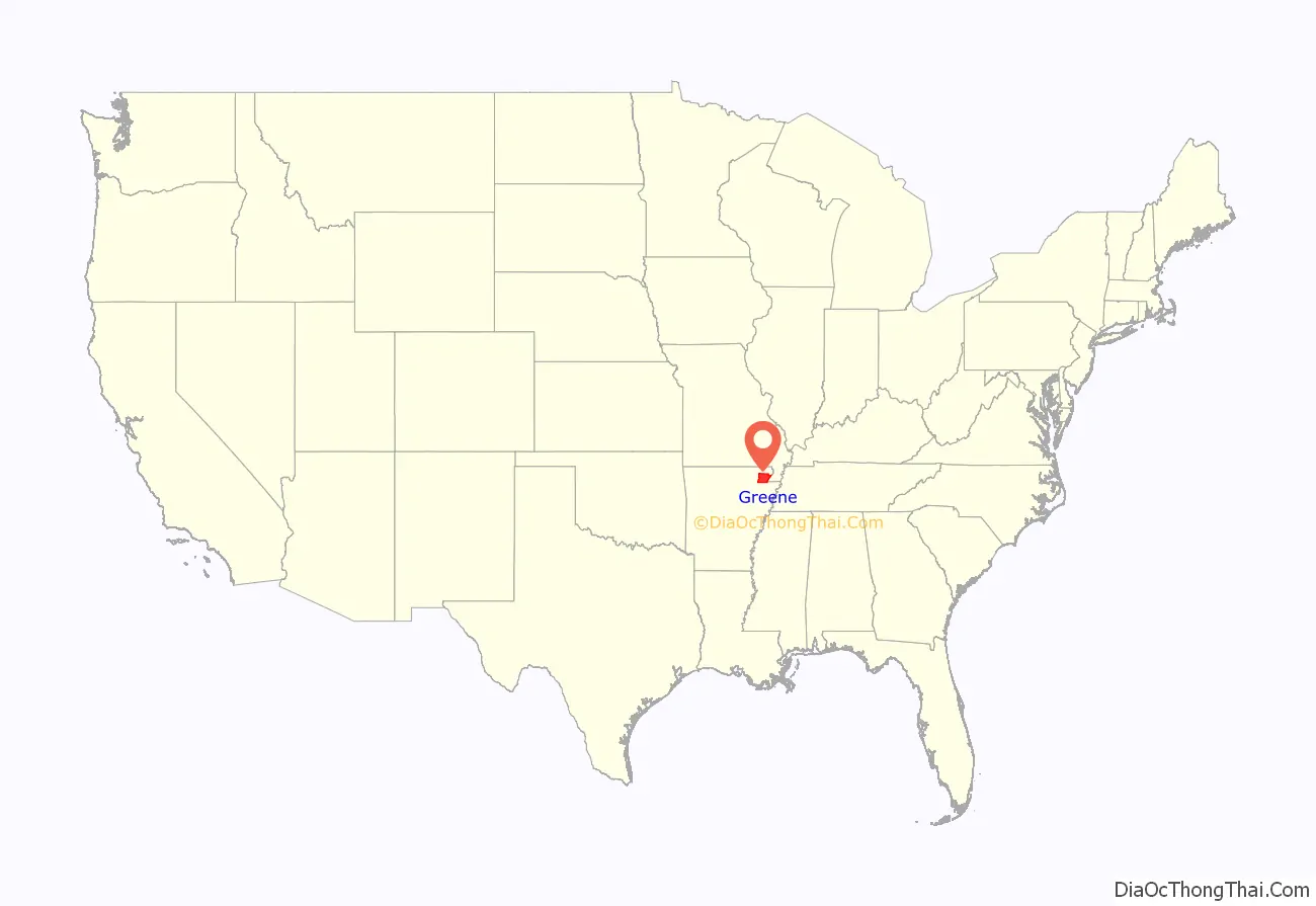
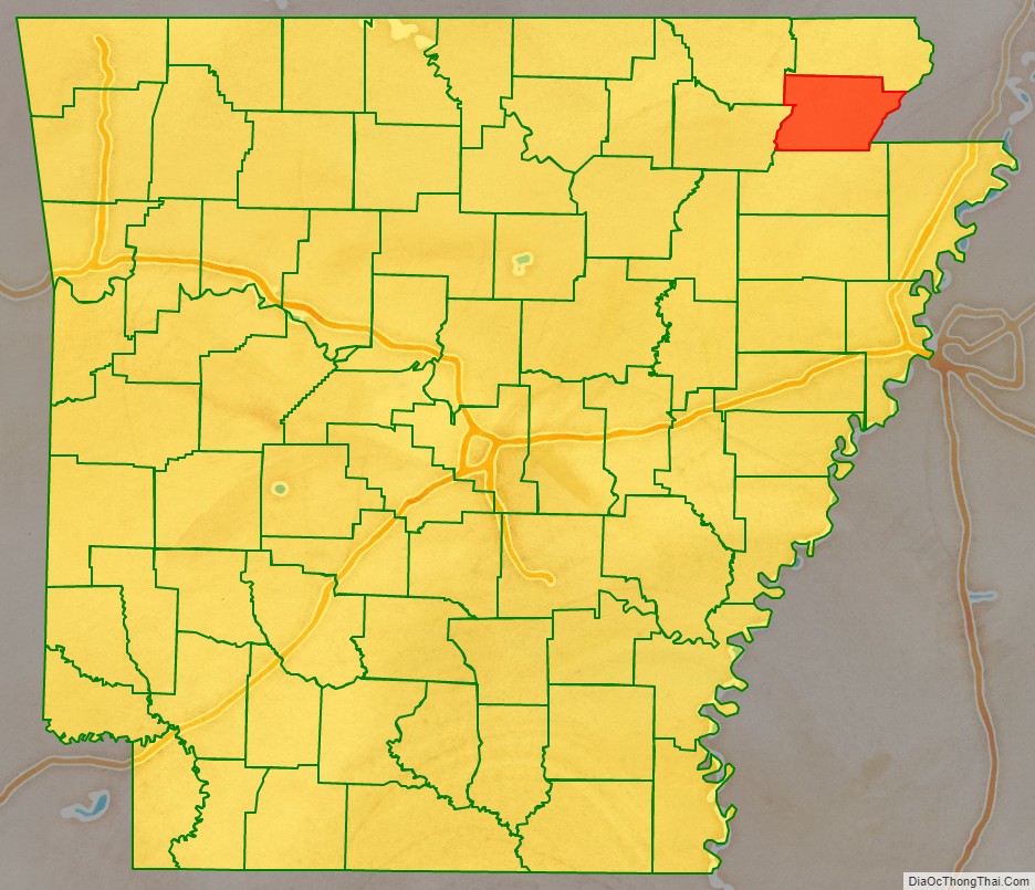
Greene County location map. Where is Greene County?
History
The first settler in the area was Benjamin Crowley, who arrived from Kentucky in 1821 and made his home about 12 miles (19 km) west of Paragould.
Greene County was formed on 5 November 1833 out of portions of Lawrence County and originally contained parts of present Clay and Craighead counties. The county was named for Revolutionary War hero Nathanael Greene. The first county seat was in Benjamin Crowley’s home. By 1836, when Arkansas became a state, the county seat was located in a settlement called “Paris” (not to be confused with present-day Paris, Arkansas).
In 1848 a national highway was made through the area, and the county seat was moved to Gainesville, which had a reputation as rather lawless. The seat remained there until 1883, when it was transferred to the new town of Paragould. The people in Gainesville opposed the move, and shots reportedly were fired, since tempers were high. The courthouse was built in 1888 and survives in downtown Paragould.
In the early 20th century, Clay, Greene, and Craighead counties had policies forbidding African Americans from living in the area.
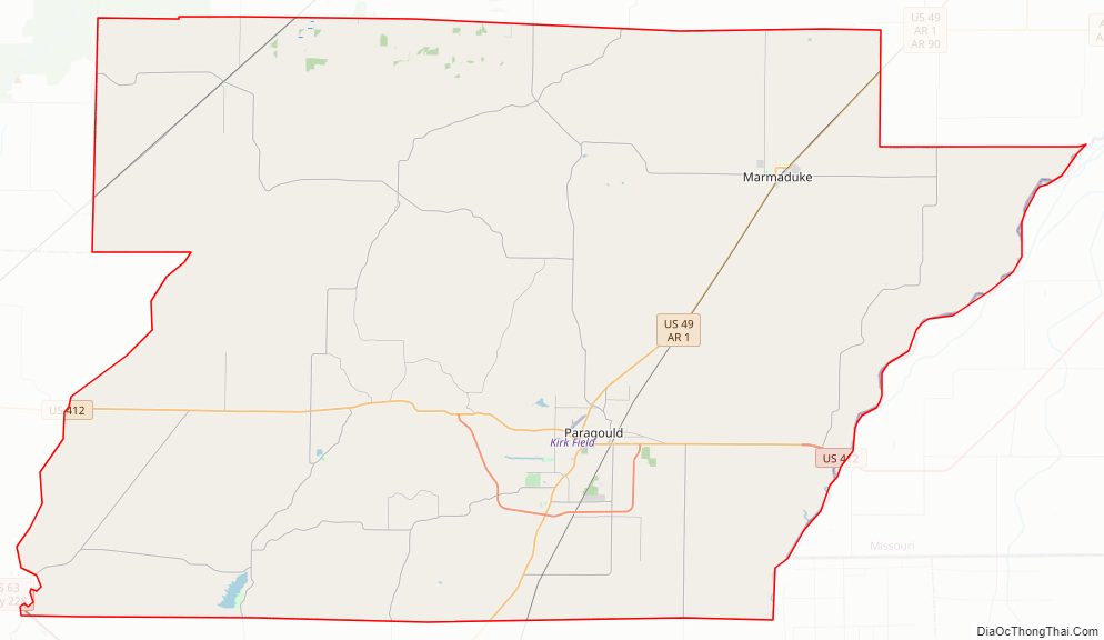
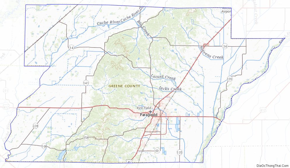
Greene County Road Map
Geography
According to the U.S. Census Bureau, the county has a total area of 580 square miles (1,500 km), of which 578 square miles (1,500 km) is land and 1.9 square miles (4.9 km) (0.3%) is water.
Major highways
- U.S. Highway 49
- U.S. Highway 49 Business
- U.S. Highway 49Y
- U.S. Highway 63
- U.S. Highway 412
- U.S. Highway 412 Business
- Highway 1
- Highway 34
- Highway 69
- Highway 90
- Highway 135
- Highway 139
- Highway 141
- Highway 168
- Highway 228
- Highway 351
- Highway 358
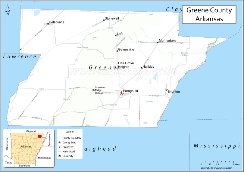
Adjacent counties
- Clay County (north)
- Dunklin County, Missouri (east)
- Craighead County (south)
- Lawrence County (southwest)
- Randolph County (northwest)
Greene County Topographic Map
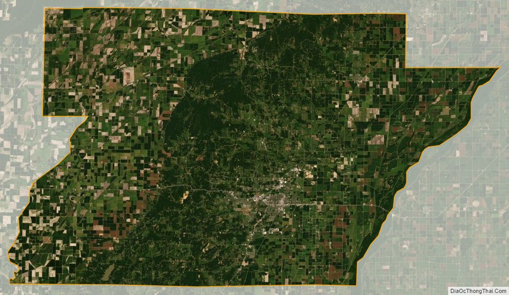
Greene County Satellite Map
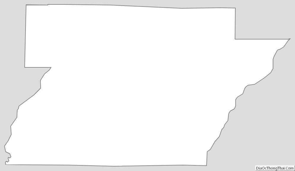
Greene County Outline Map
See also
Map of Arkansas State and its subdivision:- Arkansas
- Ashley
- Baxter
- Benton
- Boone
- Bradley
- Calhoun
- Carroll
- Chicot
- Clark
- Clay
- Cleburne
- Cleveland
- Columbia
- Conway
- Craighead
- Crawford
- Crittenden
- Cross
- Dallas
- Desha
- Drew
- Faulkner
- Franklin
- Fulton
- Garland
- Grant
- Greene
- Hempstead
- Hot Spring
- Howard
- Independence
- Izard
- Jackson
- Jefferson
- Johnson
- Lafayette
- Lawrence
- Lee
- Lincoln
- Little River
- Logan
- Lonoke
- Madison
- Marion
- Miller
- Mississippi
- Monroe
- Montgomery
- Nevada
- Newton
- Ouachita
- Perry
- Phillips
- Pike
- Poinsett
- Polk
- Pope
- Prairie
- Pulaski
- Randolph
- Saint Francis
- Saline
- Scott
- Searcy
- Sebastian
- Sevier
- Sharp
- Stone
- Union
- Van Buren
- Washington
- White
- Woodruff
- Yell
- Alabama
- Alaska
- Arizona
- Arkansas
- California
- Colorado
- Connecticut
- Delaware
- District of Columbia
- Florida
- Georgia
- Hawaii
- Idaho
- Illinois
- Indiana
- Iowa
- Kansas
- Kentucky
- Louisiana
- Maine
- Maryland
- Massachusetts
- Michigan
- Minnesota
- Mississippi
- Missouri
- Montana
- Nebraska
- Nevada
- New Hampshire
- New Jersey
- New Mexico
- New York
- North Carolina
- North Dakota
- Ohio
- Oklahoma
- Oregon
- Pennsylvania
- Rhode Island
- South Carolina
- South Dakota
- Tennessee
- Texas
- Utah
- Vermont
- Virginia
- Washington
- West Virginia
- Wisconsin
- Wyoming