Greene County is a county located on the eastern border of the U.S. state of Tennessee. As of the 2020 census, the population was 70,152. Its county seat is Greeneville. Greene County comprises the Greeneville, TN Micropolitan Statistical Area.
| Name: | Greene County |
|---|---|
| FIPS code: | 47-059 |
| State: | Tennessee |
| Founded: | 1783 |
| Named for: | Nathanael Greene |
| Seat: | Greeneville |
| Largest town: | Greeneville |
| Total Area: | 624 sq mi (1,620 km²) |
| Land Area: | 622 sq mi (1,610 km²) |
| Total Population: | 70,152 |
| Population Density: | 111/sq mi (43/km²) |
| Time zone: | UTC−5 (Eastern) |
| Summer Time Zone (DST): | UTC−4 (EDT) |
| Website: | greenecountytngov.com |
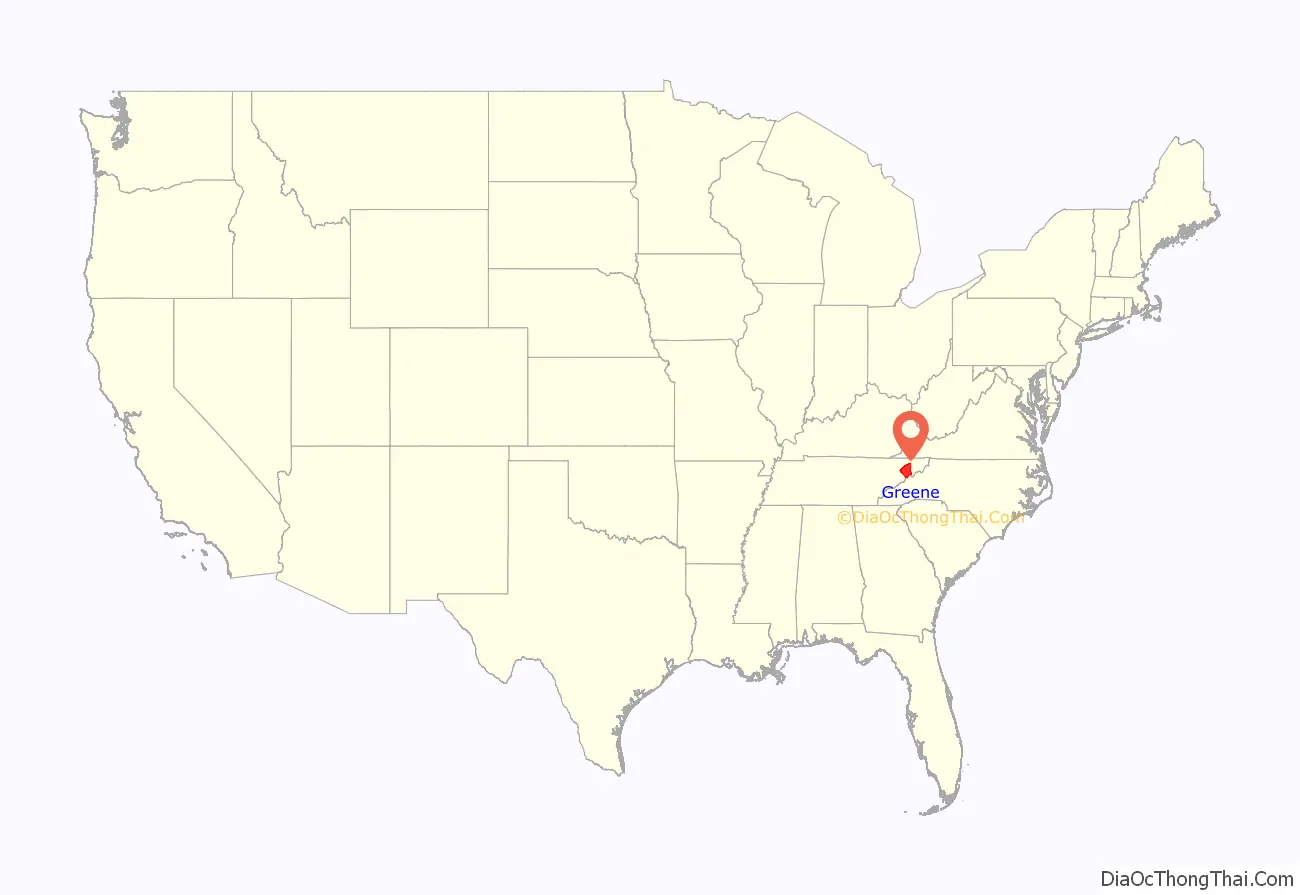
Greene County location map. Where is Greene County?
History
Greene County developed from the “Nolichucky settlement,” established by pioneer Jacob Brown on land leased in the early 1770s from the Cherokee people. The Nolichucky settlement was aligned with the Watauga settlement, centered in modern Elizabethton.
After the United States became independent, Greene County was formed in 1783 from the original Washington County, North Carolina, part of the former Washington District. The county is named for Major General Nathanael Greene (1742-1786), a major general in the Continental Army from Rhode Island. John Crockett, father of Davy Crockett, and his wife settled in the county near Limestone. Davy Crockett was born there in 1786. At the time, the area was part of the extra-legal state Franklin.
Greene County is the home of Tusculum College, the oldest college in Tennessee; the state’s oldest Methodist congregation (the Ebenezer Methodist Church, near Chuckey), and the state’s second oldest continuously cultivated farm (Elmwood Farm, part of the Earnest Farms Historic District). Revolutionary War veteran, and state legislator, Col. Joseph Hardin made Greene County his home for a period of time, serving as justice of the peace and as one of the original trustees of Tusculum (then Greeneville) College.
As with yeomen farmers in much of East Tennessee, those in Greene County were generally Unionist and opposed to secession on the eve of the Civil War. In Tennessee’s Ordinance of Secession referendum on June 8, 1861, Greene Countians voted against secession by a vote of 2,691 to 744. Following the vote (the call for secession was passed statewide), the second session of the East Tennessee Convention convened in Greeneville. It called for a separate, Union-aligned state to be formed in East Tennessee.
A railroad bridge near Mosheim was among those destroyed by the East Tennessee bridge-burning conspiracy in November 1861. Several of the conspirators who had taken part in the burning of this bridge were later captured and executed by Confederate supporters, including Jacob Hensie, Henry Fry, Jacob and Henry Harmon, and noted local potter Alex Haun.
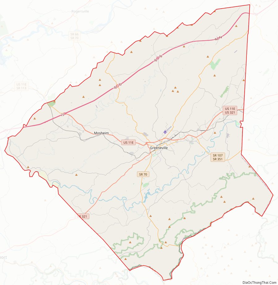
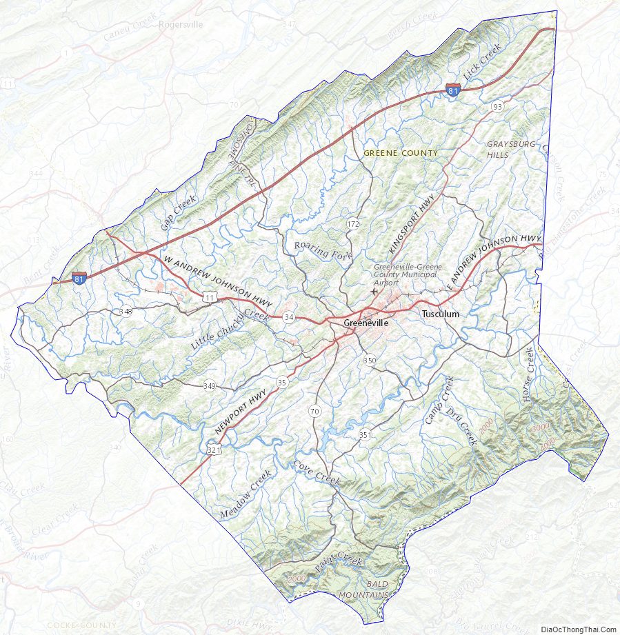
Greene County Road Map
Geography
According to the U.S. Census Bureau, the county has a total area of 624 square miles (1,620 km), of which 622 square miles (1,610 km) is land and 2.0 square miles (5.2 km) (0.3%) is water. Most of Greene County is located within the Ridge-and-Valley Appalachians, a range characterized by long, narrow ridges alternating with similarly shaped valleys. Bays Mountain, a prominent ridge in this range, forms much of Greene’s northern border with Hawkins County. The extreme southeastern part of Greene County is located within the Blue Ridge Mountains, specifically a subrange of the Blue Ridge known as the Bald Mountains. This range straddles Greene’s border with North Carolina, and includes the county’s two highest points: Gravel Knob, which rises to over 4,840 feet (1,480 m), and 4,844-foot (1,476 m) Camp Creek Bald (it’s uncertain which is higher due to lack of an exact measurement for Gravel Knob’s elevation).
Greene County is drained by the Nolichucky River, which traverses the southern half of the county. This river is impounded by Nolichucky Dam south of Greeneville, creating Davy Crockett Lake.
Major highways
- I-81
- US 11E
- US 11E Bus.
- US 321
- SR 70
- SR 93
- SR 107
- SR 172
- SR 340
- SR 348
- SR 349
- SR 350
- SR 351
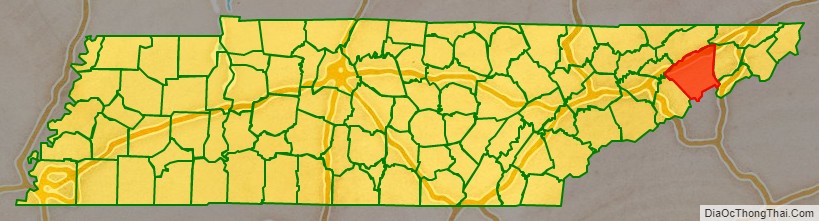
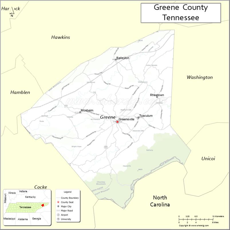
Adjacent counties
- Hawkins County (north)
- Washington County (east)
- Unicoi County (southeast)
- Madison County, North Carolina (south)
- Cocke County (southwest)
- Hamblen County (west)
National protected areas
- Andrew Johnson National Cemetery
- Andrew Johnson National Historic Site
- Appalachian Trail (part)
- Cherokee National Forest (part)
State protected areas
- Bible Covered Bridge State Historic Site
- Joachim Bible Refuge
- David Crockett Birthplace State Park (part)
- Lick Creek Bottoms Wildlife Management Area
- Nolichucky Wildlife Management Area
- Rocky Fork State Park (part)
Other historic sites
- Earnest Farms Historic District
- Greeneville Historic District
- Maden Hall Farm
Greene County Topographic Map
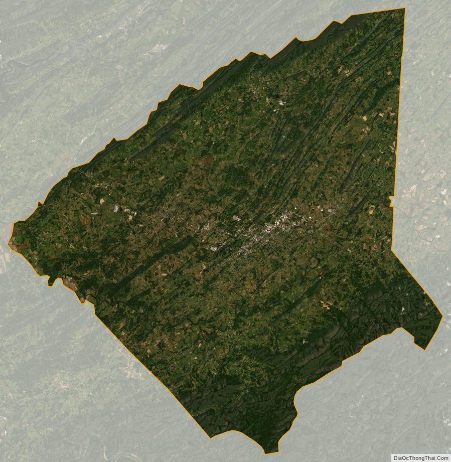
Greene County Satellite Map
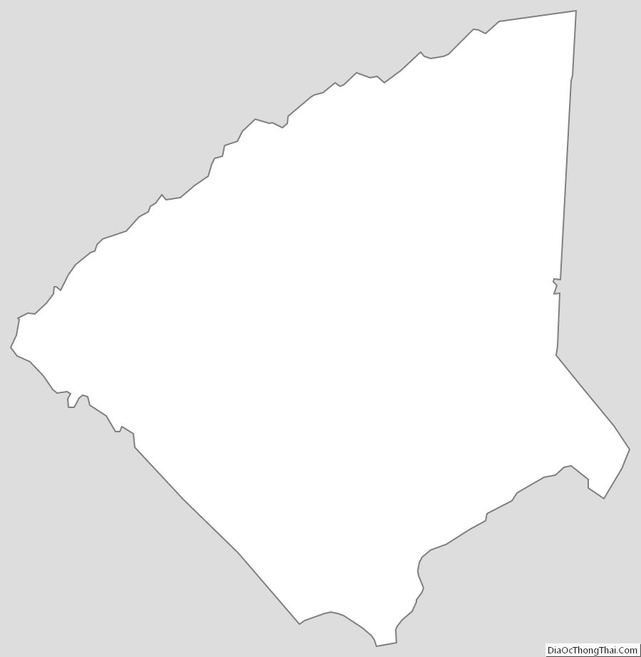
Greene County Outline Map
See also
Map of Tennessee State and its subdivision:- Anderson
- Bedford
- Benton
- Bledsoe
- Blount
- Bradley
- Campbell
- Cannon
- Carroll
- Carter
- Cheatham
- Chester
- Claiborne
- Clay
- Cocke
- Coffee
- Crockett
- Cumberland
- Davidson
- Decatur
- DeKalb
- Dickson
- Dyer
- Fayette
- Fentress
- Franklin
- Gibson
- Giles
- Grainger
- Greene
- Grundy
- Hamblen
- Hamilton
- Hancock
- Hardeman
- Hardin
- Hawkins
- Haywood
- Henderson
- Henry
- Hickman
- Houston
- Humphreys
- Jackson
- Jefferson
- Johnson
- Knox
- Lake
- Lauderdale
- Lawrence
- Lewis
- Lincoln
- Loudon
- Macon
- Madison
- Marion
- Marshall
- Maury
- McMinn
- McNairy
- Meigs
- Monroe
- Montgomery
- Moore
- Morgan
- Obion
- Overton
- Perry
- Pickett
- Polk
- Putnam
- Rhea
- Roane
- Robertson
- Rutherford
- Scott
- Sequatchie
- Sevier
- Shelby
- Smith
- Stewart
- Sullivan
- Sumner
- Tipton
- Trousdale
- Unicoi
- Union
- Van Buren
- Warren
- Washington
- Wayne
- Weakley
- White
- Williamson
- Wilson
- Alabama
- Alaska
- Arizona
- Arkansas
- California
- Colorado
- Connecticut
- Delaware
- District of Columbia
- Florida
- Georgia
- Hawaii
- Idaho
- Illinois
- Indiana
- Iowa
- Kansas
- Kentucky
- Louisiana
- Maine
- Maryland
- Massachusetts
- Michigan
- Minnesota
- Mississippi
- Missouri
- Montana
- Nebraska
- Nevada
- New Hampshire
- New Jersey
- New Mexico
- New York
- North Carolina
- North Dakota
- Ohio
- Oklahoma
- Oregon
- Pennsylvania
- Rhode Island
- South Carolina
- South Dakota
- Tennessee
- Texas
- Utah
- Vermont
- Virginia
- Washington
- West Virginia
- Wisconsin
- Wyoming