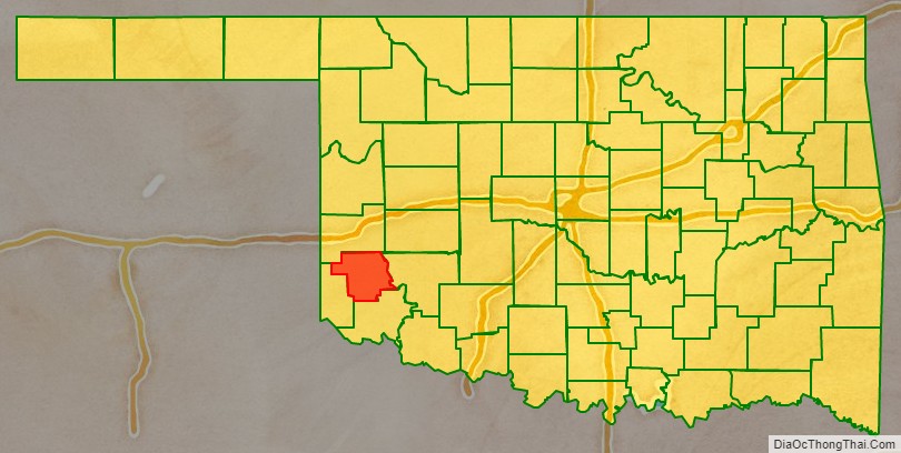
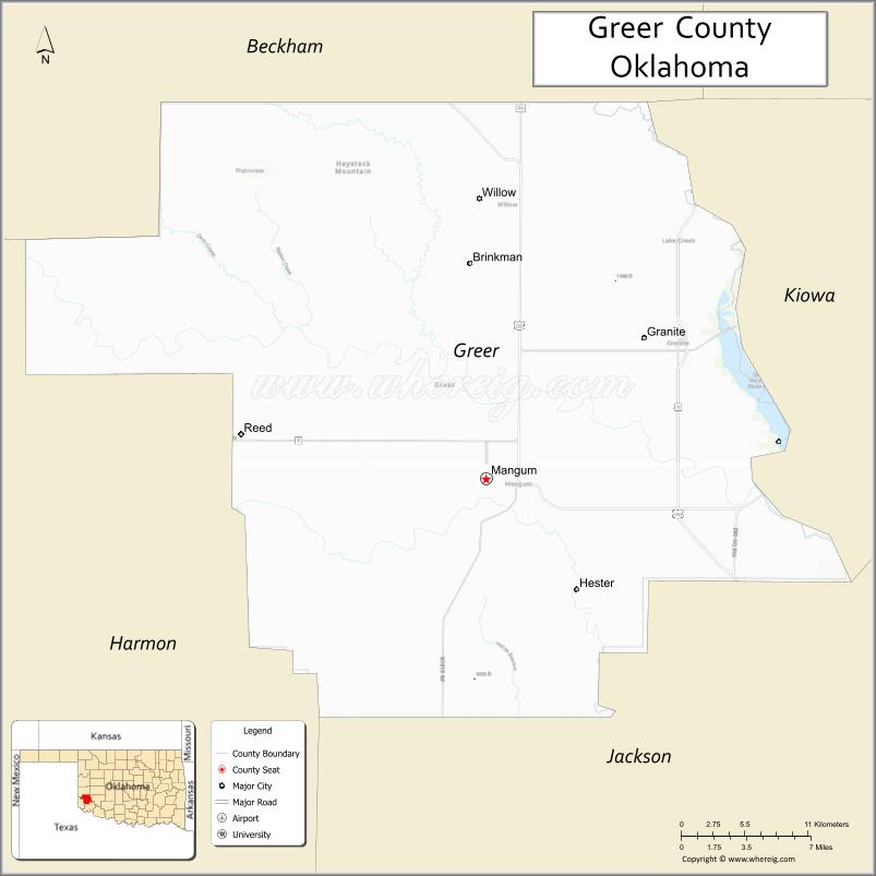
Greer County is a county located along the southwest border of the U.S. state of Oklahoma. As of the 2010 census, the population was 6,239. Its county seat is Mangum. From 1860 to 1896, the state of Texas claimed an area known as Greer County, Texas, which included present-day Greer County along with neighboring areas. In 1896 it was designated as a county in Oklahoma Territory under a ruling by the US Supreme Court. The rural Greer County is home to Quartz Mountain State Park, near the community of Lone Wolf, Oklahoma. It is also home to the Oklahoma State Reformatory, located in Granite. Its population has declined since 1930 due to changes in agriculture and migration to cities for work.
| Name: | Greer County |
|---|---|
| FIPS code: | 40-055 |
| State: | Oklahoma |
| Founded: | 1896 |
| Seat: | Mangum |
| Largest city: | Mangum |
| Total Area: | 644 sq mi (1,670 km²) |
| Land Area: | 639 sq mi (1,660 km²) |
| Total Population: | 6,239 |
| Population Density: | 9.8/sq mi (3.8/km²) |
| Time zone: | UTC−6 (Central) |
| Summer Time Zone (DST): | UTC−5 (CDT) |
| Website: | greer.okcounties.org |
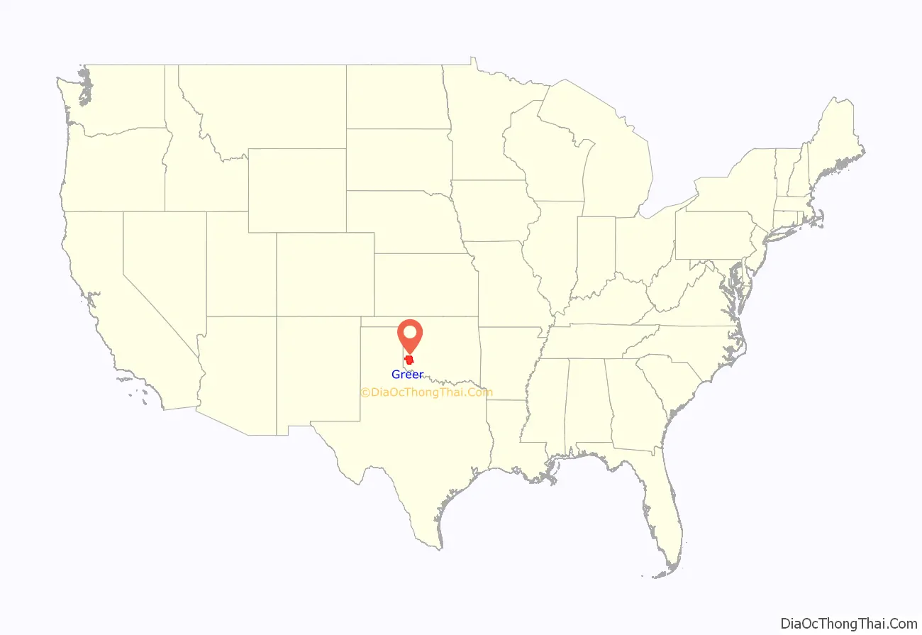
Greer County location map. Where is Greer County?
History
After a dispute over the 1819 Adams-Onís Treaty and the related 1828 Treaty of Limits, the governments of both the United States and the state of Texas claimed ownership of some 1.5 million acres (6,000 km) in what was then operated as Greer County, Texas. The county was named for former Texas lieutenant governor, John A. Greer. Litigation followed, and in the case of United States v. State of Texas 162 U.S. 1 (1896), with a ruling issued on March 16, the Supreme Court, having original jurisdiction over the case, decided in favor of the United States.
The county was assigned to the Oklahoma Territory on May 4, 1896. When Oklahoma was admitted as a state, Greer County was established according to its current boundaries; the remaining former county area was organized as Harmon, Jackson, and part of Beckham counties. The town of Mangum, designated as the county seat in 1886 when this was part of Texas, continued as the seat of Greer County, Oklahoma. From its establishment until at least 1903, Greer County was a sundown county, prohibiting African Americans from living in the county.
Originally developed for agriculture, the rural county had its peak of population in 1930. Mechanization of agriculture reduced the need for farm labor, and the population has declined as people migrated to cities for work.
Among the county attractions is Quartz Mountain State Park (known from 2002 to 2020 as Quartz Mountain Nature Park), near the community of Lone Wolf.
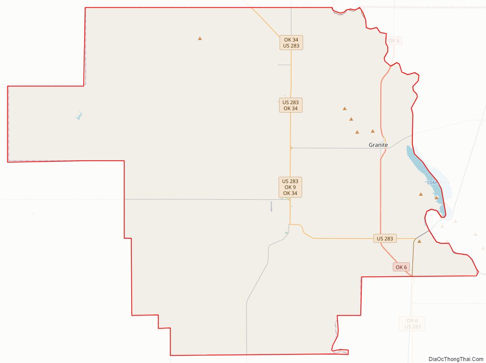
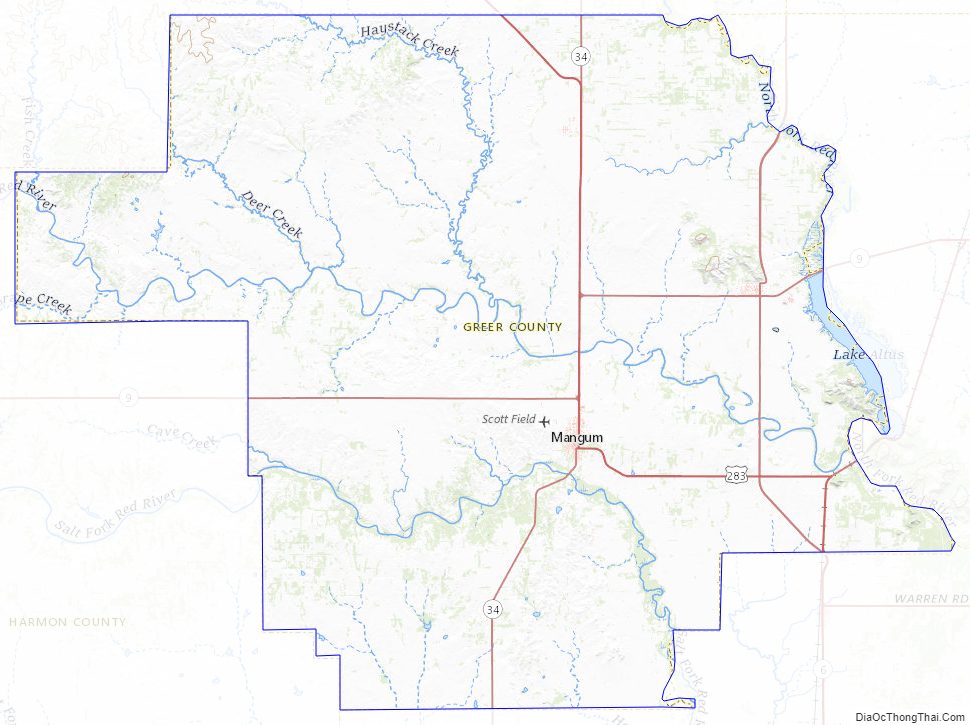
Greer County Road Map
Geography
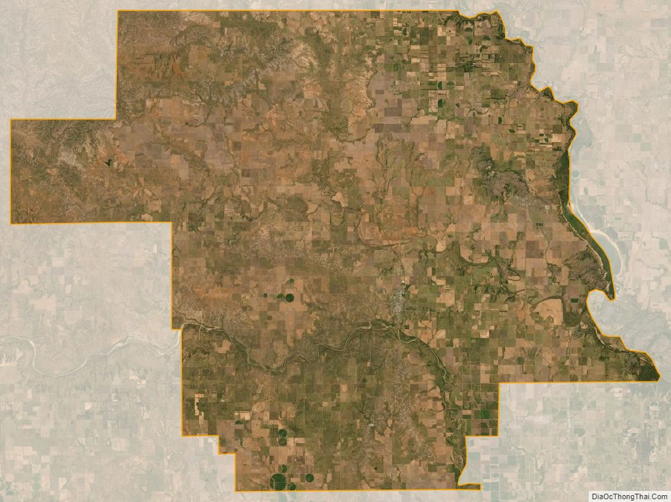
According to the U.S. Census Bureau, the county has a total area of 644 square miles (1,670 km), of which 639 square miles (1,660 km) is land and 4.3 square miles (11 km) (0.7%) is water.
Western Greer County lies in the Gypsum Hills, while the eastern one-third is in the Red Bed Plains physiographic region. The county is drained by the North Fork Red River, Elm Fork Red River, and Salt Fork Red River.
Major highways
- U.S. Highway 283
- State Highway 6
- State Highway 9
- State Highway 34
Adjacent counties
- Beckham County (north)
- Kiowa County (east)
- Jackson County (south)
- Harmon County (west)
Greer County Topographic Map
Greer County Satellite Map
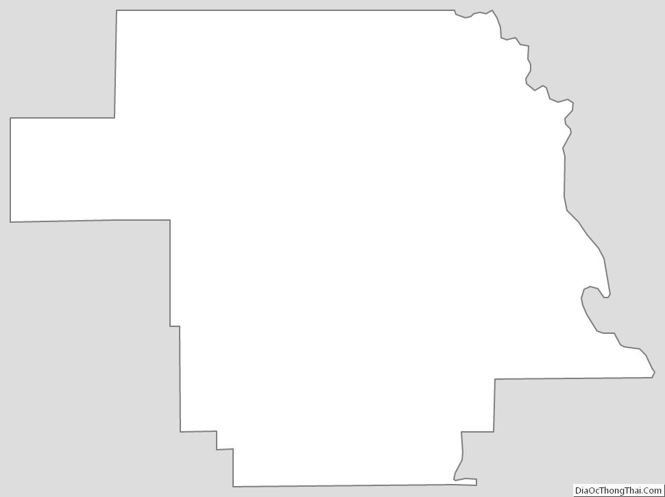
Greer County Outline Map
See also
Map of Oklahoma State and its subdivision:- Adair
- Alfalfa
- Atoka
- Beaver
- Beckham
- Blaine
- Bryan
- Caddo
- Canadian
- Carter
- Cherokee
- Choctaw
- Cimarron
- Cleveland
- Coal
- Comanche
- Cotton
- Craig
- Creek
- Custer
- Delaware
- Dewey
- Ellis
- Garfield
- Garvin
- Grady
- Grant
- Greer
- Harmon
- Harper
- Haskell
- Hughes
- Jackson
- Jefferson
- Johnston
- Kay
- Kingfisher
- Kiowa
- Latimer
- Le Flore
- Lincoln
- Logan
- Love
- Major
- Marshall
- Mayes
- McClain
- McCurtain
- McIntosh
- Murray
- Muskogee
- Noble
- Nowata
- Okfuskee
- Oklahoma
- Okmulgee
- Osage
- Ottawa
- Pawnee
- Payne
- Pittsburg
- Pontotoc
- Pottawatomie
- Pushmataha
- Roger Mills
- Rogers
- Seminole
- Sequoyah
- Stephens
- Texas
- Tillman
- Tulsa
- Wagoner
- Washington
- Washita
- Woods
- Woodward
- Alabama
- Alaska
- Arizona
- Arkansas
- California
- Colorado
- Connecticut
- Delaware
- District of Columbia
- Florida
- Georgia
- Hawaii
- Idaho
- Illinois
- Indiana
- Iowa
- Kansas
- Kentucky
- Louisiana
- Maine
- Maryland
- Massachusetts
- Michigan
- Minnesota
- Mississippi
- Missouri
- Montana
- Nebraska
- Nevada
- New Hampshire
- New Jersey
- New Mexico
- New York
- North Carolina
- North Dakota
- Ohio
- Oklahoma
- Oregon
- Pennsylvania
- Rhode Island
- South Carolina
- South Dakota
- Tennessee
- Texas
- Utah
- Vermont
- Virginia
- Washington
- West Virginia
- Wisconsin
- Wyoming