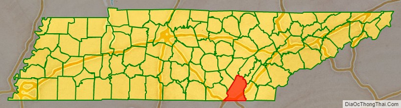
Hamilton County is a county located in the U.S. state of Tennessee. It is located in the southern part of East Tennessee on the border with Georgia. As of the 2020 census, the population was 366,207, making it the fourth-most populous county in Tennessee. Its county seat is Chattanooga, located along the Tennessee River. The county was named for Alexander Hamilton, the first Secretary of the Treasury.
Hamilton County is one of 95 counties within Tennessee. Hamilton County is part of the Chattanooga, TN-GA Metropolitan Statistical Area. The county was created on October 25, 1819. Hamilton County expanded to meet the state line with Georgia after absorbing parts of three different counties including Bledsoe, Marion, and Rhea. Part of the traditional Cherokee homeland, the county was created after the Cherokee signed a treaty in 1817 with the United States and ceded land north of the Hiwassee River. In the 21st century, Hamilton County is the eighth-highest income Tennessee location by per capita income ($26,588).
| Name: | Hamilton County |
|---|---|
| FIPS code: | 47-065 |
| State: | Tennessee |
| Founded: | October 25, 1819 |
| Named for: | Alexander Hamilton |
| Seat: | Chattanooga |
| Largest city: | Chattanooga |
| Total Area: | 576 sq mi (1,490 km²) |
| Land Area: | 542 sq mi (1,400 km²) |
| Total Population: | 366,207 |
| Population Density: | 620/sq mi (240/km²) |
| Time zone: | UTC−5 (Eastern) |
| Summer Time Zone (DST): | UTC−4 (EDT) |
| Website: | www.hamiltontn.gov |
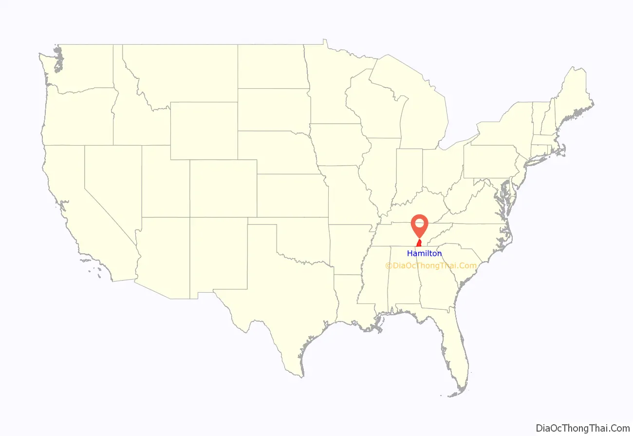
Hamilton County location map. Where is Hamilton County?
History
For thousands of years, indigenous cultures occupied this region, especially along the rivers and creeks. The area was long occupied by the historic Cherokee Nation. In the early 19th century, it was being led by John Ross. The city that is now known as Chattanooga developed at Ross’s Landing, a busy trading post recognized as the center of the Cherokee Nation. Over a series of treaties with the United States between 1819 and 1835, the Cherokee had been mostly moved out of the area.
If any Cherokee wished to stay in the area, the head of the family would have to leave the tribe and become an American citizen. Once a citizen, they would be entitled to 640 acres (260 ha) of land. At the time of death, the person’s heirs would be entitled to the land. Of the 107 reservations reported to Congress in 1819, only 39 were listed as fee simple. The other 68 reservations were allowed to continue as long as the family stayed on the land. Once the family moved, the land could be sold. This provision made it easier to remove the Cherokee from the area. The 1835 Treaty of New Echota provided the US government a legal basis for the forced removal of the Cherokee, opening their former lands for settlement. Some Cherokee leaders had agreed to this, in the belief that removal was inevitable and they could negotiate decent conditions for their people. The majority of the Cherokee opposed removal.
Hamilton County was formed on October 25, 1819 from portions of Rhea County and Cherokee land that was ceded to the US. It was named after Alexander Hamilton, an officer in the American Revolutionary War, member of the Continental Congress, the first US Secretary of Treasury, and one of the Founding Father of the United States.
At the time of the 1820 census, the County counted 821 residents, including 16 blacks, 39 slaves, and about 100 Cherokee living on six reservations. The original legislature ruled that John Gamble, William Lauderdale, and John Patterson, the three men who were responsible for founding the County, would conduct all county business in the county seat. The original county seat was in the home of Hasten Poe, who owned a popular tavern located near those three men’s farms. In 1822 the County Court was moved to the farm of Ashael Rawlings in Dallas, Tennessee; he was the newly appointed County Clerk. After the county seat was moved to Harrison, the Dallas settlement declined. The county seat was finally moved to Chattanooga in 1835.
During the Civil War, Hamilton County was the site of an important saltpeter mine. This material is the main ingredient of gunpowder and was obtained by leaching the earth from caves. Lookout Mountain Cave was a major source of saltpeter during the Civil War. The mine was operated by Robert Cravens, who owned the surrounding property. In May 1861, Cravens contracted with the Tennessee Military and Financial Board to deliver 20,000 pounds (9,100 kg) of saltpeter. On May 24, he reported that he had ten hoppers already set up in his cave. Cravens was also mining Nickajack Cave in nearby Marion County. In 1862 he quit mining at Lookout Mountain Cave and rented the cave to the Confederate Nitre and Mining Bureau, which mined the cave from June 1862 through July 1863. This mining ceased when Chattanooga was occupied by Federal forces in 1863. They stayed through the end of the war.
After the war, Tennessee rejoined the Union, and the state started to recover from the war. The long occupation had caused a breakdown in civil society. James County was established by the Tennessee General Assembly in January 1871 and was named after Reverend Jesse J. James. In early 1919 James County went bankrupt; it became a part of Hamilton County in April.
As of the 2017 census, Hamilton County is the fourth-most populated county in the state, with a population of 361,613. The growth rate is 1% per year over the last five years. Hamilton County has census records dating to the 1830s. The average income of Hamilton County is $26,560.
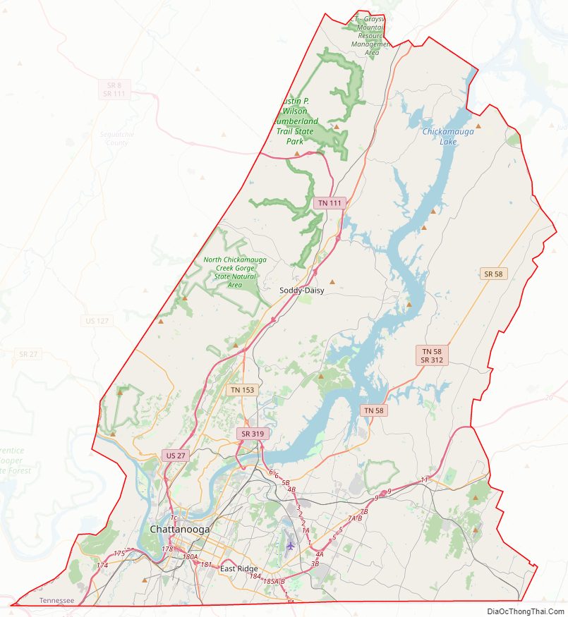
Hamilton County Road Map
Geography
According to the U.S. Census Bureau, the county has a total area of 576 square miles (1,490 km), of which 542 square miles (1,400 km) is land and 33 square miles (85 km) (5.8%) is water. Hamilton County is one of the few counties in the United States to border 10 other counties.
Natural areas of interest
Raccoon Mountain Caverns is a show cave located 8 miles northwest of downtown Chattanooga. It was originally explored in 1929 by Leo Lambert who developed trails and installed lights and opened the cave to the public on June 28, 1931. The cave was opened under the name Tennessee Caverns. The operators of the cave claim that its explored length is over 5.5 miles (8.9 km).
The Crystal Caverns Cave Spider, Nesticus furtivus, is only known from this one cave. Cave guides will occasionally spot one of these rare spiders and point it out to tourists.
Ruby Falls Cave is a show cave located on the side of Lookout Mountain south of downtown Chattanooga. It was discovered by accident on December 28, 1928 when it was intersected by an elevator shaft that was being drilled to develop Lookout Mountain Cave as a commercial cave. Ruby Falls Cave was intersected at a depth of 260 feet from the surface and Lookout Mountain Cave was reached later at a depth of 420 feet below the surface. The entire project was the work of cave developer Leo Lambert. He named the new cave’s waterfall after his wife Ruby. The lower cave, Lookout Mountain Cave, opened to the public on December 30, 1929. Ruby Falls opened to the public on June 16, 1930. Ruby Falls Cave, with its spectacular waterfall proved the more popular of the two caves and it is the only cave open to the public at the present time.
Areas such as Lookout Mountain including the famous Point Park, and Sunset Rock. Point Park is a national military park that is a tribute to the battle of Lookout mountain that took place during the American Civil War. Lookout Mountain was the area in which the last battle of the Cherokee Indians took place. It also as battlegrounds during the American Civil War and served as a base for General Ulysses S. Grant troops during the American Civil War. There are many other important areas to note on Lookout Mountain.
Adjacent counties
- Bledsoe County, Tennessee – north/CST Border
- Rhea County, Tennessee – northeast
- Meigs County, Tennessee – northeast
- Bradley County, Tennessee – east
- Whitfield County, Georgia – southeast
- Catoosa County, Georgia – south
- Walker County, Georgia – south
- Dade County, Georgia – southwest
- Marion County, Tennessee – west/CST Border
- Sequatchie County, Tennessee – northwest/CST Border
National protected area
- Chickamauga and Chattanooga National Military Park (part)
State protected areas
- Booker T. Washington State Park
- Chickamauga Wildlife Management Area (part)
- Cumberland Trail (part)
- Falling Water Falls State Natural Area
- Harrison Bay State Park
- North Chickamauga Creek State Natural Area (part)
Major highways
- I-24
- I-75
- I-124
- US 11
- US 27
- US 41
- US 64
- US 72
- US 74
- US 76
- US 127
- SR 2
- SR 8
- SR 17
- SR 27
- SR 58
- SR 60
- SR 111
- SR 153
- SR 312
- SR 317
- SR 318
- SR 319
- SR 320
- SR 321
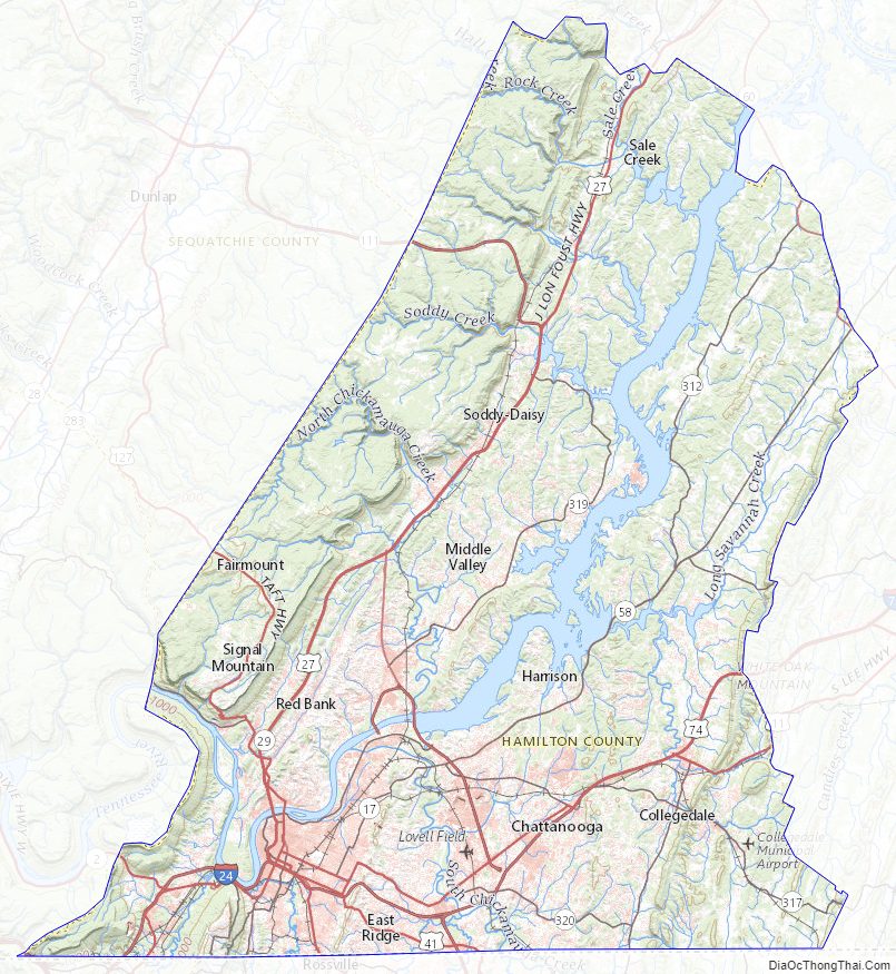
Hamilton County Topographic Map
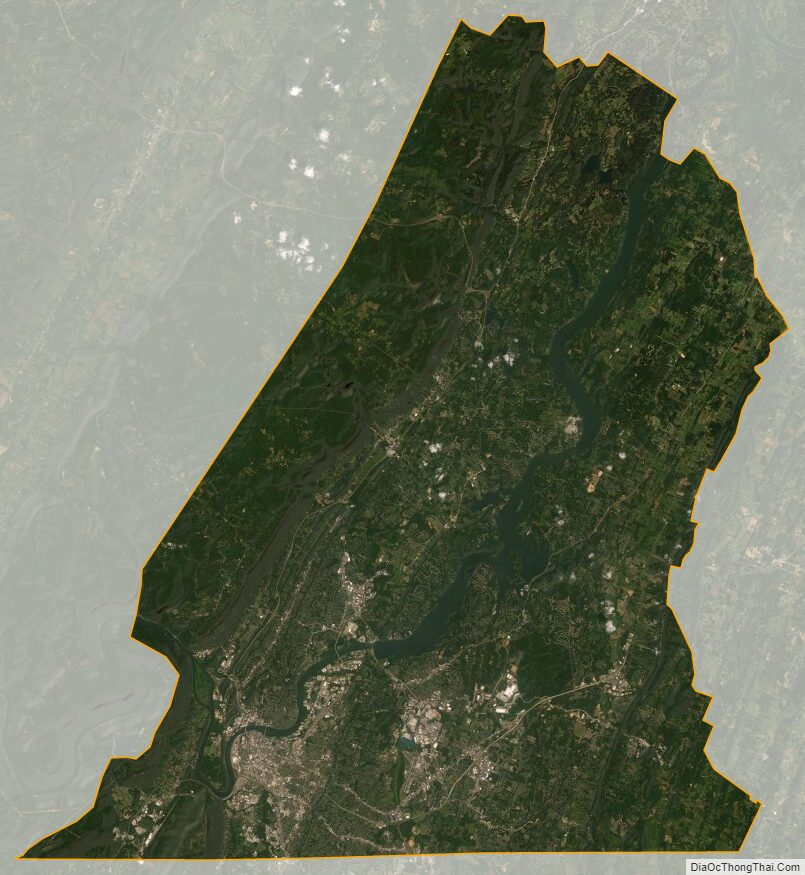
Hamilton County Satellite Map
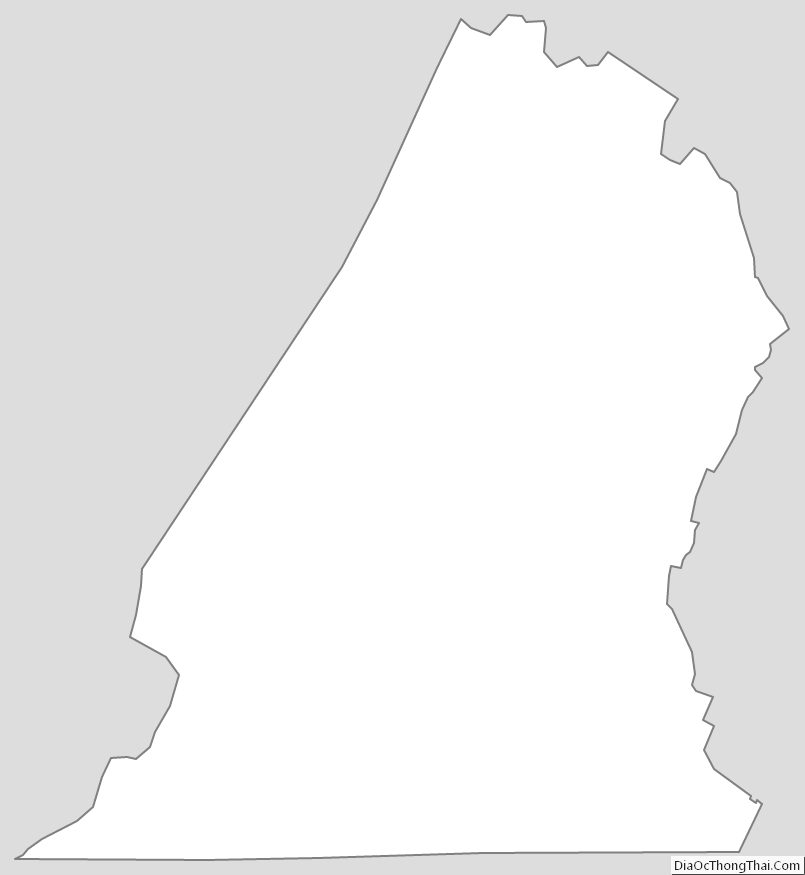
Hamilton County Outline Map
See also
Map of Tennessee State and its subdivision:- Anderson
- Bedford
- Benton
- Bledsoe
- Blount
- Bradley
- Campbell
- Cannon
- Carroll
- Carter
- Cheatham
- Chester
- Claiborne
- Clay
- Cocke
- Coffee
- Crockett
- Cumberland
- Davidson
- Decatur
- DeKalb
- Dickson
- Dyer
- Fayette
- Fentress
- Franklin
- Gibson
- Giles
- Grainger
- Greene
- Grundy
- Hamblen
- Hamilton
- Hancock
- Hardeman
- Hardin
- Hawkins
- Haywood
- Henderson
- Henry
- Hickman
- Houston
- Humphreys
- Jackson
- Jefferson
- Johnson
- Knox
- Lake
- Lauderdale
- Lawrence
- Lewis
- Lincoln
- Loudon
- Macon
- Madison
- Marion
- Marshall
- Maury
- McMinn
- McNairy
- Meigs
- Monroe
- Montgomery
- Moore
- Morgan
- Obion
- Overton
- Perry
- Pickett
- Polk
- Putnam
- Rhea
- Roane
- Robertson
- Rutherford
- Scott
- Sequatchie
- Sevier
- Shelby
- Smith
- Stewart
- Sullivan
- Sumner
- Tipton
- Trousdale
- Unicoi
- Union
- Van Buren
- Warren
- Washington
- Wayne
- Weakley
- White
- Williamson
- Wilson
- Alabama
- Alaska
- Arizona
- Arkansas
- California
- Colorado
- Connecticut
- Delaware
- District of Columbia
- Florida
- Georgia
- Hawaii
- Idaho
- Illinois
- Indiana
- Iowa
- Kansas
- Kentucky
- Louisiana
- Maine
- Maryland
- Massachusetts
- Michigan
- Minnesota
- Mississippi
- Missouri
- Montana
- Nebraska
- Nevada
- New Hampshire
- New Jersey
- New Mexico
- New York
- North Carolina
- North Dakota
- Ohio
- Oklahoma
- Oregon
- Pennsylvania
- Rhode Island
- South Carolina
- South Dakota
- Tennessee
- Texas
- Utah
- Vermont
- Virginia
- Washington
- West Virginia
- Wisconsin
- Wyoming