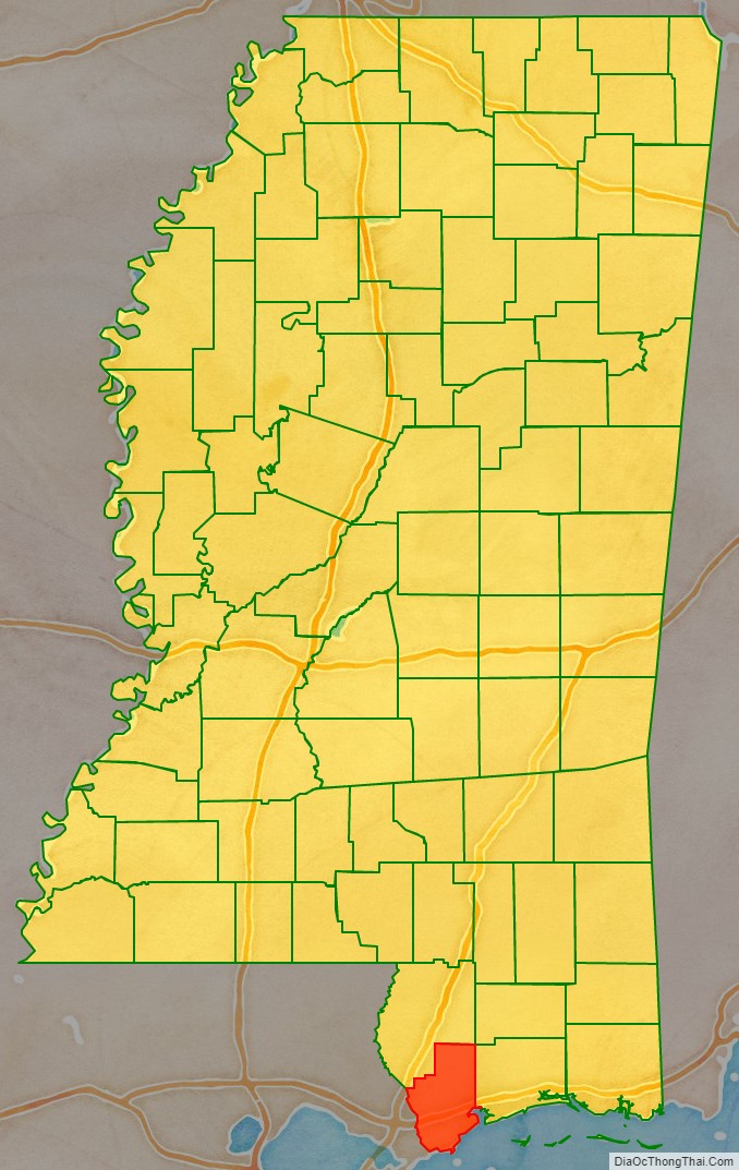
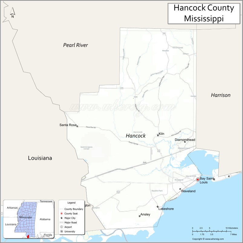
Hancock County is the southernmost county of the U.S. state of Mississippi and is named for Founding Father John Hancock. As of the 2020 census, the population was 46,053. Its county seat is Bay St. Louis.
Hancock County is part of the Gulfport–Biloxi, MS Metropolitan Statistical Area. It is situated along the Gulf of Mexico and the state line with Louisiana. The area is home to the John C. Stennis Space Center, NASA’s largest rocket engine test facility.
The county was severely damaged from Hurricane Katrina on August 29, 2005, which caused a huge storm surge and catastrophic damage.
| Name: | Hancock County |
|---|---|
| FIPS code: | 28-045 |
| State: | Mississippi |
| Founded: | 1812 |
| Named for: | John Hancock |
| Seat: | Bay St. Louis |
| Largest city: | Bay St. Louis |
| Total Area: | 553 sq mi (1,430 km²) |
| Land Area: | 474 sq mi (1,230 km²) |
| Total Population: | 46,053 |
| Population Density: | 83/sq mi (32/km²) |
| Time zone: | UTC−6 (Central) |
| Summer Time Zone (DST): | UTC−5 (CDT) |
| Website: | hancockcounty.ms.gov |
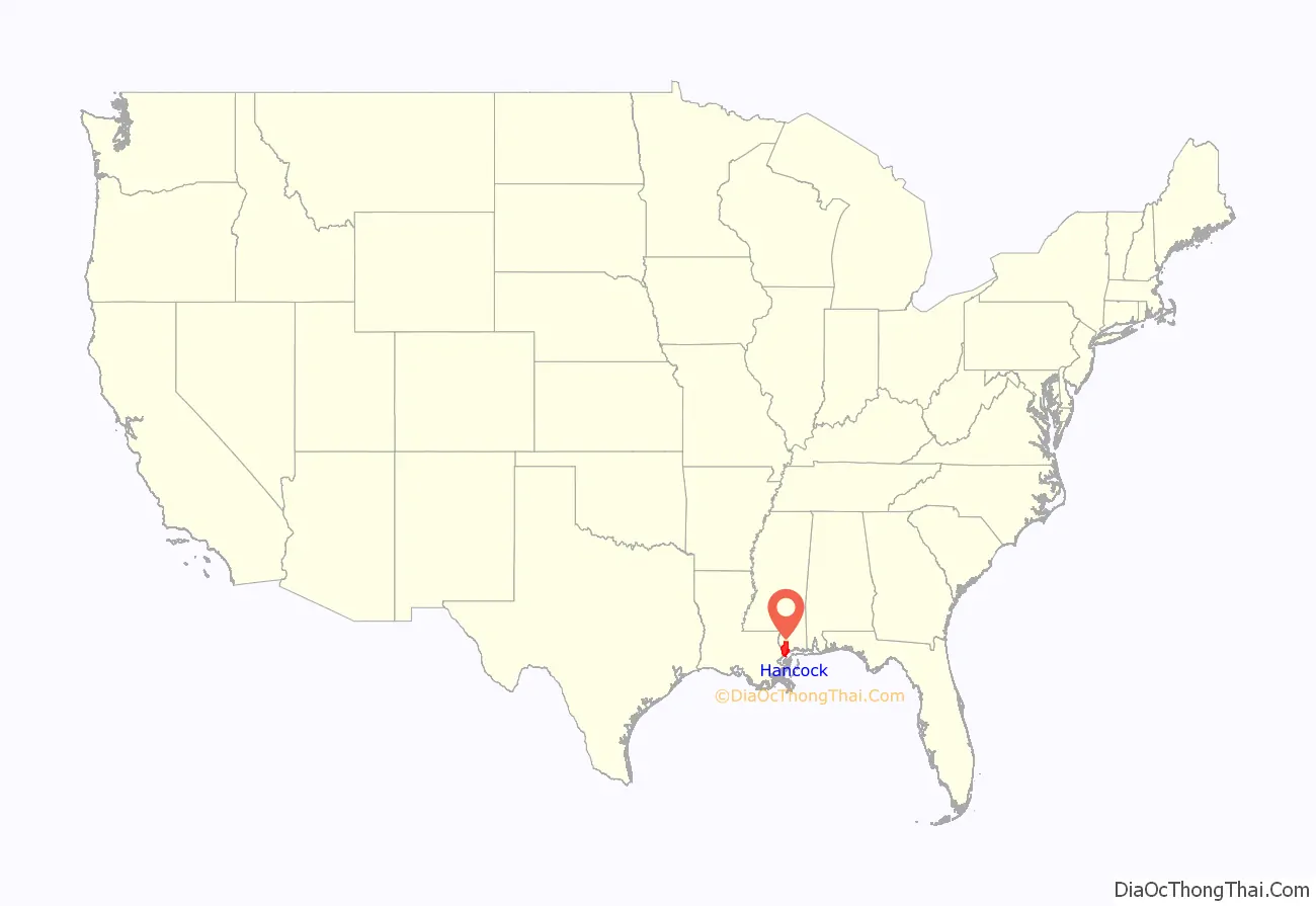
Hancock County location map. Where is Hancock County?
History
This area of Mississippi was inhabited by indigenous peoples at the time of European colonization; the French were the first settlers and traders in the area. They imported African slaves as laborers, and in time a Creole class of free people of color developed.
After the United States conducted Indian Removal in the 1830s, more Protestant Americans migrated into this area, but it retained French and African Catholic influences. Located on the Gulf Coast, the county was regularly hit by hurricanes but its residents learned to handle these incidents.
In 2005, the county was the scene of the final landfall of the eye of Hurricane Katrina, and its communities and infrastructure suffered some of the most intense damage inflicted by that storm. Over the entire 7-mile (11 km) beach front, not one building or home was left intact. Nearly the entire first block off the beach was destroyed for the entire 7-mile (11 km) stretch.
Homes as far inland as 10 miles (16 km) were flooded by the historic storm surge, which occurred during a full moon high tide. All rivers and waterways were inundated by the surge. Highway 603 south from Interstate 10 was completely submerged, and the Highway 90 – Bay St. Louis Bridge was left looking like a stack of dominoes.
Houses were floated off their foundations. In Waveland and Bay St. Louis, some homes were stranded atop the railroad tracks and others in the middle of streets. Towns like Pearlington, Waveland, Bay St. Louis, Diamondhead, and Kiln suffered catastrophic damage.
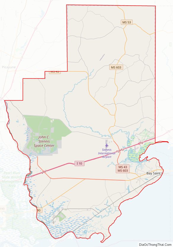
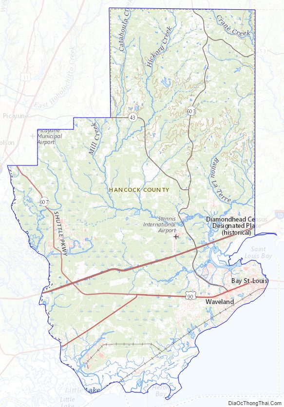
Hancock County Road Map
Geography
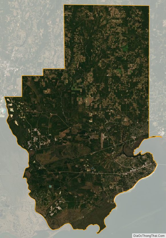
According to the U.S. Census Bureau, the county has a total area of 553 square miles (1,430 km), of which 474 square miles (1,230 km) is land and 79 square miles (200 km) (14%) is water.
Major highways
- Interstate 10
- U.S. Highway 90
- Mississippi Highway 43
- Mississippi Highway 53
- Mississippi Highway 603
- Mississippi Highway 607
Adjacent counties and parishes
- Pearl River County (north)
- Harrison County (east)
- St. Bernard Parish, Louisiana (south)
- St. Tammany Parish, Louisiana (west)
Hancock County Topographic Map
Hancock County Satellite Map
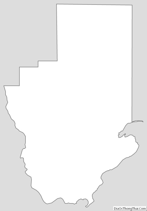
Hancock County Outline Map
See also
Map of Mississippi State and its subdivision:- Adams
- Alcorn
- Amite
- Attala
- Benton
- Bolivar
- Calhoun
- Carroll
- Chickasaw
- Choctaw
- Claiborne
- Clarke
- Clay
- Coahoma
- Copiah
- Covington
- Desoto
- Forrest
- Franklin
- George
- Greene
- Grenada
- Hancock
- Harrison
- Hinds
- Holmes
- Humphreys
- Issaquena
- Itawamba
- Jackson
- Jasper
- Jefferson
- Jefferson Davis
- Jones
- Kemper
- Lafayette
- Lamar
- Lauderdale
- Lawrence
- Leake
- Lee
- Leflore
- Lincoln
- Lowndes
- Madison
- Marion
- Marshall
- Monroe
- Montgomery
- Neshoba
- Newton
- Noxubee
- Oktibbeha
- Panola
- Pearl River
- Perry
- Pike
- Pontotoc
- Prentiss
- Quitman
- Rankin
- Scott
- Sharkey
- Simpson
- Smith
- Stone
- Sunflower
- Tallahatchie
- Tate
- Tippah
- Tishomingo
- Tunica
- Union
- Walthall
- Warren
- Washington
- Wayne
- Webster
- Wilkinson
- Winston
- Yalobusha
- Yazoo
- Alabama
- Alaska
- Arizona
- Arkansas
- California
- Colorado
- Connecticut
- Delaware
- District of Columbia
- Florida
- Georgia
- Hawaii
- Idaho
- Illinois
- Indiana
- Iowa
- Kansas
- Kentucky
- Louisiana
- Maine
- Maryland
- Massachusetts
- Michigan
- Minnesota
- Mississippi
- Missouri
- Montana
- Nebraska
- Nevada
- New Hampshire
- New Jersey
- New Mexico
- New York
- North Carolina
- North Dakota
- Ohio
- Oklahoma
- Oregon
- Pennsylvania
- Rhode Island
- South Carolina
- South Dakota
- Tennessee
- Texas
- Utah
- Vermont
- Virginia
- Washington
- West Virginia
- Wisconsin
- Wyoming