Hancock County is a county located in the U.S. state of Ohio. As of the 2020 census, the population was 74,920. Its county seat and largest city is Findlay. The county was created in 1820 and later organized in 1828. It was named for John Hancock, the first signer of the Declaration of Independence.
Hancock County comprises the Findlay, OH Micropolitan Statistical Area.
| Name: | Hancock County |
|---|---|
| FIPS code: | 39-063 |
| State: | Ohio |
| Founded: | March 1, 1828 |
| Named for: | John Hancock |
| Seat: | Findlay |
| Largest city: | Findlay |
| Total Area: | 534 sq mi (1,380 km²) |
| Land Area: | 531 sq mi (1,380 km²) |
| Total Population: | 74,920 |
| Population Density: | 140/sq mi (54/km²) |
| Time zone: | UTC−5 (Eastern) |
| Summer Time Zone (DST): | UTC−4 (EDT) |
| Website: | www.co.hancock.oh.us |
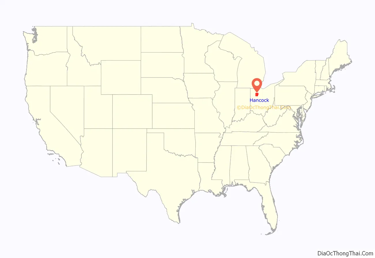
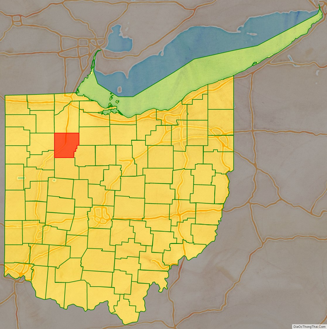
Hancock County location map. Where is Hancock County?
History
Hancock County was established on January 21, 1828, by the Ohio General Assembly from the southern portions of Wood County. Originally containing only Findlay Township, the county would add Amanda and Welfare (now Delaware) townships later in April of that year. Additional townships were laid out as follows: Jackson in 1829; Liberty and Marion in December 1830; Big Lick, Blanchard and Van Buren in 1831; Washington, Union, and Eagle in 1832; Cass and Portage in 1833; Pleasant in 1835; Orange in 1836; Madison in 1840, and finally Allen in 1850. Originally nearly 24 miles square, Hancock County would lose some of its southeast portion in 1845 to the new Wyandot County.
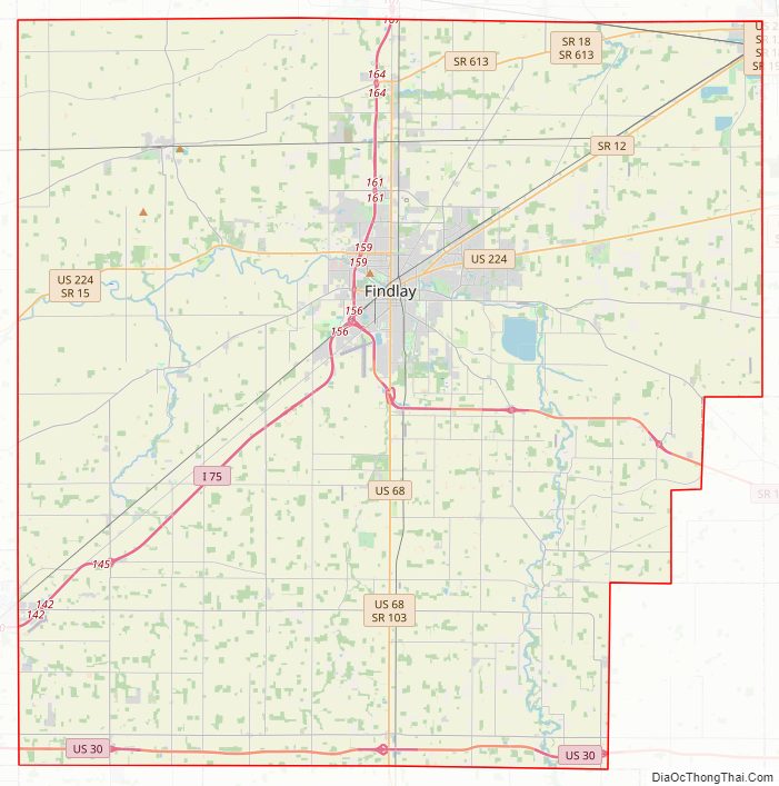
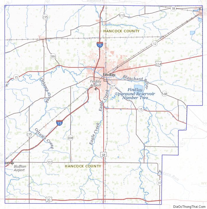
Hancock County Road Map
Geography
According to the U.S. Census Bureau, the county has a total area of 534 square miles (1,380 km), of which 531 square miles (1,380 km) is land and 2.3 square miles (6.0 km) (0.4%) is water.
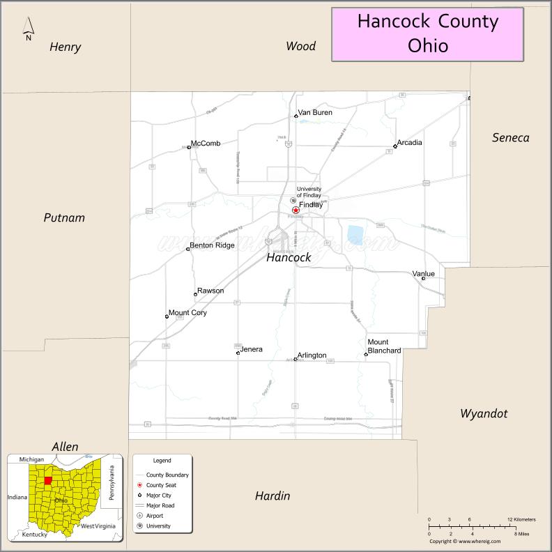
Adjacent counties
- Wood County (north)
- Seneca County (northeast)
- Wyandot County (southeast)
- Hardin County (south)
- Allen County (southwest)
- Putnam County (west)
- Henry County (northwest)
Hancock County Topographic Map
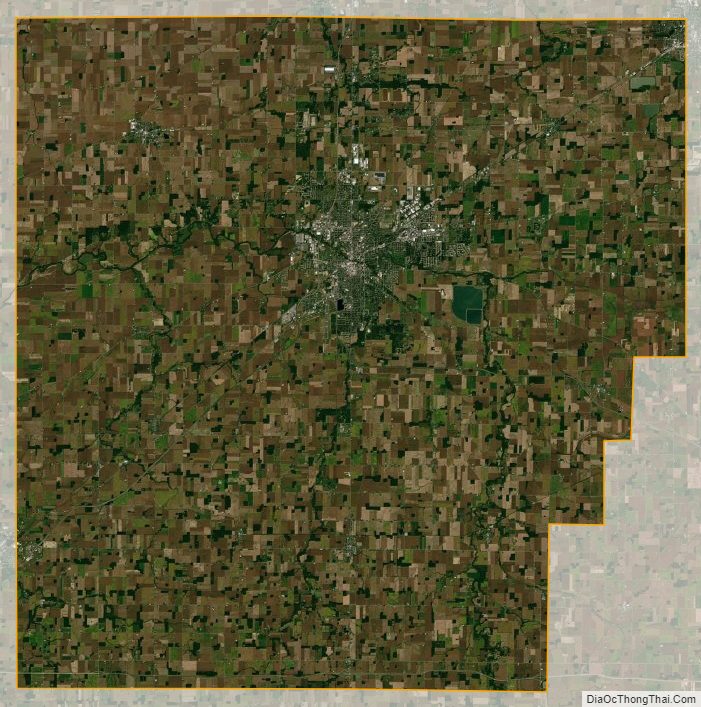
Hancock County Satellite Map
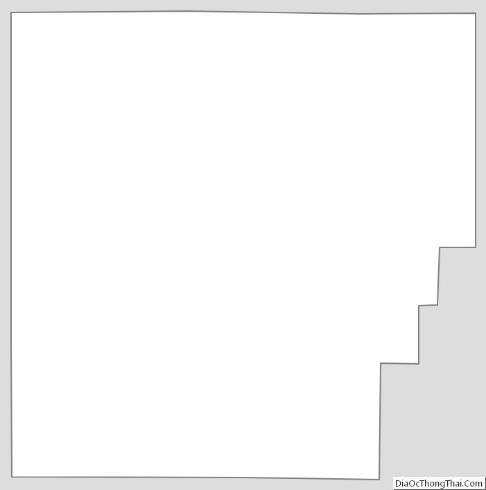
Hancock County Outline Map
See also
Map of Ohio State and its subdivision:- Adams
- Allen
- Ashland
- Ashtabula
- Athens
- Auglaize
- Belmont
- Brown
- Butler
- Carroll
- Champaign
- Clark
- Clermont
- Clinton
- Columbiana
- Coshocton
- Crawford
- Cuyahoga
- Darke
- Defiance
- Delaware
- Erie
- Fairfield
- Fayette
- Franklin
- Fulton
- Gallia
- Geauga
- Greene
- Guernsey
- Hamilton
- Hancock
- Hardin
- Harrison
- Henry
- Highland
- Hocking
- Holmes
- Huron
- Jackson
- Jefferson
- Knox
- Lake
- Lake Erie
- Lawrence
- Licking
- Logan
- Lorain
- Lucas
- Madison
- Mahoning
- Marion
- Medina
- Meigs
- Mercer
- Miami
- Monroe
- Montgomery
- Morgan
- Morrow
- Muskingum
- Noble
- Ottawa
- Paulding
- Perry
- Pickaway
- Pike
- Portage
- Preble
- Putnam
- Richland
- Ross
- Sandusky
- Scioto
- Seneca
- Shelby
- Stark
- Summit
- Trumbull
- Tuscarawas
- Union
- Van Wert
- Vinton
- Warren
- Washington
- Wayne
- Williams
- Wood
- Wyandot
- Alabama
- Alaska
- Arizona
- Arkansas
- California
- Colorado
- Connecticut
- Delaware
- District of Columbia
- Florida
- Georgia
- Hawaii
- Idaho
- Illinois
- Indiana
- Iowa
- Kansas
- Kentucky
- Louisiana
- Maine
- Maryland
- Massachusetts
- Michigan
- Minnesota
- Mississippi
- Missouri
- Montana
- Nebraska
- Nevada
- New Hampshire
- New Jersey
- New Mexico
- New York
- North Carolina
- North Dakota
- Ohio
- Oklahoma
- Oregon
- Pennsylvania
- Rhode Island
- South Carolina
- South Dakota
- Tennessee
- Texas
- Utah
- Vermont
- Virginia
- Washington
- West Virginia
- Wisconsin
- Wyoming