Hardin County is a county located in the U.S. state of Texas, United States. As of the 2020 census, its population was 56,231. The county seat is Kountze. The county is named for the family of William Hardin from Liberty County, Texas.
Hardin County is part of the Beaumont–Port Arthur, TX metropolitan statistical area.
| Name: | Hardin County |
|---|---|
| FIPS code: | 48-199 |
| State: | Texas |
| Founded: | 1858 |
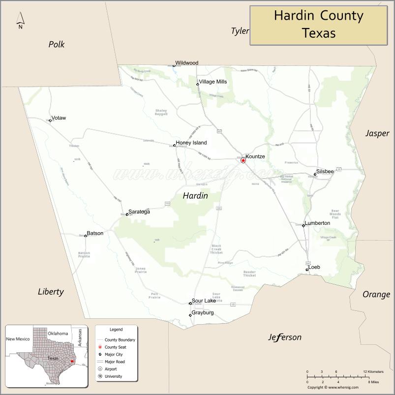
| Seat: | Kountze |
| Largest city: | Lumberton |
| Total Area: | 898 sq mi (2,330 km²) |
| Land Area: | 891 sq mi (2,310 km²) |
| Total Population: | 56,231 |
| Population Density: | 63/sq mi (24/km²) |
| Time zone: | UTC−6 (Central) |
| Summer Time Zone (DST): | UTC−5 (CDT) |
| Website: | www.co.hardin.tx.us |
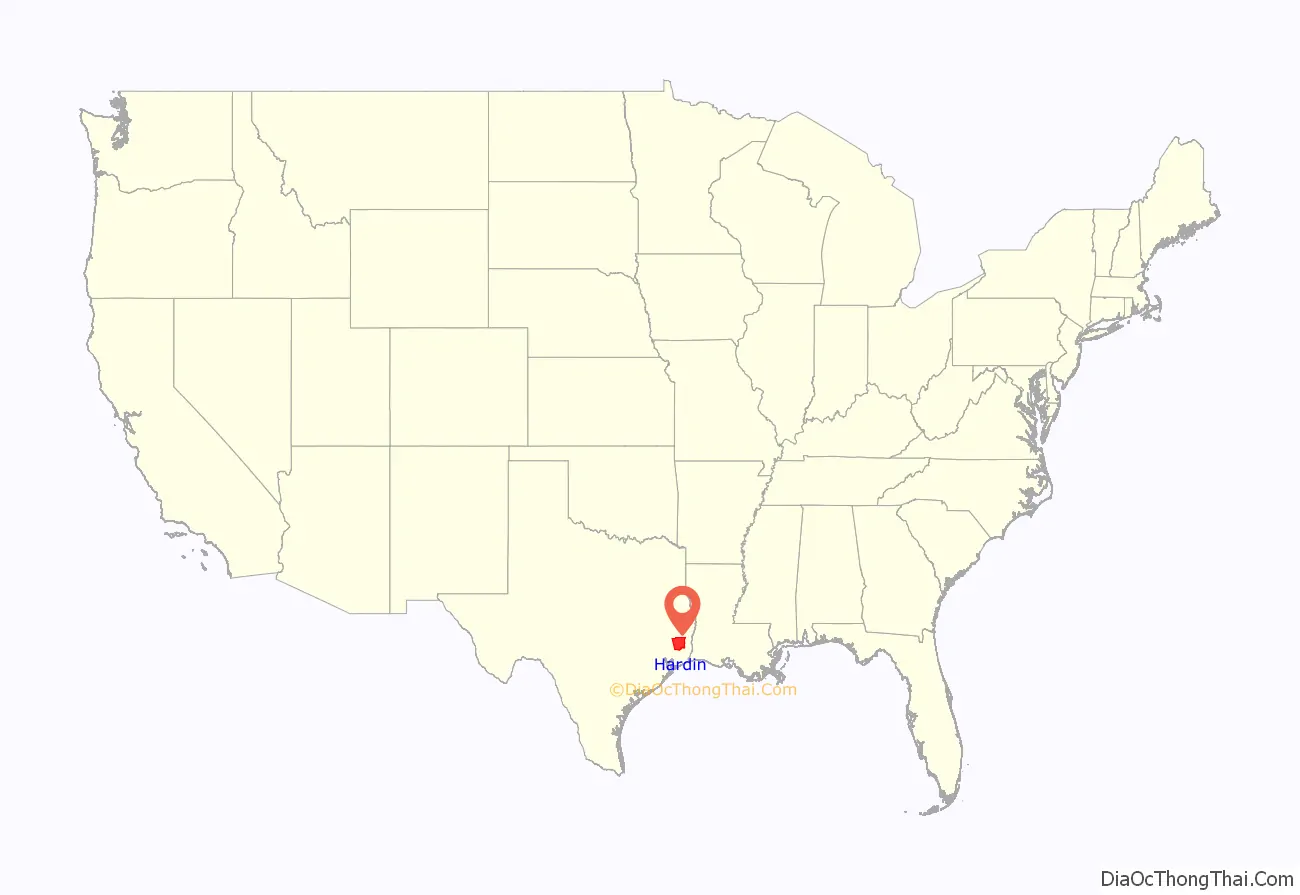
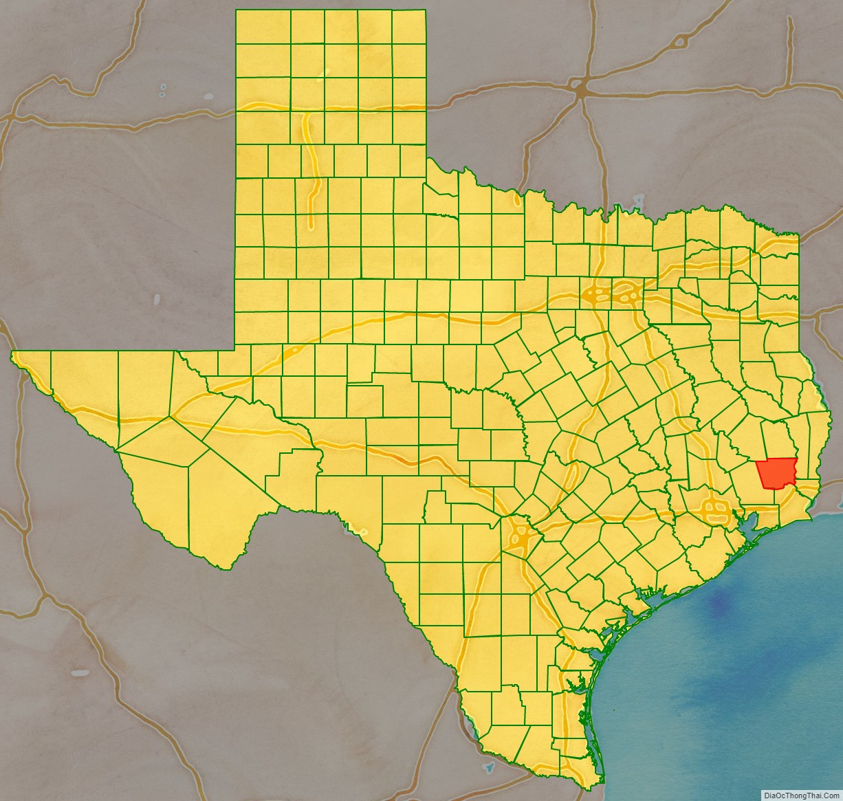
Hardin County location map. Where is Hardin County?
History
The county is named for the family of William Hardin (1801-1839), a settler, judge, and postmaster. The Hardin family cemetery is located north of Liberty.
The current Hardin County Courthouse was built in 1959. It is at least the third courthouse to serve Hardin County.
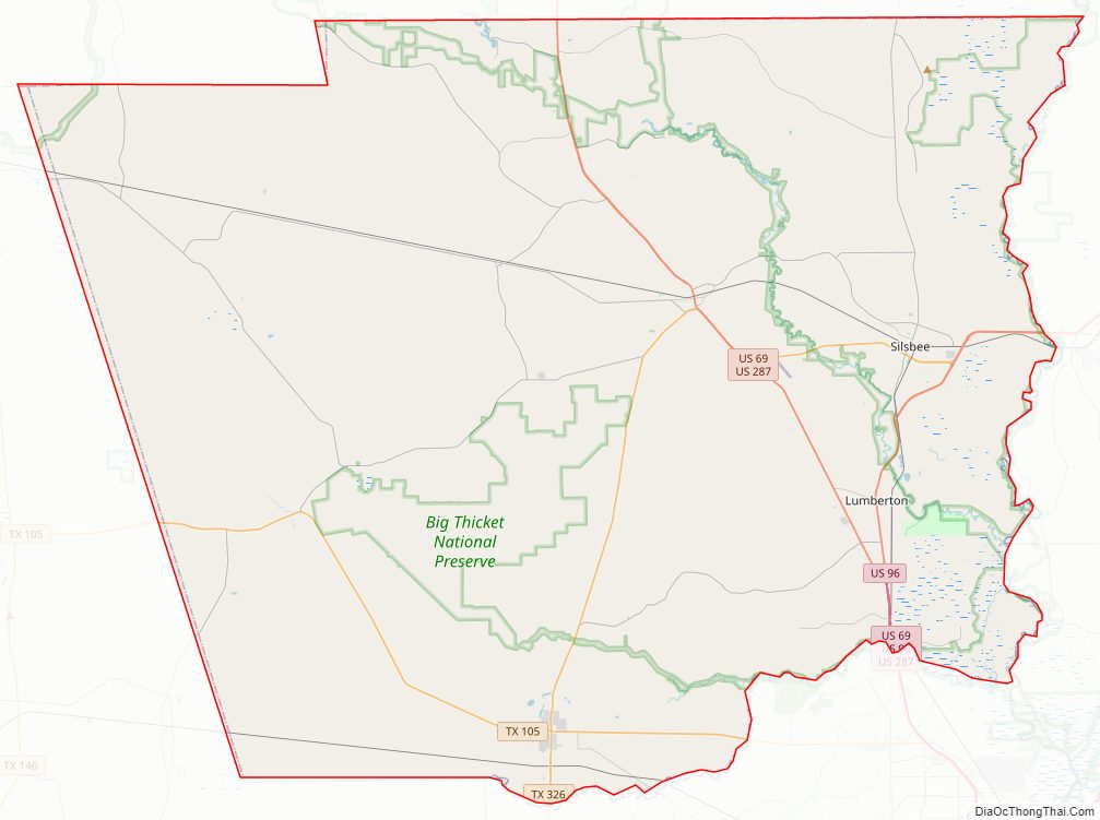
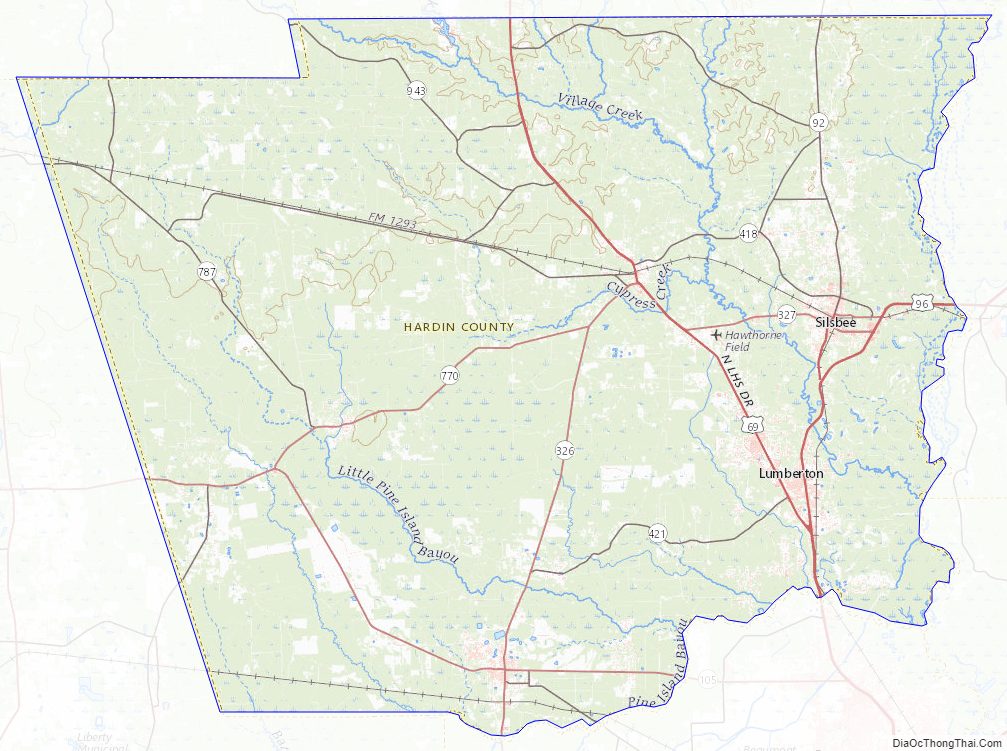
Hardin County Road Map
Geography
According to the U.S. Census Bureau, the county has a total area of 898 square miles (2,330 km), of which 7.0 square miles (18 km) (0.8%) are covered by water.
Hardin County is located on the flat coastal plains of Southeast Texas, roughly 30 mi (48 km) north of the Gulf of Mexico. The county is largely covered by the dense forest of the Big Thicket. It is crossed by numerous small streams and creeks that drain the county into the Neches River, which forms the eastern boundary of the county.
Major highways
- U.S. Highway 69/U.S. Highway 287
- U.S. Highway 96
- State Highway 105
- State Highway 326
- State Highway 327
Adjacent counties
- Tyler County (northern)
- Jasper County (east)
- Orange County (southeast)
- Jefferson County (south)
- Liberty County (southwest)
- Polk County (northwest)
Its eastern boundaries with Jasper County and Orange County are formed by the Neches River. The southern boundary with Jefferson County is formed by Pine Island Bayou
National protected area
- Big Thicket National Preserve (part)
Hardin County Topographic Map
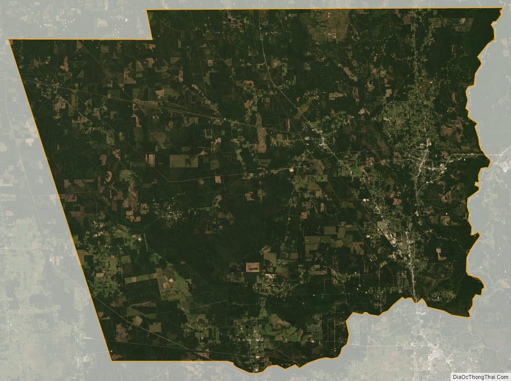
Hardin County Satellite Map
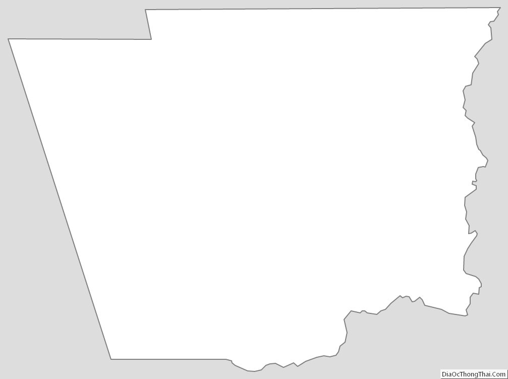
Hardin County Outline Map
See also
Map of Texas State and its subdivision:- Anderson
- Andrews
- Angelina
- Aransas
- Archer
- Armstrong
- Atascosa
- Austin
- Bailey
- Bandera
- Bastrop
- Baylor
- Bee
- Bell
- Bexar
- Blanco
- Borden
- Bosque
- Bowie
- Brazoria
- Brazos
- Brewster
- Briscoe
- Brooks
- Brown
- Burleson
- Burnet
- Caldwell
- Calhoun
- Callahan
- Cameron
- Camp
- Carson
- Cass
- Castro
- Chambers
- Cherokee
- Childress
- Clay
- Cochran
- Coke
- Coleman
- Collin
- Collingsworth
- Colorado
- Comal
- Comanche
- Concho
- Cooke
- Coryell
- Cottle
- Crane
- Crockett
- Crosby
- Culberson
- Dallam
- Dallas
- Dawson
- Deaf Smith
- Delta
- Denton
- Dewitt
- Dickens
- Dimmit
- Donley
- Duval
- Eastland
- Ector
- Edwards
- El Paso
- Ellis
- Erath
- Falls
- Fannin
- Fayette
- Fisher
- Floyd
- Foard
- Fort Bend
- Franklin
- Freestone
- Frio
- Gaines
- Galveston
- Garza
- Gillespie
- Glasscock
- Goliad
- Gonzales
- Gray
- Grayson
- Gregg
- Grimes
- Guadalupe
- Hale
- Hall
- Hamilton
- Hansford
- Hardeman
- Hardin
- Harris
- Harrison
- Hartley
- Haskell
- Hays
- Hemphill
- Henderson
- Hidalgo
- Hill
- Hockley
- Hood
- Hopkins
- Houston
- Howard
- Hudspeth
- Hunt
- Hutchinson
- Irion
- Jack
- Jackson
- Jasper
- Jeff Davis
- Jefferson
- Jim Hogg
- Jim Wells
- Johnson
- Jones
- Karnes
- Kaufman
- Kendall
- Kenedy
- Kent
- Kerr
- Kimble
- King
- Kinney
- Kleberg
- Knox
- La Salle
- Lamar
- Lamb
- Lampasas
- Lavaca
- Lee
- Leon
- Liberty
- Limestone
- Lipscomb
- Live Oak
- Llano
- Loving
- Lubbock
- Lynn
- Madison
- Marion
- Martin
- Mason
- Matagorda
- Maverick
- McCulloch
- McLennan
- McMullen
- Medina
- Menard
- Midland
- Milam
- Mills
- Mitchell
- Montague
- Montgomery
- Moore
- Morris
- Motley
- Nacogdoches
- Navarro
- Newton
- Nolan
- Nueces
- Ochiltree
- Oldham
- Orange
- Palo Pinto
- Panola
- Parker
- Parmer
- Pecos
- Polk
- Potter
- Presidio
- Rains
- Randall
- Reagan
- Real
- Red River
- Reeves
- Refugio
- Roberts
- Robertson
- Rockwall
- Runnels
- Rusk
- Sabine
- San Augustine
- San Jacinto
- San Patricio
- San Saba
- Schleicher
- Scurry
- Shackelford
- Shelby
- Sherman
- Smith
- Somervell
- Starr
- Stephens
- Sterling
- Stonewall
- Sutton
- Swisher
- Tarrant
- Taylor
- Terrell
- Terry
- Throckmorton
- Titus
- Tom Green
- Travis
- Trinity
- Tyler
- Upshur
- Upton
- Uvalde
- Val Verde
- Van Zandt
- Victoria
- Walker
- Waller
- Ward
- Washington
- Webb
- Wharton
- Wheeler
- Wichita
- Wilbarger
- Willacy
- Williamson
- Wilson
- Winkler
- Wise
- Wood
- Yoakum
- Young
- Zapata
- Zavala
- Alabama
- Alaska
- Arizona
- Arkansas
- California
- Colorado
- Connecticut
- Delaware
- District of Columbia
- Florida
- Georgia
- Hawaii
- Idaho
- Illinois
- Indiana
- Iowa
- Kansas
- Kentucky
- Louisiana
- Maine
- Maryland
- Massachusetts
- Michigan
- Minnesota
- Mississippi
- Missouri
- Montana
- Nebraska
- Nevada
- New Hampshire
- New Jersey
- New Mexico
- New York
- North Carolina
- North Dakota
- Ohio
- Oklahoma
- Oregon
- Pennsylvania
- Rhode Island
- South Carolina
- South Dakota
- Tennessee
- Texas
- Utah
- Vermont
- Virginia
- Washington
- West Virginia
- Wisconsin
- Wyoming