| Name: | Harney County |
|---|---|
| FIPS code: | 41-025 |
| State: | Oregon |
| Founded: | February 23, 1889 |
| Named for: | William S. Harney |
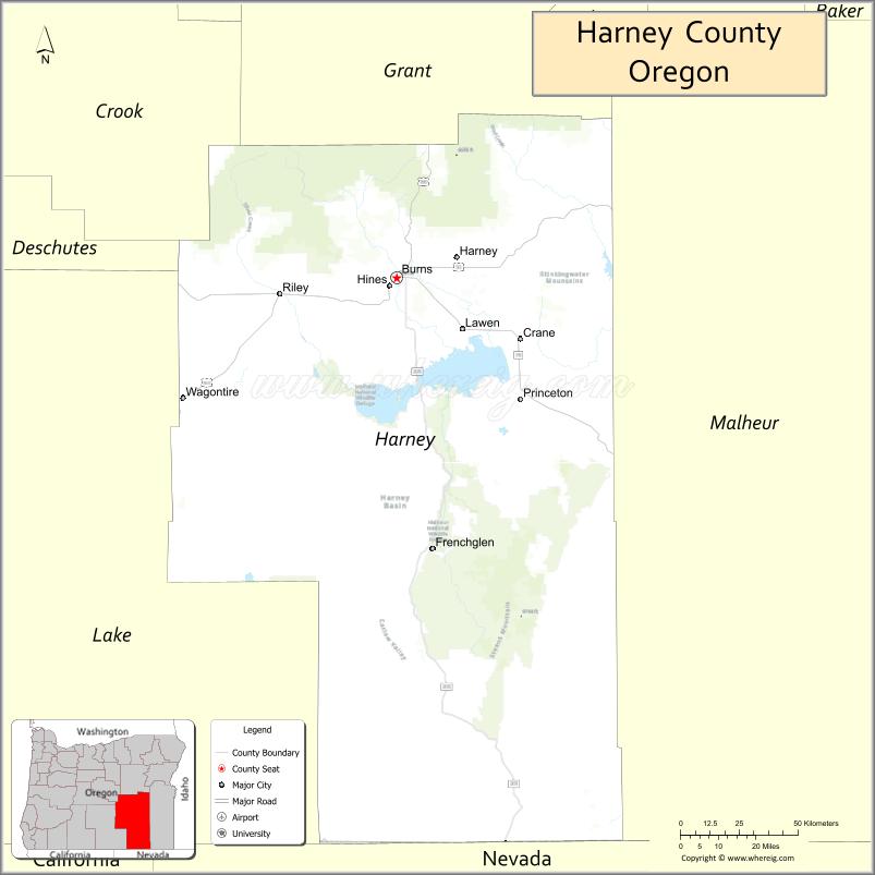
| Seat: | Burns |
| Largest city: | Burns |
| Total Area: | 10,226 sq mi (26,490 km²) |
| Land Area: | 10,133 sq mi (26,240 km²) |
| Total Population: | 7,495 |
| Population Density: | 0.7/sq mi (0.3/km²) |
| Time zone: | UTC−8 (Pacific) |
| Summer Time Zone (DST): | UTC−7 (PDT) |
| Website: | www.co.harney.or.us |
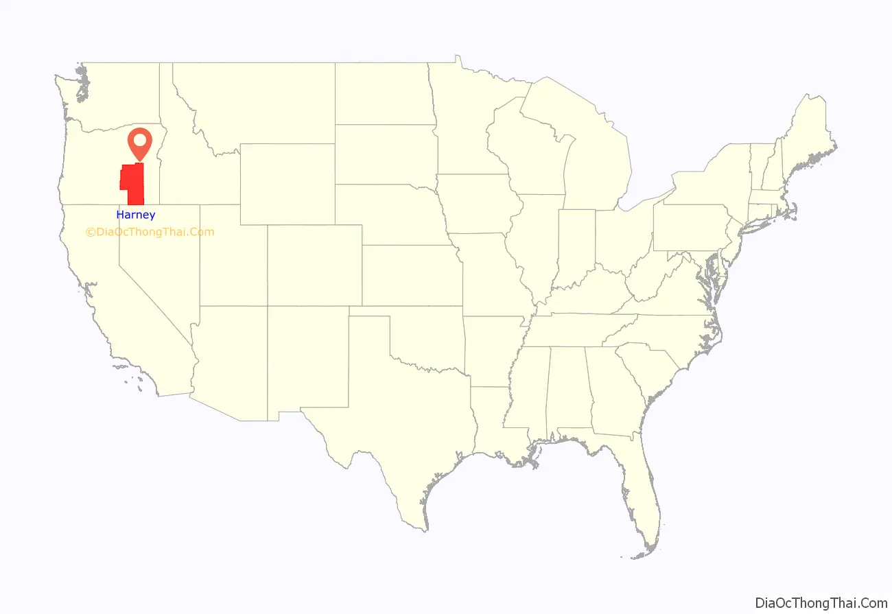
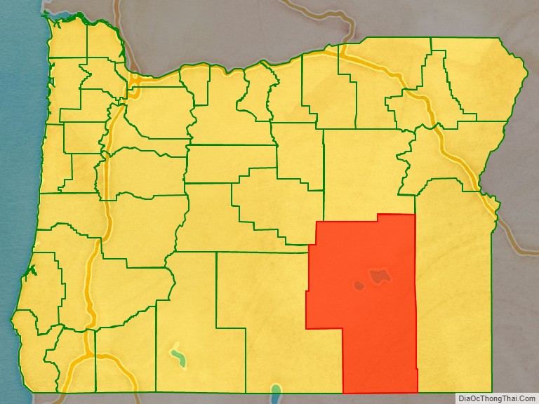
Harney County location map. Where is Harney County?
History
The Native Americans living in this region at the time of the Lewis and Clark Expedition were the Northern Paiute, who fought with the Tenino and Wasco peoples. Peter Skene Ogden was the first known European to explore this area in 1826 when he led a fur brigade for the Hudson’s Bay Company.
Harney County was carved out of the southern two-thirds of Grant County on February 25, 1889. A fierce political battle, with armed “night riders” who spirited county records from Harney to Burns, ended with Burns as the county seat in 1890.
The Malheur River Indian Reservation was created by executive order on March 14, 1871, and the Northern Paiute within the Oregon state boundaries were settled there. The federal government “discontinued” the reservation after the Bannock War of 1878. Descendants of these people form a federally recognized tribal entity, the Burns Paiute Tribe, which had 341 members in 2008. Fewer than 35.5% of the tribal members live on the Burns Paiute Indian Colony near Burns. The tribe formerly earned revenue from a small casino, the Old Camp Casino, before its closure in 2012, and renting out communal tribal lands for grazing rights to local ranchers.
The first white people to arrive through Harney County were French explorers, circa 1750ː Narceese Charbonneau (father of Toussaint Charbonneau), LaValle and a priest named Joseph Nadeau. The men came aboard a Spanish supply ship and left from San Diego on a transcontinental tour to Quebec. Instead of reaching Canada, the men arrived at southern Harney County and continued towards Idaho. In the late 1820s, Peter Skene Ogden made a description of the natural features and Indian culture from Klamath County to Harney County, following the Sylvaille River, and turning up afterwards towards Walla Walla leading a fur brigade for Hudson’s Bay Company.
2016 militia occupation
On January 2, 2016, the headquarters building of the Malheur National Wildlife Refuge was seized by armed protesters related to the Bundy standoff. The group protested the prison sentences of two ranchers convicted of arson in wildfires set in 2001 and 2006, which the ranchers claimed spread from their land into the wildlife reserve. Militia leaders, including Ammon Bundy and Jon Ritzheimer, were arrested on January 26, 2016, in an event that included the shooting of militant LaVoy Finicum. The following day, only four militants remained, and they surrendered on February 11, 2016.
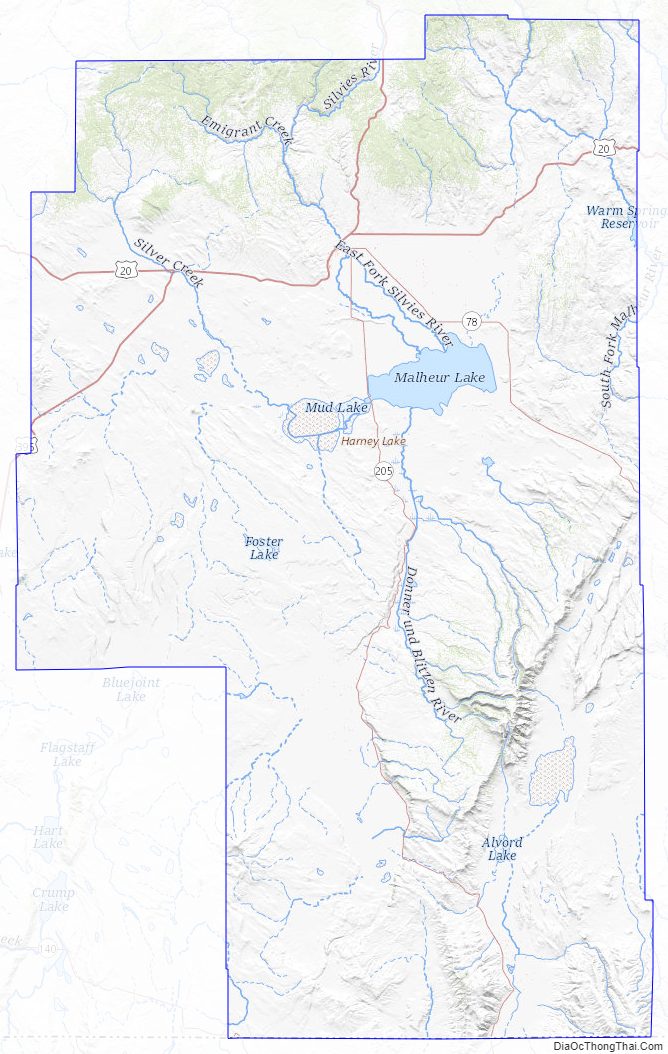
Harney County Road Map
Geography
According to the United States Census Bureau, the county has a total area of 10,226 square miles (26,490 km), of which 10,133 square miles (26,240 km) is land and 93 square miles (240 km) (0.9%) is water. It is the largest county in Oregon by area and the tenth-largest county in the United States (excluding boroughs and census areas in Alaska).
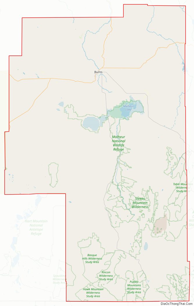
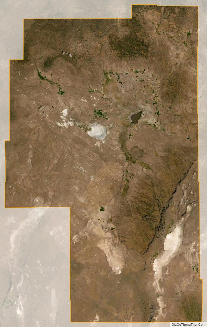
Steens Mountain is the county’s most prominent geographical feature, rising to 9,700 feet (3,000 m) above sea level and spanning many miles across a region that is otherwise fairly flat. To its southeast is the Alvord Desert—the driest place in Oregon—and the Trout Creek Mountains, which extend south into Nevada. South of Steens Mountain, the Pueblo Mountains are another remote range in Oregon and Nevada. North of Steens Mountain lies the Harney Basin, which contains Malheur Lake and Harney Lake.
Adjacent counties
- Crook County – northwest
- Grant County – north
- Malheur County – east/Mountain Time Border
- Humboldt County, Nevada – south
- Washoe County, Nevada – southwest
- Lake County – west
- Deschutes County – northwest
Time Zones
Although the county is officially in the Pacific Time Zone, unincorporated Drewsey, just west of the Malheur County line unofficially observes the Mountain Time Zone.
National protected areas
- Malheur National Forest (part)
- Malheur National Wildlife Refuge
- Ochoco National Forest (part)
Harney County Topographic Map
Harney County Satellite Map
Harney County Outline Map
See also
Map of Oregon State and its subdivision: Map of other states:- Alabama
- Alaska
- Arizona
- Arkansas
- California
- Colorado
- Connecticut
- Delaware
- District of Columbia
- Florida
- Georgia
- Hawaii
- Idaho
- Illinois
- Indiana
- Iowa
- Kansas
- Kentucky
- Louisiana
- Maine
- Maryland
- Massachusetts
- Michigan
- Minnesota
- Mississippi
- Missouri
- Montana
- Nebraska
- Nevada
- New Hampshire
- New Jersey
- New Mexico
- New York
- North Carolina
- North Dakota
- Ohio
- Oklahoma
- Oregon
- Pennsylvania
- Rhode Island
- South Carolina
- South Dakota
- Tennessee
- Texas
- Utah
- Vermont
- Virginia
- Washington
- West Virginia
- Wisconsin
- Wyoming