Harper County is a county located in the U.S. state of Oklahoma. As of the 2010 census, the population was 3,685, making it the fourth-least populous county in Oklahoma. The county seat is Buffalo. It was created in 1907 from the northwestern part of Woodward County, and named for Oscar Green Harper, who was clerk of the Oklahoma Constitutional Convention.
| Name: | Harper County |
|---|---|
| FIPS code: | 40-059 |
| State: | Oklahoma |
| Founded: | 1907 |
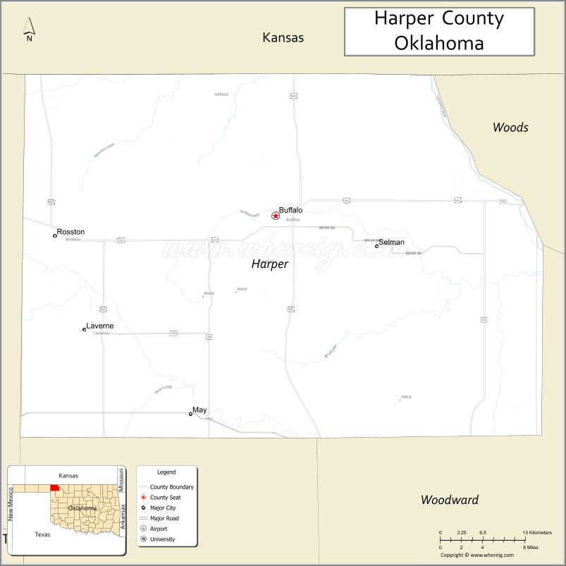
| Seat: | Buffalo |
| Largest town: | Laverne |
| Total Area: | 1,041 sq mi (2,700 km²) |
| Land Area: | 1,039 sq mi (2,690 km²) |
| Total Population: | 3,685 |
| Population Density: | 3.5/sq mi (1.4/km²) |
| Time zone: | UTC−6 (Central) |
| Summer Time Zone (DST): | UTC−5 (CDT) |
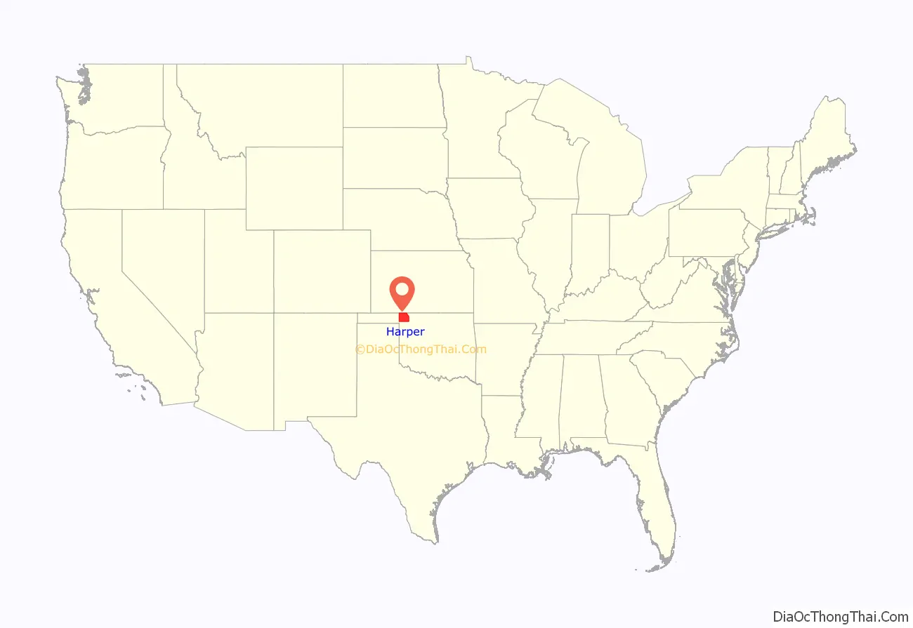
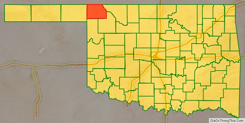
Harper County location map. Where is Harper County?
History
During the late 19th century, the area now known as Harper County was part of the Cherokee Outlet, reserved for use by the Cherokee Nation by treaties in 1828 and 1835, The U.S. government opened the outlet for settlement by non-Indians in 1893. The area was divided into counties after the formation of what is now the state of Oklahoma. Harper County was created in 1907. It was named for Oscar Green Harper, who was a local resident, school teacher, and served as clerk of the Oklahoma Constitutional Convention.
The present county lay on several trails that were blazed during the 19th century. One of the most significant was the Fort Dodge to Camp Supply Military Trail. It was used followed in 1868 by the U.S. Army’s Seventh Cavalry, to move men and supplies to build Camp Supply (forerunner of the present town of Fort Supply, Oklahoma). The Great Western Trail (also known as the Dodge City Trail) was first used between South Texas and Fort Robinson, Nebraska, in 1874. The Cimarron Valley Turnpike Company built a bridge over the Cimarron River in 1908 to facilitate travel between Englewood, Kansas and Oklahoma.
A 1908 election was held to determine whether Buffalo or Doby Springs would become the county seat. Buffalo won the election. Doby Springs later ceased to be a town and is now a park in Buffalo. Other ghost towns in the county are Paruna, Flat, Avis, Readout, Cross, Alto, Cupid, and Stockholm.
Railroads first came to Harper County in 1912, when the Wichita Falls and Northwestern Railway, a subsidiary of the Missouri, Kansas and Texas Railway (MK&T), built a line through Dunlap, May, Laverne, and Rosston. The locally owned Buffalo and Northwestern Railroad (B&NW), connected Buffalo with Waynoka in 1919–20. The Atchison, Topeka and Santa Fe Railway acquired the B&NW in 1920. The MK&T line was abandoned in 1970.
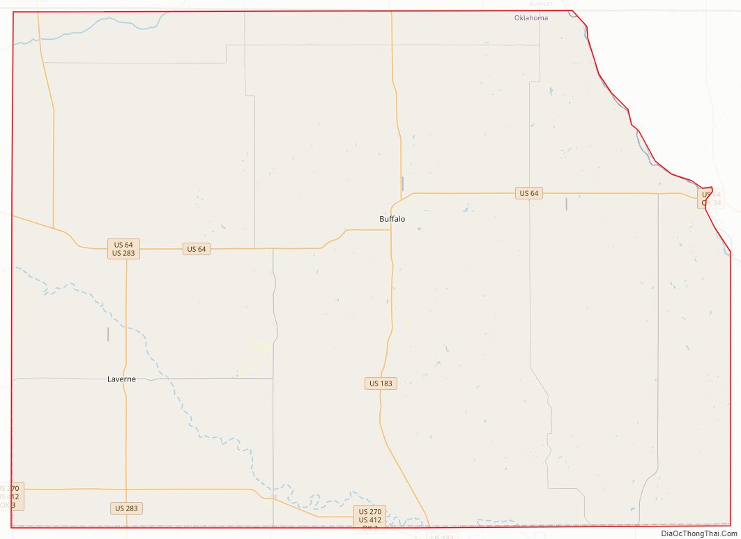
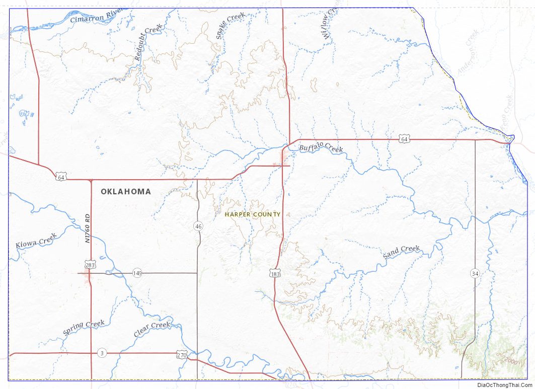
Harper County Road Map
Geography
According to the U.S. Census Bureau, the county has a total area of 1,041 square miles (2,700 km), of which 1,039 square miles (2,690 km) is land and 2.0 square miles (5.2 km) (0.2%) is water. The county is drained by the Cimarron River and the Beaver River.
Major highways
- U.S. Highway 64
- U.S. Highway 183
- U.S. Highway 270
- U.S. Highway 283
- U.S. Highway 412
- State Highway 3
- State Highway 34
- State Highway 46
- State Highway 149
Adjacent counties
- Comanche County, Kansas (northeast)
- Woods County (east)
- Woodward County (southeast)
- Ellis County (south)
- Beaver County (west)
- Clark County, Kansas (northwest)
Harper County Topographic Map
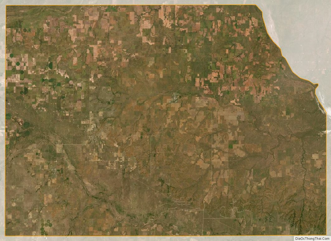
Harper County Satellite Map
Harper County Outline Map

See also
Map of Oklahoma State and its subdivision:- Adair
- Alfalfa
- Atoka
- Beaver
- Beckham
- Blaine
- Bryan
- Caddo
- Canadian
- Carter
- Cherokee
- Choctaw
- Cimarron
- Cleveland
- Coal
- Comanche
- Cotton
- Craig
- Creek
- Custer
- Delaware
- Dewey
- Ellis
- Garfield
- Garvin
- Grady
- Grant
- Greer
- Harmon
- Harper
- Haskell
- Hughes
- Jackson
- Jefferson
- Johnston
- Kay
- Kingfisher
- Kiowa
- Latimer
- Le Flore
- Lincoln
- Logan
- Love
- Major
- Marshall
- Mayes
- McClain
- McCurtain
- McIntosh
- Murray
- Muskogee
- Noble
- Nowata
- Okfuskee
- Oklahoma
- Okmulgee
- Osage
- Ottawa
- Pawnee
- Payne
- Pittsburg
- Pontotoc
- Pottawatomie
- Pushmataha
- Roger Mills
- Rogers
- Seminole
- Sequoyah
- Stephens
- Texas
- Tillman
- Tulsa
- Wagoner
- Washington
- Washita
- Woods
- Woodward
- Alabama
- Alaska
- Arizona
- Arkansas
- California
- Colorado
- Connecticut
- Delaware
- District of Columbia
- Florida
- Georgia
- Hawaii
- Idaho
- Illinois
- Indiana
- Iowa
- Kansas
- Kentucky
- Louisiana
- Maine
- Maryland
- Massachusetts
- Michigan
- Minnesota
- Mississippi
- Missouri
- Montana
- Nebraska
- Nevada
- New Hampshire
- New Jersey
- New Mexico
- New York
- North Carolina
- North Dakota
- Ohio
- Oklahoma
- Oregon
- Pennsylvania
- Rhode Island
- South Carolina
- South Dakota
- Tennessee
- Texas
- Utah
- Vermont
- Virginia
- Washington
- West Virginia
- Wisconsin
- Wyoming