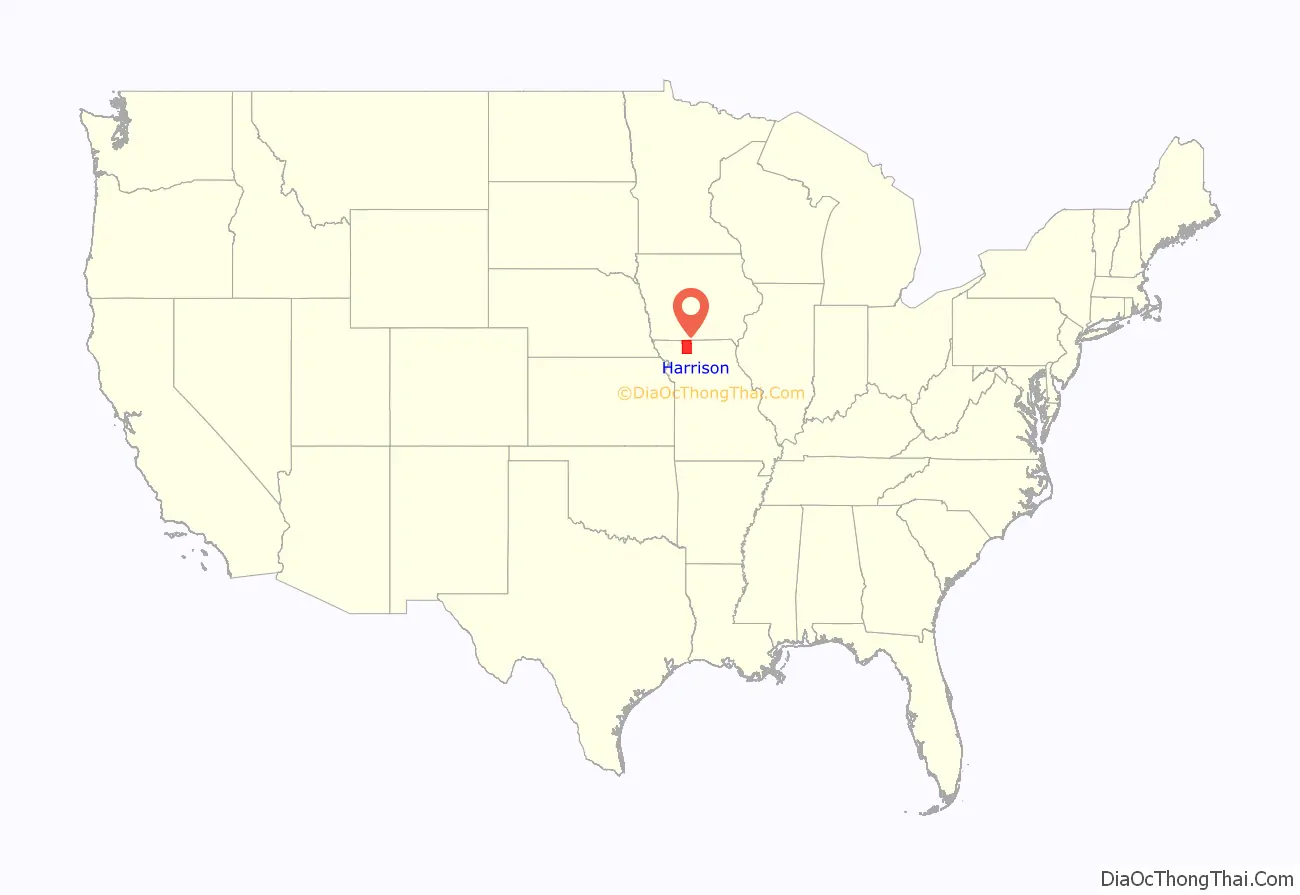
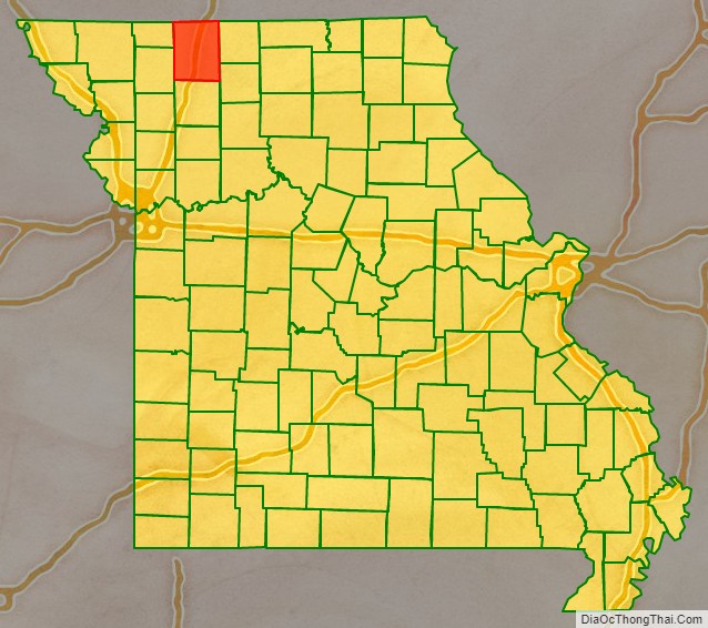
Harrison County is a county located in the northwest portion of the U.S. state of Missouri. As of the 2020 census, the population was 8,157. It’s county seat is Bethany. The county was organized February 14, 1845 and named for U.S. Representative Albert G. Harrison of Missouri.
| Name: | Harrison County |
|---|---|
| FIPS code: | 29-081 |
| State: | Missouri |
| Founded: | February 14, 1845 |
| Named for: | Albert G. Harrison |
| Seat: | Bethany |
| Largest city: | Bethany |
| Total Area: | 726 sq mi (1,880 km²) |
| Land Area: | 723 sq mi (1,870 km²) |
| Total Population: | 8,157 |
| Population Density: | 11/sq mi (4.3/km²) |
| Time zone: | UTC−6 (Central) |
| Summer Time Zone (DST): | UTC−5 (CDT) |
Harrison County location map. Where is Harrison County?
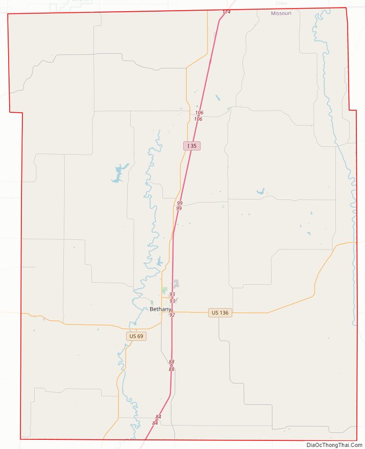
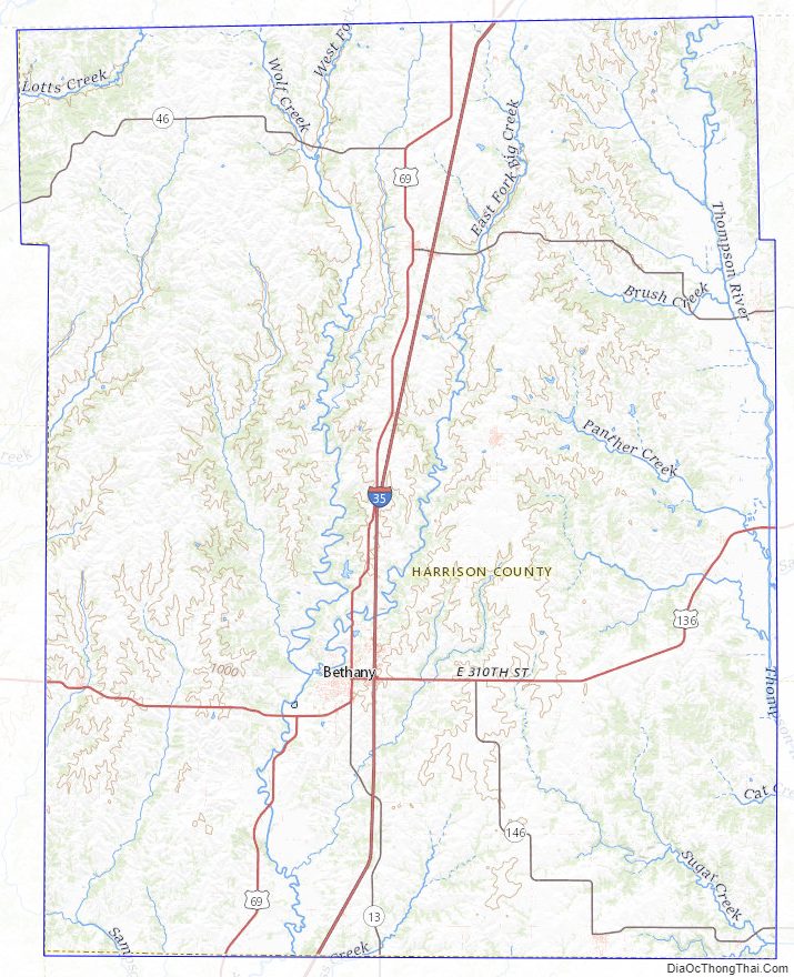
Harrison County Road Map

Geography
According to the U.S. Census Bureau, the county has a total area of 726 square miles (1,880 km), of which 723 square miles (1,870 km) is land and 3.9 square miles (10 km) (0.5%) is water.
Adjacent counties
- Ringgold County, Iowa (north)
- Decatur County, Iowa (northeast)
- Mercer County (east)
- Grundy County (southeast)
- Daviess County (south)
- Gentry County (southwest)
- Worth County (northwest)
Major highways
- Interstate 35
- U.S. Route 69
- U.S. Route 136
- Route 13
- Route 46
- Route 146
Harrison County Topographic Map
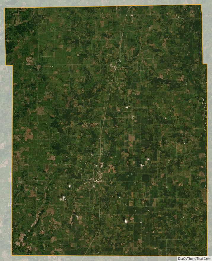
Harrison County Satellite Map
Harrison County Outline Map

See also
Map of Missouri State and its subdivision:- Adair
- Andrew
- Atchison
- Audrain
- Barry
- Barton
- Bates
- Benton
- Bollinger
- Boone
- Buchanan
- Butler
- Caldwell
- Callaway
- Camden
- Cape Girardeau
- Carroll
- Carter
- Cass
- Cedar
- Chariton
- Christian
- Clark
- Clay
- Clinton
- Cole
- Cooper
- Crawford
- Dade
- Dallas
- Daviess
- De Kalb
- Dent
- Douglas
- Dunklin
- Franklin
- Gasconade
- Gentry
- Greene
- Grundy
- Harrison
- Henry
- Hickory
- Holt
- Howard
- Howell
- Iron
- Jackson
- Jasper
- Jefferson
- Johnson
- Knox
- Laclede
- Lafayette
- Lawrence
- Lewis
- Lincoln
- Linn
- Livingston
- Macon
- Madison
- Maries
- Marion
- McDonald
- Mercer
- Miller
- Mississippi
- Moniteau
- Monroe
- Montgomery
- Morgan
- New Madrid
- Newton
- Nodaway
- Oregon
- Osage
- Ozark
- Pemiscot
- Perry
- Pettis
- Phelps
- Pike
- Platte
- Polk
- Pulaski
- Putnam
- Ralls
- Randolph
- Ray
- Reynolds
- Ripley
- Saint Charles
- Saint Clair
- Saint Francois
- Saint Louis
- Sainte Genevieve
- Saline
- Schuyler
- Scotland
- Scott
- Shannon
- Shelby
- Stoddard
- Stone
- Sullivan
- Taney
- Texas
- Vernon
- Warren
- Washington
- Wayne
- Webster
- Worth
- Wright
- Alabama
- Alaska
- Arizona
- Arkansas
- California
- Colorado
- Connecticut
- Delaware
- District of Columbia
- Florida
- Georgia
- Hawaii
- Idaho
- Illinois
- Indiana
- Iowa
- Kansas
- Kentucky
- Louisiana
- Maine
- Maryland
- Massachusetts
- Michigan
- Minnesota
- Mississippi
- Missouri
- Montana
- Nebraska
- Nevada
- New Hampshire
- New Jersey
- New Mexico
- New York
- North Carolina
- North Dakota
- Ohio
- Oklahoma
- Oregon
- Pennsylvania
- Rhode Island
- South Carolina
- South Dakota
- Tennessee
- Texas
- Utah
- Vermont
- Virginia
- Washington
- West Virginia
- Wisconsin
- Wyoming