| Name: | Hemphill County |
|---|---|
| FIPS code: | 48-211 |
| State: | Texas |
| Founded: | 1887 |
| Named for: | John Hemphill |
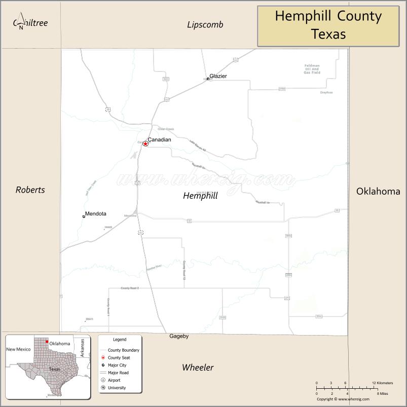
| Seat: | Canadian |
| Largest city: | Canadian |
| Total Area: | 912 sq mi (2,360 km²) |
| Land Area: | 906 sq mi (2,350 km²) |
| Total Population: | 3,382 |
| Population Density: | 3.7/sq mi (1.4/km²) |
| Time zone: | UTC−6 (Central) |
| Summer Time Zone (DST): | UTC−5 (CDT) |
| Website: | www.co.hemphill.tx.us |
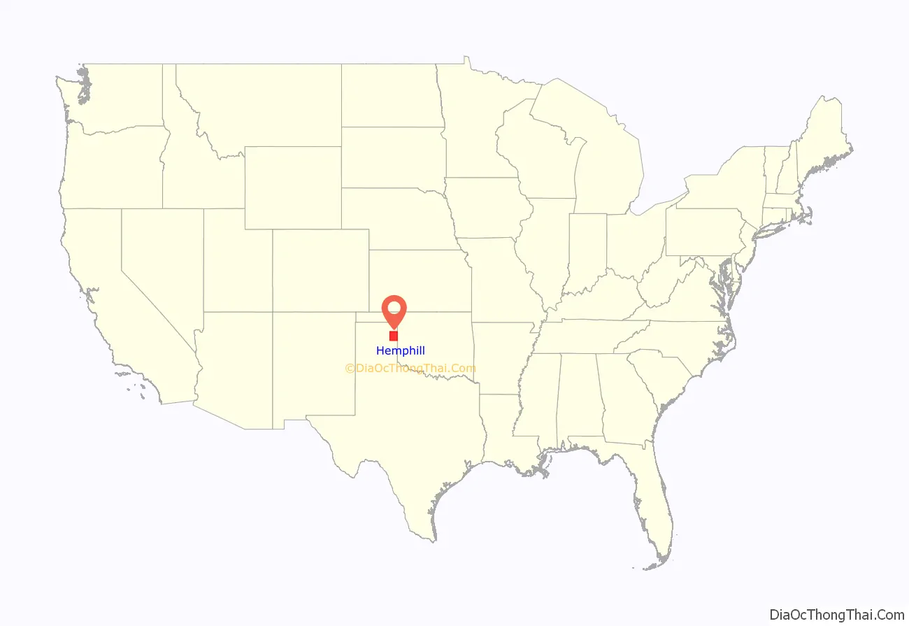
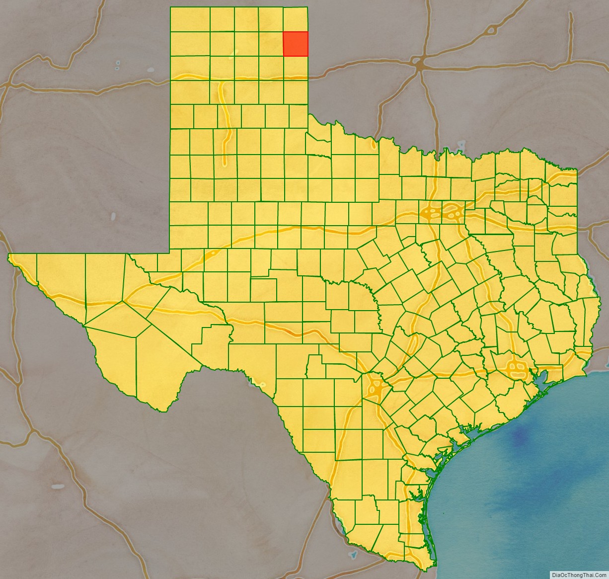
Hemphill County location map. Where is Hemphill County?
History
Early history
For the 200 years leading up to 1875, nomadic Indian tribes representing the Apache, Comanche, Kiowa, and others roamed the Panhandle following the huge bison (buffalo) herds. In search for an alternate route to California through Santa Fe, New Mexico, Josiah Gregg (1840), and Captain Randolph B. Marcy (1845) surveyed trails that crossed Hemphill County, following the south bank of the Canadian River.
The 1874–75 Red River War was an effort by the United States Army to force the Indians of the Southern Plains to move to Indian Territory in present-day Oklahoma. Two major battles took place in what would become Hemphill County: the Battle of Lyman’s Wagon Train and the Battle of Buffalo Wallow.
On April 12, 1879, Wheeler County became the first organized county in the Panhandle, with 14 other unorganized counties attached to it, one of which was Hemphill County. Hemphill County was organized in July 1887.
Influence of Santa Fe Railroad
In 1886, the Southern Kansas Railway Company, a Santa Fe subsidiary, began to build a rail line into the Panhandle of Texas. The tracks entered Hemphill County during 1887 and further encouraged settlement in the area, creating three town sites: Mendota, Canadian, and Glazier.
In 1907, Canadian was designated a division point by the Santa Fe, a factor which brought diversification to the previously ranching economy of the area. The Santa Fe influence remained very strong until the mid-1950s, when the railway moved its employees to Amarillo.
Meanwhile, Hemphill County was roughly the midway point of two smaller lines, the Clinton and Oklahoma Western Railroad Company and the Clinton-Oklahoma-Western Railroad Company of Texas.
Oil production
During the 1970s, the county grew due to a rapid expansion of oil production. Though oil was discovered in the county in 1955, production remained relatively small because the technology had not yet progressed to efficiently capture the very deep reserves known to exist. By 1974, oil production had reached 999,000 barrels (158,800 m) and more than 1,891,000 bbl (300,600 m) in 1978. In 2000, about 505,000 bbl (80,300 m) of oil and more than 8 billion cubic feet of natural gas were produced in the county, but the future looked very bright.
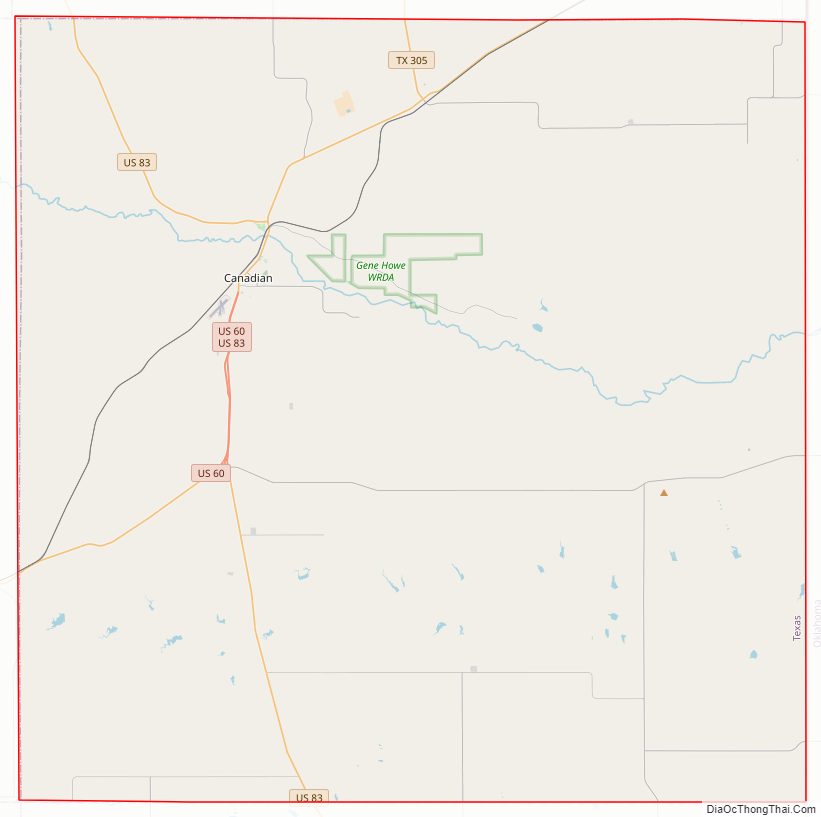
Hemphill County Road Map
Geography
According to the U.S. Census Bureau, the county has a total area of 912 sq mi (2,360 km), of which 906 sq mi (2,350 km) are land and 5.9 sq mi (15 km) (0.6%) are covered by water.
Major highways
- U.S. Highway 60
- U.S. Highway 83
- State Highway 33
Adjacent counties
- Lipscomb County (north)
- Ellis County, Oklahoma (northeast)
- Roger Mills County, Oklahoma (southeast)
- Wheeler County (south)
- Roberts County (west)
- Gray County (southwest)
National protected area
- Black Kettle National Grassland (part)
Hemphill County Topographic Map

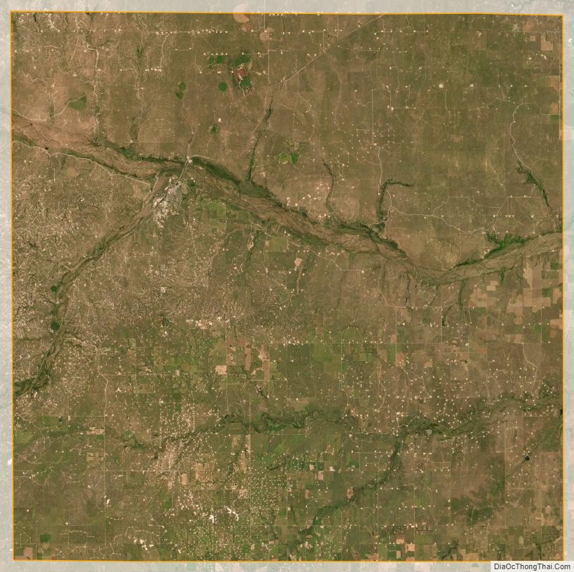
Hemphill County Satellite Map
Hemphill County Outline Map

See also
Map of Texas State and its subdivision:- Anderson
- Andrews
- Angelina
- Aransas
- Archer
- Armstrong
- Atascosa
- Austin
- Bailey
- Bandera
- Bastrop
- Baylor
- Bee
- Bell
- Bexar
- Blanco
- Borden
- Bosque
- Bowie
- Brazoria
- Brazos
- Brewster
- Briscoe
- Brooks
- Brown
- Burleson
- Burnet
- Caldwell
- Calhoun
- Callahan
- Cameron
- Camp
- Carson
- Cass
- Castro
- Chambers
- Cherokee
- Childress
- Clay
- Cochran
- Coke
- Coleman
- Collin
- Collingsworth
- Colorado
- Comal
- Comanche
- Concho
- Cooke
- Coryell
- Cottle
- Crane
- Crockett
- Crosby
- Culberson
- Dallam
- Dallas
- Dawson
- Deaf Smith
- Delta
- Denton
- Dewitt
- Dickens
- Dimmit
- Donley
- Duval
- Eastland
- Ector
- Edwards
- El Paso
- Ellis
- Erath
- Falls
- Fannin
- Fayette
- Fisher
- Floyd
- Foard
- Fort Bend
- Franklin
- Freestone
- Frio
- Gaines
- Galveston
- Garza
- Gillespie
- Glasscock
- Goliad
- Gonzales
- Gray
- Grayson
- Gregg
- Grimes
- Guadalupe
- Hale
- Hall
- Hamilton
- Hansford
- Hardeman
- Hardin
- Harris
- Harrison
- Hartley
- Haskell
- Hays
- Hemphill
- Henderson
- Hidalgo
- Hill
- Hockley
- Hood
- Hopkins
- Houston
- Howard
- Hudspeth
- Hunt
- Hutchinson
- Irion
- Jack
- Jackson
- Jasper
- Jeff Davis
- Jefferson
- Jim Hogg
- Jim Wells
- Johnson
- Jones
- Karnes
- Kaufman
- Kendall
- Kenedy
- Kent
- Kerr
- Kimble
- King
- Kinney
- Kleberg
- Knox
- La Salle
- Lamar
- Lamb
- Lampasas
- Lavaca
- Lee
- Leon
- Liberty
- Limestone
- Lipscomb
- Live Oak
- Llano
- Loving
- Lubbock
- Lynn
- Madison
- Marion
- Martin
- Mason
- Matagorda
- Maverick
- McCulloch
- McLennan
- McMullen
- Medina
- Menard
- Midland
- Milam
- Mills
- Mitchell
- Montague
- Montgomery
- Moore
- Morris
- Motley
- Nacogdoches
- Navarro
- Newton
- Nolan
- Nueces
- Ochiltree
- Oldham
- Orange
- Palo Pinto
- Panola
- Parker
- Parmer
- Pecos
- Polk
- Potter
- Presidio
- Rains
- Randall
- Reagan
- Real
- Red River
- Reeves
- Refugio
- Roberts
- Robertson
- Rockwall
- Runnels
- Rusk
- Sabine
- San Augustine
- San Jacinto
- San Patricio
- San Saba
- Schleicher
- Scurry
- Shackelford
- Shelby
- Sherman
- Smith
- Somervell
- Starr
- Stephens
- Sterling
- Stonewall
- Sutton
- Swisher
- Tarrant
- Taylor
- Terrell
- Terry
- Throckmorton
- Titus
- Tom Green
- Travis
- Trinity
- Tyler
- Upshur
- Upton
- Uvalde
- Val Verde
- Van Zandt
- Victoria
- Walker
- Waller
- Ward
- Washington
- Webb
- Wharton
- Wheeler
- Wichita
- Wilbarger
- Willacy
- Williamson
- Wilson
- Winkler
- Wise
- Wood
- Yoakum
- Young
- Zapata
- Zavala
- Alabama
- Alaska
- Arizona
- Arkansas
- California
- Colorado
- Connecticut
- Delaware
- District of Columbia
- Florida
- Georgia
- Hawaii
- Idaho
- Illinois
- Indiana
- Iowa
- Kansas
- Kentucky
- Louisiana
- Maine
- Maryland
- Massachusetts
- Michigan
- Minnesota
- Mississippi
- Missouri
- Montana
- Nebraska
- Nevada
- New Hampshire
- New Jersey
- New Mexico
- New York
- North Carolina
- North Dakota
- Ohio
- Oklahoma
- Oregon
- Pennsylvania
- Rhode Island
- South Carolina
- South Dakota
- Tennessee
- Texas
- Utah
- Vermont
- Virginia
- Washington
- West Virginia
- Wisconsin
- Wyoming