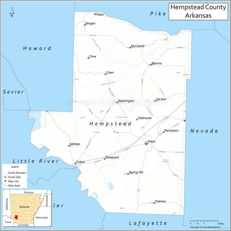
Hempstead County is a county located in the U.S. state of Arkansas. As of the 2020 census, the population was 20,065, down from 22,609 at the 2010 census. The county seat is Hope. Hempstead County is Arkansas’s fourth county, formed on December 15, 1818, alongside Clark and Pulaski counties. The county is named for Edward Hempstead, a delegate to the U.S. Congress from the Missouri Territory, which included present-day Arkansas at the time. It is an alcohol prohibition or dry county.
42nd United States President Bill Clinton (in office 1993-2001) was born in the county seat of Hope on August 19, 1946. Clinton is the only President to be born in Arkansas, as of 2022.
| Name: | Hempstead County |
|---|---|
| FIPS code: | 05-057 |
| State: | Arkansas |
| Founded: | December 15, 1818 |
| Named for: | Edward Hempstead |
| Seat: | Hope |
| Largest city: | Hope |
| Total Area: | 741 sq mi (1,920 km²) |
| Land Area: | 728 sq mi (1,890 km²) |
| Total Population: | 20,065 |
| Population Density: | 27/sq mi (10/km²) |
| Time zone: | UTC−6 (Central) |
| Summer Time Zone (DST): | UTC−5 (CDT) |
| Website: | hempsteadcountyar.com |
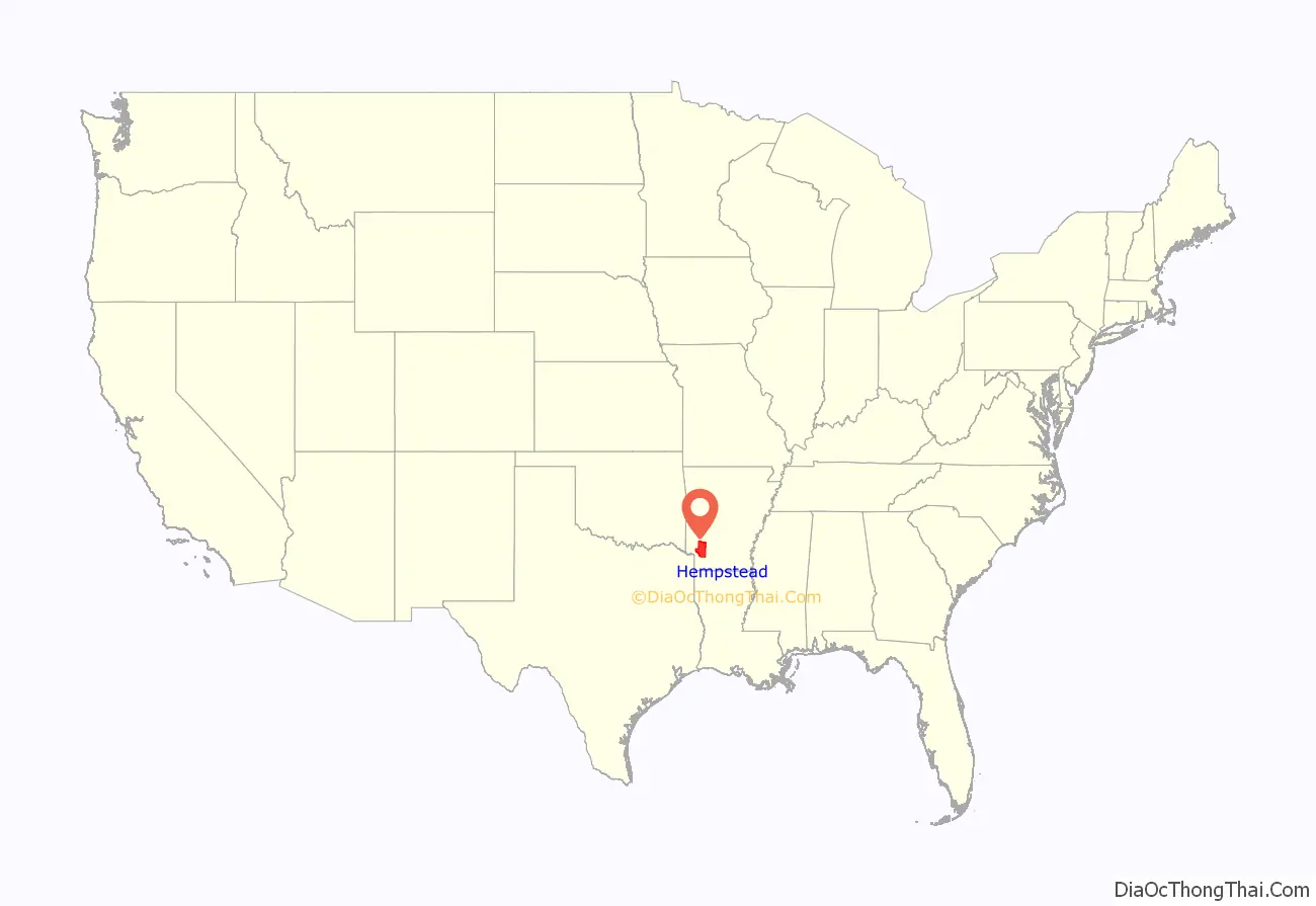
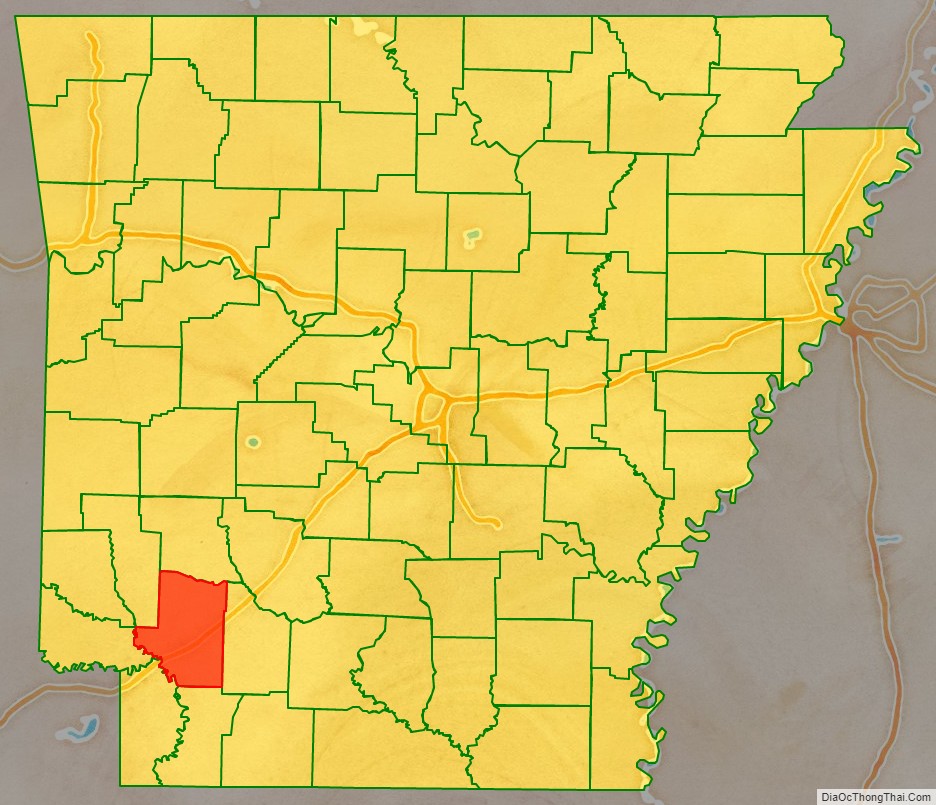
Hempstead County location map. Where is Hempstead County?
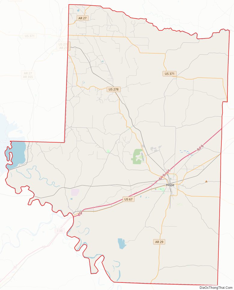
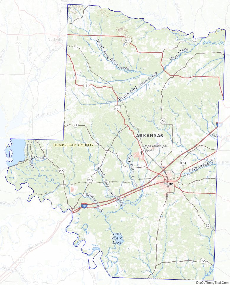
Hempstead County Road Map
Geography
According to the U.S. Census Bureau, the county has a total area of 741 square miles (1,920 km), of which 728 square miles (1,890 km) is land and 14 square miles (36 km) (1.8%) is water. Hempstead County is alternately considered as part of the greater regions of South Arkansas or Southwest Arkansas.
Major highways
- Interstate 30
- U.S. Highway 67
- U.S. Highway 278
- U.S. Highway 371
- Highway 4
- Highway 27
- Highway 29
- Highway 32
Adjacent counties
- Pike County (north)
- Nevada County (east)
- Lafayette County (south)
- Miller County (southwest)
- Little River County (west)
- Howard County (northwest)
Hempstead County Topographic Map
Hempstead County Satellite Map

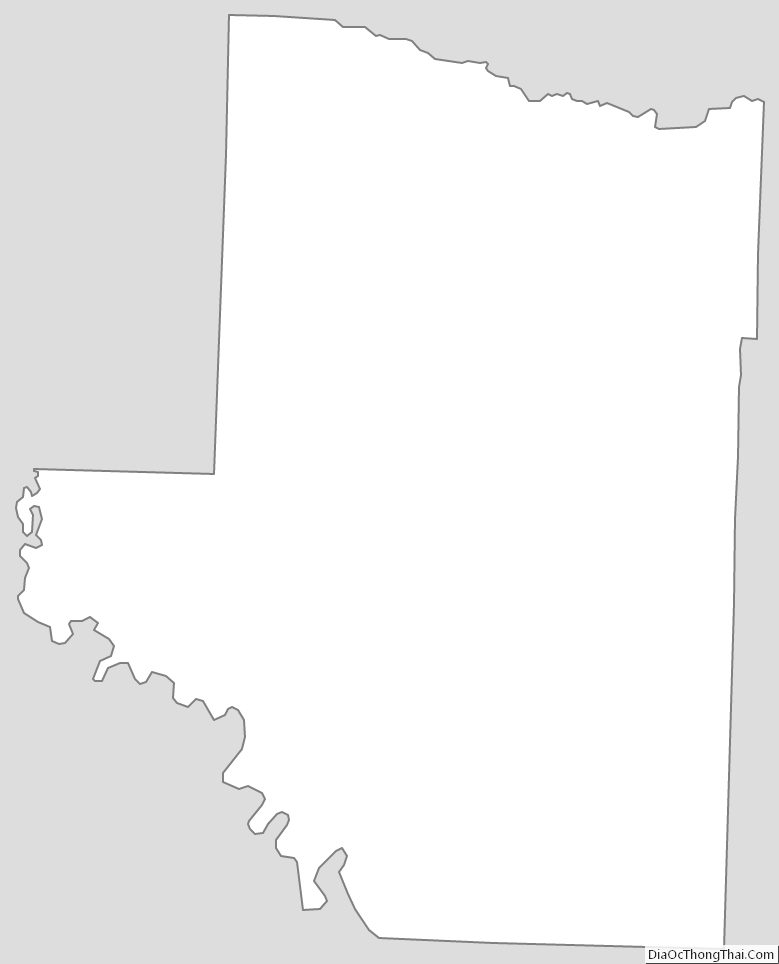
Hempstead County Outline Map
See also
Map of Arkansas State and its subdivision:- Arkansas
- Ashley
- Baxter
- Benton
- Boone
- Bradley
- Calhoun
- Carroll
- Chicot
- Clark
- Clay
- Cleburne
- Cleveland
- Columbia
- Conway
- Craighead
- Crawford
- Crittenden
- Cross
- Dallas
- Desha
- Drew
- Faulkner
- Franklin
- Fulton
- Garland
- Grant
- Greene
- Hempstead
- Hot Spring
- Howard
- Independence
- Izard
- Jackson
- Jefferson
- Johnson
- Lafayette
- Lawrence
- Lee
- Lincoln
- Little River
- Logan
- Lonoke
- Madison
- Marion
- Miller
- Mississippi
- Monroe
- Montgomery
- Nevada
- Newton
- Ouachita
- Perry
- Phillips
- Pike
- Poinsett
- Polk
- Pope
- Prairie
- Pulaski
- Randolph
- Saint Francis
- Saline
- Scott
- Searcy
- Sebastian
- Sevier
- Sharp
- Stone
- Union
- Van Buren
- Washington
- White
- Woodruff
- Yell
- Alabama
- Alaska
- Arizona
- Arkansas
- California
- Colorado
- Connecticut
- Delaware
- District of Columbia
- Florida
- Georgia
- Hawaii
- Idaho
- Illinois
- Indiana
- Iowa
- Kansas
- Kentucky
- Louisiana
- Maine
- Maryland
- Massachusetts
- Michigan
- Minnesota
- Mississippi
- Missouri
- Montana
- Nebraska
- Nevada
- New Hampshire
- New Jersey
- New Mexico
- New York
- North Carolina
- North Dakota
- Ohio
- Oklahoma
- Oregon
- Pennsylvania
- Rhode Island
- South Carolina
- South Dakota
- Tennessee
- Texas
- Utah
- Vermont
- Virginia
- Washington
- West Virginia
- Wisconsin
- Wyoming