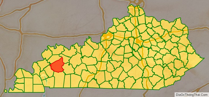
Hopkins County is a county located in the western part of the U.S. state of Kentucky. As of the 2020 census, the population was 45,423. Its county seat is Madisonville. Hopkins County was created December 9, 1806 from Henderson County. It was named for General Samuel Hopkins, an officer in both the American Revolutionary War and War of 1812, and later a Kentucky legislator and U.S. Congressman.
The Madisonville, Kentucky Micropolitan Statistical Area includes all of Hopkins County.
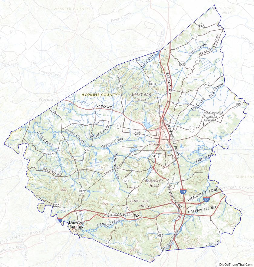
The topography ranges from flatlands along the broad river valleys of the Pond River, Tradewater River, and Green River, to hilly and rolling land in the southern and central parts of the county. Coal mines operate in the southern part of Hopkins County and agriculture is a mainstay in the northern part. Major crops are soybeans, corn, and tobacco. Along with coal, resources include oil and natural gas.
| Name: | Hopkins County |
|---|---|
| FIPS code: | 21-107 |
| State: | Kentucky |
| Founded: | 1806 |
| Named for: | Samuel Hopkins |
| Seat: | Madisonville |
| Largest city: | Madisonville |
| Total Area: | 554 sq mi (1,430 km²) |
| Land Area: | 542 sq mi (1,400 km²) |
| Total Population: | 45,423 |
| Population Density: | 82/sq mi (32/km²) |
| Time zone: | UTC−6 (Central) |
| Summer Time Zone (DST): | UTC−5 (CDT) |
| Website: | hopkinscounty.ky.gov |
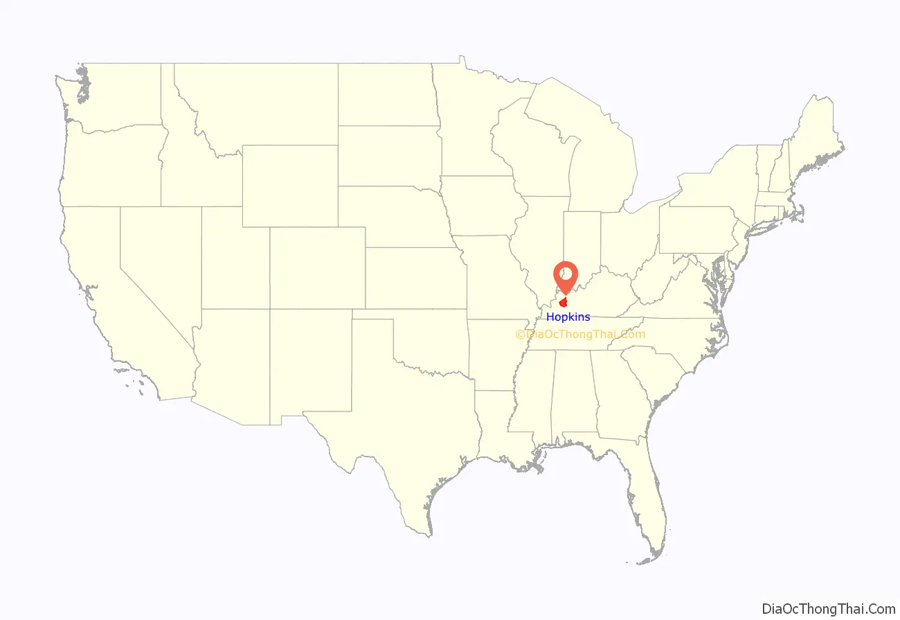
Hopkins County location map. Where is Hopkins County?
History
The earliest inhabitants were prehistoric Native Americans who lived, hunted, and farmed in the region. One of their settlements was a rough stone structure on Fort Ridge, which has since been destroyed by strip mining for coal. Some of the early settlers were Revolutionary War veterans who received land grants for their service from Virginia in the area southwest of the Green River. Among these was Baron Von Steuben, a Prussian officer who had trained George Washington’s Continental Army at Valley Forge during the winter of 1776–77. He had received a grant of several thousand acres in the northwest part of the county. According to tradition, Von Steuben was wounded in an Indian attack on his first visit to Kentucky. He then quit-claimed his property. Nevertheless, a salt spring on his grant came to be known as Steuben’s Lick. By the 1880s, the community that grew up around the lick was known as Manitou.
Roads in the county often followed animal trails that led to salt and mineral springs. The major traces were those which connected the county seat at Madisonville with Henderson to the north, Hopkinsville to the south, and Russellville to the southeast. Numerous other trails led to the mills and ferries on the Pond and Tradewater Rivers and their tributaries.
On January 3, 1829, Ashbyburg in the northeastern part of the county was incorporated. Located on the Green River, it thrived as a steamboat landing during the 19th century. Other antebellum communities included Nebo, Kentucky, northwest of Madisonville, and Charleston, Kentucky, named after “Free Charles,” a black freedman who operated a tavern in the southwest part of the county.
Hopkins County was divided by the American Civil War. Union supporters joined the 35th Kentucky Infantry (Mounted), a regiment recruited locally in late 1863 by James M. Shackelford, while in 1862 Adam Rankin Johnson had recruited Confederate troops for his 10th Kentucky Cavalry Regiment. The courthouse in Madisonville was burned by Kentucky Confederates led by Gen. Hylan Benton Lyon on December 17, 1864, as they passed through western Kentucky, since it was being used to house Union soldiers.
However, the harsh policies imposed by the occupying Union armies caused much resentment and served to increase the sympathy for the Confederate cause. Because of that, the majority of the white population voted for the Democratic Party well into the 20th century.
Farming was the major occupation in Hopkins County for most of the 19th century, with tobacco the leading crop. Around 1837 local blacksmith James Woolfolk found an outcropping of coal on his land.
Post-Civil War
John Bayless Earle, whom the town of Earlington, Kentucky was named for, opened the first coal mine in the county in 1869. Mining did not become a major industry until the Louisville & Nashville Railroad pushed its line southward from Henderson through Madisonville and toward Nashville in 1870.
Two years later, the Elizabethtown and Paducah Railroad (now Paducah and Louisville Railway) entered the county from the east. Many new communities were first established as railroad stops, including Crofton, Hanson, Mortons Gap, Nortonville, and White Plains. Dawson Springs, in the southwestern part of the county, began to thrive in the 1880s as a health resort, but its popularity had faded by the time of the Great Depression of the 1930s.
Economy and politics: late 20th century to present
Beginning in 1968, the majority white voters began to favor Republican Party presidential candidates. Since 2000, they have consistently voted for Republican candidates for the presidency (see table below), and increasingly so in local and statewide elections as well.
By 1970, Hopkins County was the second-largest producer of coal in the Western Coal Field, after Muhlenberg County, and the third-largest coal producer in the entire state after Muhlenberg and Pike County. In 1971 the county also ranked fifth in Kentucky in oil production.
Coal and oil-related businesses were major county employers by 1990. Development of resources was aided by the construction of the north–south Pennyrile Parkway and the east–west Western Kentucky Parkway through the county by the early 1970s. In 1987 farms occupied 41 percent of the land area, with 72 percent of farmland under cultivation.
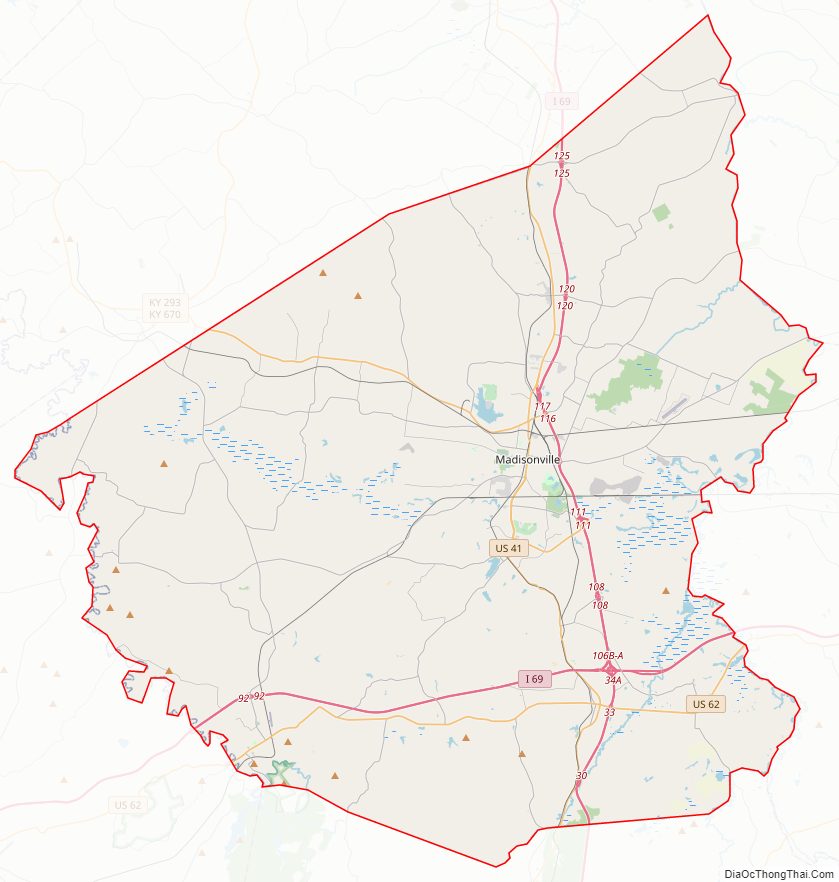
Hopkins County Road Map
Geography
According to the United States Census Bureau, the county has a total area of 554 square miles (1,430 km), of which 542 square miles (1,400 km) is land and 12 square miles (31 km) (2.2%) is water.
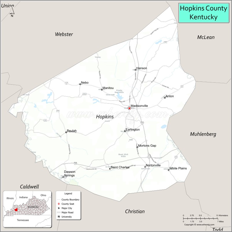
Adjacent counties
- Webster County (northwest)
- McLean County (northeast)
- Muhlenberg County (southeast)
- Christian County (south)
- Caldwell County (southwest)
Hopkins County Topographic Map
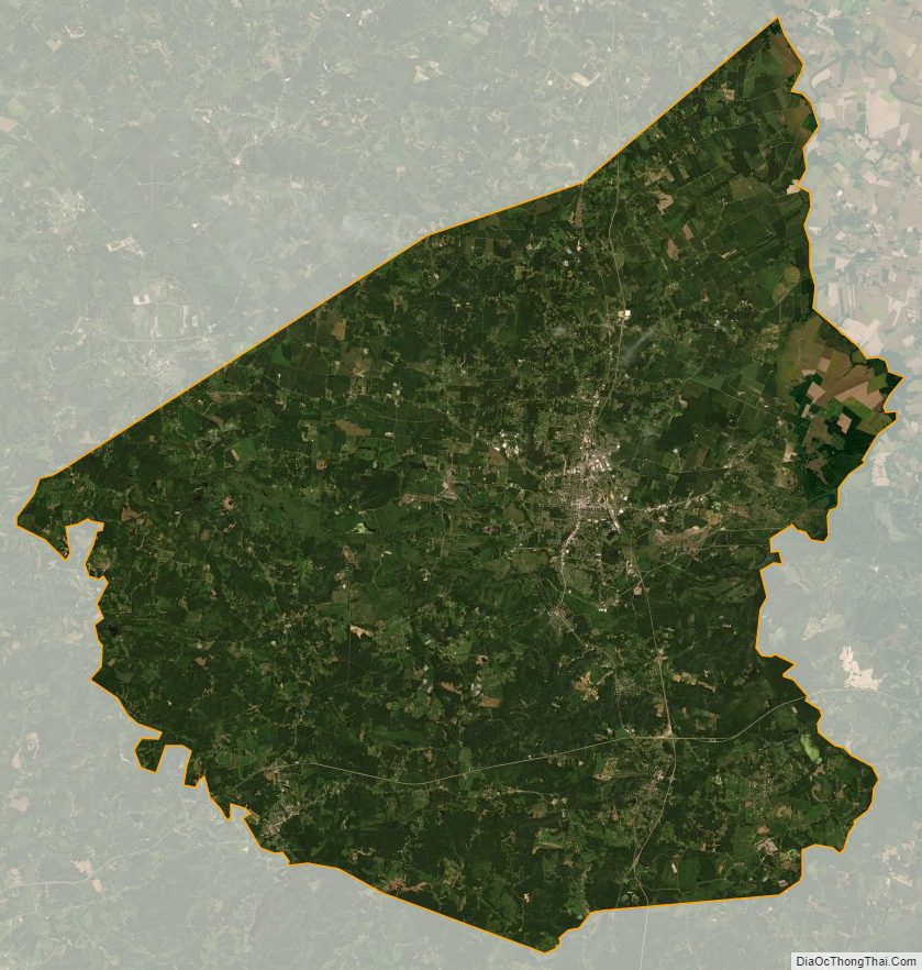
Hopkins County Satellite Map
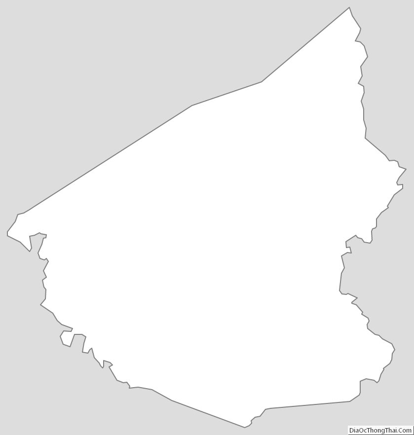
Hopkins County Outline Map
See also
Map of Kentucky State and its subdivision:- Adair
- Allen
- Anderson
- Ballard
- Barren
- Bath
- Bell
- Boone
- Bourbon
- Boyd
- Boyle
- Bracken
- Breathitt
- Breckinridge
- Bullitt
- Butler
- Caldwell
- Calloway
- Campbell
- Carlisle
- Carroll
- Carter
- Casey
- Christian
- Clark
- Clay
- Clinton
- Crittenden
- Cumberland
- Daviess
- Edmonson
- Elliott
- Estill
- Fayette
- Fleming
- Floyd
- Franklin
- Fulton
- Gallatin
- Garrard
- Grant
- Graves
- Grayson
- Green
- Greenup
- Hancock
- Hardin
- Harlan
- Harrison
- Hart
- Henderson
- Henry
- Hickman
- Hopkins
- Jackson
- Jefferson
- Jessamine
- Johnson
- Kenton
- Knott
- Knox
- Larue
- Laurel
- Lawrence
- Lee
- Leslie
- Letcher
- Lewis
- Lincoln
- Livingston
- Logan
- Lyon
- Madison
- Magoffin
- Marion
- Marshall
- Martin
- Mason
- McCracken
- McCreary
- McLean
- Meade
- Menifee
- Mercer
- Metcalfe
- Monroe
- Montgomery
- Morgan
- Muhlenberg
- Nelson
- Nicholas
- Ohio
- Oldham
- Owen
- Owsley
- Pendleton
- Perry
- Pike
- Powell
- Pulaski
- Robertson
- Rockcastle
- Rowan
- Russell
- Scott
- Shelby
- Simpson
- Spencer
- Taylor
- Todd
- Trigg
- Trimble
- Union
- Warren
- Washington
- Wayne
- Webster
- Whitley
- Wolfe
- Woodford
- Alabama
- Alaska
- Arizona
- Arkansas
- California
- Colorado
- Connecticut
- Delaware
- District of Columbia
- Florida
- Georgia
- Hawaii
- Idaho
- Illinois
- Indiana
- Iowa
- Kansas
- Kentucky
- Louisiana
- Maine
- Maryland
- Massachusetts
- Michigan
- Minnesota
- Mississippi
- Missouri
- Montana
- Nebraska
- Nevada
- New Hampshire
- New Jersey
- New Mexico
- New York
- North Carolina
- North Dakota
- Ohio
- Oklahoma
- Oregon
- Pennsylvania
- Rhode Island
- South Carolina
- South Dakota
- Tennessee
- Texas
- Utah
- Vermont
- Virginia
- Washington
- West Virginia
- Wisconsin
- Wyoming