Howard County is a county in the state of Nebraska. As of the 2010 United States Census, the population was 6,274. Its county seat is St. Paul. The county was formed in 1871 and named after Civil War General Oliver Otis Howard.
Howard County is part of the Grand Island, NE Metropolitan Statistical Area.
In the Nebraska license plate system, Howard County is represented by the prefix 49 (it had the 49th-largest number of vehicles registered in the state when the license plate system was established in 1922).
| Name: | Howard County |
|---|---|
| FIPS code: | 31-093 |
| State: | Nebraska |
| Founded: | 1871 |
| Named for: | Oliver O. Howard |
| Seat: | St. Paul |
| Largest city: | St. Paul |
| Total Area: | 576 sq mi (1,490 km²) |
| Land Area: | 569 sq mi (1,470 km²) |
| Total Population: | 6,531 |
| Population Density: | 11.3/sq mi (4.4/km²) |
| Time zone: | UTC−6 (Central) |
| Summer Time Zone (DST): | UTC−5 (CDT) |
| Website: | www.howardcounty.ne.gov |
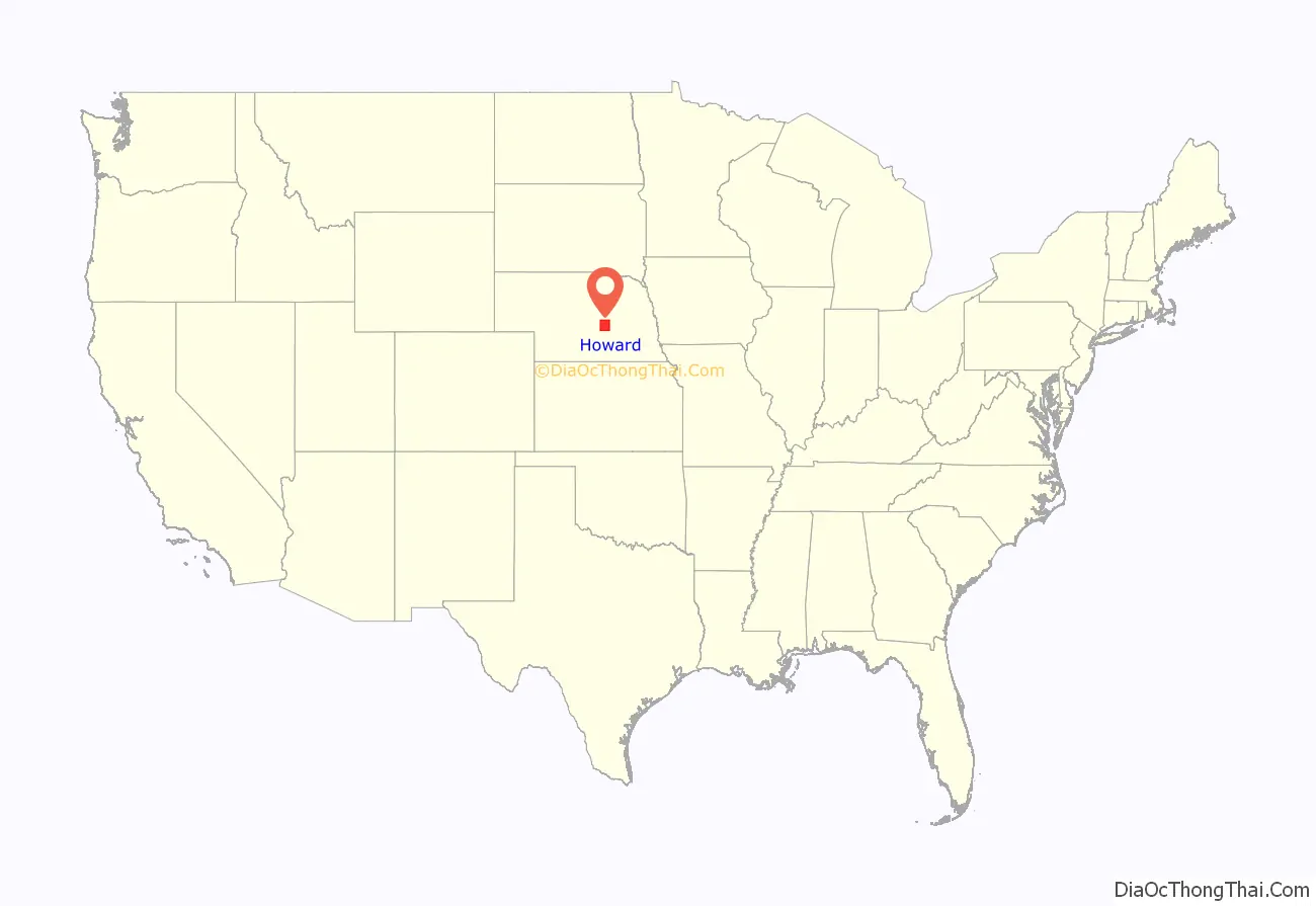
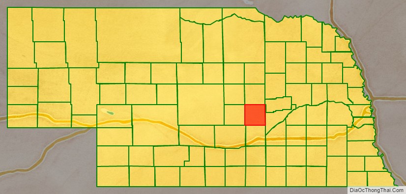
Howard County location map. Where is Howard County?
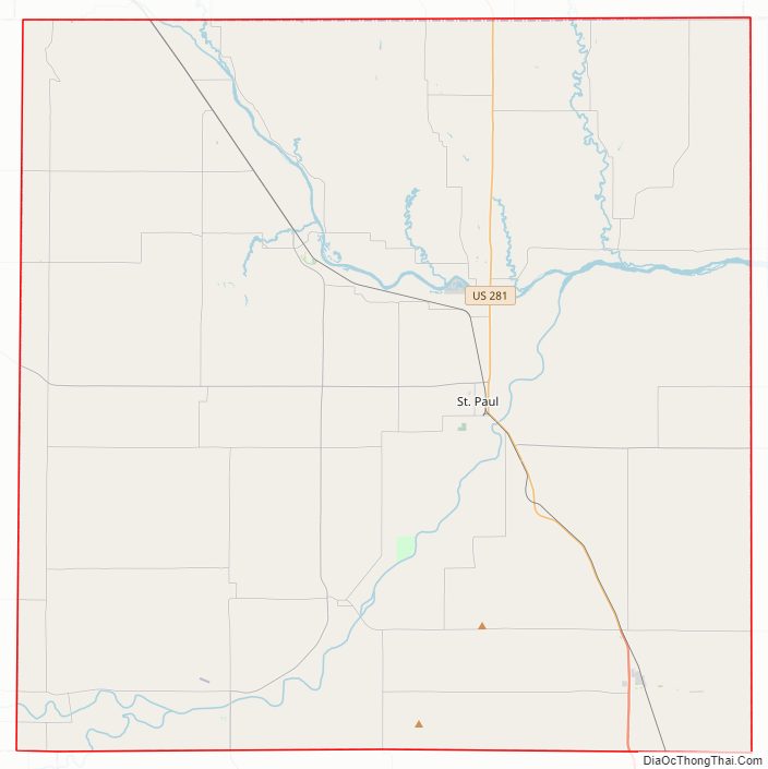
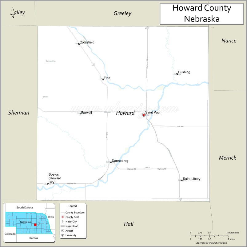
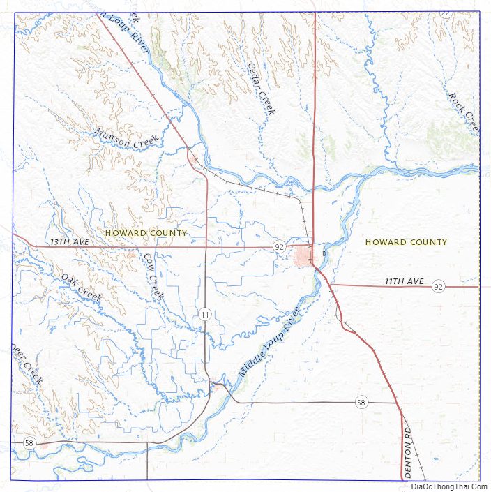
Howard County Road Map
Geography
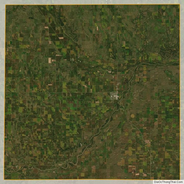
The terrain of Howard consists of low rolling hills. The leveled hilltops are mostly used for agriculture. The Upper Loup River flows southeastward into the county near its NW corner, turning eastward to flow toward its junction with Middle Loup River. The Middle Loup River flows northeastward into the county near its SW corner, turning north to join with the Upper Loup River near the county midpoint to form the Loup River, flowing eastward into Merrick County. The county has a total area of 576 square miles (1,490 km), of which 569 square miles (1,470 km) is land and 6.3 square miles (16 km) (1.1%) is water.
Major highways
- U.S. Highway 281
- Nebraska Highway 11
- Nebraska Highway 22
- Nebraska Highway 58
- Nebraska Highway 92
Adjacent counties
- Merrick County – east
- Hall County – south
- Buffalo County – southwest
- Sherman County – west
- Greeley County – north
Protected areas
- Loup Junction State Wildlife Management Area
Howard County Topographic Map
Howard County Satellite Map
Howard County Outline Map

See also
Map of Nebraska State and its subdivision:- Adams
- Antelope
- Arthur
- Banner
- Blaine
- Boone
- Box Butte
- Boyd
- Brown
- Buffalo
- Burt
- Butler
- Cass
- Cedar
- Chase
- Cherry
- Cheyenne
- Clay
- Colfax
- Cuming
- Custer
- Dakota
- Dawes
- Dawson
- Deuel
- Dixon
- Dodge
- Douglas
- Dundy
- Fillmore
- Franklin
- Frontier
- Furnas
- Gage
- Garden
- Garfield
- Gosper
- Grant
- Greeley
- Hall
- Hamilton
- Harlan
- Hayes
- Hitchcock
- Holt
- Hooker
- Howard
- Jefferson
- Johnson
- Kearney
- Keith
- Keya Paha
- Kimball
- Knox
- Lancaster
- Lincoln
- Logan
- Loup
- Madison
- McPherson
- Merrick
- Morrill
- Nance
- Nemaha
- Nuckolls
- Otoe
- Pawnee
- Perkins
- Phelps
- Pierce
- Platte
- Polk
- Red Willow
- Richardson
- Rock
- Saline
- Sarpy
- Saunders
- Scotts Bluff
- Seward
- Sheridan
- Sherman
- Sioux
- Stanton
- Thayer
- Thomas
- Thurston
- Valley
- Washington
- Wayne
- Webster
- Wheeler
- York
- Alabama
- Alaska
- Arizona
- Arkansas
- California
- Colorado
- Connecticut
- Delaware
- District of Columbia
- Florida
- Georgia
- Hawaii
- Idaho
- Illinois
- Indiana
- Iowa
- Kansas
- Kentucky
- Louisiana
- Maine
- Maryland
- Massachusetts
- Michigan
- Minnesota
- Mississippi
- Missouri
- Montana
- Nebraska
- Nevada
- New Hampshire
- New Jersey
- New Mexico
- New York
- North Carolina
- North Dakota
- Ohio
- Oklahoma
- Oregon
- Pennsylvania
- Rhode Island
- South Carolina
- South Dakota
- Tennessee
- Texas
- Utah
- Vermont
- Virginia
- Washington
- West Virginia
- Wisconsin
- Wyoming