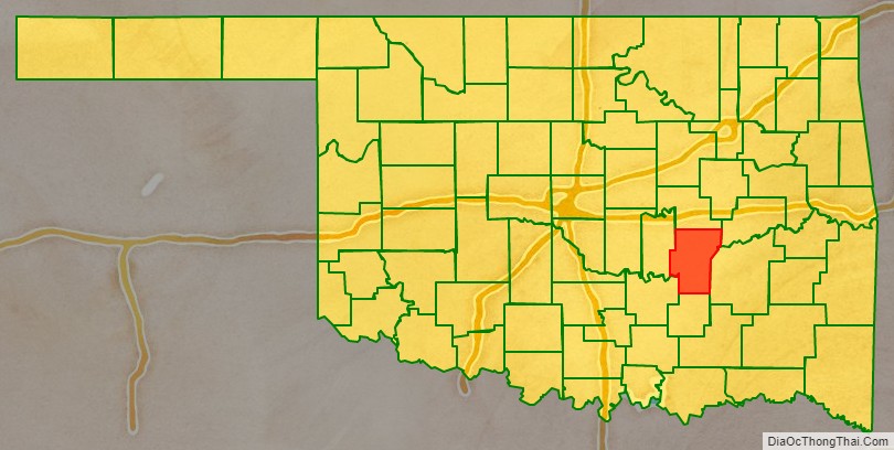
Hughes County is a county located in south central U.S. state of Oklahoma. As of the 2010 census, the population was 14,003. Its county seat is Holdenville. The county was named for W. C. Hughes, an Oklahoma City lawyer who was a member of the Oklahoma Constitutional Convention.
| Name: | Hughes County |
|---|---|
| FIPS code: | 40-063 |
| State: | Oklahoma |
| Founded: | 1907 |
| Named for: | W. C. Hughes |
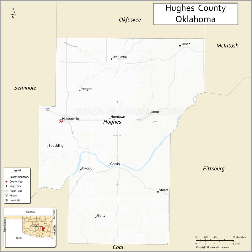
| Seat: | Holdenville |
| Largest city: | Holdenville |
| Total Area: | 815 sq mi (2,110 km²) |
| Land Area: | 805 sq mi (2,080 km²) |
| Total Population: | 14,003 |
| Population Density: | 17/sq mi (7/km²) |
| Time zone: | UTC−6 (Central) |
| Summer Time Zone (DST): | UTC−5 (CDT) |
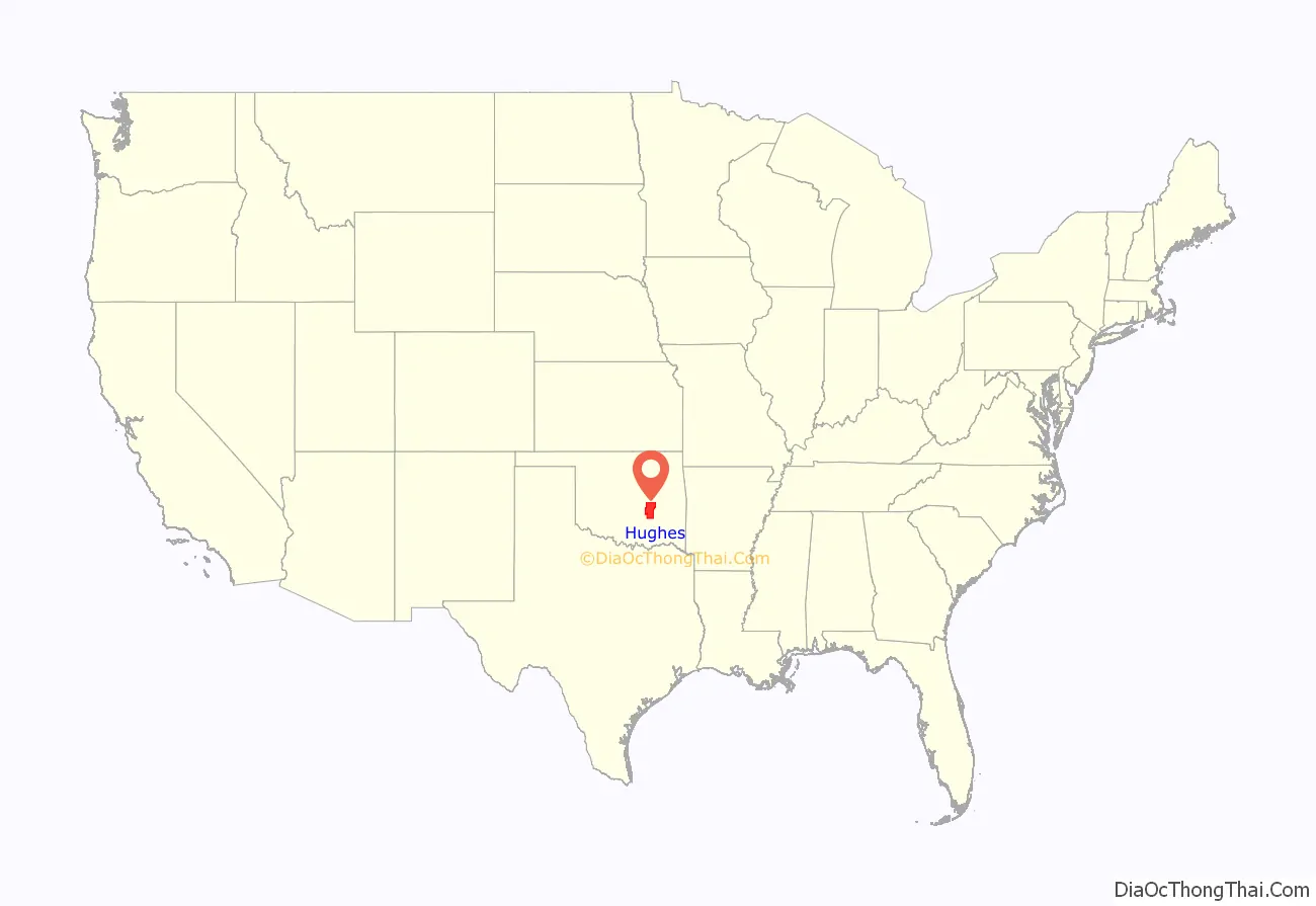
Hughes County location map. Where is Hughes County?
History
The area now occupied by Hughes County was part of Indian Territory in the 19th Century. The Creeks settled in the northern part, which fell within the Wewoka District of the Creek Nation, while the Choctaws settled in the southern, which fell within portions of Atoka County and Tobucksy County of the Choctaw Nation. In 1834, Camp Holmes was established and used as a base for the Dodge-Leavenworth Expedition. It was near Edwards’ Store on Little River, one of the first settlements in this area. Also, following Quapaw removal in 1834, several small groups of Quapaw dispersed throughout Indian Territory. There were absentee groups of Quapaw living along the Red River and in Creek, Choctaw and Cherokee territory. There was a Quapaw settlement near camp Holmes in Hughes County.
When the Choctaw, Oklahoma and Gulf Railroad built in 1895, the Edward’s settlement was moved north for access to the railroad. The town established there was named Holden, for James Franklin Holder, a railroad official. However, the Post Office Department would not accept that name because it was too similar to the name Holder. The town was renamed Holdenville. The post office opened November 15, 1895. Holdenville incorporated in 1898.
Hughes County was created at statehood and named for W. C. Hughes, an Oklahoma City lawyer who was a member of the Oklahoma Constitutional Convention.
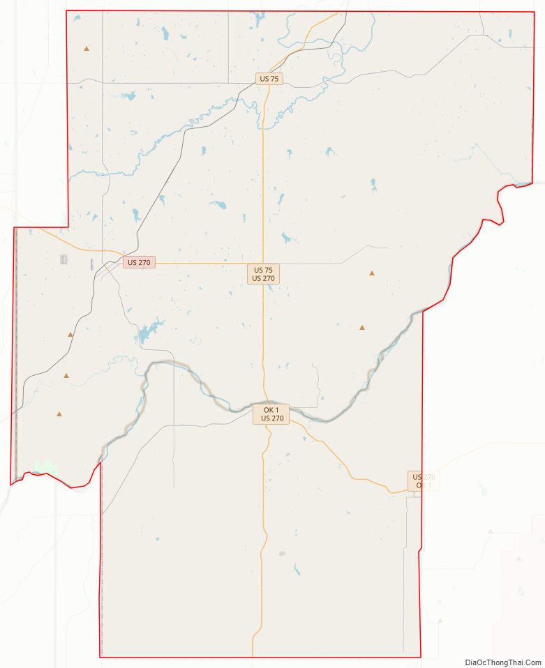
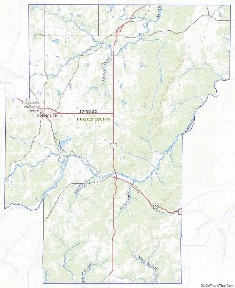
Hughes County Road Map
Geography
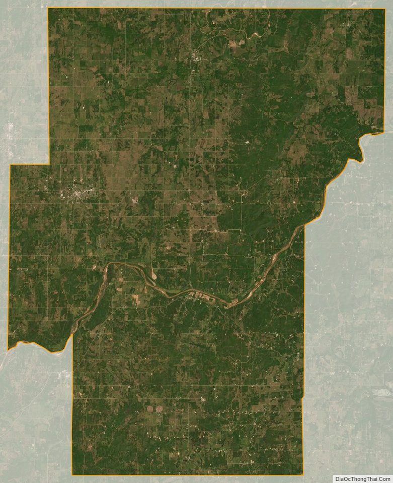
According to the U.S. Census Bureau, the county has a total area of 815 square miles (2,110 km), of which 805 square miles (2,080 km) is land and 10 square miles (26 km) (1.3%) is water. The county is located in the Sandstone Hills physiographic region. It is drained by the North Canadian River, Canadian River, and Little River.
The county includes Holdenville and Wetumka lakes.
Major highways
- U.S. Highway 75
- U.S. Highway 270
- State Highway 9
- State Highway 27
- State Highway 48
Adjacent counties
- Okfuskee County (north)
- McIntosh County (northeast)
- Pittsburg County (east)
- Coal County (south)
- Pontotoc County (southwest)
- Seminole County (west)
Hughes County Topographic Map
Hughes County Satellite Map
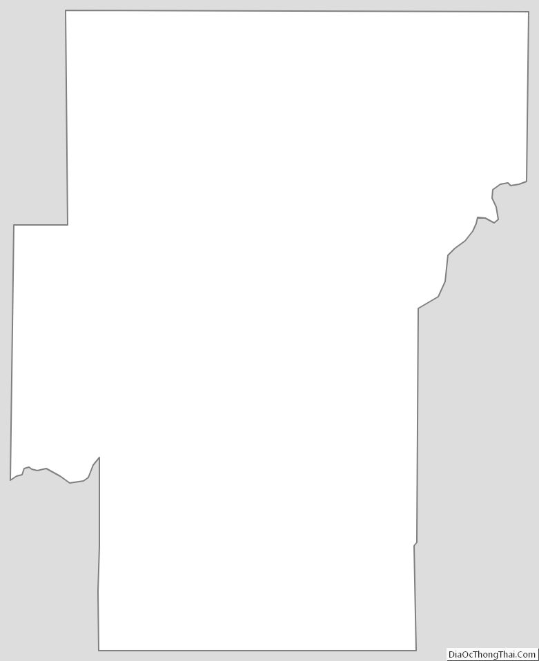
Hughes County Outline Map
See also
Map of Oklahoma State and its subdivision:- Adair
- Alfalfa
- Atoka
- Beaver
- Beckham
- Blaine
- Bryan
- Caddo
- Canadian
- Carter
- Cherokee
- Choctaw
- Cimarron
- Cleveland
- Coal
- Comanche
- Cotton
- Craig
- Creek
- Custer
- Delaware
- Dewey
- Ellis
- Garfield
- Garvin
- Grady
- Grant
- Greer
- Harmon
- Harper
- Haskell
- Hughes
- Jackson
- Jefferson
- Johnston
- Kay
- Kingfisher
- Kiowa
- Latimer
- Le Flore
- Lincoln
- Logan
- Love
- Major
- Marshall
- Mayes
- McClain
- McCurtain
- McIntosh
- Murray
- Muskogee
- Noble
- Nowata
- Okfuskee
- Oklahoma
- Okmulgee
- Osage
- Ottawa
- Pawnee
- Payne
- Pittsburg
- Pontotoc
- Pottawatomie
- Pushmataha
- Roger Mills
- Rogers
- Seminole
- Sequoyah
- Stephens
- Texas
- Tillman
- Tulsa
- Wagoner
- Washington
- Washita
- Woods
- Woodward
- Alabama
- Alaska
- Arizona
- Arkansas
- California
- Colorado
- Connecticut
- Delaware
- District of Columbia
- Florida
- Georgia
- Hawaii
- Idaho
- Illinois
- Indiana
- Iowa
- Kansas
- Kentucky
- Louisiana
- Maine
- Maryland
- Massachusetts
- Michigan
- Minnesota
- Mississippi
- Missouri
- Montana
- Nebraska
- Nevada
- New Hampshire
- New Jersey
- New Mexico
- New York
- North Carolina
- North Dakota
- Ohio
- Oklahoma
- Oregon
- Pennsylvania
- Rhode Island
- South Carolina
- South Dakota
- Tennessee
- Texas
- Utah
- Vermont
- Virginia
- Washington
- West Virginia
- Wisconsin
- Wyoming