Indiana County is a county in the Commonwealth of Pennsylvania. It is located in the west central part of Pennsylvania. As of the 2020 census, the population was 83,246. Its county seat is Indiana. Indiana County comprises the Indiana, PA Micropolitan Statistical Area, which is also included in the Pittsburgh-New Castle-Weirton, PA-WV-OH Combined Statistical Area.
Prior to the Revolutionary War, some settlers proposed this as part of a larger, separate colony to be known as Vandalia, but opposing interests and the war intervened. Afterward, claims to the territory by both the states of Virginia and Pennsylvania had to be reconciled. After this land was assigned to Pennsylvania by the federal government according to the placement of the Mason–Dixon line, Indiana County was created on March 30, 1803, from parts of Westmoreland and Clearfield counties and was formally organized in 1806.
| Name: | Indiana County |
|---|---|
| FIPS code: | 42-063 |
| State: | Pennsylvania |
| Founded: | November 3, 1806 |
| Seat: | Indiana |
| Total Area: | 834 sq mi (2,160 km²) |
| Land Area: | 827 sq mi (2,140 km²) |
| Total Population: | 83,246 |
| Population Density: | 101/sq mi (39/km²) |
| Time zone: | UTC−5 (Eastern) |
| Summer Time Zone (DST): | UTC−4 (EDT) |
| Website: | www.indianacountypa.gov |
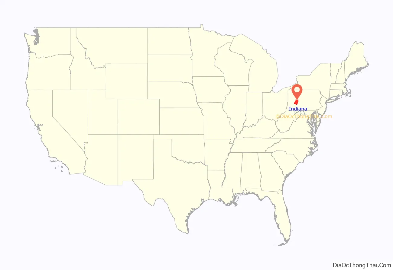
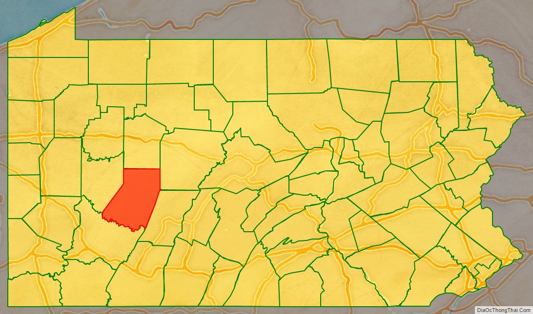
Indiana County location map. Where is Indiana County?
History
Indiana County (Indiana meaning “land of the Indians”) derives its name from the so-called “Indiana Grant of 1768” that the Iroquois Six Nations were forced to make to “suffering traders” under the Fort Stanwix Treaty of 1768. The Iroquois had controlled much of the Ohio River valley as their hunting grounds since the 17th century, and Anglo-American colonists were moving into the area and wanted to develop it. Traders arranged to force the Iroquois to grant land under the treaty in relations to losses due to Pontiac’s Rebellion.
Some of the grantees joined forces with the Ohio Company, forming a larger development company based on enlarging their grant of land. They proposed that the entire large area would become a new British colony, possibly to be called Pittsylvania or Vandalia. It was to be bordered on the north and west by the Ohio River, and made up of what are now parts of eastern Kentucky, northern West Virginia (then part of the Virginia Colony), and western Pennsylvania. Anglo-European colonists from Virginia and Pennsylvania had already started to move into the area, which was identified by these various names as Indiana and the other above names on some maps of the late 1700s.
Opposition from other interest groups and the American Revolutionary War intervened before Britain approved such a colony. Afterward, some United States speculators proposed setting up a state in this area to be called Vandalia, or Westsylvania, as appears on some maps of the period.
But both the states of Virginia and Pennsylvania claimed the land based on their colonial charters. In establishing the Mason–Dixon line, the federal government assigned the Indiana Grant to Pennsylvania. As population increased after the war, this county was made up in 1803 of territory from Westmoreland and Clearfield counties; it was formally organized in 1806.
Kentucky and West Virginia continued to be associated with Virginia for some time, being separately admitted as states in the early 19th century and during the American Civil War, respectively. The area in Pennsylvania was unrelated to and was physically separated from the later named Indiana Territory established north of the Ohio River in 1800 by the new United States; that territory was eventually admitted to the Union as the State of Indiana.
Indiana County was known as a “hotbed of abolition”, and was home to at least two African Methodist Episcopal Zion churches as well as other anti-slavery Protestants such as Wesleyan Methodists and Baptists. It was also in Indiana, local abolitionist leader James Moorhead published several anti-slavery newspapers. The first of these was The Clarion of Freedom, founded in 1843. Moorhead eventually sold the Clarion and founded a new anti-slavery paper, the Indiana Independent, which he published until his death in 1857. The Independent was published by his son J. W. Moorhead after his death. Blairsville was home to another abolitionist newspaper, The Appalachian, which was pro-Free Soil from 1848.
Indiana County was an active hub of the Underground Railroad. At least 90 county residents are known to have been conductors or agents, guiding fugitive slaves between hiding places on their way to freedom in Canada.
In the 21st century, Indiana County comprises the Indiana, PA Micropolitan Statistical Area. This is included in the Pittsburgh-New Castle-Weirton, PA-WV-OH Combined Statistical Area. It is in the defined region of the Pittsburgh media market. Indiana County is served by three different area codes: 724, 814, and 582.
The county proclaims itself the “Christmas Tree Capital of the World”, shipping over one million trees annually. Agriculture is a major part of its economy.
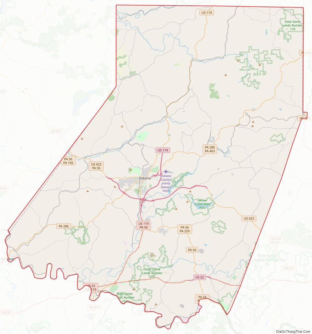
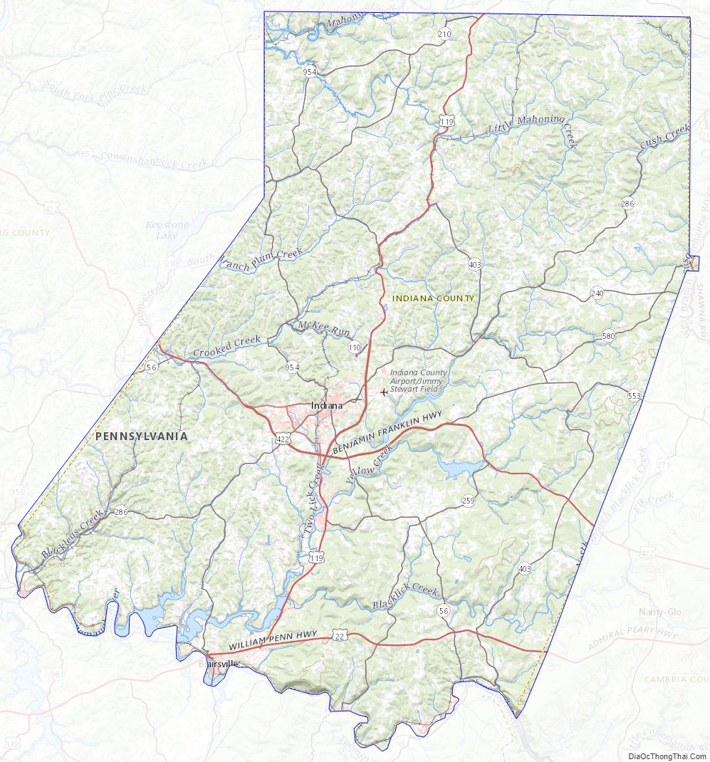
Indiana County Road Map
Geography
According to the U.S. Census Bureau, the county has a total area of 834 square miles (2,160 km), of which 827 square miles (2,140 km) is land and 7.3 square miles (19 km) (0.9%) is water. Located in the county is the Buttermilk Falls Natural Area. The county has a humid continental climate which is warm-summer, (Dfb) except along the Conemaugh, from below Strangford and the Kiskiminetas River, where it is hot-summer (Dfa). Average monthly temperatures in the borough of Indiana range from 27.2 °F in January to 70.9 °F in July. [1]
Adjacent counties
- Jefferson County (north)
- Clearfield County (northeast)
- Cambria County (southeast)
- Westmoreland County (south)
- Armstrong County (west)
Major highways
- US 22
- US 119
- US 219
- US 422
- US 422 Bus.
- PA 36
- PA 56
- PA 85
- PA 110
- PA 156
- PA 210
- PA 217
- PA 240
- PA 259
- PA 286
- PA 403
- PA 553
- PA 580
- PA 711
- PA 954
Indiana County Topographic Map
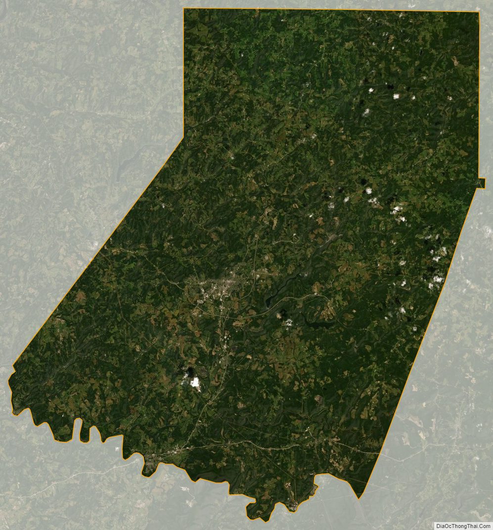
Indiana County Satellite Map
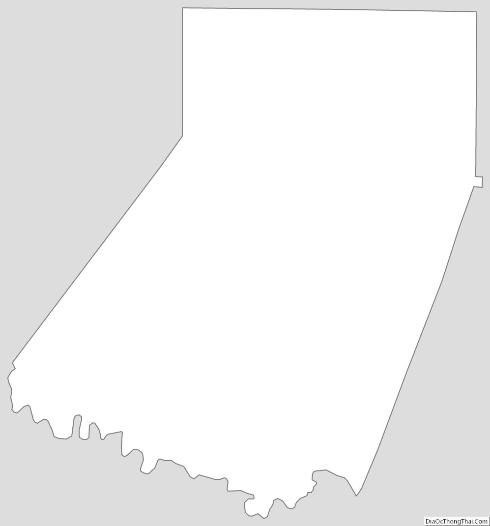
Indiana County Outline Map
See also
Map of Pennsylvania State and its subdivision:- Adams
- Allegheny
- Armstrong
- Beaver
- Bedford
- Berks
- Blair
- Bradford
- Bucks
- Butler
- Cambria
- Cameron
- Carbon
- Centre
- Chester
- Clarion
- Clearfield
- Clinton
- Columbia
- Crawford
- Cumberland
- Dauphin
- Delaware
- Elk
- Erie
- Fayette
- Forest
- Franklin
- Fulton
- Greene
- Huntingdon
- Indiana
- Jefferson
- Juniata
- Lackawanna
- Lancaster
- Lawrence
- Lebanon
- Lehigh
- Luzerne
- Lycoming
- Mc Kean
- Mercer
- Mifflin
- Monroe
- Montgomery
- Montour
- Northampton
- Northumberland
- Perry
- Philadelphia
- Pike
- Potter
- Schuylkill
- Snyder
- Somerset
- Sullivan
- Susquehanna
- Tioga
- Union
- Venango
- Warren
- Washington
- Wayne
- Westmoreland
- Wyoming
- York
- Alabama
- Alaska
- Arizona
- Arkansas
- California
- Colorado
- Connecticut
- Delaware
- District of Columbia
- Florida
- Georgia
- Hawaii
- Idaho
- Illinois
- Indiana
- Iowa
- Kansas
- Kentucky
- Louisiana
- Maine
- Maryland
- Massachusetts
- Michigan
- Minnesota
- Mississippi
- Missouri
- Montana
- Nebraska
- Nevada
- New Hampshire
- New Jersey
- New Mexico
- New York
- North Carolina
- North Dakota
- Ohio
- Oklahoma
- Oregon
- Pennsylvania
- Rhode Island
- South Carolina
- South Dakota
- Tennessee
- Texas
- Utah
- Vermont
- Virginia
- Washington
- West Virginia
- Wisconsin
- Wyoming