Iron County is a county in the Upper Peninsula of the U.S. state of Michigan. As of the 2020 Census, the population was 11,631. The county seat is Crystal Falls.
| Name: | Iron County |
|---|---|
| FIPS code: | 26-071 |
| State: | Michigan |
| Founded: | April 3, 1885 |
| Named for: | Iron ore |
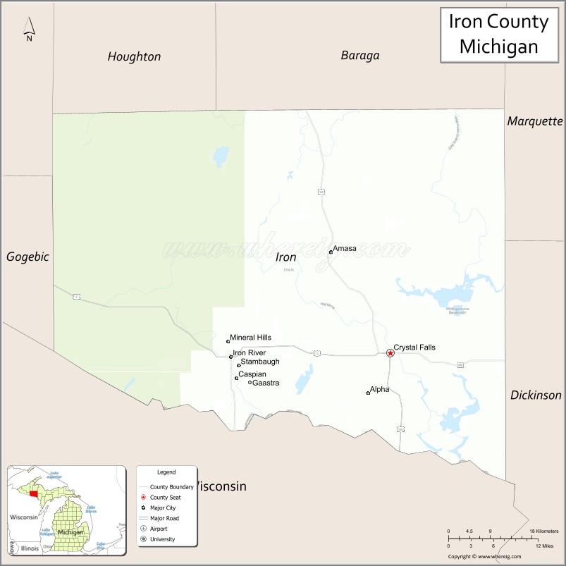
| Seat: | Crystal Falls |
| Largest city: | Iron River |
| Total Area: | 1,211 sq mi (3,140 km²) |
| Land Area: | 1,166 sq mi (3,020 km²) |
| Total Population: | 11,631 |
| Population Density: | 10/sq mi (4/km²) |
| Time zone: | UTC−6 (Central) |
| Summer Time Zone (DST): | UTC−5 (CDT) |
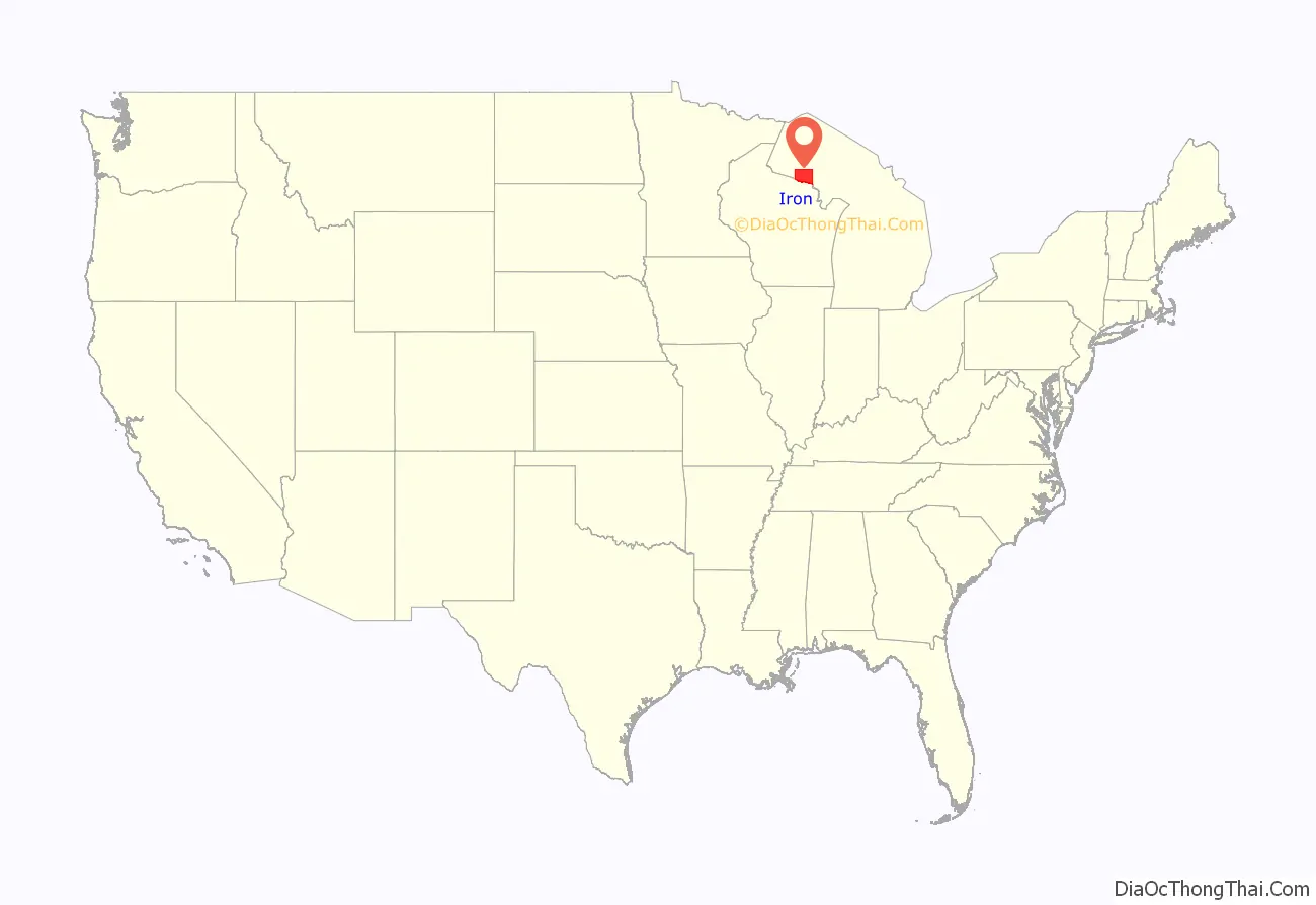
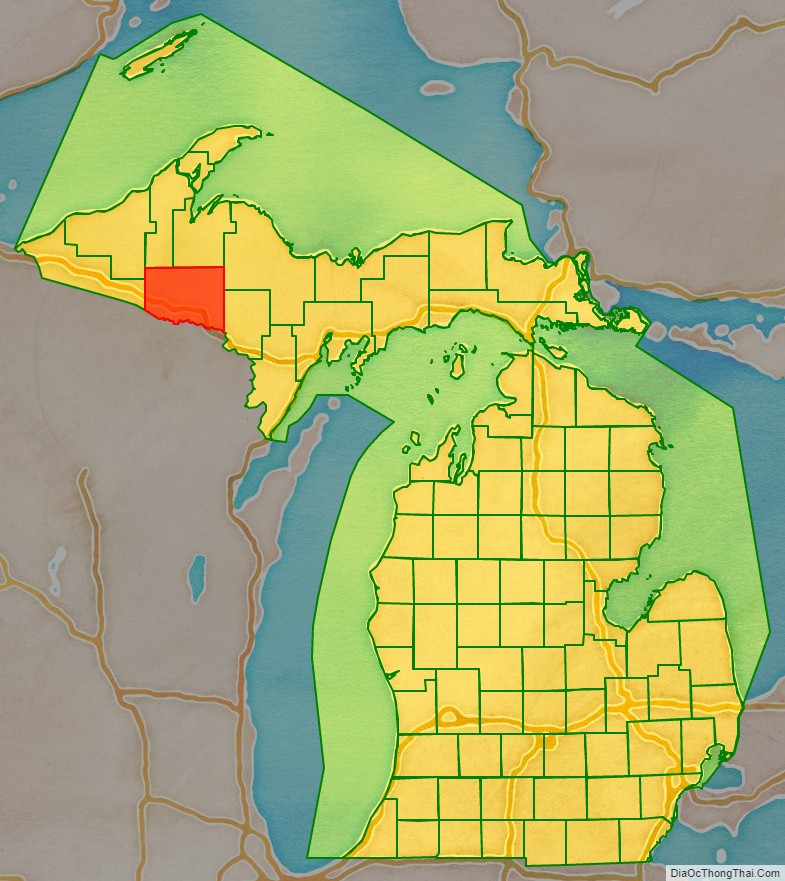
Iron County location map. Where is Iron County?
History
Iron County was organized in 1885, with territory partitioned from Marquette and Menominee counties. In 1890, the county’s population was 4,432. It was named for the valuable iron ore found within its borders.
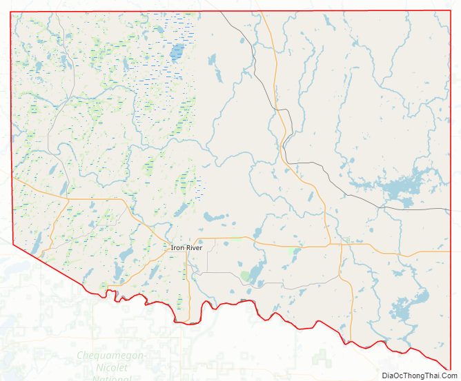
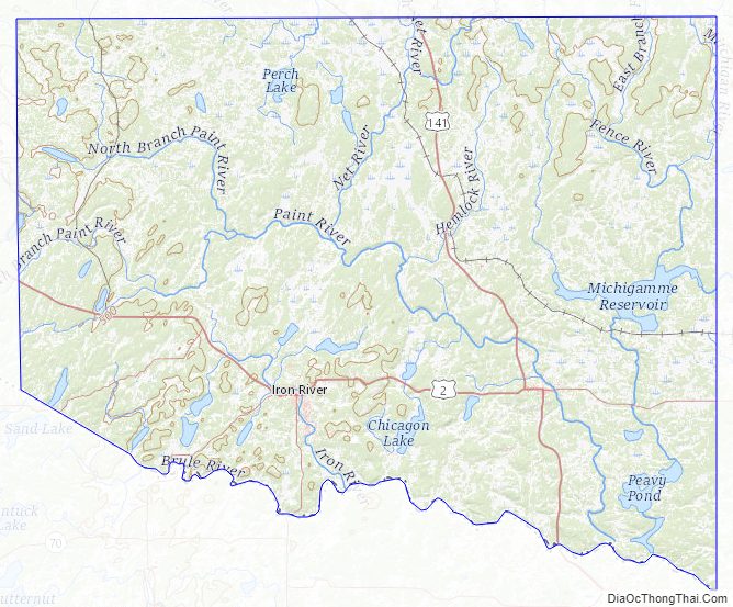
Iron County Road Map
Geography
According to the U.S. Census Bureau, the county has an area of 1,211 square miles (3,140 km), of which 1,166 square miles (3,020 km) is land and 45 square miles (120 km) (3.7%) is water. Along with Dickinson County, it is one of only two landlocked counties in the Upper Peninsula.
Major highways
- US 2 – runs east–west through lower part of county. Enters west line at 6 miles (10 km) above SW corner, then runs east and southeast to Crystal Falls, where it turns south and runs into Wisconsin. Passes Mineral Hills, Iron River, and Fortune Lake.
- US 141 – runs north–south through center of county. Enters north line of county from Covington in Baraga County, then runs south to intersection with US-2 at Crystal Falls.
- M-69 – runs east from Crystal Falls into Dickinson County.
- M-73 – enters south line of county from Nelma, Wisconsin, then runs northeast to intersection with US-2 at Iron River.
- M-189 – enters south line of county from Tipler, Wisconsin, then runs north to intersection with US-2 at Iron River.
Adjacent counties
- Houghton County (north/EST Border)
- Baraga County (north/EST Border)
- Marquette County (northeast/EST Border)
- Dickinson County (east)
- Florence County, Wisconsin (southeast)
- Forest County, Wisconsin (south)
- Vilas County, Wisconsin (southwest)
- Gogebic County (west)
- Ontonagon County (northwest/EST Border)
National protected area
- Ottawa National Forest (part)
Iron County Topographic Map
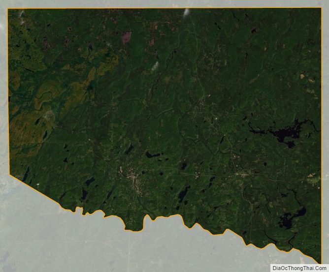
Iron County Satellite Map
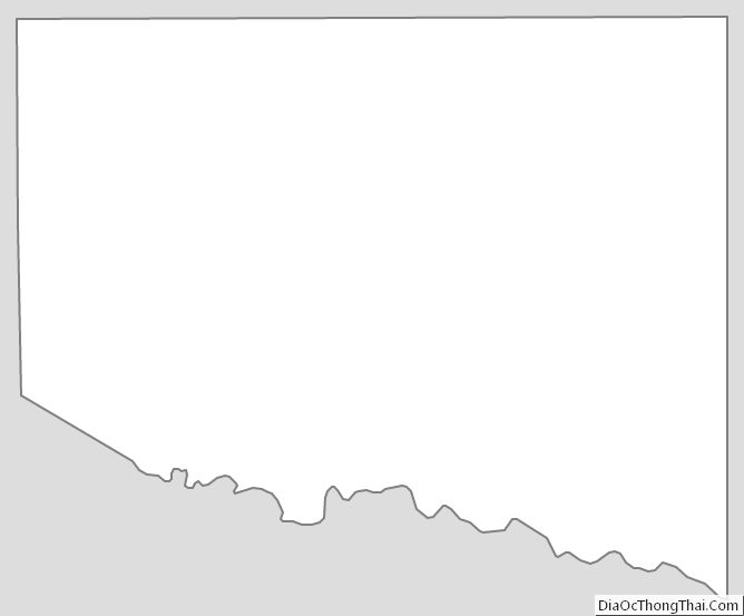
Iron County Outline Map
See also
Map of Michigan State and its subdivision:- Alcona
- Alger
- Allegan
- Alpena
- Antrim
- Arenac
- Baraga
- Barry
- Bay
- Benzie
- Berrien
- Branch
- Calhoun
- Cass
- Charlevoix
- Cheboygan
- Chippewa
- Clare
- Clinton
- Crawford
- Delta
- Dickinson
- Eaton
- Emmet
- Genesee
- Gladwin
- Gogebic
- Grand Traverse
- Gratiot
- Hillsdale
- Houghton
- Huron
- Ingham
- Ionia
- Iosco
- Iron
- Isabella
- Jackson
- Kalamazoo
- Kalkaska
- Kent
- Keweenaw
- Lake
- Lake Hurron
- Lake Michigan
- Lake St. Clair
- Lake Superior
- Lapeer
- Leelanau
- Lenawee
- Livingston
- Luce
- Mackinac
- Macomb
- Manistee
- Marquette
- Mason
- Mecosta
- Menominee
- Midland
- Missaukee
- Monroe
- Montcalm
- Montmorency
- Muskegon
- Newaygo
- Oakland
- Oceana
- Ogemaw
- Ontonagon
- Osceola
- Oscoda
- Otsego
- Ottawa
- Presque Isle
- Roscommon
- Saginaw
- Saint Clair
- Saint Joseph
- Sanilac
- Schoolcraft
- Shiawassee
- Tuscola
- Van Buren
- Washtenaw
- Wayne
- Wexford
- Alabama
- Alaska
- Arizona
- Arkansas
- California
- Colorado
- Connecticut
- Delaware
- District of Columbia
- Florida
- Georgia
- Hawaii
- Idaho
- Illinois
- Indiana
- Iowa
- Kansas
- Kentucky
- Louisiana
- Maine
- Maryland
- Massachusetts
- Michigan
- Minnesota
- Mississippi
- Missouri
- Montana
- Nebraska
- Nevada
- New Hampshire
- New Jersey
- New Mexico
- New York
- North Carolina
- North Dakota
- Ohio
- Oklahoma
- Oregon
- Pennsylvania
- Rhode Island
- South Carolina
- South Dakota
- Tennessee
- Texas
- Utah
- Vermont
- Virginia
- Washington
- West Virginia
- Wisconsin
- Wyoming