Jackson County is located in the Arkansas Delta in the U.S. state of Arkansas. The county is named for Andrew Jackson, a national hero during the War of 1812. By the county’s formation in 1829, Jackson had become the seventh President of the United States. Jackson County is home to seven incorporated towns and four incorporated cities, including Newport, the largest city and county seat. The county is also the site of numerous unincorporated communities and ghost towns. Occupying 633.94 square miles (164,190 ha), Jackson County is the 41st largest county of the 75 in Arkansas. As of the 2020 Census, the county’s population was 16,755. Based on population, the county is the 44th-largest county in Arkansas. Although terrain rises in the west, most of Jackson County is within the Arkansas Delta, characterized by largely flat terrain with fertile soils. Historically covered in forest, bayous and swamps, the area was cleared for agriculture by early settlers. It is drained by the White River.
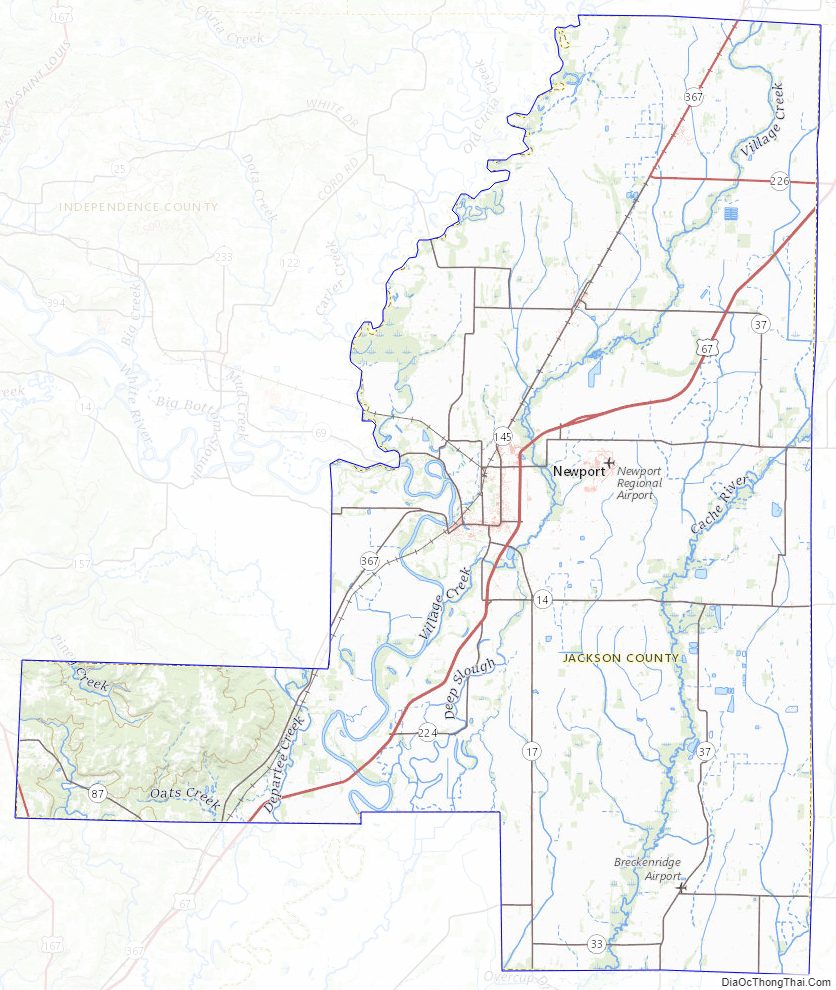
Although no Interstate highways are located in Jackson County, two United States highways (U.S. Route 67 (US 67) and US 167) and fifteen Arkansas state highways run in the county. A Union Pacific Railroad line also crosses the county.
| Name: | Jackson County |
|---|---|
| FIPS code: | 05-067 |
| State: | Arkansas |
| Founded: | November 5, 1829 |
| Named for: | Andrew Jackson |
| Seat: | Newport |
| Largest city: | Newport |
| Total Area: | 642 sq mi (1,660 km²) |
| Land Area: | 634 sq mi (1,640 km²) |
| Total Population: | 16,755 |
| Population Density: | 26/sq mi (10/km²) |
| Time zone: | UTC−6 (Central) |
| Summer Time Zone (DST): | UTC−5 (CDT) |
| Website: | www.jacksoncountyar.org |
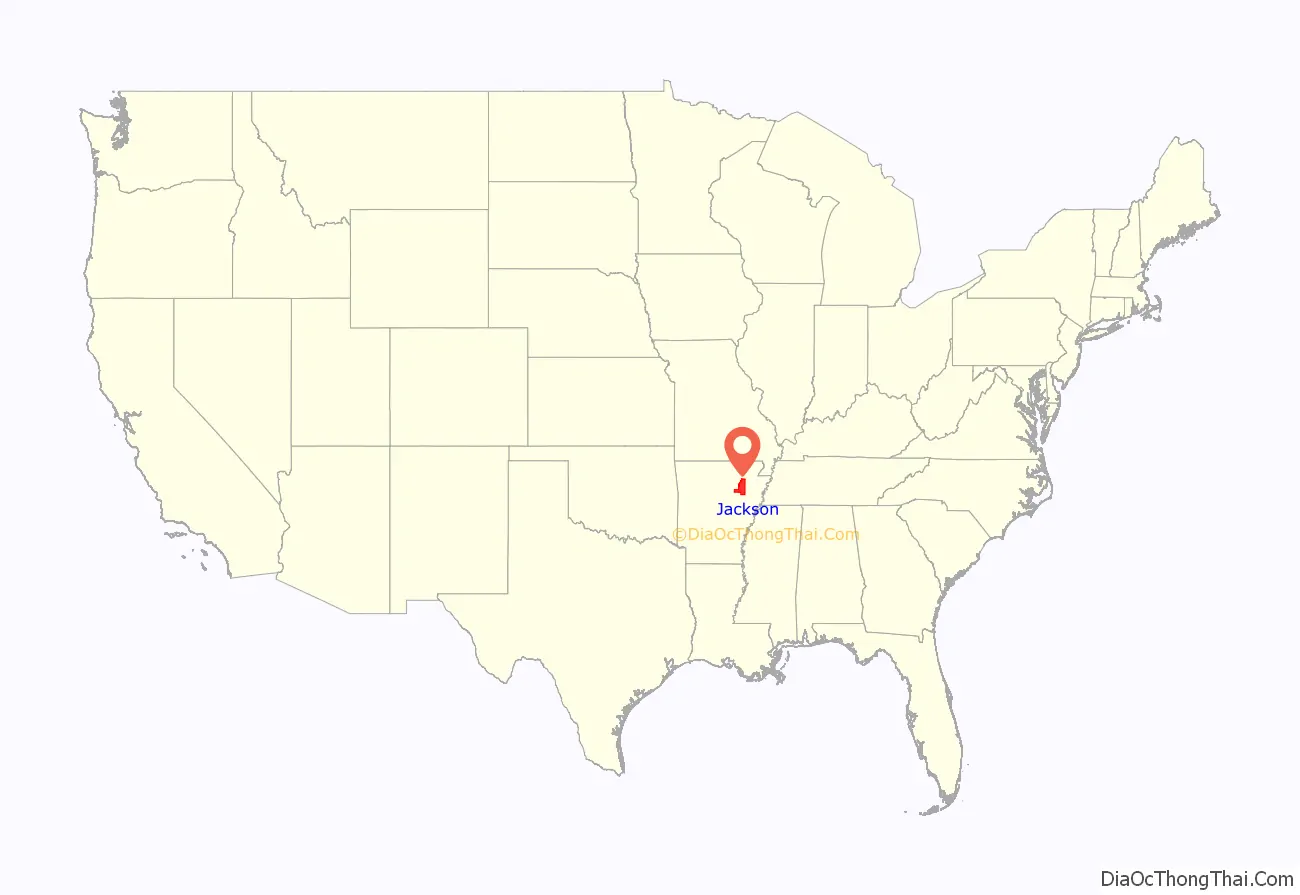
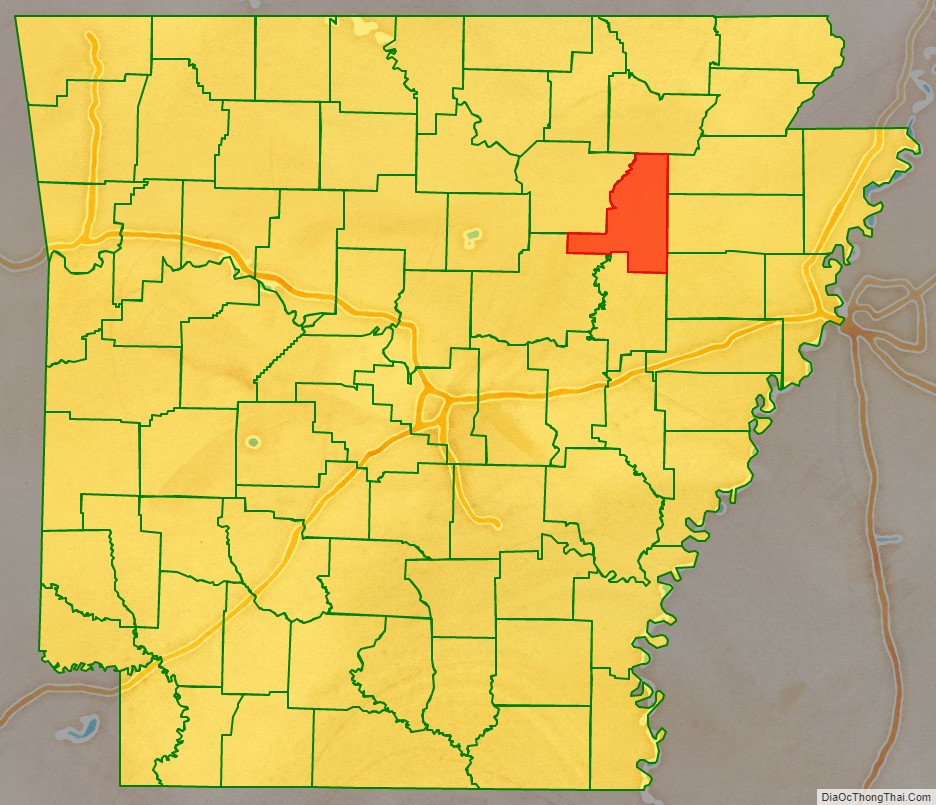
Jackson County location map. Where is Jackson County?
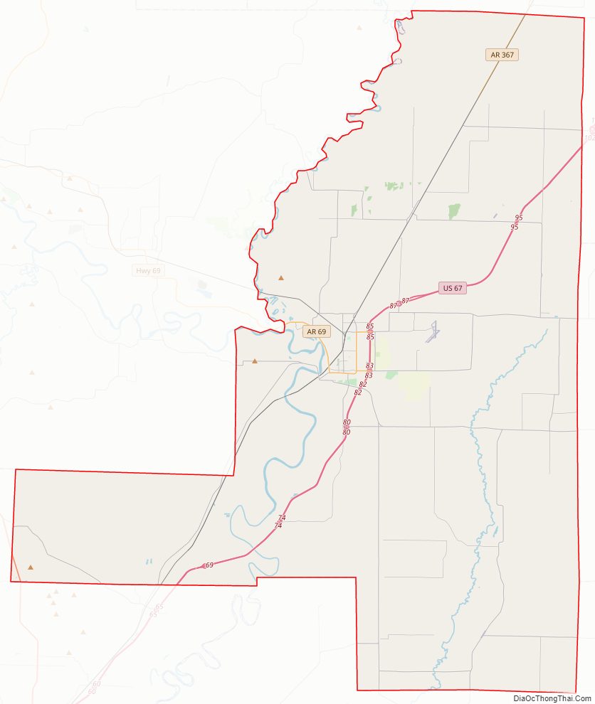
Jackson County Road Map
Geography
According to the U.S. Census Bureau, the county has a total area of 642 square miles (1,660 km), of which 634 square miles (1,640 km) is land and 7.6 square miles (20 km) (1.2%) is water.
Major highways
- Future Interstate 57
- U.S. Highway 67
- U.S. Highway 167
- Highway 14
- Highway 17
- Highway 18
- Highway 18 Spur
- Highway 33
- Highway 37
- Highway 42
- Highway 69
- Highway 69 Spur
- Highway 87
- Highway 145
- Highway 157
- Highway 224
- Highway 226
- Highway 367
- Highway 384
- Airport Highway 980
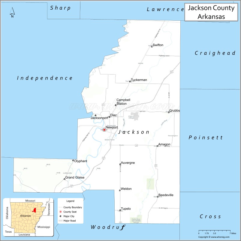
Adjacent counties
- Lawrence County (north)
- Craighead County (northeast)
- Poinsett County (east)
- Cross County (southeast)
- Woodruff County (south)
- White County (southwest)
- Independence County (west)
National protected area
- Cache River National Wildlife Refuge (part)
Jackson County Topographic Map
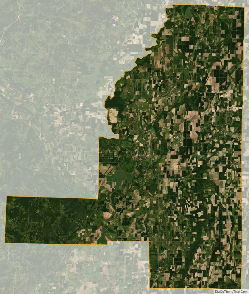
Jackson County Satellite Map
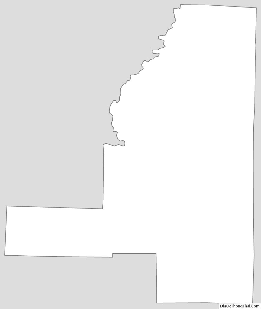
Jackson County Outline Map
See also
Map of Arkansas State and its subdivision:- Arkansas
- Ashley
- Baxter
- Benton
- Boone
- Bradley
- Calhoun
- Carroll
- Chicot
- Clark
- Clay
- Cleburne
- Cleveland
- Columbia
- Conway
- Craighead
- Crawford
- Crittenden
- Cross
- Dallas
- Desha
- Drew
- Faulkner
- Franklin
- Fulton
- Garland
- Grant
- Greene
- Hempstead
- Hot Spring
- Howard
- Independence
- Izard
- Jackson
- Jefferson
- Johnson
- Lafayette
- Lawrence
- Lee
- Lincoln
- Little River
- Logan
- Lonoke
- Madison
- Marion
- Miller
- Mississippi
- Monroe
- Montgomery
- Nevada
- Newton
- Ouachita
- Perry
- Phillips
- Pike
- Poinsett
- Polk
- Pope
- Prairie
- Pulaski
- Randolph
- Saint Francis
- Saline
- Scott
- Searcy
- Sebastian
- Sevier
- Sharp
- Stone
- Union
- Van Buren
- Washington
- White
- Woodruff
- Yell
- Alabama
- Alaska
- Arizona
- Arkansas
- California
- Colorado
- Connecticut
- Delaware
- District of Columbia
- Florida
- Georgia
- Hawaii
- Idaho
- Illinois
- Indiana
- Iowa
- Kansas
- Kentucky
- Louisiana
- Maine
- Maryland
- Massachusetts
- Michigan
- Minnesota
- Mississippi
- Missouri
- Montana
- Nebraska
- Nevada
- New Hampshire
- New Jersey
- New Mexico
- New York
- North Carolina
- North Dakota
- Ohio
- Oklahoma
- Oregon
- Pennsylvania
- Rhode Island
- South Carolina
- South Dakota
- Tennessee
- Texas
- Utah
- Vermont
- Virginia
- Washington
- West Virginia
- Wisconsin
- Wyoming