Jackson County is a county located in the U.S. state of Michigan. Its population was 160,366 as of the 2020 Census. The county seat is Jackson. The county was set off in 1829 and organized in 1832. It is named for U.S. President Andrew Jackson and considered to be one of Michigan’s “Cabinet counties”, named for members of Jackson’s Cabinet.
Jackson County comprises the Jackson, MI Metropolitan Statistical Area.
The Jackson County Courthouse was designed by Claire Allen, a prominent southern Michigan architect. Jackson County is also home to the Michigan Whitetail Hall of Fame.
| Name: | Jackson County |
|---|---|
| FIPS code: | 26-075 |
| State: | Michigan |
| Named for: | Andrew Jackson |
| Seat: | Jackson |
| Largest city: | Jackson |
| Total Area: | 723 sq mi (1,870 km²) |
| Land Area: | 702 sq mi (1,820 km²) |
| Total Population: | 160,366 |
| Population Density: | 228/sq mi (88/km²) |
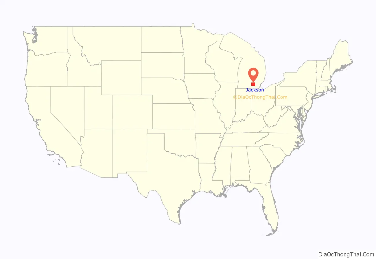
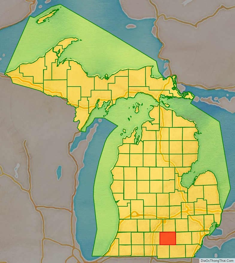
Jackson County location map. Where is Jackson County?
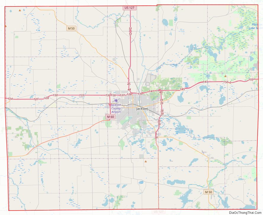
Jackson County Road Map
Geography
According to the U.S. Census Bureau, the county has a total area of 723 square miles (1,870 km), of which 702 square miles (1,820 km) is land and 22 square miles (57 km) (3.0%) is water.
Rivers
The Grand River is Michigan’s longest river. It starts in Somerset Township in Hillsdale County and Liberty Township in Jackson County. It then flows through a small part of Columbia Township, into Summit township, and then right through the Jackson city limits. It then flows through Blackman Charter Township and then Rives Township and Tompkins Township before entering Ingham County, Eaton County, Clinton County, Ionia County, Kent County, Ottawa County and into the city of Grand Haven where it empties into Lake Michigan. The river is 260 miles (420 km) long; its watershed drains an area of 5,572 miles (8,967 km) including 18 counties and 158 townships.
The Kalamazoo River is made up of the north and south branches.
The north branch starts in Jackson County in Hanover Township. It starts in Pine Hills Lake and Farewell Lake and flows through a small part of Liberty Township and then back into Hanover Township. It then flows into Spring Arbor Township and Concord Township. It then flows out of Jackson County and into Calhoun County before it goes through the town of Albion where the north branch connects with the south branch and they form to be one river.
The south branch starts in the wetlands near the town North Adams in Hillsdale County and flows through the rest of Hillsdale County. It enters Jackson County and goes through a small part of Hanover Township before reentering Hillsdale County and then reentering Jackson County where it goes through Pulaski Township. It then enters Calhoun County and connects with the northern branch when it reaches the town of Albion.
When the south branch and north branch connect to form just the Kalamazoo River, it then flows through the rest of Calhoun County. It then enters Kalamazoo County and then Allegan County. When it reaches the towns of Saugatuck and Douglas it stops and enters Lake Michigan. In total the Kalamazoo River is 166 miles (267 km) long, and its watershed drains a total of 2,020 miles (3,250 km) and drains into 8 counties.
Adjacent counties
- Livingston County (northeast)
- Ingham County (north)
- Eaton County (northwest)
- Washtenaw County (east)
- Calhoun County (west)
- Lenawee County (southeast)
- Hillsdale County (southwest)
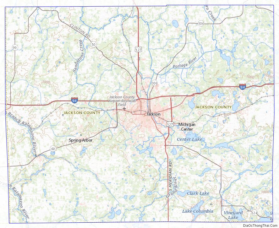
Jackson County Topographic Map
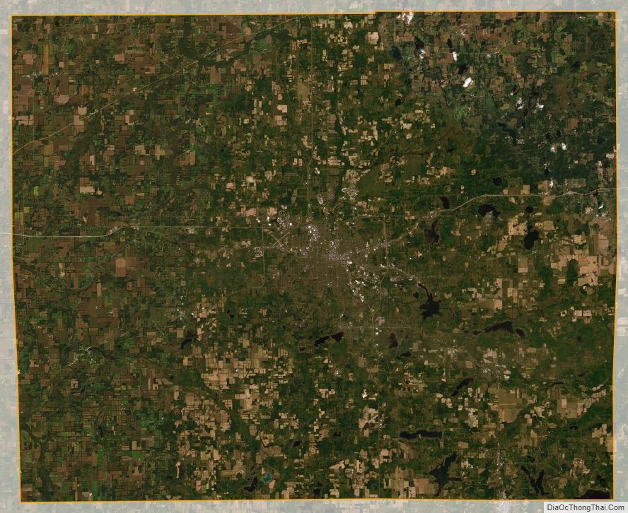
Jackson County Satellite Map
Jackson County Outline Map

See also
Map of Michigan State and its subdivision:- Alcona
- Alger
- Allegan
- Alpena
- Antrim
- Arenac
- Baraga
- Barry
- Bay
- Benzie
- Berrien
- Branch
- Calhoun
- Cass
- Charlevoix
- Cheboygan
- Chippewa
- Clare
- Clinton
- Crawford
- Delta
- Dickinson
- Eaton
- Emmet
- Genesee
- Gladwin
- Gogebic
- Grand Traverse
- Gratiot
- Hillsdale
- Houghton
- Huron
- Ingham
- Ionia
- Iosco
- Iron
- Isabella
- Jackson
- Kalamazoo
- Kalkaska
- Kent
- Keweenaw
- Lake
- Lake Hurron
- Lake Michigan
- Lake St. Clair
- Lake Superior
- Lapeer
- Leelanau
- Lenawee
- Livingston
- Luce
- Mackinac
- Macomb
- Manistee
- Marquette
- Mason
- Mecosta
- Menominee
- Midland
- Missaukee
- Monroe
- Montcalm
- Montmorency
- Muskegon
- Newaygo
- Oakland
- Oceana
- Ogemaw
- Ontonagon
- Osceola
- Oscoda
- Otsego
- Ottawa
- Presque Isle
- Roscommon
- Saginaw
- Saint Clair
- Saint Joseph
- Sanilac
- Schoolcraft
- Shiawassee
- Tuscola
- Van Buren
- Washtenaw
- Wayne
- Wexford
- Alabama
- Alaska
- Arizona
- Arkansas
- California
- Colorado
- Connecticut
- Delaware
- District of Columbia
- Florida
- Georgia
- Hawaii
- Idaho
- Illinois
- Indiana
- Iowa
- Kansas
- Kentucky
- Louisiana
- Maine
- Maryland
- Massachusetts
- Michigan
- Minnesota
- Mississippi
- Missouri
- Montana
- Nebraska
- Nevada
- New Hampshire
- New Jersey
- New Mexico
- New York
- North Carolina
- North Dakota
- Ohio
- Oklahoma
- Oregon
- Pennsylvania
- Rhode Island
- South Carolina
- South Dakota
- Tennessee
- Texas
- Utah
- Vermont
- Virginia
- Washington
- West Virginia
- Wisconsin
- Wyoming