Jackson County is a county in the U.S. state of Minnesota. As of the 2020 census, the population was 9,989. Its county seat is Jackson.
| Name: | Jackson County |
|---|---|
| FIPS code: | 27-063 |
| State: | Minnesota |
| Founded: | May 23, 1857 |
| Named for: | Henry Jackson |
| Seat: | Jackson |
| Largest city: | Jackson |
| Total Area: | 719 sq mi (1,860 km²) |
| Land Area: | 703 sq mi (1,820 km²) |
| Total Population: | 9,989 |
| Population Density: | 14.2/sq mi (5.5/km²) |
| Time zone: | UTC−6 (Central) |
| Summer Time Zone (DST): | UTC−5 (CDT) |
| Website: | www.co.jackson.mn.us |
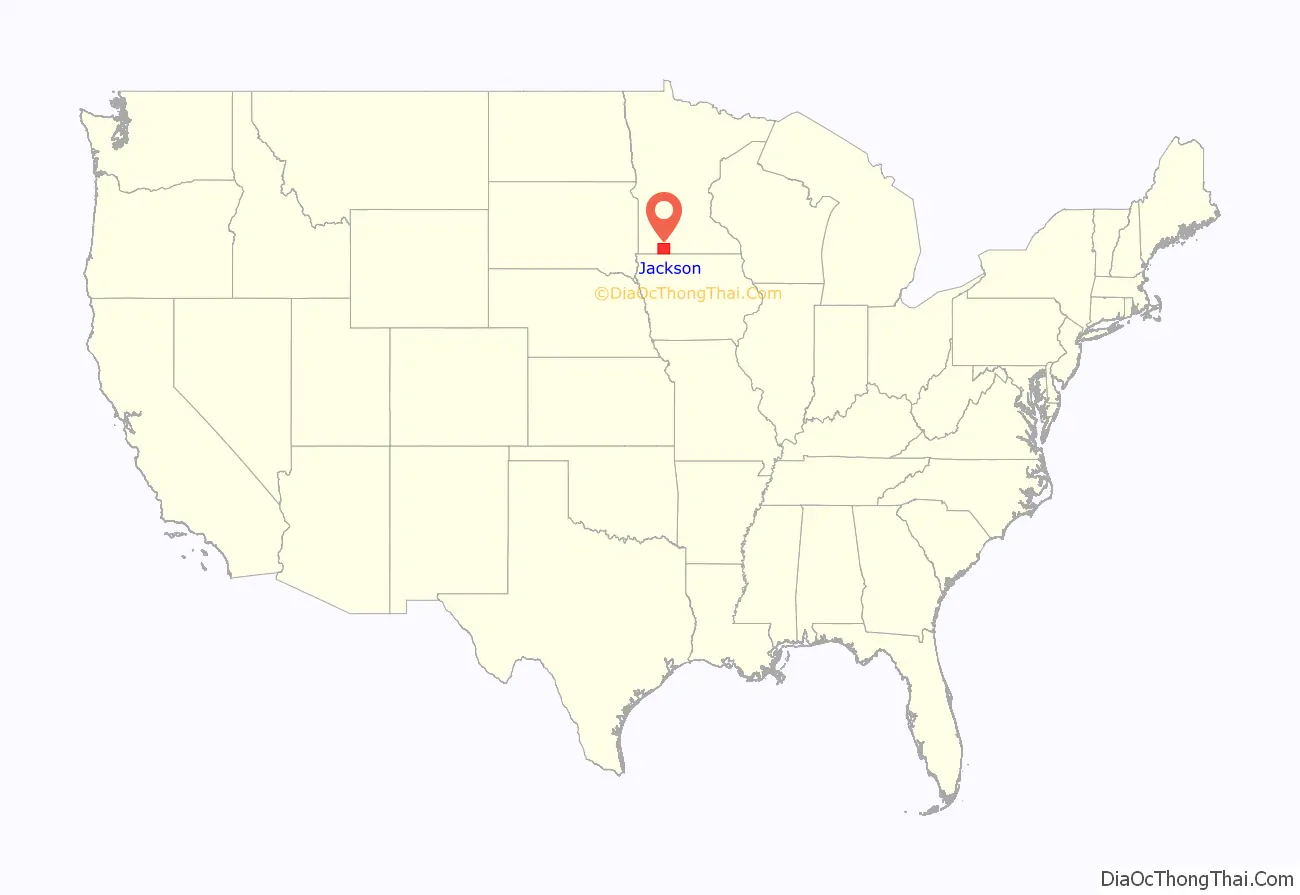
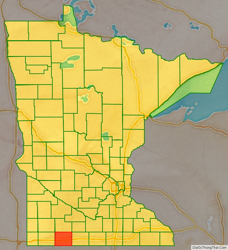
Jackson County location map. Where is Jackson County?
History
The county was created on May 23, 1857. It was named for Henry Jackson, the first merchant in St. Paul.
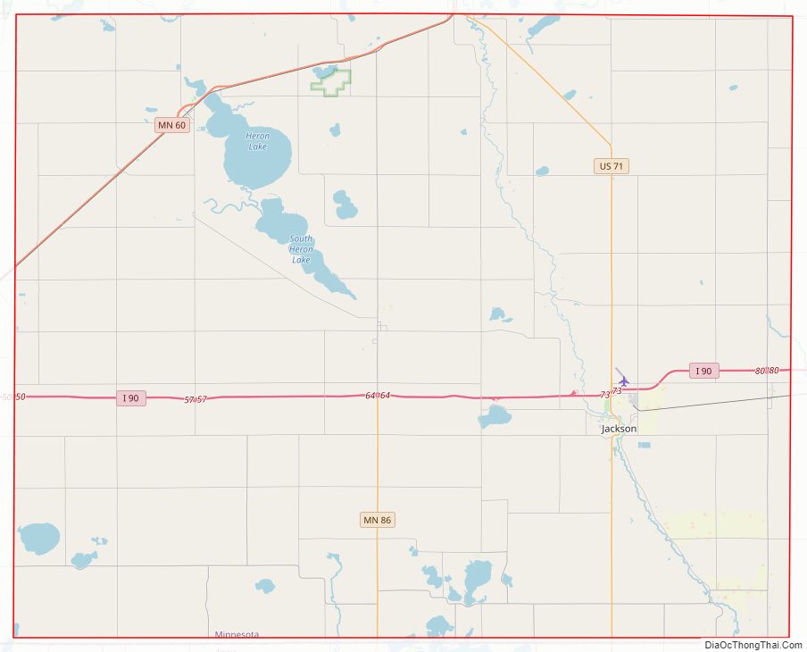
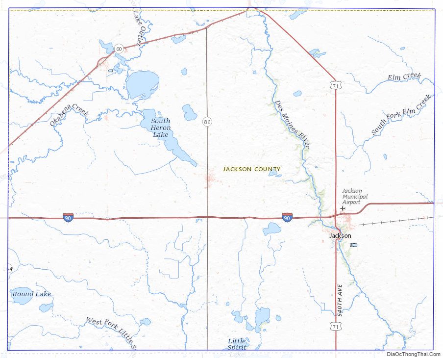
Jackson County Road Map
Geography
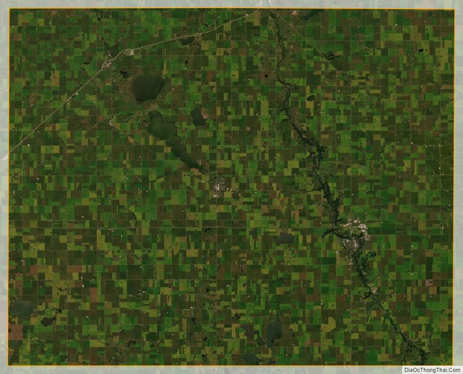
Jackson County lies on the south side of Minnesota. Its south border abuts the north border of the state of Iowa. The Des Moines River flows south-southeasterly through the central part of the county, thence into Iowa. The county terrain is hilly and carved with drainages and gullies. The area is devoted to agriculture. The terrain generally slopes to the south and east; its highest point is on the lower west border, at 1,545′ (471m) ASL. The county has a total area of 719 square miles (1,860 km), of which 703 square miles (1,820 km) is land and 16 square miles (41 km) (2.3%) is water.
Lakes
- Andersons Marsh
- Boot Lake
- Chandler Lake
- Clear Lake (part)
- Clear Lake (Des Moines Township and Hunter Township)
- Fish Lake (part)
- Heron Lake (4 lakes, connected by streams, all called Heron Lake)
- Illinois Lake
- Independence Lake
- Iowa Lake (part)
- Lake Flaherty
- Laurs Lake
- Little Spirit Lake
- Loon Lake
- Pearl Lake
- Round Lake
- Rush Lake (Sioux Valley Township)
- Rush Lake (Minneota Township)
- Skunk Lake
- South Heron Lake
- Spirit Lake
- String Lake (part)
- Teal Lake
- Timber Lake
Protected areas
- Anderson County Park
- Bootleg State Wildlife Management Area
- Caraway State Wildlife Management Area
- Des Moines River Scientific and Natural Area
- Holthe Prairie Scientific and Natural Area
- Husen Scientific and Natural Area
- Kilen Woods State Park
- Laurs Lake State Wildlife Management Area
- Minnesota Slough State Wildlife Management Area
- Robertson County Park
- Sangl State Wildlife Management Area
- Summers State Wildlife Management Area
Major highways
- Interstate 90
- U.S. Highway 71
- Minnesota State Highway 60
- Minnesota State Highway 86
- Minnesota State Highway 264
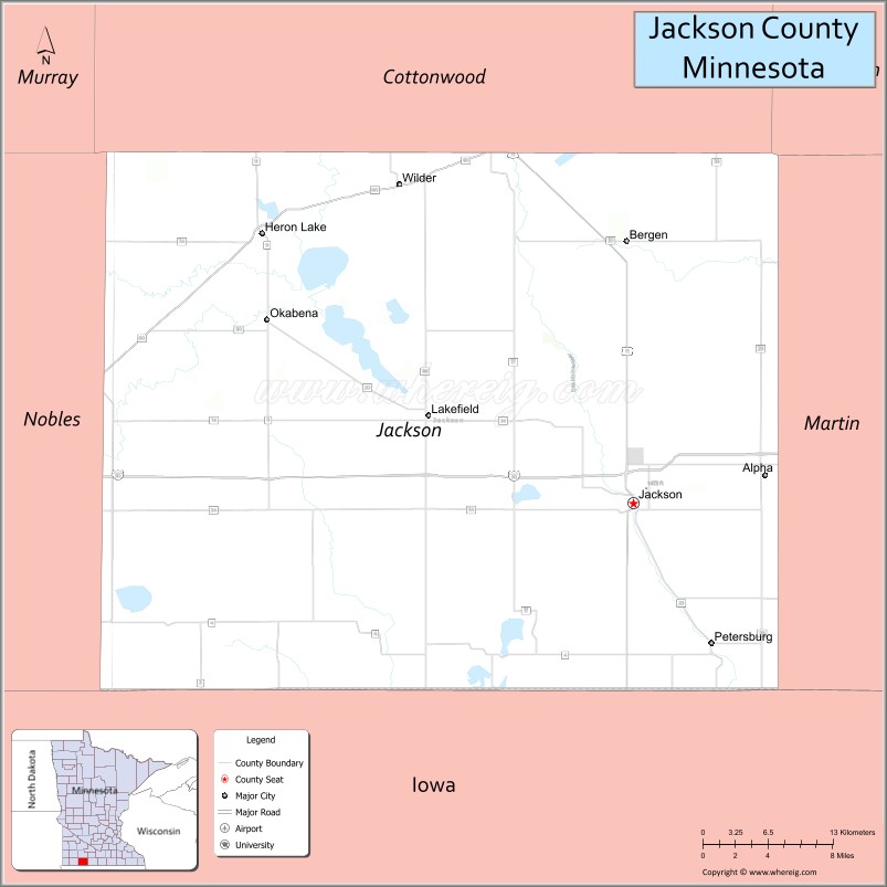
Adjacent counties
- Cottonwood County – north
- Watonwan County – northeast
- Martin County – east
- Emmet County, Iowa – southeast
- Dickinson County, Iowa – south
- Osceola County, Iowa – southwest
- Nobles County – west
Jackson County Topographic Map
Jackson County Satellite Map
Jackson County Outline Map

See also
Map of Minnesota State and its subdivision:- Aitkin
- Anoka
- Becker
- Beltrami
- Benton
- Big Stone
- Blue Earth
- Brown
- Carlton
- Carver
- Cass
- Chippewa
- Chisago
- Clay
- Clearwater
- Cook
- Cottonwood
- Crow Wing
- Dakota
- Dodge
- Douglas
- Faribault
- Fillmore
- Freeborn
- Goodhue
- Grant
- Hennepin
- Houston
- Hubbard
- Isanti
- Itasca
- Jackson
- Kanabec
- Kandiyohi
- Kittson
- Koochiching
- Lac qui Parle
- Lake
- Lake of the Woods
- Lake Superior
- Le Sueur
- Lincoln
- Lyon
- Mahnomen
- Marshall
- Martin
- McLeod
- Meeker
- Mille Lacs
- Morrison
- Mower
- Murray
- Nicollet
- Nobles
- Norman
- Olmsted
- Otter Tail
- Pennington
- Pine
- Pipestone
- Polk
- Pope
- Ramsey
- Red Lake
- Redwood
- Renville
- Rice
- Rock
- Roseau
- Saint Louis
- Scott
- Sherburne
- Sibley
- Stearns
- Steele
- Stevens
- Swift
- Todd
- Traverse
- Wabasha
- Wadena
- Waseca
- Washington
- Watonwan
- Wilkin
- Winona
- Wright
- Yellow Medicine
- Alabama
- Alaska
- Arizona
- Arkansas
- California
- Colorado
- Connecticut
- Delaware
- District of Columbia
- Florida
- Georgia
- Hawaii
- Idaho
- Illinois
- Indiana
- Iowa
- Kansas
- Kentucky
- Louisiana
- Maine
- Maryland
- Massachusetts
- Michigan
- Minnesota
- Mississippi
- Missouri
- Montana
- Nebraska
- Nevada
- New Hampshire
- New Jersey
- New Mexico
- New York
- North Carolina
- North Dakota
- Ohio
- Oklahoma
- Oregon
- Pennsylvania
- Rhode Island
- South Carolina
- South Dakota
- Tennessee
- Texas
- Utah
- Vermont
- Virginia
- Washington
- West Virginia
- Wisconsin
- Wyoming