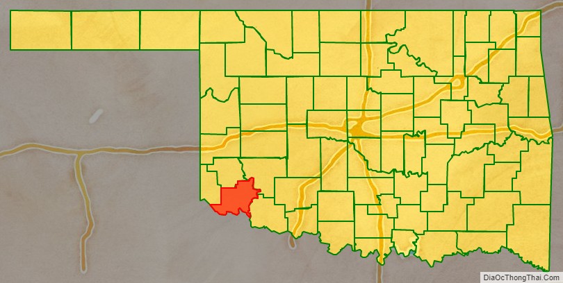
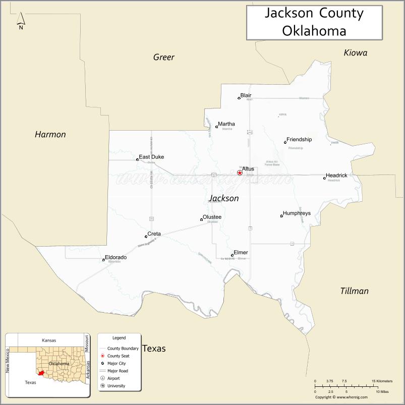
Jackson County is a county located in the southwestern corner of the U.S. state of Oklahoma. As of the 2010 census, the population was 26,446. Its county seat is Altus. According to the Encyclopedia of Oklahoma History and Culture, the county was named for two historical figures: President Andrew Jackson and Confederate General Stonewall Jackson. One source states that the county was named only for the former President, while an earlier source states it was named only for General Stonewall Jackson.
Jackson County comprises the Altus, OK Micropolitan Statistical Area.
| Name: | Jackson County |
|---|---|
| FIPS code: | 40-065 |
| State: | Oklahoma |
| Founded: | 1907 |
| Named for: | Stonewall Jackson |
| Seat: | Altus |
| Largest city: | Altus |
| Total Area: | 804 sq mi (2,080 km²) |
| Land Area: | 803 sq mi (2,080 km²) |
| Total Population: | 26,446 |
| Population Density: | 33/sq mi (13/km²) |
| Time zone: | UTC−6 (Central) |
| Summer Time Zone (DST): | UTC−5 (CDT) |
| Website: | jackson.okcounties.org |
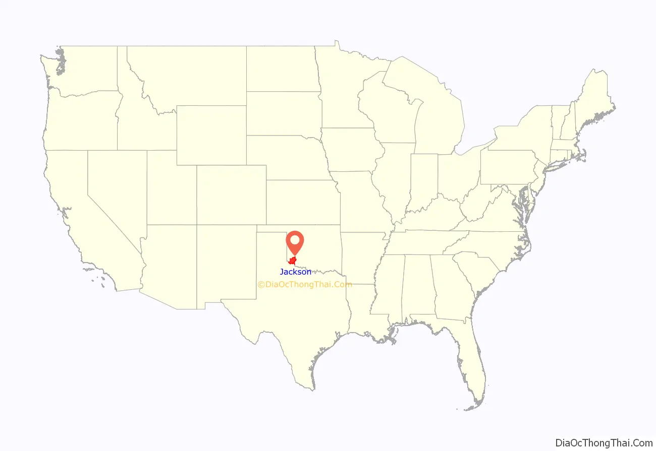
Jackson County location map. Where is Jackson County?
History
After a dispute over the Adams-Onís Treaty of 1819, both the governments of the United States and the state of Texas claimed ownership of some 1,500,000 acres (6,100 km) in what was then operated as Greer County, Texas. Litigation followed, and in the case of United States v. State of Texas 162 U.S. 1 (1896), issued on March 16, the Supreme Court, having original jurisdiction over the case, decided in favor of the United States. Greer County was then assigned to the Oklahoma Territory on May 4, 1896. When Oklahoma became the 46th U.S. state (November 16, 1907), old “Greer County” was divided into Greer, Jackson, and part of Beckham counties.
Altus was originally designated as the seat of Jackson County. Olustee vied in an unsuccessful bid to replace Altus as the seat in an election on July 18, 1908.
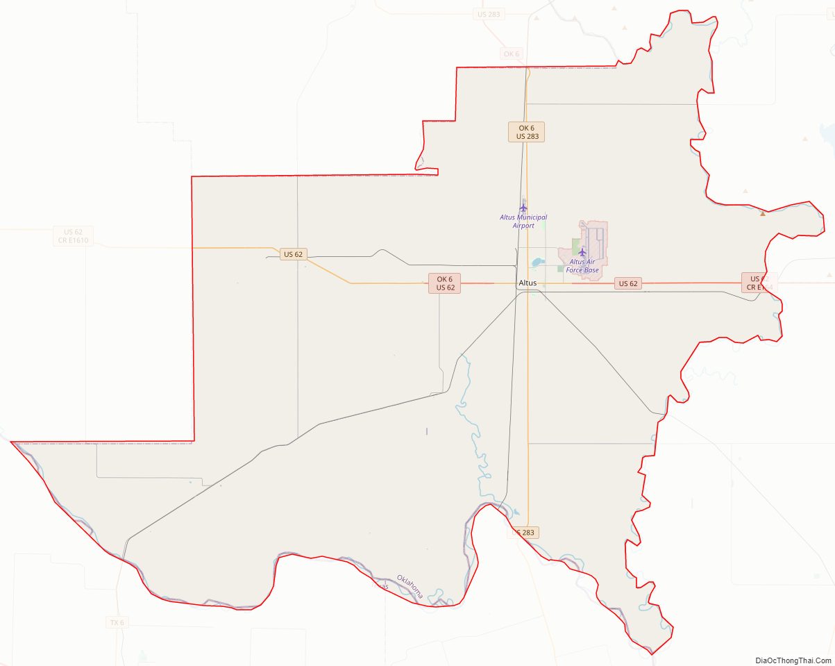
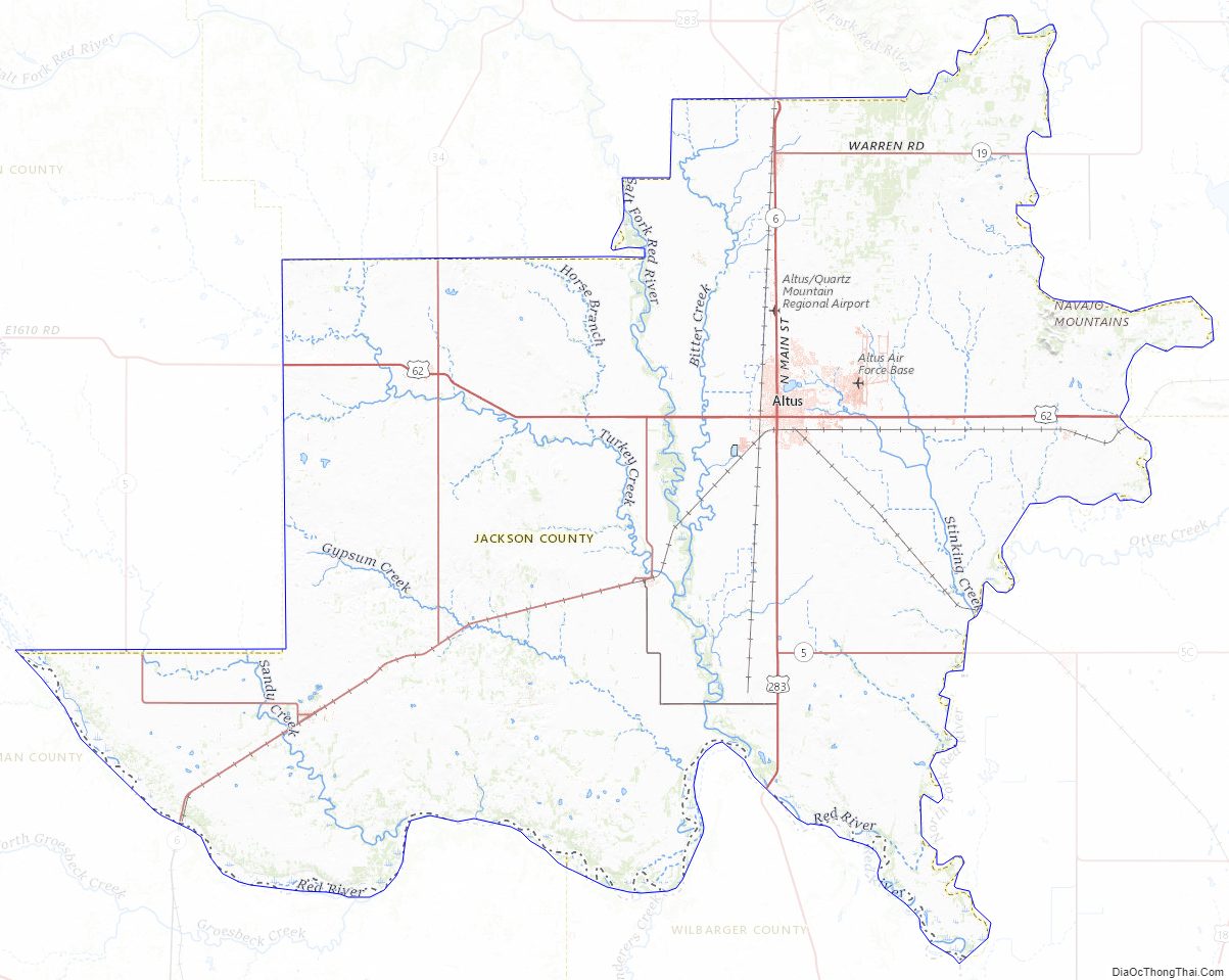
Jackson County Road Map
Geography
According to the U.S. Census Bureau, the county has a total area of 804 square miles (2,080 km), of which 803 square miles (2,080 km) is land and 1.6 square miles (4.1 km) (0.2%) is water.
Most of the county is within the Red Bed Plains physiographic region. The western part lies in the Gypsum Hills and the northeastern part is in the Wichita Mountains. The county is drained by the Red River and its tributaries, the North Fork of the Red River and the Salt Fork of the Red River.
Major highways
- U.S. Highway 62
- U.S. Highway 283
- State Highway 5
- State Highway 6
- State Highway 34
Adjacent counties
- Greer County (north)
- Kiowa County (northeast)
- Tillman County (east)
- Wilbarger County, Texas (south)
- Hardeman County, Texas (southwest)
- Harmon County (west)
Jackson County Topographic Map
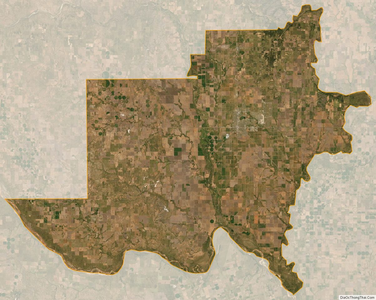
Jackson County Satellite Map
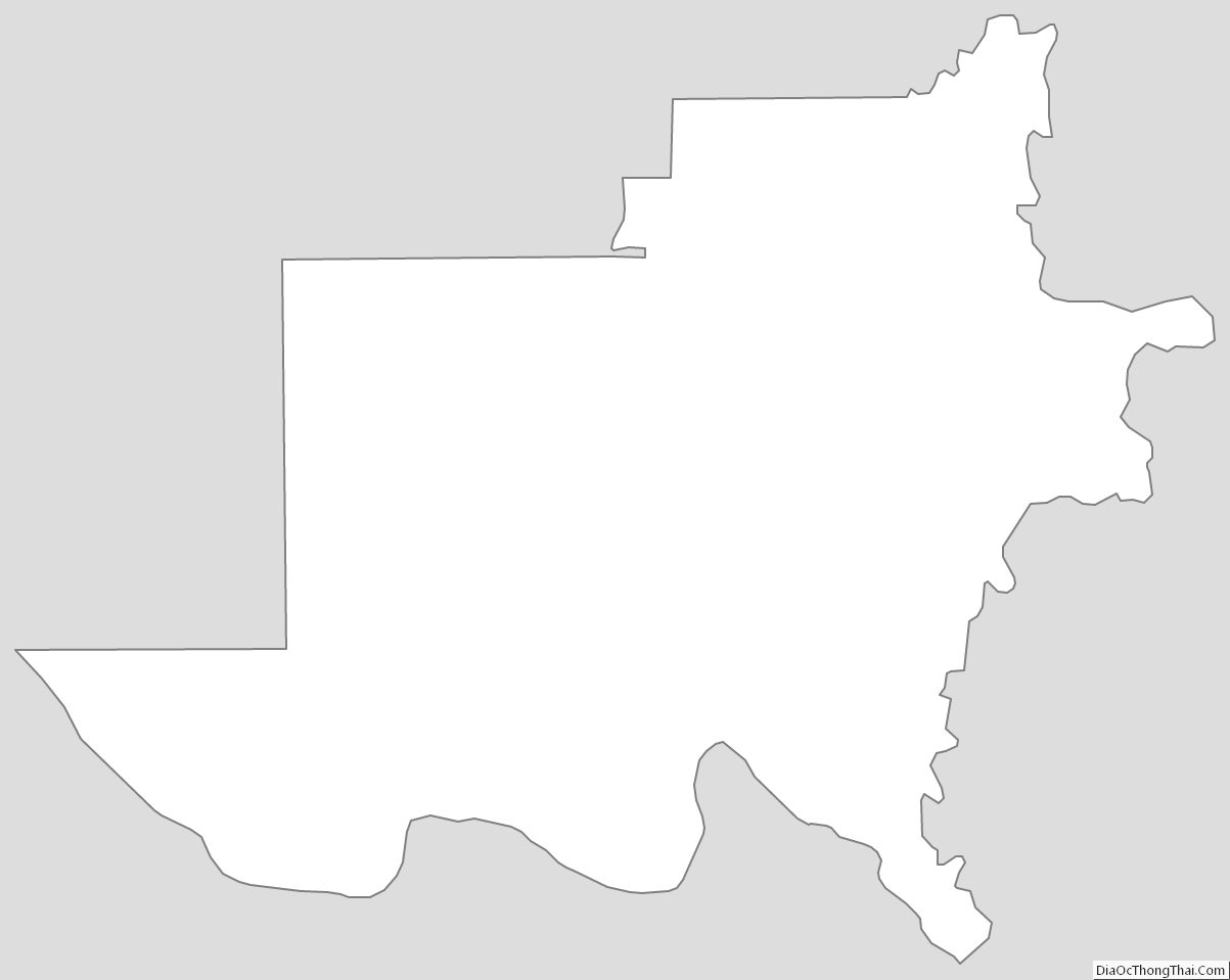
Jackson County Outline Map
See also
Map of Oklahoma State and its subdivision:- Adair
- Alfalfa
- Atoka
- Beaver
- Beckham
- Blaine
- Bryan
- Caddo
- Canadian
- Carter
- Cherokee
- Choctaw
- Cimarron
- Cleveland
- Coal
- Comanche
- Cotton
- Craig
- Creek
- Custer
- Delaware
- Dewey
- Ellis
- Garfield
- Garvin
- Grady
- Grant
- Greer
- Harmon
- Harper
- Haskell
- Hughes
- Jackson
- Jefferson
- Johnston
- Kay
- Kingfisher
- Kiowa
- Latimer
- Le Flore
- Lincoln
- Logan
- Love
- Major
- Marshall
- Mayes
- McClain
- McCurtain
- McIntosh
- Murray
- Muskogee
- Noble
- Nowata
- Okfuskee
- Oklahoma
- Okmulgee
- Osage
- Ottawa
- Pawnee
- Payne
- Pittsburg
- Pontotoc
- Pottawatomie
- Pushmataha
- Roger Mills
- Rogers
- Seminole
- Sequoyah
- Stephens
- Texas
- Tillman
- Tulsa
- Wagoner
- Washington
- Washita
- Woods
- Woodward
- Alabama
- Alaska
- Arizona
- Arkansas
- California
- Colorado
- Connecticut
- Delaware
- District of Columbia
- Florida
- Georgia
- Hawaii
- Idaho
- Illinois
- Indiana
- Iowa
- Kansas
- Kentucky
- Louisiana
- Maine
- Maryland
- Massachusetts
- Michigan
- Minnesota
- Mississippi
- Missouri
- Montana
- Nebraska
- Nevada
- New Hampshire
- New Jersey
- New Mexico
- New York
- North Carolina
- North Dakota
- Ohio
- Oklahoma
- Oregon
- Pennsylvania
- Rhode Island
- South Carolina
- South Dakota
- Tennessee
- Texas
- Utah
- Vermont
- Virginia
- Washington
- West Virginia
- Wisconsin
- Wyoming