Jackson County is one of the 36 counties in the U.S. state of Oregon. As of the 2020 census, the population was 223,259. The county seat is Medford. The county is named for Andrew Jackson, the seventh president of the United States.
Jackson County comprises the Medford, OR Metropolitan Statistical Area.
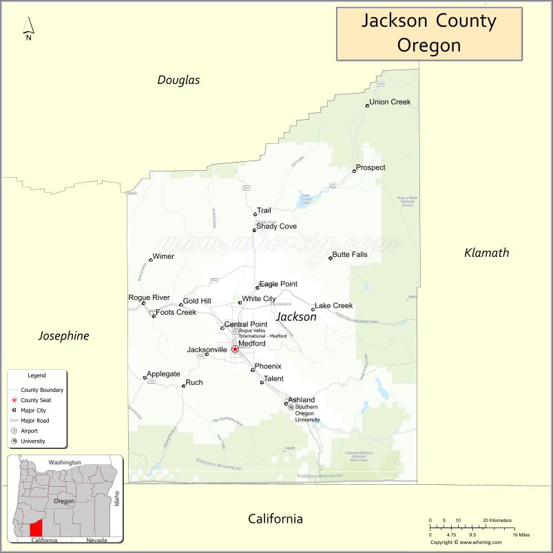
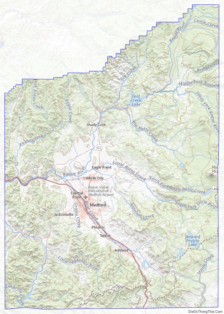
There are 11 incorporated cities and 34 unincorporated communities in Jackson County; the largest is Medford, which has been the county seat since 1927.
| Name: | Jackson County |
|---|---|
| FIPS code: | 41-029 |
| State: | Oregon |
| Founded: | January 12, 1852 |
| Named for: | Andrew Jackson |
| Seat: | Medford |
| Largest city: | Medford |
| Total Area: | 2,802 sq mi (7,260 km²) |
| Land Area: | 2,784 sq mi (7,210 km²) |
| Total Population: | 223,259 |
| Population Density: | 80/sq mi (30/km²) |
| Time zone: | UTC−8 (Pacific) |
| Summer Time Zone (DST): | UTC−7 (PDT) |
| Website: | jacksoncountyor.org |
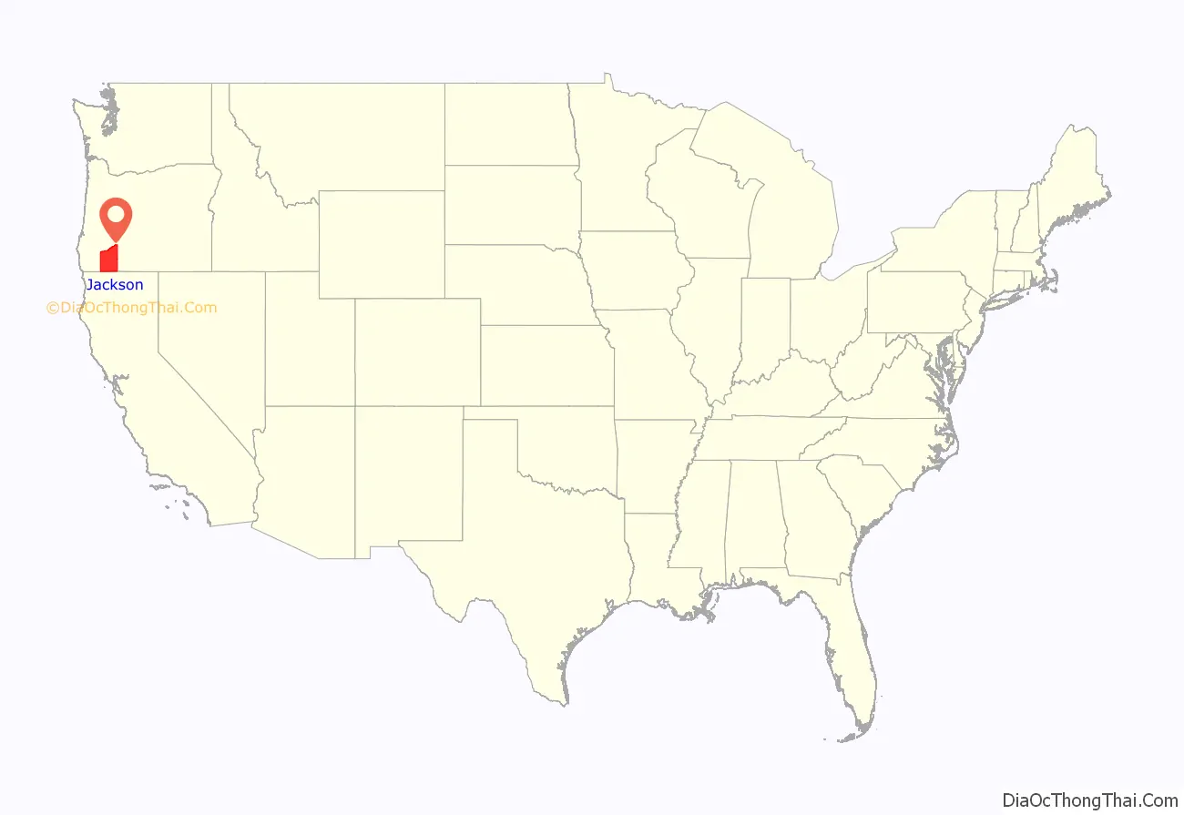
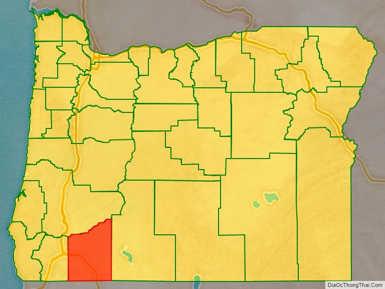
Jackson County location map. Where is Jackson County?
History
Modoc, Shasta, Takelma, Latgawa, and Umpqua Indian tribes are all native to the region of present Jackson County. Prior to the 1850s, the Klickitats from the north raided the area.
The Territorial Legislature created Jackson County on January 12, 1852, from the southwestern portion of Lane County and the unorganized area south of Douglas and Umpqua Counties. It included lands which now lie in Coos, Curry, Josephine, Klamath and Lake Counties. Gold discoveries in the Illinois River valley and the Rogue River valley near Jacksonville in 1852, and the completion of a wagon road connecting the county with California to the south and Douglas County to the north led to an influx of non-native settlers.
Conflict between the miners and Native Americans led to war in 1853, which continued intermittently until the final defeat of the last band under chiefs John and George by a combined force of regular army and civilians May 29, 1856 at Big Bend on the Rogue River. The Native Americans had received the worse of the fighting throughout this conflict, and as they began to surrender, they were herded to existing reservations, beginning in January 1856 when one group was marched to the Grand Ronde Indian Reservation west of Salem. Over the following months, other groups were forced to leave until by May 1857 almost all of the Shasta, Takelma, and Latgawas tribes had been relocated to the Siletz Reservation, where they remained.
Jacksonville was designated as the first county seat in 1853. However, Jacksonville declined due to diminishing returns in the local goldfields and the construction in the 1880s of the Oregon and California Railroad. This railroad bypassed Jacksonville and instead went through Medford, located five miles (8 km) east of Jacksonville. Medford’s prospects improved because of the location of the railroad and the accompanying commerce and development as Jacksonville continued its steady decline. Jacksonville fended off suggestions to move the county seat until 1927 when Medford was finally selected as the county seat.
In March 2004, Jackson County became the first of an eventual 35 counties in Oregon to implement a voluntary plan of fireproofing homes situated on properties zoned as part of the forestland-urban interface. This requires homeowners to maintain a 30′ or greater firebreak around their structures, and affects 12,000 homeowners. In 2007, this plan becomes mandatory for many landowners, under threat of liability if their property is involved in a fire.
On May 15, 2007, residents voted not to reopen the county’s 15 libraries, which had been closed since April 6 due to a shortage of funds. This was the largest library closure in the history of the United States. The libraries were reopened, with reduced hours, on October 24, 2007.
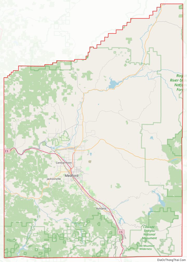
Jackson County Road Map
Geography
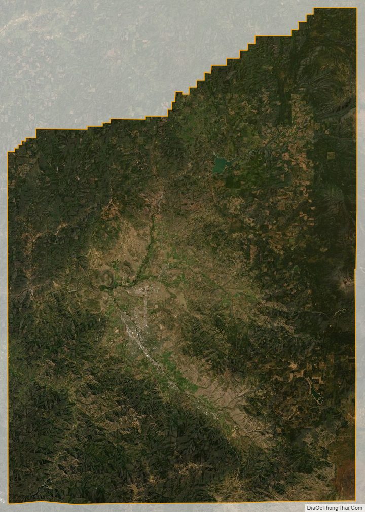
According to the United States Census Bureau, the county has a total area of 2,802 square miles (7,260 km), of which 2,784 square miles (7,210 km) is land and 18 square miles (47 km) (0.6%) is water. A portion of the Umpqua National Forest is in Jackson County.
Located entirely within Jackson County is Bear Creek and its watershed, a tributary of the Rogue River. The population centers of Medford, Ashland, Phoenix, Talent, and Central Point are located along the stream. It connects with the Rogue River near the Upper and Lower Table Rock lava formations.
Adjacent counties
- Douglas County (north)
- Klamath County (east)
- Siskiyou County, California (south)
- Josephine County (west)
National protected areas
- Cascade–Siskiyou National Monument
- Crater Lake National Park (part)
- Klamath National Forest (part)
- Rogue River-Siskiyou National Forest (part)
- Umpqua National Forest (part)
Jackson County Topographic Map
Jackson County Satellite Map
Jackson County Outline Map

See also
Map of Oregon State and its subdivision: Map of other states:- Alabama
- Alaska
- Arizona
- Arkansas
- California
- Colorado
- Connecticut
- Delaware
- District of Columbia
- Florida
- Georgia
- Hawaii
- Idaho
- Illinois
- Indiana
- Iowa
- Kansas
- Kentucky
- Louisiana
- Maine
- Maryland
- Massachusetts
- Michigan
- Minnesota
- Mississippi
- Missouri
- Montana
- Nebraska
- Nevada
- New Hampshire
- New Jersey
- New Mexico
- New York
- North Carolina
- North Dakota
- Ohio
- Oklahoma
- Oregon
- Pennsylvania
- Rhode Island
- South Carolina
- South Dakota
- Tennessee
- Texas
- Utah
- Vermont
- Virginia
- Washington
- West Virginia
- Wisconsin
- Wyoming