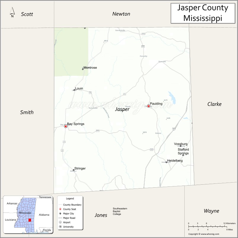
Jasper County is located in the U.S. state of Mississippi. At the 2020 census, the population was 16,367. In 1906, the state legislature established two county courts, one at the first county seat of Paulding in the eastern part of the county and also one at Bay Springs in the west, where the railroad had been constructed. Jasper County is part of the Laurel, MS Micropolitan Statistical Area.
Bay Springs growth passed that of Paulding. No roadway connected the two parts of the county until one was built in 1935–1936. The still largely rural county is the major producer in the state of gas and oil, located in the southeast, and of timber, cattle, and poultry.
| Name: | Jasper County |
|---|---|
| FIPS code: | 28-061 |
| State: | Mississippi |
| Founded: | 1833 |
| Named for: | William Jasper |
| Seat: | Bay Springs and Paulding |
| Largest city: | Bay Springs |
| Total Area: | 677 sq mi (1,750 km²) |
| Land Area: | 676 sq mi (1,750 km²) |
| Total Population: | 16,367 |
| Population Density: | 24/sq mi (9.3/km²) |
| Time zone: | UTC−6 (Central) |
| Summer Time Zone (DST): | UTC−5 (CDT) |
| Website: | www.co.jasper.ms.us |
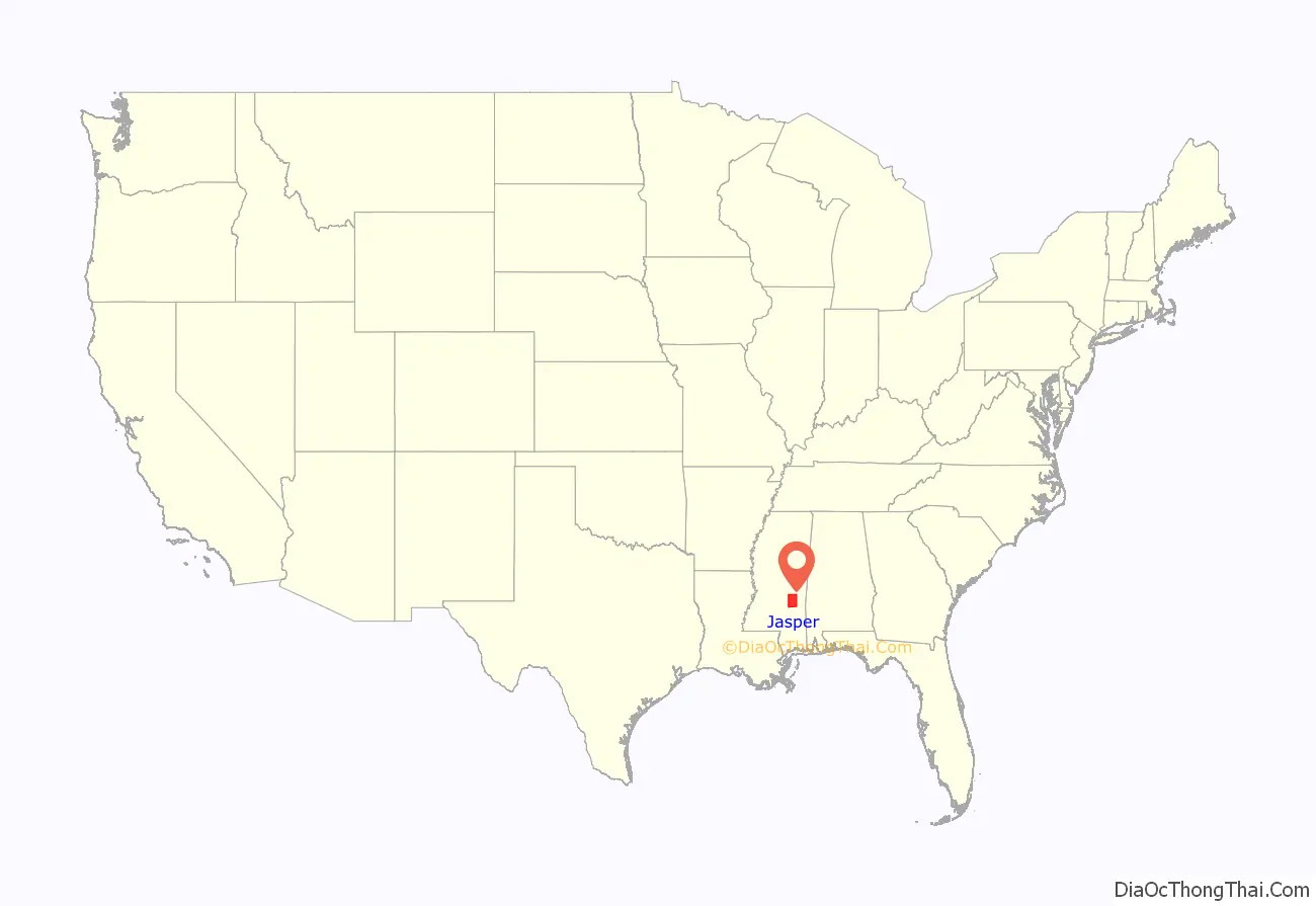
Jasper County location map. Where is Jasper County?
History
Developed during the period of Indian Removal from the Southeast and increasing settlement by European Americans in the region, Jasper County was formed in 1833 from the middle section of what was previously a much larger Jones County. It was named for Sgt. William Jasper who distinguished himself in the defense of Fort Moultrie in 1776 during the American Revolutionary War. When a shell from a British warship shot away the flagstaff, he recovered the flag, raised it on a temporary staff, and held it under fire until a new staff was installed. Sgt. Jasper was killed in the Siege of Savannah in 1779.
During the antebellum years, cotton was cultivated with slave labor on large plantations in the county. This was the heyday of the county seat of Paulding, Mississippi, called the “Queen City of the East.” It was a trading center for the plantations, as well as for yeomen farmers in the area. While some African Americans left the county in the early 20th century during the Great Migration out of the rural South to northern cities, in 2010 Jasper County had a population that was 52.6 percent African American, reflecting its history of cotton development and of people’s ties to generations in this land.
In the late nineteenth century, when local people declined to invest in railroad construction at Paulding, developers shifted the route to the west, stimulating growth at Bay Springs, where a sawmill had been built in 1880. About 1900 that community was incorporated as a city. In 1906 the state legislature designated Bay Springs as the second county seat. It attracted major timber companies, such as Georgia Pacific, and other industries.
It was not until 1935–1936, during the Great Depression under a WPA project, that the first east–west road was built across the county, connecting the city of Bay Springs in the west with Rose Hill, north of the community of Paulding, in the east.
Medical facilities have been built at Bay Springs, with the Jasper General Hospital operating since 1962. Jasper General Patient Rehab was constructed on the hospital grounds in 2012 to supplement the offerings.
Recreation in the county includes a 9-hole golf course at the Bay Springs Country Club. Fishing and hunting are available, including around Lake Claude Bennett near Rose Hill.
In the 21st century, the county is still largely rural, leading the state in timber, cattle, and poultry production. It is the state’s major producer of gas and oil, with resources concentrated near the community of Heidelberg.
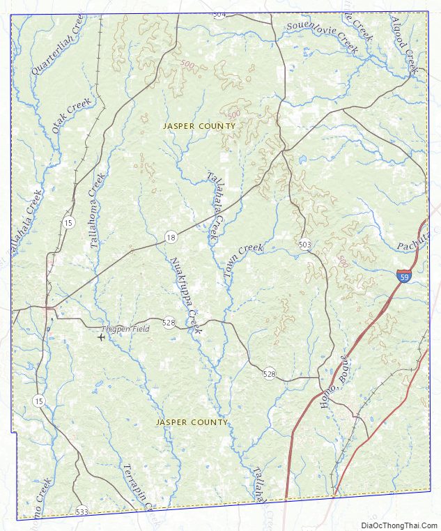
Jasper County Road Map
Geography
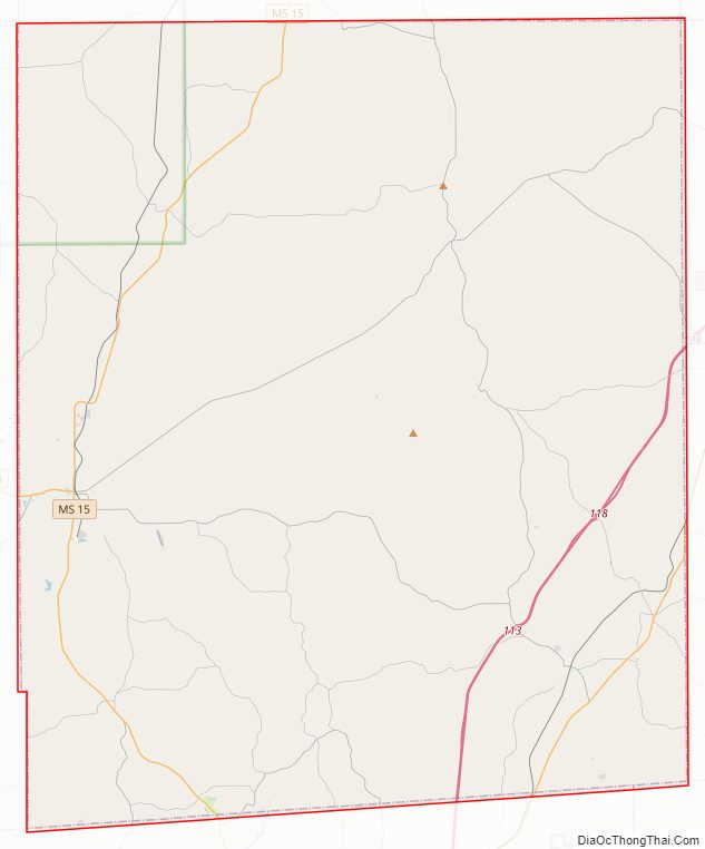
According to the U.S. Census Bureau, the county has a total area of 677 square miles (1,750 km), of which 676 square miles (1,750 km) is land and 1.2 square miles (3.1 km) (0.2%) is water.
Major highways
- Interstate 59
- U.S. Highway 11
- Mississippi Highway 15
- Mississippi Highway 18
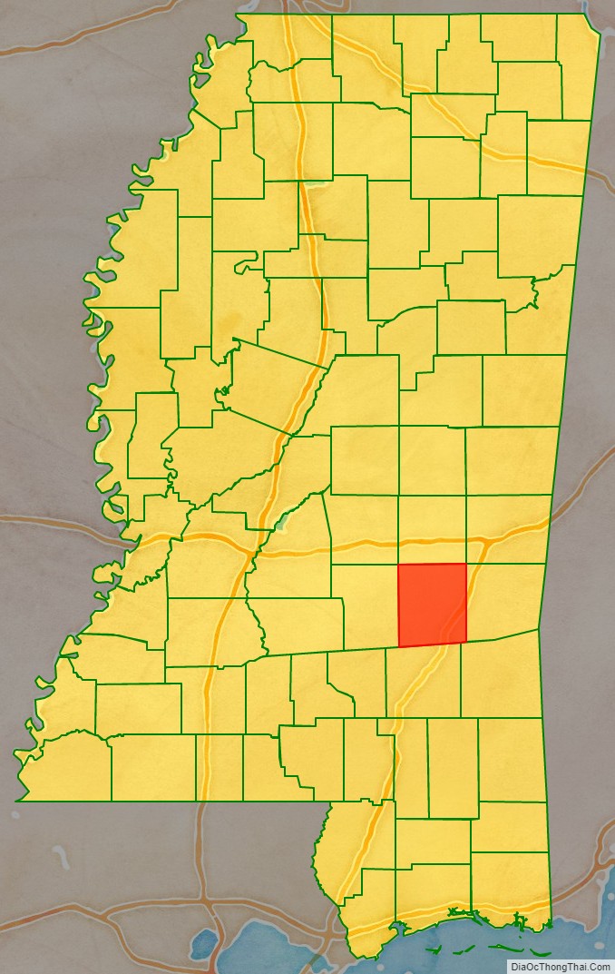
Adjacent counties
- Newton County (north)
- Clarke County (east)
- Wayne County (southeast)
- Jones County (south)
- Smith County (west)
National protected area
- Bienville National Forest (part)
Jasper County Topographic Map
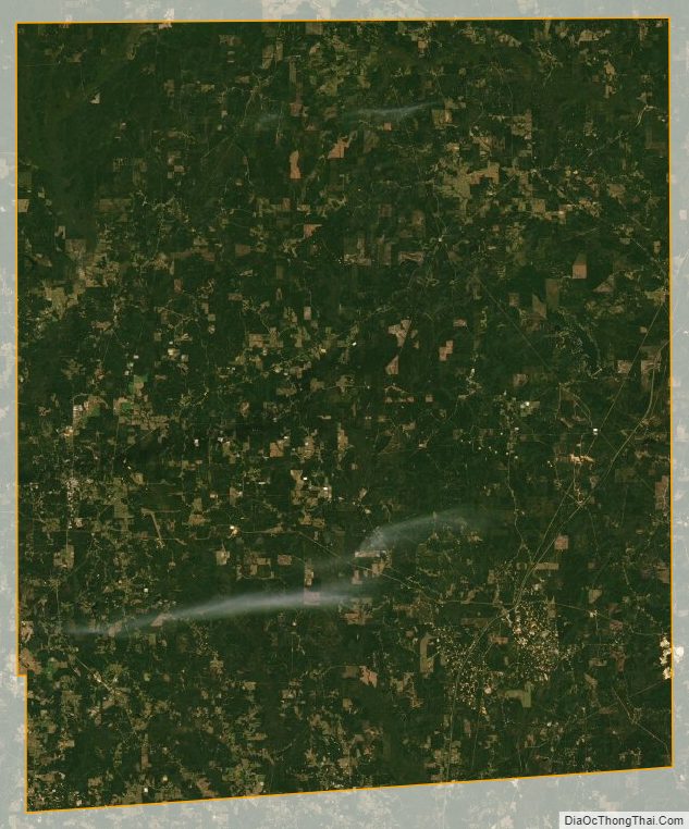
Jasper County Satellite Map
Jasper County Outline Map

See also
Map of Mississippi State and its subdivision:- Adams
- Alcorn
- Amite
- Attala
- Benton
- Bolivar
- Calhoun
- Carroll
- Chickasaw
- Choctaw
- Claiborne
- Clarke
- Clay
- Coahoma
- Copiah
- Covington
- Desoto
- Forrest
- Franklin
- George
- Greene
- Grenada
- Hancock
- Harrison
- Hinds
- Holmes
- Humphreys
- Issaquena
- Itawamba
- Jackson
- Jasper
- Jefferson
- Jefferson Davis
- Jones
- Kemper
- Lafayette
- Lamar
- Lauderdale
- Lawrence
- Leake
- Lee
- Leflore
- Lincoln
- Lowndes
- Madison
- Marion
- Marshall
- Monroe
- Montgomery
- Neshoba
- Newton
- Noxubee
- Oktibbeha
- Panola
- Pearl River
- Perry
- Pike
- Pontotoc
- Prentiss
- Quitman
- Rankin
- Scott
- Sharkey
- Simpson
- Smith
- Stone
- Sunflower
- Tallahatchie
- Tate
- Tippah
- Tishomingo
- Tunica
- Union
- Walthall
- Warren
- Washington
- Wayne
- Webster
- Wilkinson
- Winston
- Yalobusha
- Yazoo
- Alabama
- Alaska
- Arizona
- Arkansas
- California
- Colorado
- Connecticut
- Delaware
- District of Columbia
- Florida
- Georgia
- Hawaii
- Idaho
- Illinois
- Indiana
- Iowa
- Kansas
- Kentucky
- Louisiana
- Maine
- Maryland
- Massachusetts
- Michigan
- Minnesota
- Mississippi
- Missouri
- Montana
- Nebraska
- Nevada
- New Hampshire
- New Jersey
- New Mexico
- New York
- North Carolina
- North Dakota
- Ohio
- Oklahoma
- Oregon
- Pennsylvania
- Rhode Island
- South Carolina
- South Dakota
- Tennessee
- Texas
- Utah
- Vermont
- Virginia
- Washington
- West Virginia
- Wisconsin
- Wyoming