Jefferson County is a county located in the Big Bend region in the northern part of the U.S. state of Florida. As of the 2020 census, the population was 14,510. Its county seat is Monticello.
Jefferson County is part of the Tallahassee, FL Metropolitan Statistical Area but is the 3rd most rural county in Florida. There are no traffic signals within the entire county.
| Name: | Jefferson County |
|---|---|
| FIPS code: | 12-065 |
| State: | Florida |
| Founded: | January 20, 1827 |
| Named for: | Thomas Jefferson |
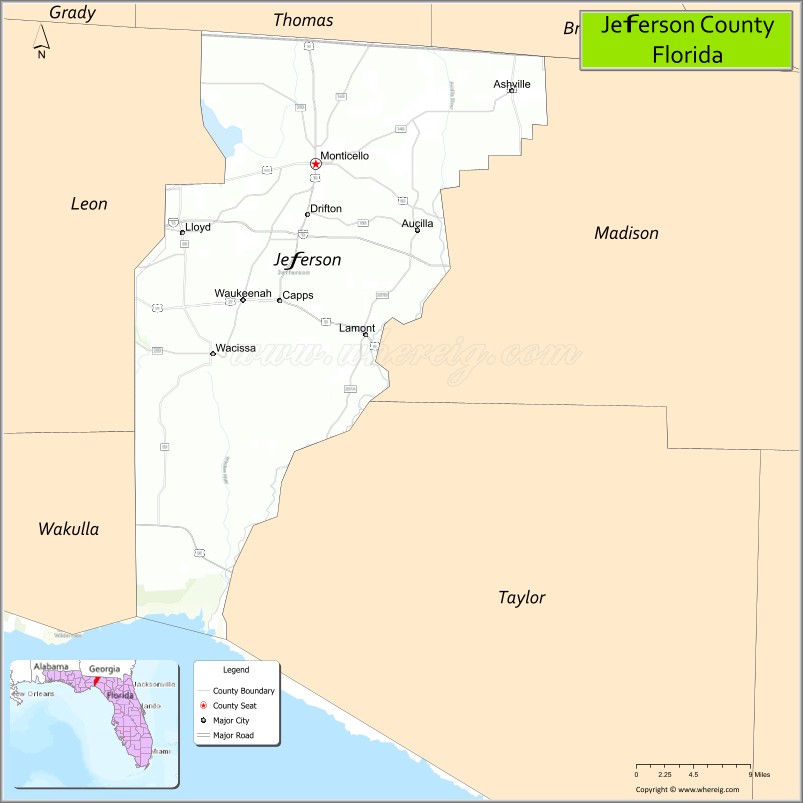
| Seat: | Monticello |
| Largest city: | Monticello |
| Total Area: | 637 sq mi (1,650 km²) |
| Land Area: | 598 sq mi (1,550 km²) |
| Total Population: | 14,510 |
| Population Density: | 23/sq mi (9/km²) |
| Time zone: | UTC−5 (Eastern) |
| Summer Time Zone (DST): | UTC−4 (EDT) |
| Website: | www.jeffersoncountyfl.gov |
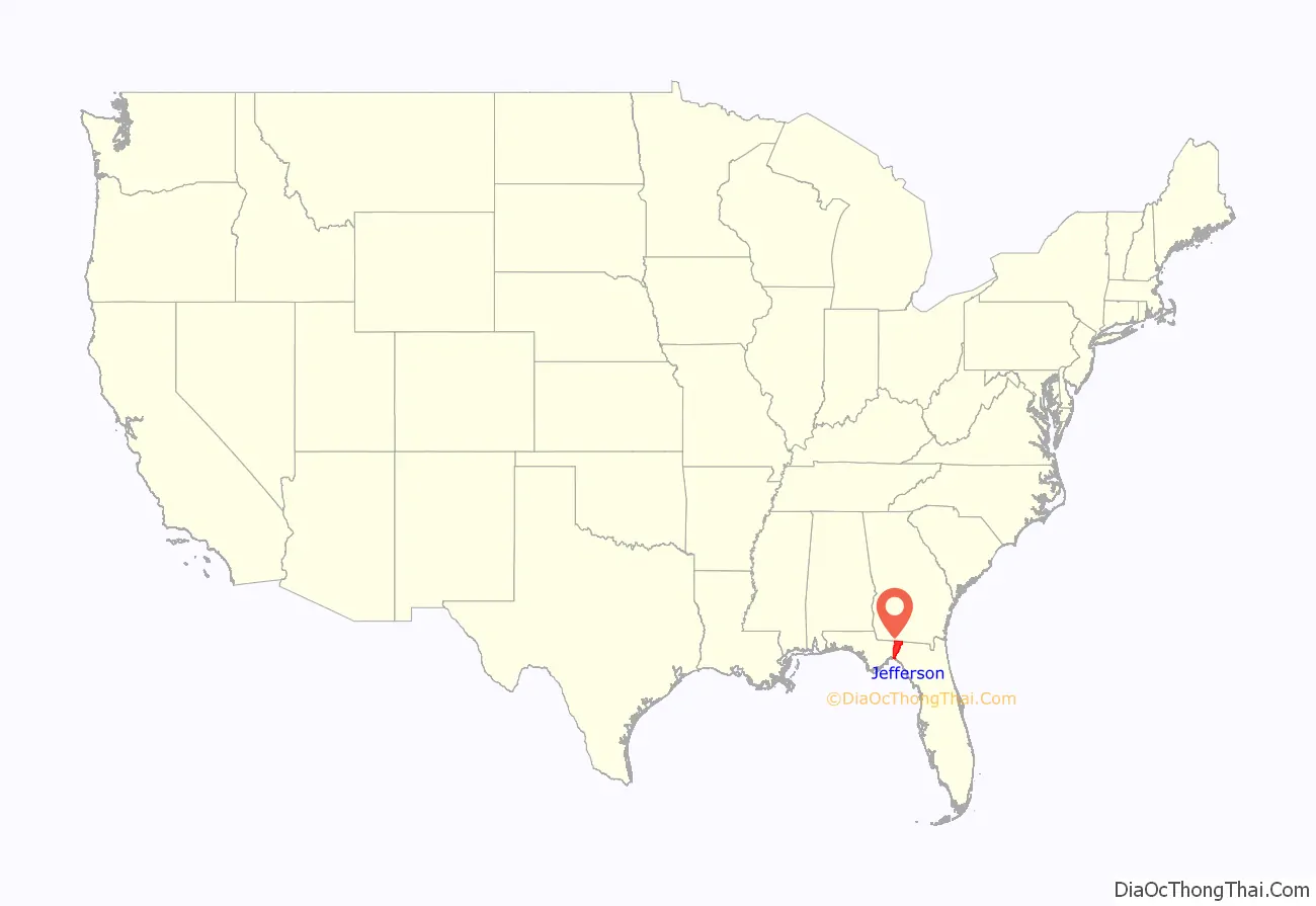
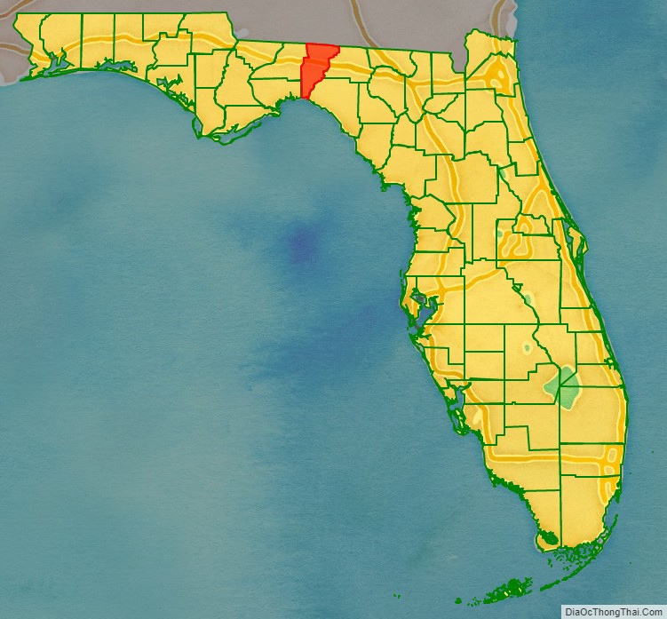
Jefferson County location map. Where is Jefferson County?
History
Jefferson County was created in 1827. It was named for Thomas Jefferson, third president of the United States, who had died the year before the county’s establishment.
Forts of Jefferson County
- Fort Roger Jones (1839), Aucilla (Ocilla Ferry), north of US 90.
- Fort Noel (1839–1842), south of Lamont on the Aucilla River, six miles (10 km) northwest of Fort Pleasant in Taylor County. Also known as Fort Number Three (M).
- Camp Carter (1838), near Waukeenah.
- Fort Welaunee (1838), a settlers’ fort on the Welaunee Plantation near Wacissa. Fort Gamble (1839–1843) was later established here.
- Fort Aucilla (1843), two miles (3 km) south-east of Fort Gamble, southwest of Lamont, between the Aucilla and Wacissa Rivers. Also spelled Ocilla.
- Fort Wacissa (1838), a settlers’ fort located south of Wacissa on the Wacissa River, west of Cabbage Grove.
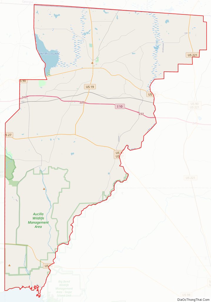
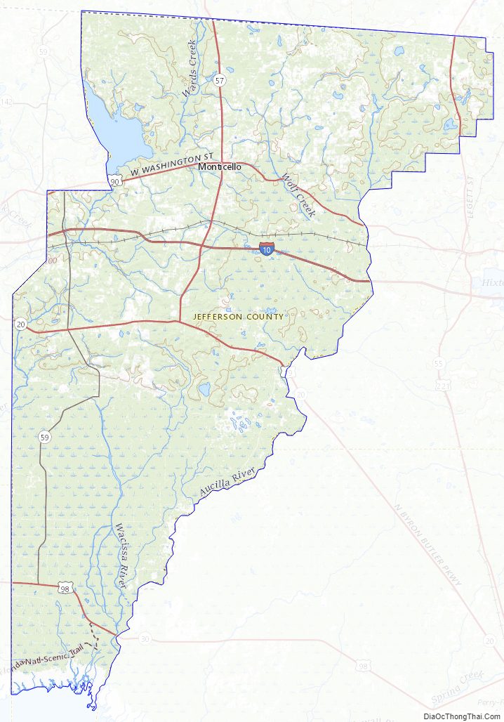
Jefferson County Road Map
Geography
According to the U.S. Census Bureau, the county has a total area of 637 square miles (1,650 km), of which 598 square miles (1,550 km) is land and 38 square miles (98 km) (6.0%) is water.
Jefferson County is the only county in Florida which borders both the state of Georgia and the Gulf of Mexico.
Adjacent counties
- Thomas County, Georgia – north
- Brooks County, Georgia – northeast
- Madison County – east
- Taylor County – southeast
- Wakulla County – southwest
- Leon County – west
National protected area
- St. Marks National Wildlife Refuge (part)
Water Bodies
- Aucilla River
- Lake Miccosukee
- Wacissa River
- Gulf of Mexico
Jefferson County Topographic Map
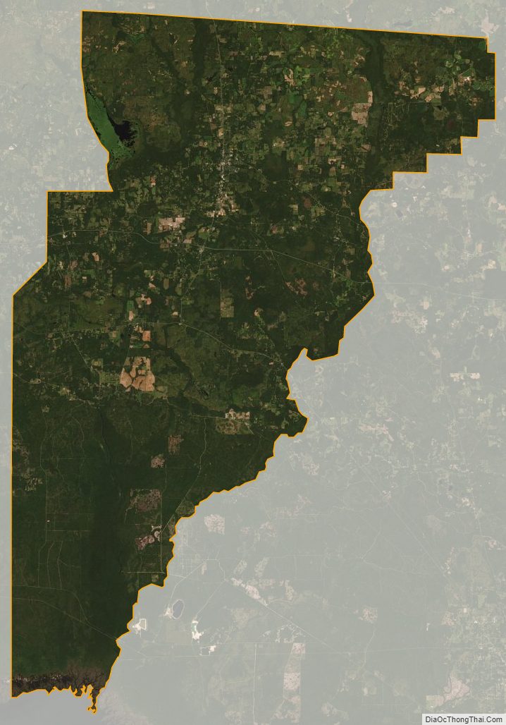
Jefferson County Satellite Map
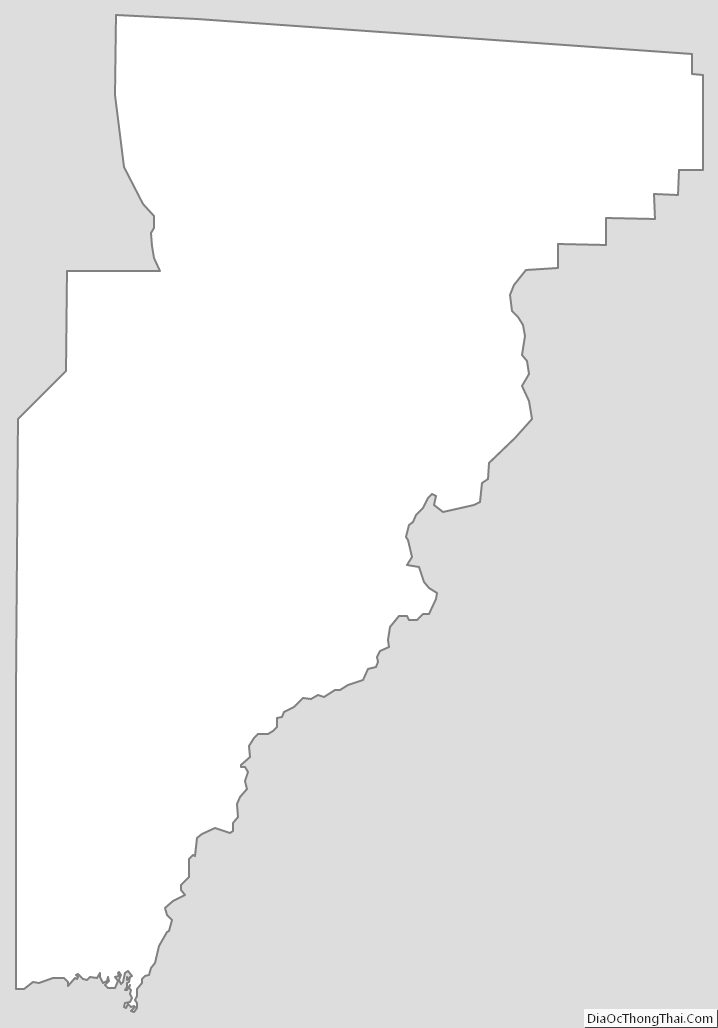
Jefferson County Outline Map
See also
Map of Florida State and its subdivision:- Alachua
- Baker
- Bay
- Bradford
- Brevard
- Broward
- Calhoun
- Charlotte
- Citrus
- Clay
- Collier
- Columbia
- Desoto
- Dixie
- Duval
- Escambia
- Flagler
- Franklin
- Gadsden
- Gilchrist
- Glades
- Gulf
- Hamilton
- Hardee
- Hendry
- Hernando
- Highlands
- Hillsborough
- Holmes
- Indian River
- Jackson
- Jefferson
- Lafayette
- Lake
- Lee
- Leon
- Levy
- Liberty
- Madison
- Manatee
- Marion
- Martin
- Miami-Dade
- Monroe
- Nassau
- Okaloosa
- Okeechobee
- Orange
- Osceola
- Palm Beach
- Pasco
- Pinellas
- Polk
- Putnam
- Saint Johns
- Saint Lucie
- Santa Rosa
- Sarasota
- Seminole
- Sumter
- Suwannee
- Taylor
- Union
- Volusia
- Wakulla
- Walton
- Washington
- Alabama
- Alaska
- Arizona
- Arkansas
- California
- Colorado
- Connecticut
- Delaware
- District of Columbia
- Florida
- Georgia
- Hawaii
- Idaho
- Illinois
- Indiana
- Iowa
- Kansas
- Kentucky
- Louisiana
- Maine
- Maryland
- Massachusetts
- Michigan
- Minnesota
- Mississippi
- Missouri
- Montana
- Nebraska
- Nevada
- New Hampshire
- New Jersey
- New Mexico
- New York
- North Carolina
- North Dakota
- Ohio
- Oklahoma
- Oregon
- Pennsylvania
- Rhode Island
- South Carolina
- South Dakota
- Tennessee
- Texas
- Utah
- Vermont
- Virginia
- Washington
- West Virginia
- Wisconsin
- Wyoming