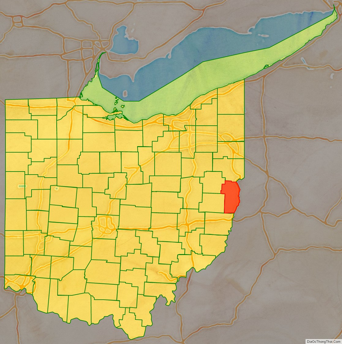
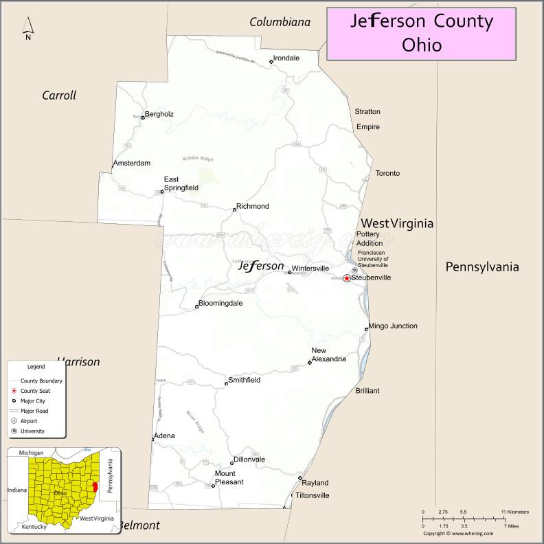
Jefferson County is a county located in the U.S. state of Ohio. As of the 2020 census, the population was 65,249. Its county seat is Steubenville. The county is named for Thomas Jefferson, who was vice president at the time of its creation.
Jefferson County is part of the Weirton–Steubenville, WV–OH Metropolitan Statistical Area, which is also included in the Pittsburgh–New Castle–Weirton, PA–WV–OH Combined Statistical Area.
| Name: | Jefferson County |
|---|---|
| FIPS code: | 39-081 |
| State: | Ohio |
| Founded: | July 29, 1797 |
| Named for: | Thomas Jefferson |
| Seat: | Steubenville |
| Largest city: | Steubenville |
| Total Area: | 411 sq mi (1,060 km²) |
| Land Area: | 408 sq mi (1,060 km²) |
| Total Population: | 65,249 |
| Population Density: | 160/sq mi (60/km²) |
| Time zone: | UTC−5 (Eastern) |
| Summer Time Zone (DST): | UTC−4 (EDT) |
| Website: | www.jeffersoncountyoh.com |
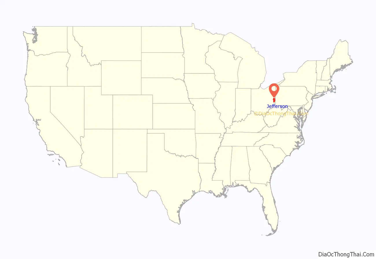
Jefferson County location map. Where is Jefferson County?
History
Jefferson County was organized on July 29, 1797, by proclamation of Governor Arthur St. Clair, six years before Ohio was granted statehood. Its boundaries were originally quite large, including all of northeastern Ohio east of the Cuyahoga River, but it was divided and redrawn several times before assuming its present-day boundaries in 1833, after the formation of neighboring Carroll County.
In 1786, the United States built Fort Steuben to protect the government surveyors mapping the land west of the Ohio River. When the surveyors completed their task a few years later, the fort was abandoned. In the meantime, settlers had built homes around the fort; they named their settlement La Belle. When the county was created in 1797, La Belle was selected as the County seat. The town was subsequently renamed Steubenville, in honor of the abandoned fort.
During the first half of the 19th century, Steubenville was primarily a port town, and the rest of the county consisted of small villages and farms. However, in 1856, Frazier, Kilgore and Company erected a rolling mill (the forerunner of steel mills) and the Steubenville Coal and Mining Company sank a coal shaft, resulting in Jefferson County becoming one of the leading centers of the new Industrial Revolution.
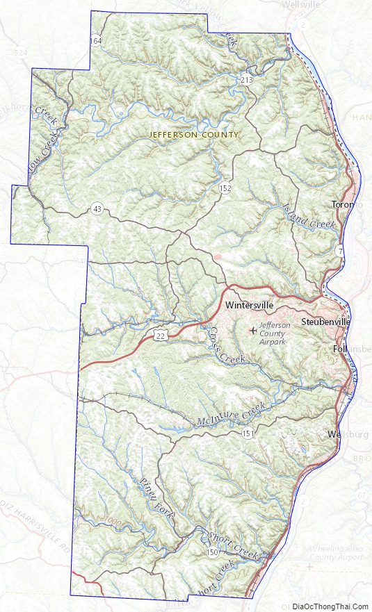
Jefferson County Road Map
Geography
According to the U.S. Census Bureau, the county has a total area of 411 square miles (1,060 km), of which 408 square miles (1,060 km) is land and 2.6 square miles (6.7 km) (0.6%) is water.
Adjacent counties
- Columbiana County (north)
- Hancock County, West Virginia (northeast)
- Brooke County, West Virginia (east)
- Ohio County, West Virginia (southeast)
- Belmont County (south)
- Harrison County (southwest)
- Carroll County (northwest)
Major highways
- US 22
- US 250
- SR 7
- SR 43
- SR 150
- SR 151
- SR 152
- SR 164
- SR 213
- SR 646
- SR 647
Jefferson County Topographic Map
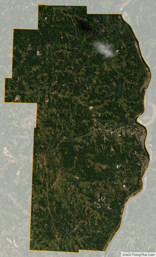
Jefferson County Satellite Map
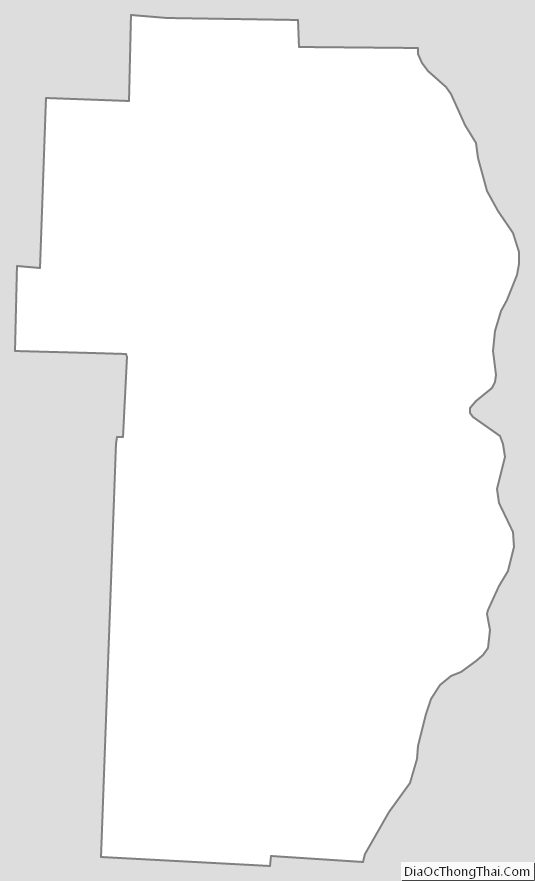
Jefferson County Outline Map
See also
Map of Ohio State and its subdivision:- Adams
- Allen
- Ashland
- Ashtabula
- Athens
- Auglaize
- Belmont
- Brown
- Butler
- Carroll
- Champaign
- Clark
- Clermont
- Clinton
- Columbiana
- Coshocton
- Crawford
- Cuyahoga
- Darke
- Defiance
- Delaware
- Erie
- Fairfield
- Fayette
- Franklin
- Fulton
- Gallia
- Geauga
- Greene
- Guernsey
- Hamilton
- Hancock
- Hardin
- Harrison
- Henry
- Highland
- Hocking
- Holmes
- Huron
- Jackson
- Jefferson
- Knox
- Lake
- Lake Erie
- Lawrence
- Licking
- Logan
- Lorain
- Lucas
- Madison
- Mahoning
- Marion
- Medina
- Meigs
- Mercer
- Miami
- Monroe
- Montgomery
- Morgan
- Morrow
- Muskingum
- Noble
- Ottawa
- Paulding
- Perry
- Pickaway
- Pike
- Portage
- Preble
- Putnam
- Richland
- Ross
- Sandusky
- Scioto
- Seneca
- Shelby
- Stark
- Summit
- Trumbull
- Tuscarawas
- Union
- Van Wert
- Vinton
- Warren
- Washington
- Wayne
- Williams
- Wood
- Wyandot
- Alabama
- Alaska
- Arizona
- Arkansas
- California
- Colorado
- Connecticut
- Delaware
- District of Columbia
- Florida
- Georgia
- Hawaii
- Idaho
- Illinois
- Indiana
- Iowa
- Kansas
- Kentucky
- Louisiana
- Maine
- Maryland
- Massachusetts
- Michigan
- Minnesota
- Mississippi
- Missouri
- Montana
- Nebraska
- Nevada
- New Hampshire
- New Jersey
- New Mexico
- New York
- North Carolina
- North Dakota
- Ohio
- Oklahoma
- Oregon
- Pennsylvania
- Rhode Island
- South Carolina
- South Dakota
- Tennessee
- Texas
- Utah
- Vermont
- Virginia
- Washington
- West Virginia
- Wisconsin
- Wyoming