Jefferson County is a county in the Coastal Plain or Gulf Prairie region of Southeast Texas. The Neches River forms its northeast boundary. As of the 2020 census, the population was 256,526. The county seat is Beaumont. Jefferson County has the highest percentage of African Americans in the state of Texas.
The county was established in 1835 as a municipality of Mexico, which had gained independence from Spain. Because the area was lightly settled, the Mexican government allowed European Americans from the United States to settle here if they pledged loyalty to Mexico. This was organized as a county in 1837 after Texas achieved independence as a republic. It was named by European-American settlers for U.S. president Thomas Jefferson. Texas later became part of the US.
Jefferson County is part of the Beaumont–Port Arthur Metropolitan Statistical Area and has the highest population of the four-county MSA. It has three state correctional facilities and a federal high-security prison in unincorporated areas of the county. Together they have a maximum capacity of nearly 9,000 prisoners.
| Name: | Jefferson County |
|---|---|
| FIPS code: | 48-245 |
| State: | Texas |
| Founded: | 1837 |
| Named for: | Thomas Jefferson |
| Seat: | Beaumont |
| Largest city: | Beaumont |
| Total Area: | 1,113 sq mi (2,880 km²) |
| Land Area: | 876 sq mi (2,270 km²) |
| Total Population: | 253,704 |
| Time zone: | UTC−6 (Central) |
| Summer Time Zone (DST): | UTC−5 (CDT) |
| Website: | www.co.jefferson.tx.us |
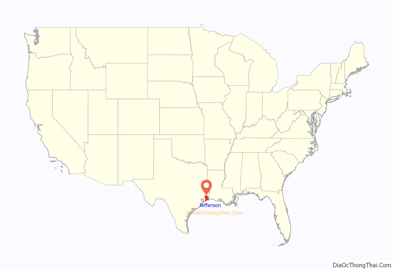
Jefferson County location map. Where is Jefferson County?
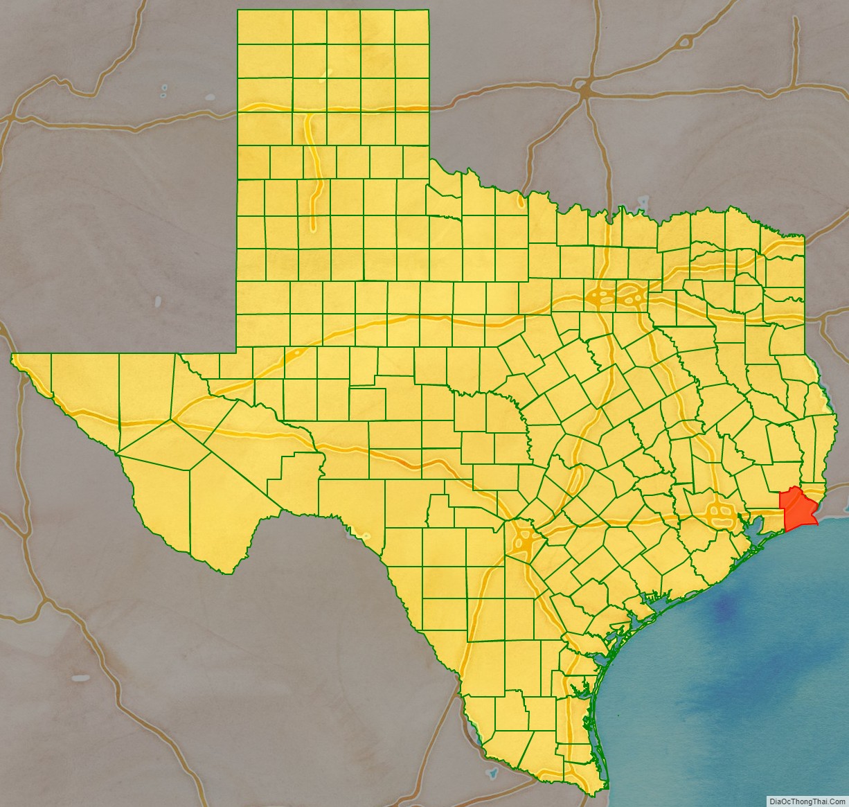
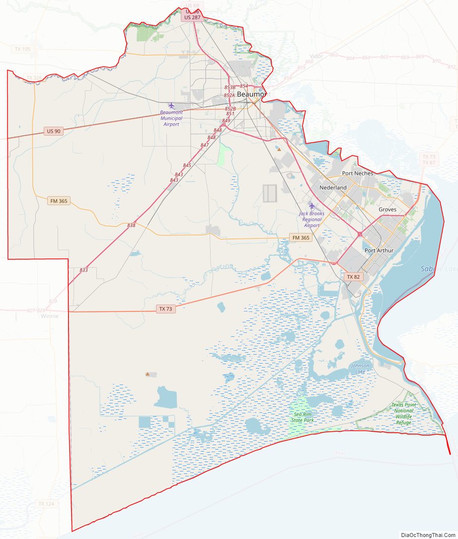
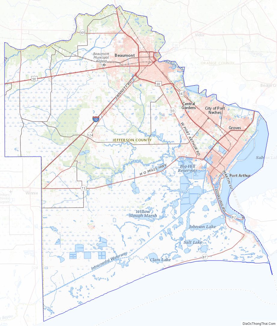
Jefferson County Road Map
Geography
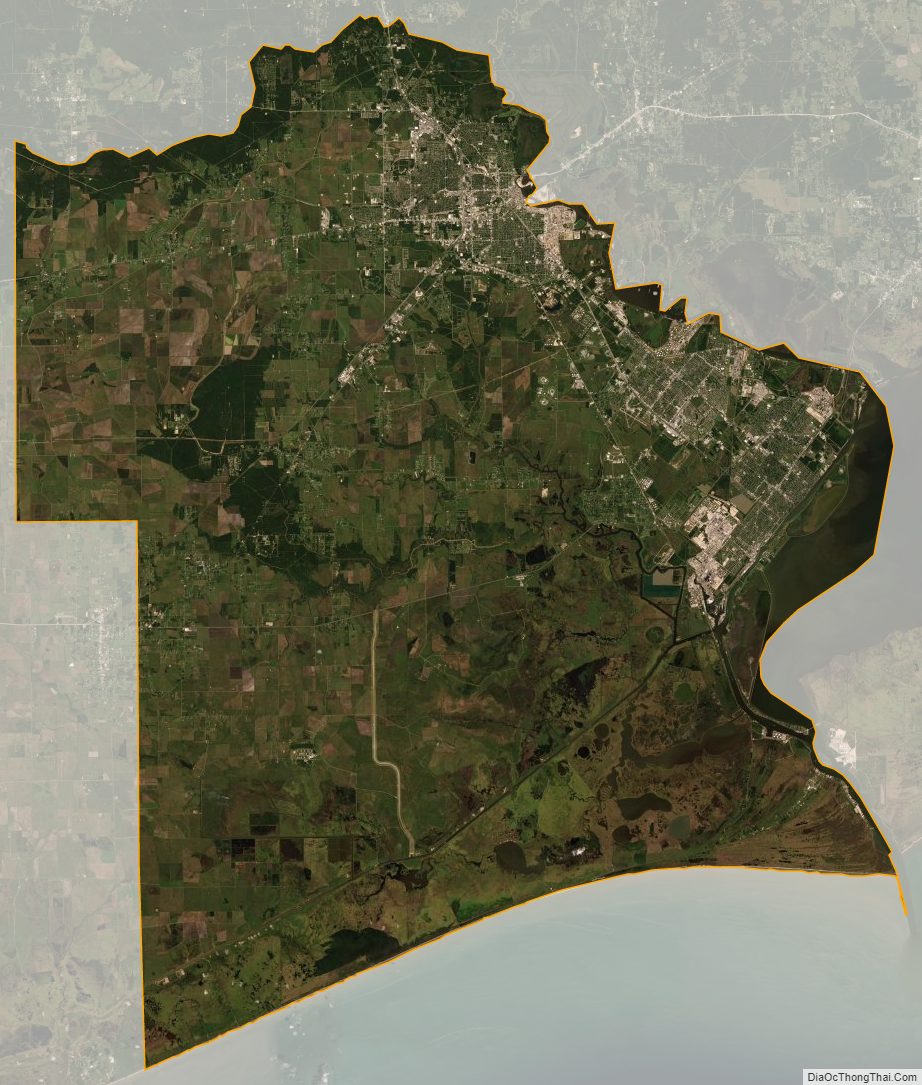
According to the U.S. Census Bureau, the county has a total area of 1,113 square miles (2,880 km), of which 876 square miles (2,270 km) is land and 236 square miles (610 km) (21%) is water.
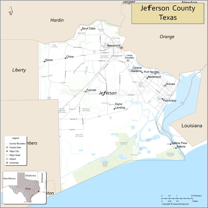
Jefferson County is on the plains of the Texas Gulf Coast in the southeastern part of the state. It is bounded on the north by Pine Island Bayou, on the northeast by the Neches River, and on the east by Sabine Lake and the mouth of the Sabine River, a natural outlet called Sabine Pass. The southern part of the county is largely marshland, much of which is within Sea Rim State Park, reaching the storm-battered beach at the Gulf of Mexico.
Major highways
- Interstate 10
- U.S. Highway 69/U.S. Highway 96/U.S. Highway 287
- U.S. Highway 90
- State Highway 73
- State Highway 82
- State Highway 87
- State Highway 105
- State Highway 124
- State Highway 326
- State Highway 347
Adjacent counties and parishes
- Hardin County (north)
- Orange County (northeast)
- Chambers County (southwest)
- Liberty County (northwest)
- Cameron Parish, Louisiana (east)
National protected areas
- Big Thicket National Preserve (part)
- McFaddin National Wildlife Refuge
- Texas Point National Wildlife Refuge
Jefferson County Topographic Map
Jefferson County Satellite Map
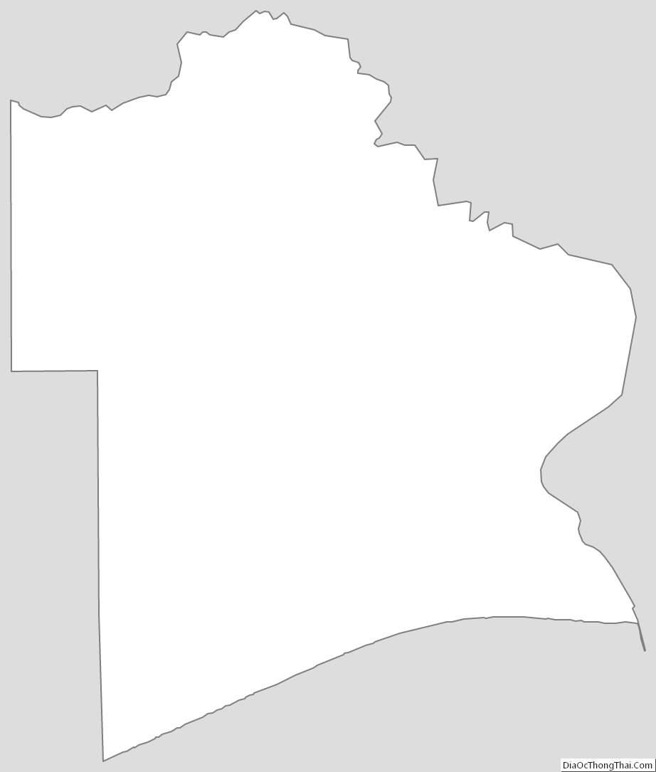
Jefferson County Outline Map
See also
Map of Texas State and its subdivision:- Anderson
- Andrews
- Angelina
- Aransas
- Archer
- Armstrong
- Atascosa
- Austin
- Bailey
- Bandera
- Bastrop
- Baylor
- Bee
- Bell
- Bexar
- Blanco
- Borden
- Bosque
- Bowie
- Brazoria
- Brazos
- Brewster
- Briscoe
- Brooks
- Brown
- Burleson
- Burnet
- Caldwell
- Calhoun
- Callahan
- Cameron
- Camp
- Carson
- Cass
- Castro
- Chambers
- Cherokee
- Childress
- Clay
- Cochran
- Coke
- Coleman
- Collin
- Collingsworth
- Colorado
- Comal
- Comanche
- Concho
- Cooke
- Coryell
- Cottle
- Crane
- Crockett
- Crosby
- Culberson
- Dallam
- Dallas
- Dawson
- Deaf Smith
- Delta
- Denton
- Dewitt
- Dickens
- Dimmit
- Donley
- Duval
- Eastland
- Ector
- Edwards
- El Paso
- Ellis
- Erath
- Falls
- Fannin
- Fayette
- Fisher
- Floyd
- Foard
- Fort Bend
- Franklin
- Freestone
- Frio
- Gaines
- Galveston
- Garza
- Gillespie
- Glasscock
- Goliad
- Gonzales
- Gray
- Grayson
- Gregg
- Grimes
- Guadalupe
- Hale
- Hall
- Hamilton
- Hansford
- Hardeman
- Hardin
- Harris
- Harrison
- Hartley
- Haskell
- Hays
- Hemphill
- Henderson
- Hidalgo
- Hill
- Hockley
- Hood
- Hopkins
- Houston
- Howard
- Hudspeth
- Hunt
- Hutchinson
- Irion
- Jack
- Jackson
- Jasper
- Jeff Davis
- Jefferson
- Jim Hogg
- Jim Wells
- Johnson
- Jones
- Karnes
- Kaufman
- Kendall
- Kenedy
- Kent
- Kerr
- Kimble
- King
- Kinney
- Kleberg
- Knox
- La Salle
- Lamar
- Lamb
- Lampasas
- Lavaca
- Lee
- Leon
- Liberty
- Limestone
- Lipscomb
- Live Oak
- Llano
- Loving
- Lubbock
- Lynn
- Madison
- Marion
- Martin
- Mason
- Matagorda
- Maverick
- McCulloch
- McLennan
- McMullen
- Medina
- Menard
- Midland
- Milam
- Mills
- Mitchell
- Montague
- Montgomery
- Moore
- Morris
- Motley
- Nacogdoches
- Navarro
- Newton
- Nolan
- Nueces
- Ochiltree
- Oldham
- Orange
- Palo Pinto
- Panola
- Parker
- Parmer
- Pecos
- Polk
- Potter
- Presidio
- Rains
- Randall
- Reagan
- Real
- Red River
- Reeves
- Refugio
- Roberts
- Robertson
- Rockwall
- Runnels
- Rusk
- Sabine
- San Augustine
- San Jacinto
- San Patricio
- San Saba
- Schleicher
- Scurry
- Shackelford
- Shelby
- Sherman
- Smith
- Somervell
- Starr
- Stephens
- Sterling
- Stonewall
- Sutton
- Swisher
- Tarrant
- Taylor
- Terrell
- Terry
- Throckmorton
- Titus
- Tom Green
- Travis
- Trinity
- Tyler
- Upshur
- Upton
- Uvalde
- Val Verde
- Van Zandt
- Victoria
- Walker
- Waller
- Ward
- Washington
- Webb
- Wharton
- Wheeler
- Wichita
- Wilbarger
- Willacy
- Williamson
- Wilson
- Winkler
- Wise
- Wood
- Yoakum
- Young
- Zapata
- Zavala
- Alabama
- Alaska
- Arizona
- Arkansas
- California
- Colorado
- Connecticut
- Delaware
- District of Columbia
- Florida
- Georgia
- Hawaii
- Idaho
- Illinois
- Indiana
- Iowa
- Kansas
- Kentucky
- Louisiana
- Maine
- Maryland
- Massachusetts
- Michigan
- Minnesota
- Mississippi
- Missouri
- Montana
- Nebraska
- Nevada
- New Hampshire
- New Jersey
- New Mexico
- New York
- North Carolina
- North Dakota
- Ohio
- Oklahoma
- Oregon
- Pennsylvania
- Rhode Island
- South Carolina
- South Dakota
- Tennessee
- Texas
- Utah
- Vermont
- Virginia
- Washington
- West Virginia
- Wisconsin
- Wyoming