Jefferson Davis County is a county located in the U.S. state of Mississippi. As of the 2020 census, the population was 11,321. Its county seat is Prentiss. The county is named after Mississippi Senator and Confederate President Jefferson Davis. The county was carved out of Covington and Lawrence counties in March 1906. Governor James K. Vardaman signed the bill creating the county on May 9, 1906.
| Name: | Jefferson Davis County |
|---|---|
| FIPS code: | 28-065 |
| State: | Mississippi |
| Founded: | 1906 |
| Named for: | Jefferson Davis |
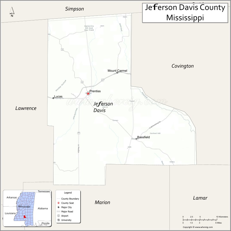
| Seat: | Prentiss |
| Largest town: | Prentiss |
| Total Area: | 409 sq mi (1,060 km²) |
| Land Area: | 408 sq mi (1,060 km²) |
| Total Population: | 11,321 |
| Population Density: | 28/sq mi (11/km²) |
| Time zone: | UTC−6 (Central) |
| Summer Time Zone (DST): | UTC−5 (CDT) |
| Website: | www.jeffersondaviscountyms.com |
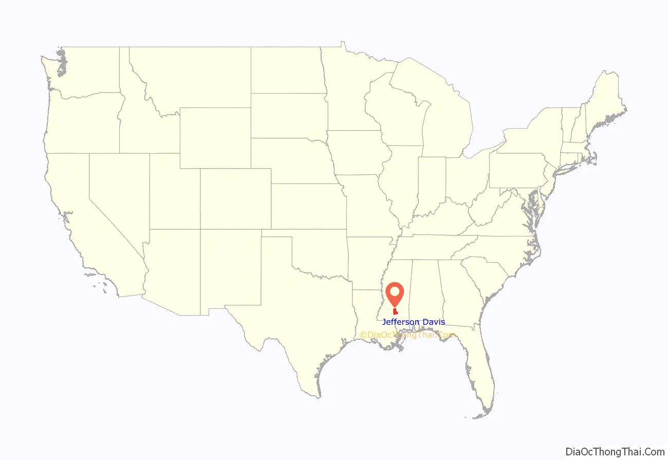
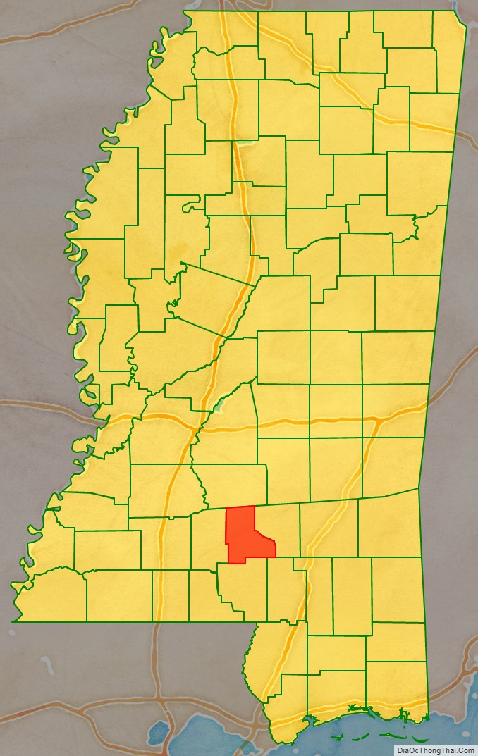
Jefferson Davis County location map. Where is Jefferson Davis County?
History
The genesis of the county occurred on March 31, 1906, when a Mississippi state legislative act authorized the new country’s boundaries. The residents of western Covington County and eastern Lawrence County had frequently complained of the rivers and streams impeding the route to their respective county seats. Jefferson Davis County was the state’s 77th county.
A 1906 special referendum determined that the county seat would be Prentiss, named for either famed Mississippi lawmaker and orator Seargent Smith Prentiss, or wealthy landowner Prentiss Webb Berry. The settlement was originally named Blountville after early settler William Blount.
In 1933, the county was the first in Mississippi to issue a prohibition on alcohol after the repeal of the Eighteenth Amendment to the United States Constitution. Round dancing in the community hall was banned in 1938.
In 1935, notorious bank robber Raymond Hamilton, known to hide out in the county’s wilderness, was involved in a hostage situation after robbing Prentiss’ Bank of Blountville, but escaped in Memphis.
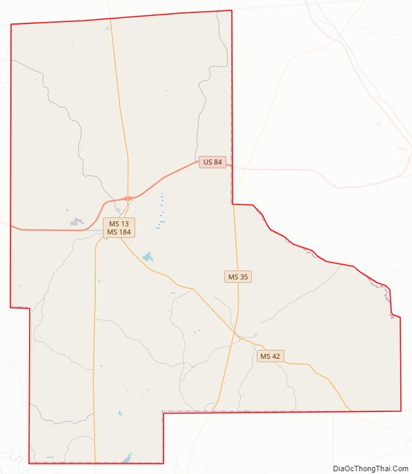
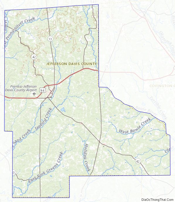
Jefferson Davis County Road Map
Geography
According to the U.S. Census Bureau, the county has a total area of 409 square miles (1,060 km), of which 408 square miles (1,060 km) is land and 0.7 square miles (1.8 km) (0.2%) is water.
Major highways
- U.S. Route 84
- Mississippi Highway 13
- Mississippi Highway 35
- Mississippi Highway 42
- Mississippi Highway 43
Adjacent counties
- Simpson County (north)
- Covington County (east)
- Lamar County (southeast)
- Marion County (south)
- Lawrence County (west)
Jefferson Davis County Topographic Map
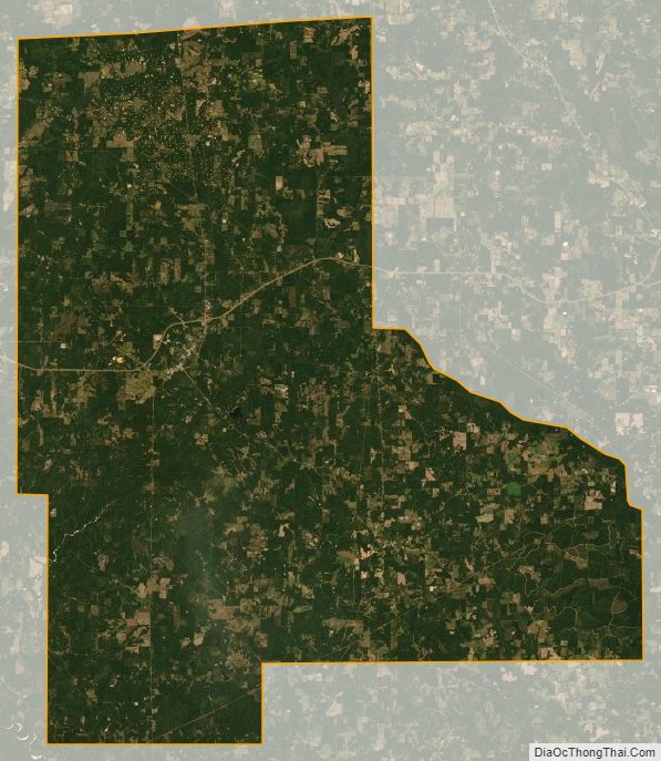
Jefferson Davis County Satellite Map
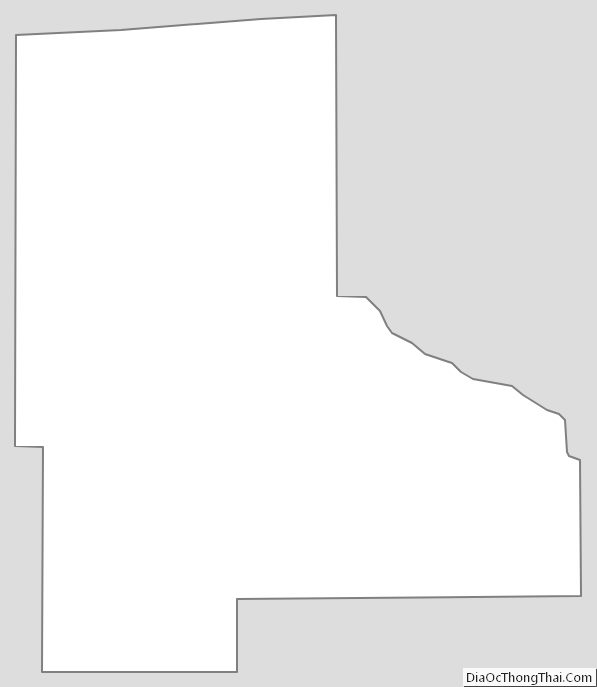
Jefferson Davis County Outline Map
See also
Map of Mississippi State and its subdivision:- Adams
- Alcorn
- Amite
- Attala
- Benton
- Bolivar
- Calhoun
- Carroll
- Chickasaw
- Choctaw
- Claiborne
- Clarke
- Clay
- Coahoma
- Copiah
- Covington
- Desoto
- Forrest
- Franklin
- George
- Greene
- Grenada
- Hancock
- Harrison
- Hinds
- Holmes
- Humphreys
- Issaquena
- Itawamba
- Jackson
- Jasper
- Jefferson
- Jefferson Davis
- Jones
- Kemper
- Lafayette
- Lamar
- Lauderdale
- Lawrence
- Leake
- Lee
- Leflore
- Lincoln
- Lowndes
- Madison
- Marion
- Marshall
- Monroe
- Montgomery
- Neshoba
- Newton
- Noxubee
- Oktibbeha
- Panola
- Pearl River
- Perry
- Pike
- Pontotoc
- Prentiss
- Quitman
- Rankin
- Scott
- Sharkey
- Simpson
- Smith
- Stone
- Sunflower
- Tallahatchie
- Tate
- Tippah
- Tishomingo
- Tunica
- Union
- Walthall
- Warren
- Washington
- Wayne
- Webster
- Wilkinson
- Winston
- Yalobusha
- Yazoo
- Alabama
- Alaska
- Arizona
- Arkansas
- California
- Colorado
- Connecticut
- Delaware
- District of Columbia
- Florida
- Georgia
- Hawaii
- Idaho
- Illinois
- Indiana
- Iowa
- Kansas
- Kentucky
- Louisiana
- Maine
- Maryland
- Massachusetts
- Michigan
- Minnesota
- Mississippi
- Missouri
- Montana
- Nebraska
- Nevada
- New Hampshire
- New Jersey
- New Mexico
- New York
- North Carolina
- North Dakota
- Ohio
- Oklahoma
- Oregon
- Pennsylvania
- Rhode Island
- South Carolina
- South Dakota
- Tennessee
- Texas
- Utah
- Vermont
- Virginia
- Washington
- West Virginia
- Wisconsin
- Wyoming