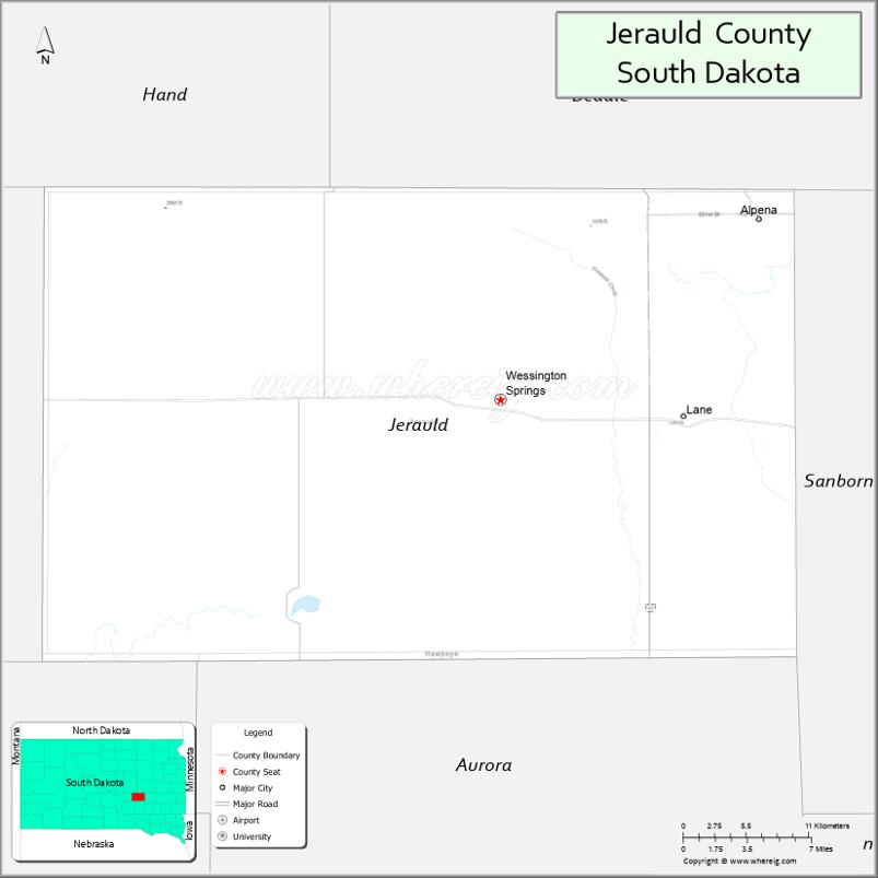
Jerauld County is a county in the U.S. state of South Dakota. As of the 2020 census, the population was 1,663. Its county seat is Wessington Springs.
| Name: | Jerauld County |
|---|---|
| FIPS code: | 46-073 |
| State: | South Dakota |
| Founded: | 1883 |
| Named for: | H. J. Jerauld |
| Seat: | Wessington Springs |
| Largest city: | Wessington Springs |
| Total Area: | 533 sq mi (1,380 km²) |
| Land Area: | 526 sq mi (1,360 km²) |
| Total Population: | 1,663 |
| Population Density: | 3.1/sq mi (1.2/km²) |
| Time zone: | UTC−6 (Central) |
| Summer Time Zone (DST): | UTC−5 (CDT) |
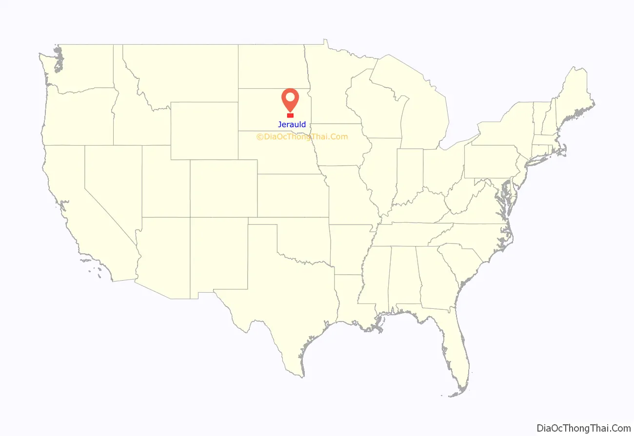
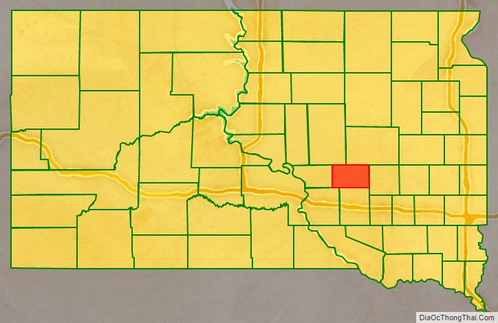
Jerauld County location map. Where is Jerauld County?
History
In 1873, the area occupied by the present Jerauld county was organized into Wetmore County. In 1881, Wetmore and its neighbor county to the south, Cragin County, were combined to form Aurora County. In 1883, the area of the former Wetmore County was reincorporated as present-day Jerauld County.
It was named for H. J. Jerauld, a legislator.
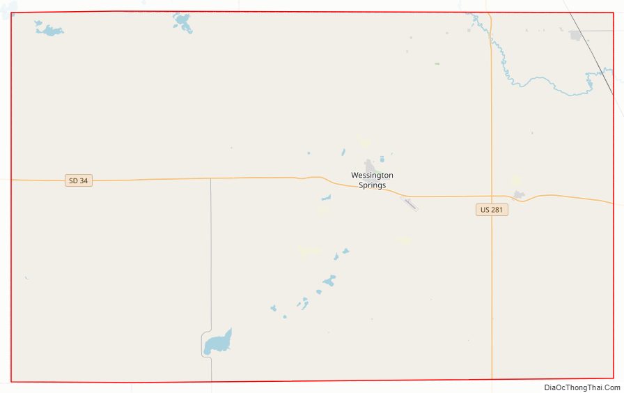
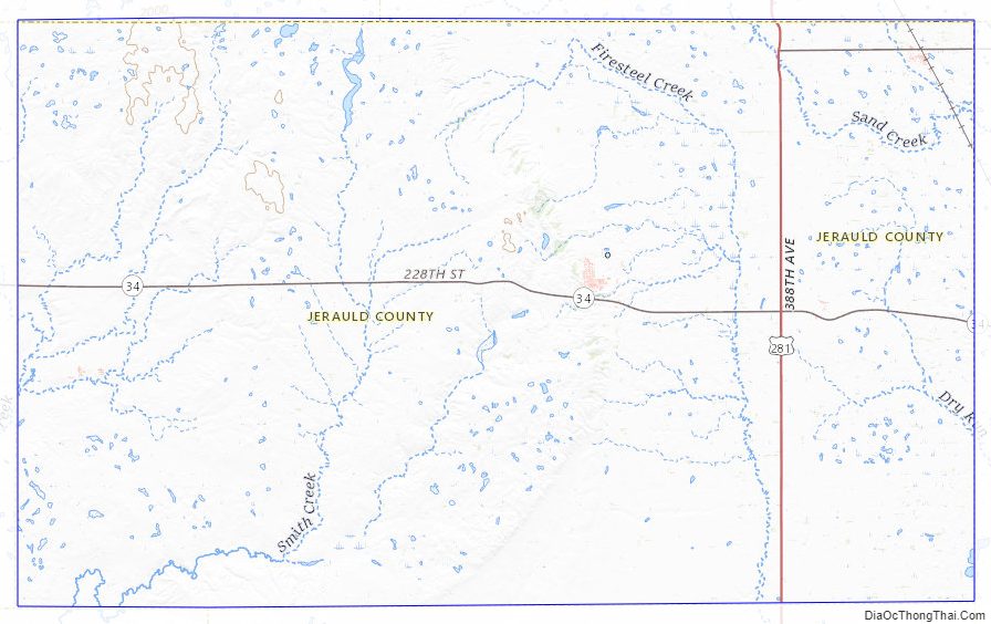
Jerauld County Road Map
Geography
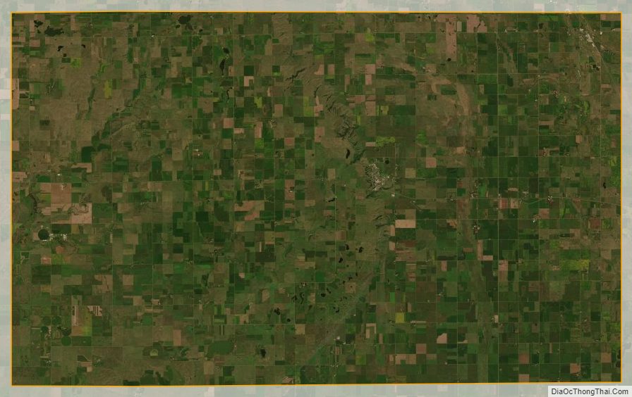
The terrain of Jerauld County consists of low rolling hills, mostly devoted to agriculture. The terrain slopes to the south and east, with the county’s highest point on the west boundary line near its NW corner, at 1,932′ (589m) ASL. The county has a total area of 533 square miles (1,380 km), of which 526 square miles (1,360 km) is land and 6.4 square miles (17 km) (1.2%) is water.
Major highways
- U.S. Highway 281
- South Dakota Highway 34
- South Dakota Highway 224
Adjacent counties
- Beadle County – northeast
- Sanborn County – east
- Aurora County – south
- Brule County – southwest
- Buffalo County – west
- Hand County – northwest
Protected areas
- Crow Lake State Game Production Area
- Horseshoe Lake State Game Production Area
Lakes
- Bakers Lake
- Cottonwood Lake
- Horseshoe Lake
- Long Lake
- Rempter Lake
- Twin Lakes (partial)
Jerauld County Topographic Map
Jerauld County Satellite Map
Jerauld County Outline Map

See also
Map of South Dakota State and its subdivision:- Aurora
- Beadle
- Bennett
- Bon Homme
- Brookings
- Brown
- Brule
- Buffalo
- Butte
- Campbell
- Charles Mix
- Clark
- Clay
- Codington
- Corson
- Custer
- Davison
- Day
- Deuel
- Dewey
- Douglas
- Edmunds
- Fall River
- Faulk
- Grant
- Gregory
- Haakon
- Hamlin
- Hand
- Hanson
- Harding
- Hughes
- Hutchinson
- Hyde
- Jackson
- Jerauld
- Jones
- Kingsbury
- Lake
- Lawrence
- Lincoln
- Lyman
- Marshall
- McCook
- McPherson
- Meade
- Mellette
- Miner
- Minnehaha
- Moody
- Pennington
- Perkins
- Potter
- Roberts
- Sanborn
- Shannon
- Spink
- Stanley
- Sully
- Todd
- Tripp
- Turner
- Union
- Walworth
- Yankton
- Ziebach
- Alabama
- Alaska
- Arizona
- Arkansas
- California
- Colorado
- Connecticut
- Delaware
- District of Columbia
- Florida
- Georgia
- Hawaii
- Idaho
- Illinois
- Indiana
- Iowa
- Kansas
- Kentucky
- Louisiana
- Maine
- Maryland
- Massachusetts
- Michigan
- Minnesota
- Mississippi
- Missouri
- Montana
- Nebraska
- Nevada
- New Hampshire
- New Jersey
- New Mexico
- New York
- North Carolina
- North Dakota
- Ohio
- Oklahoma
- Oregon
- Pennsylvania
- Rhode Island
- South Carolina
- South Dakota
- Tennessee
- Texas
- Utah
- Vermont
- Virginia
- Washington
- West Virginia
- Wisconsin
- Wyoming