Josephine County is one of the 36 counties in the U.S. state of Oregon. As of the 2020 census, the population was 88,090. The county seat is Grants Pass. The county is named after Virginia Josephine Rollins (1834-1912), a settler who was the first white woman to live in the county’s boundaries. Josephine County comprises the Grants Pass, OR Metropolitan Statistical Area, which is included in the Medford-Grants Pass, OR Combined Statistical Area.
| Name: | Josephine County |
|---|---|
| FIPS code: | 41-033 |
| State: | Oregon |
| Founded: | January 22, 1856 |
| Named for: | Virginia “Josephine” Rollins |
| Seat: | Grants Pass |
| Largest city: | Grants Pass |
| Total Area: | 1,642 sq mi (4,250 km²) |
| Land Area: | 1,640 sq mi (4,200 km²) |
| Total Population: | 88,090 |
| Population Density: | 50/sq mi (20/km²) |
| Time zone: | UTC−8 (Pacific) |
| Summer Time Zone (DST): | UTC−7 (PDT) |
| Website: | www.co.josephine.or.us |
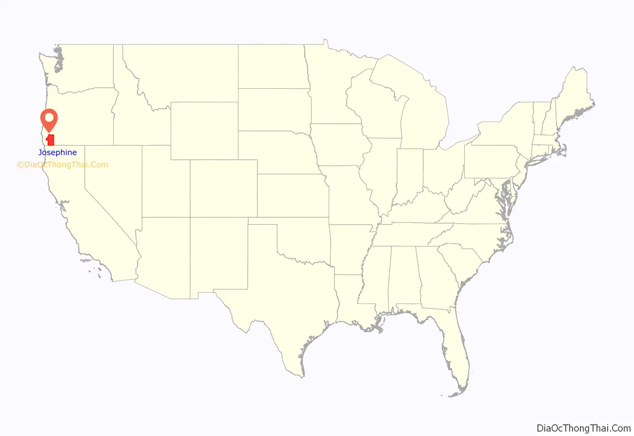
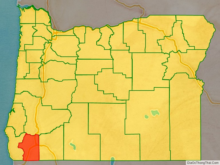
Josephine County location map. Where is Josephine County?
History
The discovery of rich placers at Sailor Diggings (later known as Waldo) in 1852 and the resulting gold rush brought the first settlers to this region. Several U.S. Army forts were maintained in the county and many engagements during the Rogue River Indian War (1855–1858) took place within its boundaries. In 1851, a group of prospectors moved to the Illinois Valley and made the first discovery of gold in Southern Oregon. In this group was Floyd Rollins and his daughter, Josephine Rollins Ort, after whom the county is named. On January 22, 1856, a bill was passed by the territorial legislature separating what is now Josephine County from Jackson County. The bill made Sailor Diggings (later known as Waldo) the county seat. It was the nineteenth, and last, county created before statehood.
In 1885, the county seat was relocated to Kerby, where the county’s first jail was built. In 1885, the Oregon Legislature adjusted the boundary between Jackson and Josephine County, making Grants Pass a part of Josephine County. This was done primarily to have a railroad head within the new county. In June 1886 the voters of Josephine County considered three towns for the new county seat. These were: Kerby, Wilderville and Grants Pass. Grants Pass won with 116 votes out of the 716 ballots cast.
In the 1920s, the county improved its tourist facilities. In 1922, the Grants Pass Cavemen booster club was created, where members dressed in furs and wielded clubs at events. Events organized by the club ranged from simply blocking traffic, to bidding on the construction of the San Francisco–Oakland Bay Bridge (at a cost of 23,756,000 deer hides), to initiating politicians into their club including Mark Hatfield and Thomas E. Dewey during his 1948 presidential campaign. Russian newspapers used images of the Grants Pass Cavemen to show ‘how the rich “cavort” in America.’ Although bridges had been built across the Rogue River by the 1920s, ferries were still used to convey people and cars across. The first Grants Pass bridge was destroyed by a flood in 1890. The first newspaper in Josephine County was the Argus, which began publication on March 13, 1885. It lasted only a few months, but the Grants Pass Courier began three weeks later. The Illinois Valley News published in Cave Junction started in 1937 and is still a paper of record in Josephine County publishing every Wednesday. In 1897, the first legal hanging took place in Josephine County. Lemson W. Melson confessed to the murder of Charles Perry while the noose was around his neck.
Ethnic history
Although several tribes of Native Americans lived in the area from which Josephine County was created, most of their members had been moved to the reservation at Grand Ronde by the end of the Rogue River Indian War. Soon afterwards all Indians in southwest Oregon, with the exception of a few small bands, were moved to the Coast reservation (later known as the Siletz Reservation). Josephine County was also the home to a large Chinese population. Most had come to the area to work gold claims purchased from whites no longer interested in working them. Even though they could not own land, they had to pay a tax to mine gold, and were usually relegated to inferior claims.
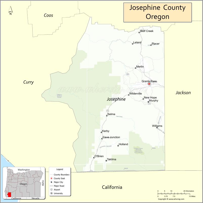
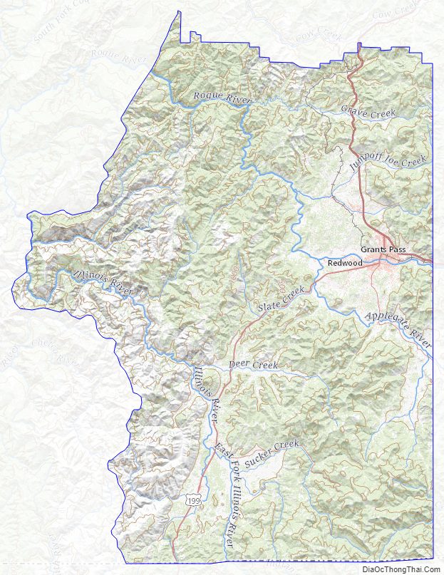
Josephine County Road Map
Geography
According to the United States Census Bureau, the county has a total
area of 1,642 square miles (4,250 km), of which 1,640 square miles (4,200 km) is land and 2.2 square miles (5.7 km) (0.1%) is water.
Adjacent counties
- Douglas County (north)
- Jackson County (east)
- Siskiyou County, California (south)
- Del Norte County, California (southwest)
- Curry County (west)
National protected areas
- Oregon Caves National Monument
- Rogue River-Siskiyou National Forest (part)
Josephine County Topographic Map
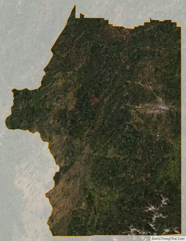
Josephine County Satellite Map
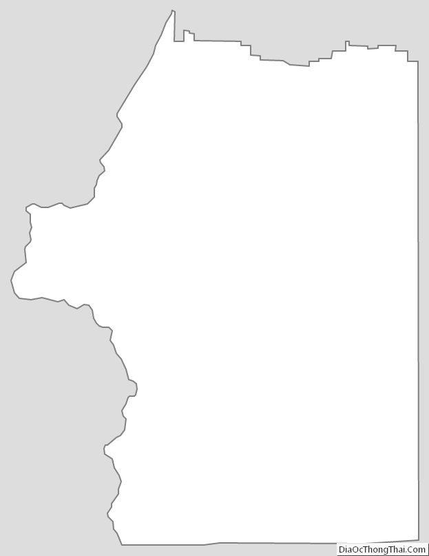
Josephine County Outline Map
See also
Map of Oregon State and its subdivision: Map of other states:- Alabama
- Alaska
- Arizona
- Arkansas
- California
- Colorado
- Connecticut
- Delaware
- District of Columbia
- Florida
- Georgia
- Hawaii
- Idaho
- Illinois
- Indiana
- Iowa
- Kansas
- Kentucky
- Louisiana
- Maine
- Maryland
- Massachusetts
- Michigan
- Minnesota
- Mississippi
- Missouri
- Montana
- Nebraska
- Nevada
- New Hampshire
- New Jersey
- New Mexico
- New York
- North Carolina
- North Dakota
- Ohio
- Oklahoma
- Oregon
- Pennsylvania
- Rhode Island
- South Carolina
- South Dakota
- Tennessee
- Texas
- Utah
- Vermont
- Virginia
- Washington
- West Virginia
- Wisconsin
- Wyoming