Kalkaska County (/kælˈkæskə/ kal-KASS-kə) is located in the U.S. state of Michigan. As of the 2020 Census, the population was 17,939. The county seat is Kalkaska.
Kalkaska County is included in the Traverse City Micropolitan Statistical Area. Although it is located on Michigan’s Lower Peninsula, Kalkaska County is considered part of Northern Michigan.
| Name: | Kalkaska County |
|---|---|
| FIPS code: | 26-079 |
| State: | Michigan |
| Founded: | 1840 |
| Seat: | Kalkaska |
| Total Area: | 571 sq mi (1,480 km²) |
| Land Area: | 560 sq mi (1,500 km²) |
| Total Population: | 17,939 |
| Population Density: | 31/sq mi (12/km²) |
| Time zone: | UTC−5 (Eastern) |
| Summer Time Zone (DST): | UTC−4 (EDT) |
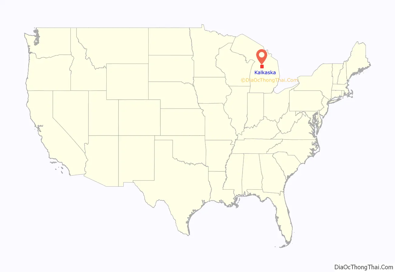
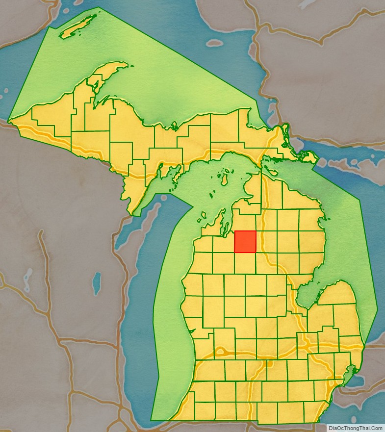
Kalkaska County location map. Where is Kalkaska County?
History
Kalkaska County, originally named Wabassee County, was separated from Michilimackinac County in 1840, renamed in 1843. In 1851, Kalkaska County was attached to Grand Traverse County for legal purposes. The first settler in Kalkaska County was William Copeland, from England, who purchased land in the northwest corner of the county in 1855. Kalkaska County was organized in its own right on January 27, 1871. Crawford County was then temporarily attached to Kalkaska County for legal purposes.
The discovery of substantial deposits of oil and natural gas resulted in the construction of a processing plant by Shell Oil Company in 1973 and a major economic boom in the community.
Etymology
The county’s name is a pseudo-Native American word coined by Henry Schoolcraft, a Michigan geographer and ethnologist. The name is thought to be a Chippewa word meaning flat or burned-over country. An alternative theory is that this is a neologism or neonym created by Henry Schoolcraft, originally spelled Calcasca. Some theorists suggest this is word play. Schoolcraft’s family name had been Calcraft, and the Ks may have been added to make the name appear more like a Native American word.
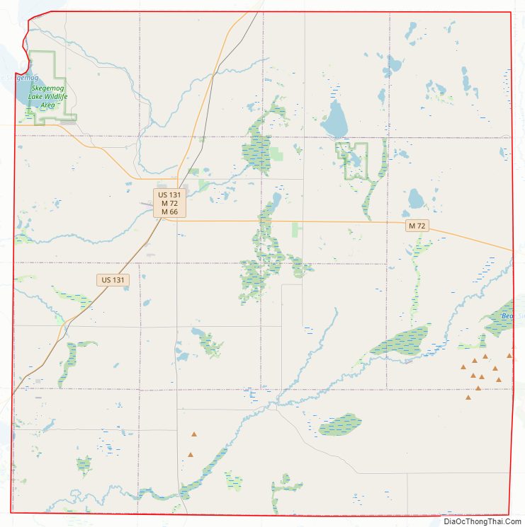
Kalkaska County Road Map
Geography
According to the U.S. Census Bureau, the county has a total area of 571 square miles (1,480 km), of which 560 square miles (1,500 km) is land and 11 square miles (28 km) (1.9%) is water.
Kalkaska Sand, the state soil of Michigan, was named after the county because of the large amounts deposited in the area from glaciers in the Ice Age.
Kalkaska County has over 80 lakes and 275 miles (443 km) of streams and rivers. Much of the county is marshland. County elevation ranges from 595 feet (181 m) to about 1,246 feet (380 m). This makes it one of the more uneven counties in the Lower Peninsula.
The Pere Marquette State Forest covers much of the county. Glaciers shaped the area, creating a unique regional ecosystem. A large portion of the area is the Grayling outwash plain, a broad outwash plain including sandy ice-disintegration ridges; jack pine barrens, some white pine-red pine forest, and northern hardwood forest. Large lakes were created by glacial action.
Lakes
- Torch Lake
- Starvation Lake
- Lake Skegemog
- Bear Lake
- Manistee Lake
- Grass Lake
- Rainbow Lake
- Blue Lake
- Cub Lake
- Twin Lake
- Little Twin Lake
- Pickerel Lake
- Squaw Lake
- Indian Lake
- Perch Lake
- Crawford Lake
- Lost Lake
- Johnson Rd Lake
- Log Lake
- Selkirk Lake
- Kettle Lake
- Lake Placid
- Sand Lake
- Twenty Eight Lakes
- East Lake
- Long Lake
- Lake Five
- Wheeler Lake
- Fife Lake
Rivers
- Boardman River
- Little Rapid River
- Manistee River
- Rapid River
- Torch River
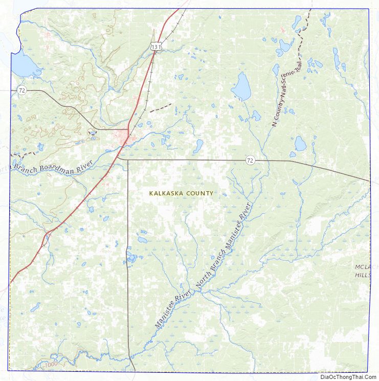
Major highways
- US 131 – runs NE through the western part of the county. Enters at 4 miles (6.4 km) north of SW corner; exits into Antrim County near midpoint of north county line.
- M-66 – runs north–south through west-central part of county. Passes Kalkaska.
- M-72 – runs east and ESE through middle portion of county. Passes Kalkaska.
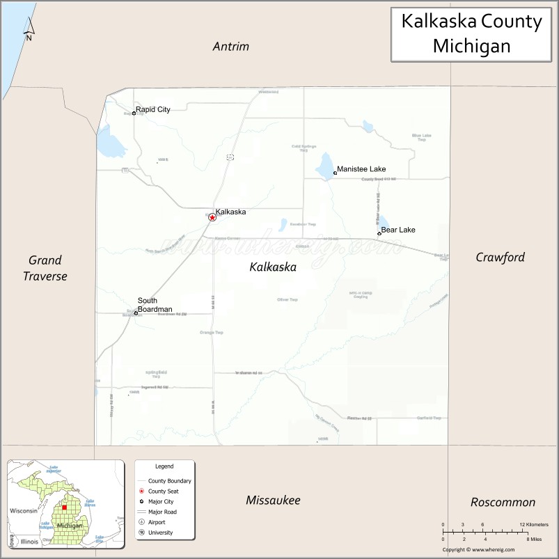
Adjacent counties
- Antrim County – north
- Otsego County – northeast
- Crawford County – east
- Roscommon County – southeast
- Missaukee County – south
- Wexford County – southwest
- Grand Traverse County – west
Kalkaska County Topographic Map
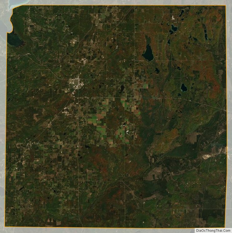
Kalkaska County Satellite Map
Kalkaska County Outline Map

See also
Map of Michigan State and its subdivision:- Alcona
- Alger
- Allegan
- Alpena
- Antrim
- Arenac
- Baraga
- Barry
- Bay
- Benzie
- Berrien
- Branch
- Calhoun
- Cass
- Charlevoix
- Cheboygan
- Chippewa
- Clare
- Clinton
- Crawford
- Delta
- Dickinson
- Eaton
- Emmet
- Genesee
- Gladwin
- Gogebic
- Grand Traverse
- Gratiot
- Hillsdale
- Houghton
- Huron
- Ingham
- Ionia
- Iosco
- Iron
- Isabella
- Jackson
- Kalamazoo
- Kalkaska
- Kent
- Keweenaw
- Lake
- Lake Hurron
- Lake Michigan
- Lake St. Clair
- Lake Superior
- Lapeer
- Leelanau
- Lenawee
- Livingston
- Luce
- Mackinac
- Macomb
- Manistee
- Marquette
- Mason
- Mecosta
- Menominee
- Midland
- Missaukee
- Monroe
- Montcalm
- Montmorency
- Muskegon
- Newaygo
- Oakland
- Oceana
- Ogemaw
- Ontonagon
- Osceola
- Oscoda
- Otsego
- Ottawa
- Presque Isle
- Roscommon
- Saginaw
- Saint Clair
- Saint Joseph
- Sanilac
- Schoolcraft
- Shiawassee
- Tuscola
- Van Buren
- Washtenaw
- Wayne
- Wexford
- Alabama
- Alaska
- Arizona
- Arkansas
- California
- Colorado
- Connecticut
- Delaware
- District of Columbia
- Florida
- Georgia
- Hawaii
- Idaho
- Illinois
- Indiana
- Iowa
- Kansas
- Kentucky
- Louisiana
- Maine
- Maryland
- Massachusetts
- Michigan
- Minnesota
- Mississippi
- Missouri
- Montana
- Nebraska
- Nevada
- New Hampshire
- New Jersey
- New Mexico
- New York
- North Carolina
- North Dakota
- Ohio
- Oklahoma
- Oregon
- Pennsylvania
- Rhode Island
- South Carolina
- South Dakota
- Tennessee
- Texas
- Utah
- Vermont
- Virginia
- Washington
- West Virginia
- Wisconsin
- Wyoming