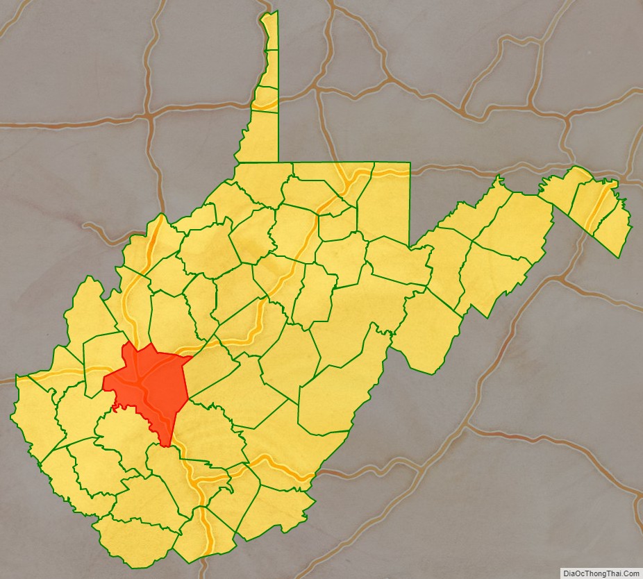
Kanawha County (/kəˈnɔːə/ kə-NAW-ə) is a county in the U.S. state of West Virginia. As of the 2020 census, the population was 180,745, making it West Virginia’s most populous county. The county seat is Charleston, which is also the state capital. Kanawha County is part of the Charleston, WV Metropolitan Statistical Area.
| Name: | Kanawha County |
|---|---|
| FIPS code: | 54-039 |
| State: | West Virginia |
| Founded: | October 5, 1789 |
| Named for: | Kanawha River |
| Seat: | Charleston |
| Largest city: | Charleston |
| Total Area: | 911 sq mi (2,360 km²) |
| Land Area: | 902 sq mi (2,340 km²) |
| Total Population: | 180,745 |
| Population Density: | 200/sq mi (77/km²) |
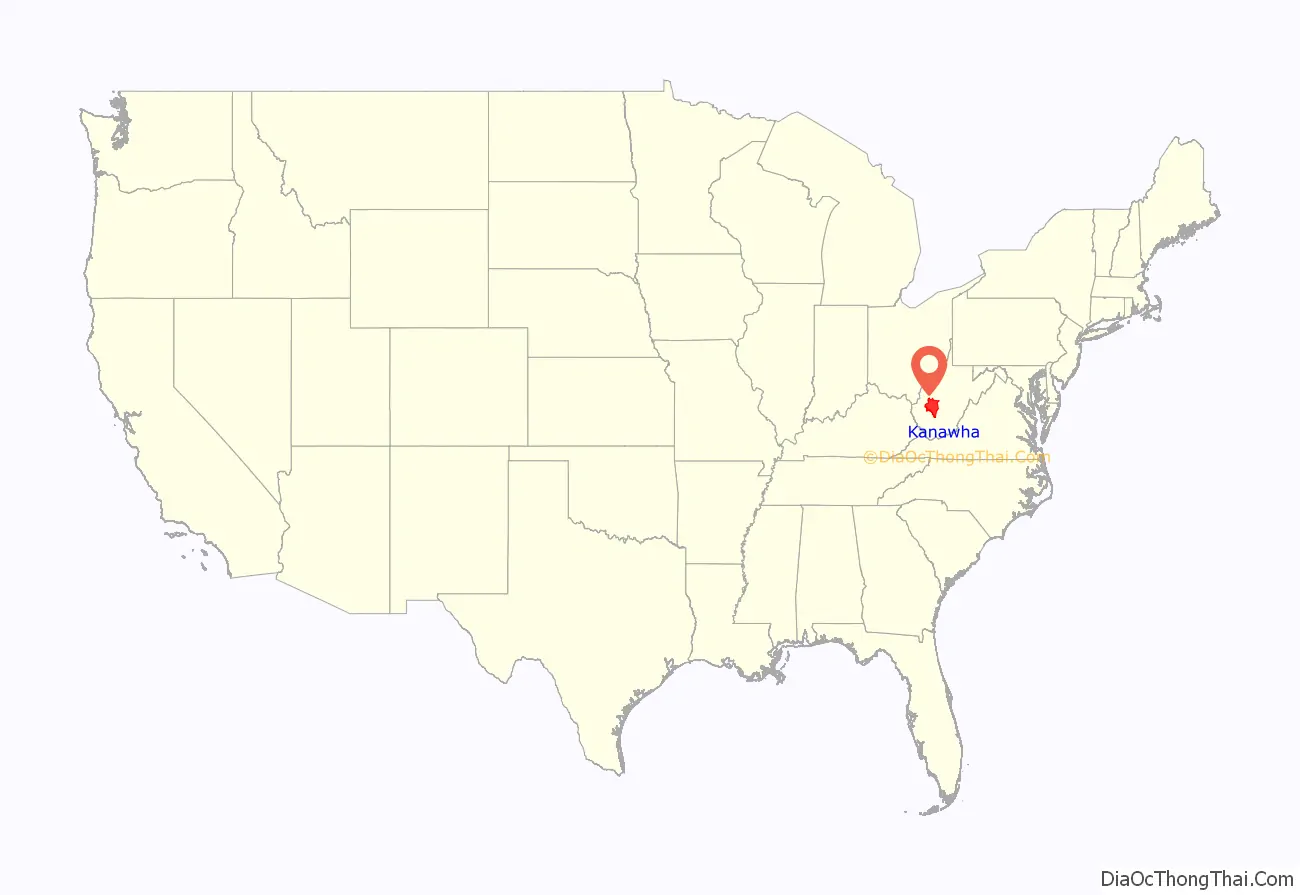
Kanawha County location map. Where is Kanawha County?
History
The county began taking formation on November 14, 1788, under the authorization of the Virginia General Assembly and was founded on October 5, 1789. The county was named for the Kanawha River, which in turn was named after a Native American tribe that lived in the area. During the American Civil War, a number of state infantry and cavalry regiments were organized in the county for both Confederate Army and Union Army service.
In 1863 West Virginia’s counties were divided into civil townships, with the intention of encouraging local government. This proved impractical in the heavily rural state, and in 1872 the townships were converted into magisterial districts. Kanawha County was divided into ten districts: Big Sandy, Cabin Creek, Charleston, Elk, Jefferson, Loudon, Malden, Poca, Union, and Washington. In the 1970s the historic districts were consolidated into five new magisterial districts: District 1, District 2, District 3, District 4, and District 5. A District 6 was created in the 1980s, but in the 1990s the county was redistricted again, reducing the number of magisterial districts to four: District 1, District 2, District 3, and District 4.
Kanawha County was the site of a bloody miners’ strike in 1912, and a school textbook controversy in 1974, that resulted in bombings, and received national attention.
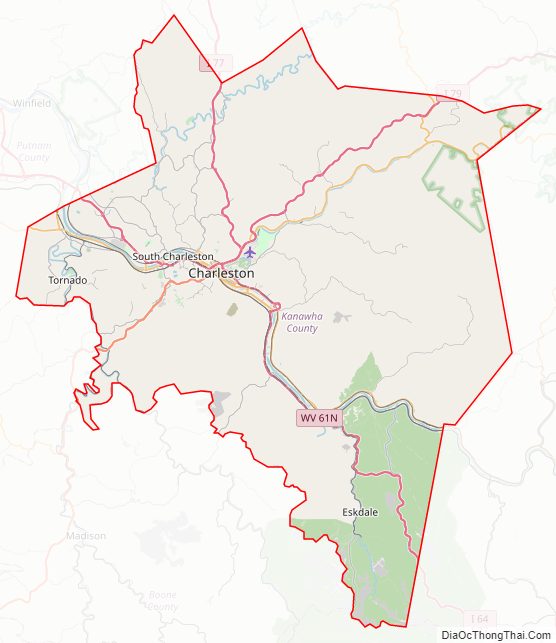
Kanawha County Road Map
Geography
According to the United States Census Bureau, the county has a total area of 911 square miles (2,360 km), of which 902 square miles (2,340 km) is land and 9.3 square miles (24 km) (1.0%) is water. It is the fourth-largest county in West Virginia by area.
Adjacent counties
- Roane County (north)
- Clay County (northeast)
- Nicholas County (east)
- Fayette County (east)
- Raleigh County (southeast)
- Boone County (south)
- Lincoln County (southwest)
- Putnam County (west)
- Jackson County (northwest)
Major highways
- Interstate 64
- Interstate 77
- Interstate 79
- U.S. Route 60
- U.S. Route 119
- West Virginia Route 4
- West Virginia Route 25
- West Virginia Route 34
- West Virginia Route 61
- West Virginia Route 62
- West Virginia Route 94
- West Virginia Route 114
- West Virginia Route 214
- West Virginia Route 501
- West Virginia Route 601
- West Virginia Route 622
- West Virginia Route 817
Kanawha County Topographic Map
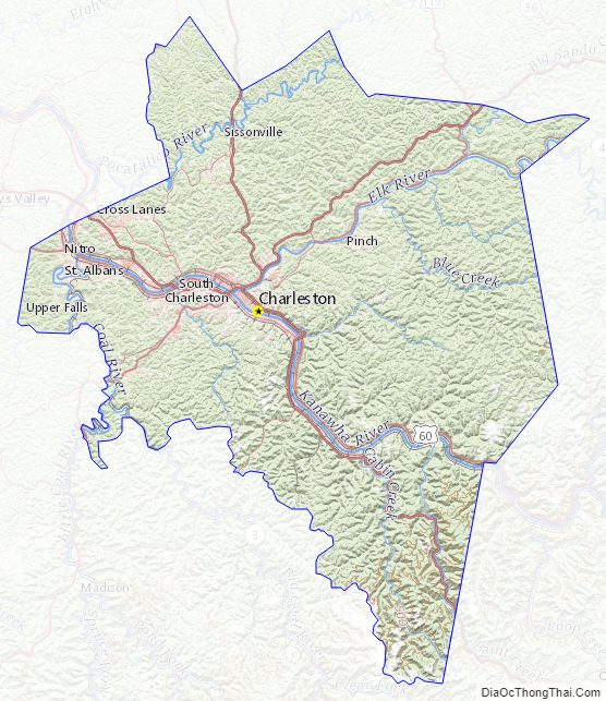
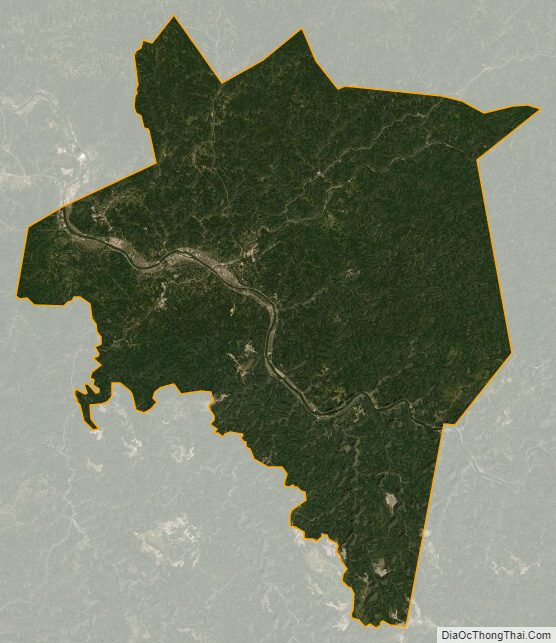
Kanawha County Satellite Map
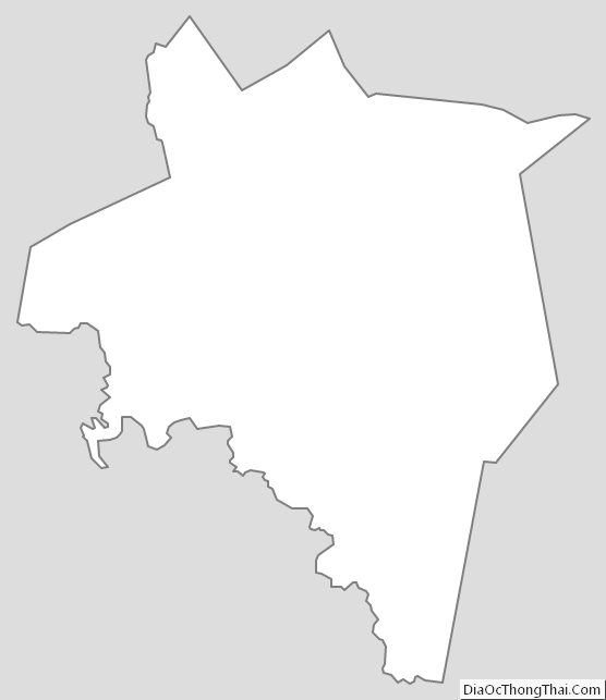
Kanawha County Outline Map
See also
Map of West Virginia State and its subdivision:- Barbour
- Berkeley
- Boone
- Braxton
- Brooke
- Cabell
- Calhoun
- Clay
- Doddridge
- Fayette
- Gilmer
- Grant
- Greenbrier
- Hampshire
- Hancock
- Hardy
- Harrison
- Jackson
- Jefferson
- Kanawha
- Lewis
- Lincoln
- Logan
- Marion
- Marshall
- Mason
- McDowell
- Mercer
- Mineral
- Mingo
- Monongalia
- Monroe
- Morgan
- Nicholas
- Ohio
- Pendleton
- Pleasants
- Pocahontas
- Preston
- Putnam
- Raleigh
- Randolph
- Ritchie
- Roane
- Summers
- Taylor
- Tucker
- Tyler
- Upshur
- Wayne
- Webster
- Wetzel
- Wirt
- Wood
- Wyoming
- Alabama
- Alaska
- Arizona
- Arkansas
- California
- Colorado
- Connecticut
- Delaware
- District of Columbia
- Florida
- Georgia
- Hawaii
- Idaho
- Illinois
- Indiana
- Iowa
- Kansas
- Kentucky
- Louisiana
- Maine
- Maryland
- Massachusetts
- Michigan
- Minnesota
- Mississippi
- Missouri
- Montana
- Nebraska
- Nevada
- New Hampshire
- New Jersey
- New Mexico
- New York
- North Carolina
- North Dakota
- Ohio
- Oklahoma
- Oregon
- Pennsylvania
- Rhode Island
- South Carolina
- South Dakota
- Tennessee
- Texas
- Utah
- Vermont
- Virginia
- Washington
- West Virginia
- Wisconsin
- Wyoming