Kandiyohi County (/ˌkændiˈjoʊhaɪ/ KAN-dee-YOH-hy) is a county in the U.S. state of Minnesota. As of the 2020 census, its population is 43,732. As of November 20, 1871, its county seat is Willmar.
Kandiyohi County comprises the US Census Bureau’s “Willmar, MN Micropolitan Statistical Area”.
| Name: | Kandiyohi County |
|---|---|
| FIPS code: | 27-067 |
| State: | Minnesota |
| Founded: | March 20, 1858 |
| Named for: | “where buffalo fish come” (Dakota) |
| Seat: | Willmar |
| Largest city: | Willmar |
| Total Area: | 862 sq mi (2,230 km²) |
| Land Area: | 797 sq mi (2,060 km²) |
| Total Population: | 43,732 |
| Population Density: | 54.9/sq mi (21.2/km²) |
| Time zone: | UTC−6 (Central) |
| Summer Time Zone (DST): | UTC−5 (CDT) |
| Website: | www.co.kandiyohi.mn.us |
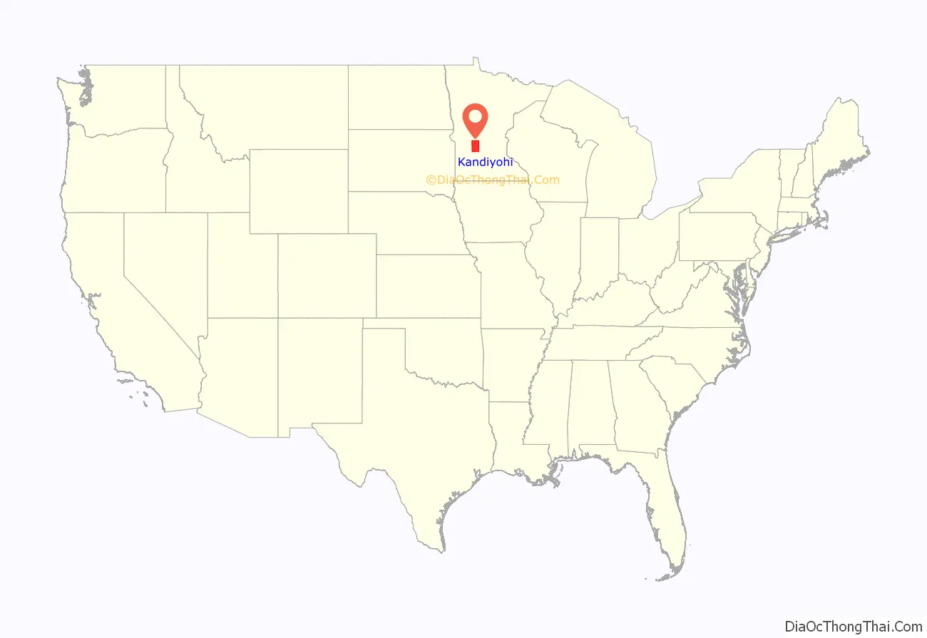
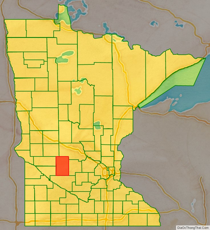
Kandiyohi County location map. Where is Kandiyohi County?
History
Kandiyohi County is named for a Dakota word meaning “where the buffalo fish come”. (kandi’ – the buffalo fish + oh-hi’-yu – v. of hiyu – to come through). It was organized on March 20, 1858, with Kandiyohi established as the county seat in 1870 (it was then called Kandiyohi Station, as it was merely a stop on the railroad line). The original county occupied only the southern half of its current area. Development was slow, and in 1870 the state legislature called for Monongalia County to merge with Kandiyohi. It took until November 21, 1871, to agree on the centrally located Willmar as the county seat.
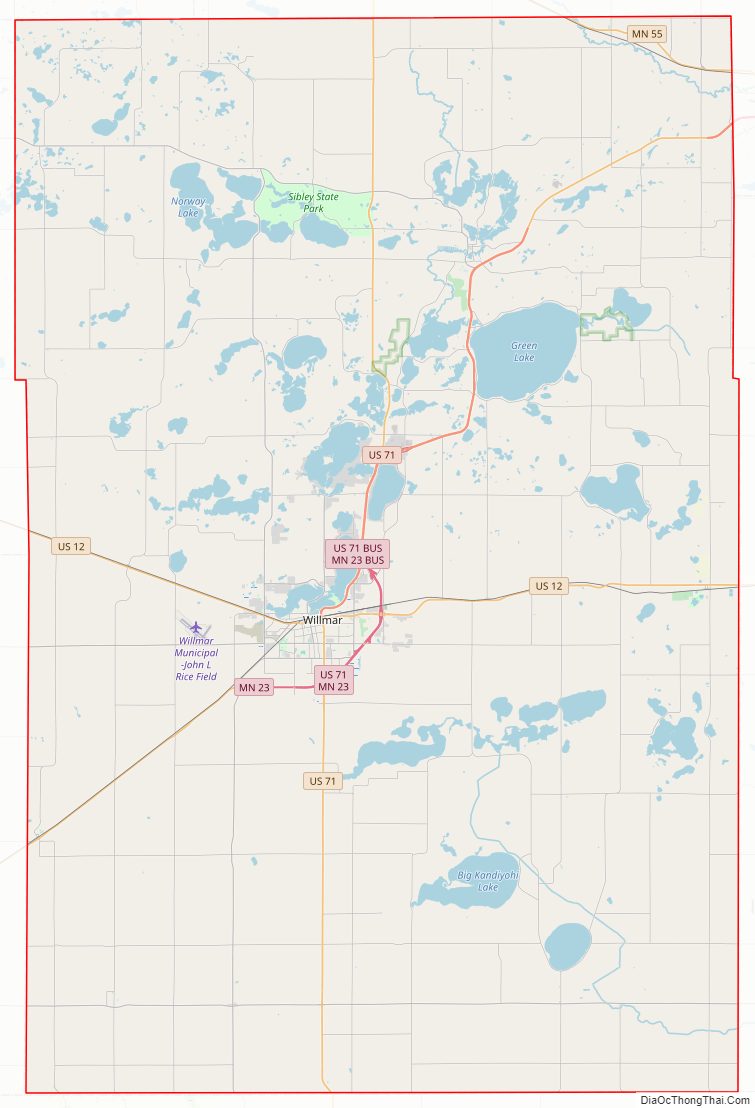
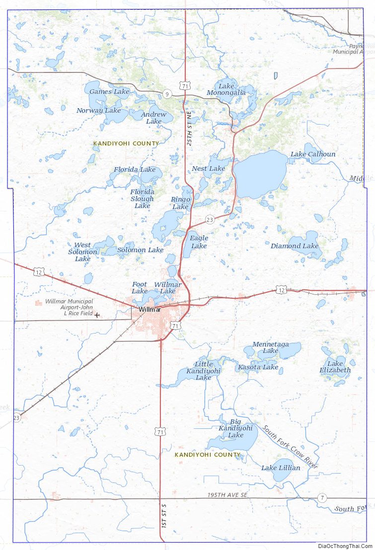
Kandiyohi County Road Map
Geography
The terrain of Kandiyohi County consists of rolling hills, partly wooded, mostly devoted to agriculture. The territory slopes to the south and west, with the highest point near its northeastern corner, at 1,306′ (398m) ASL. The county has a total area of 862 square miles (2,230 km), of which 797 square miles (2,060 km) are land and 66 square miles (170 km) (7.6%) are covered by water. Kandiyohi County is one of seven southern Minnesota counties that have no forest soils; only prairie ecosystems of savannas and prairies exist.
Lakes
- Bass Lake
- Bear Lake
- Big Kandiyohi Lake
- Burr Oak Lake
- Calhoun Lake
- Cherry Lake
- Church Lake
- Crook Lake
- Diamond Lake
- Dog Lake
- Downs Lake
- Eagle Lake
- East Solomon Lake
- East Sunburg Lake
- Elkhorn Lake
- Ella Lake
- Emma Lake
- Florida Lake
- Foot Lake
- Games Lake
- George Lake
- Ging Lake
- Green Lake
- Hefta Lake
- Henchien Lake
- Henderson Lake
- Henium Lake
- Hubbard Lake
- Johnson Lake
- Knutsons Lake
- Lake Andrew
- Lake Carrie
- Lake Eight
- Lake Eleanor
- Lake Elizabeth
- Lake Kasota
- Lake Lillian
- Lake Minnetaga
- Lindgren Lake
- Little Kandiyohi Lake
- Long Lake (Dovre Township)
- Long Lake: (Irving and Roseville townships)
- Mamre Lake
- Mary Lake
- Middle Lake
- Mud Lake
- Nest Lake
- Norstedt Lake
- Norway Lake
- Olson Lake
- Otter Lake
- Point Lake
- Prairie Lake
- Ringo Lake
- Saint Johns Lake
- Schultz Lake
- Shoemaker Lake
- Skataas Lake
- Skull Lake
- Sperry Lake
- Stevens Lake
- Summit Lake
- Swan Lake (Colfax and Lake Andrew townships)
- Swan Lake: (Dovre and Willmar townships)
- Swan Lake: (Kandiyohi Township)
- Swan Lake: (Mamre Township)
- Swenson Lake
- Taits Lake
- Thompson Lake
- Timber Lake
- Twin Lakes
- Wagonga Lake
- West Solomon Lake
- West Sunburg Lake (part)
- Wheeler Lake
- Willmar Lake
- Woodcock Lake (Green Lake Township)
- Woodcock Lake: (New London and Green Lake townships)
Major highways
- U.S. Highway 12
- U.S. Highway 71
- US 71 Bus.
- Minnesota State Highway 4
- Minnesota State Highway 7
- Minnesota State Highway 9
- Minnesota State Highway 23
- MN 23 Bus.
- Minnesota State Highway 40
- Minnesota State Highway 55
- Minnesota State Highway 104
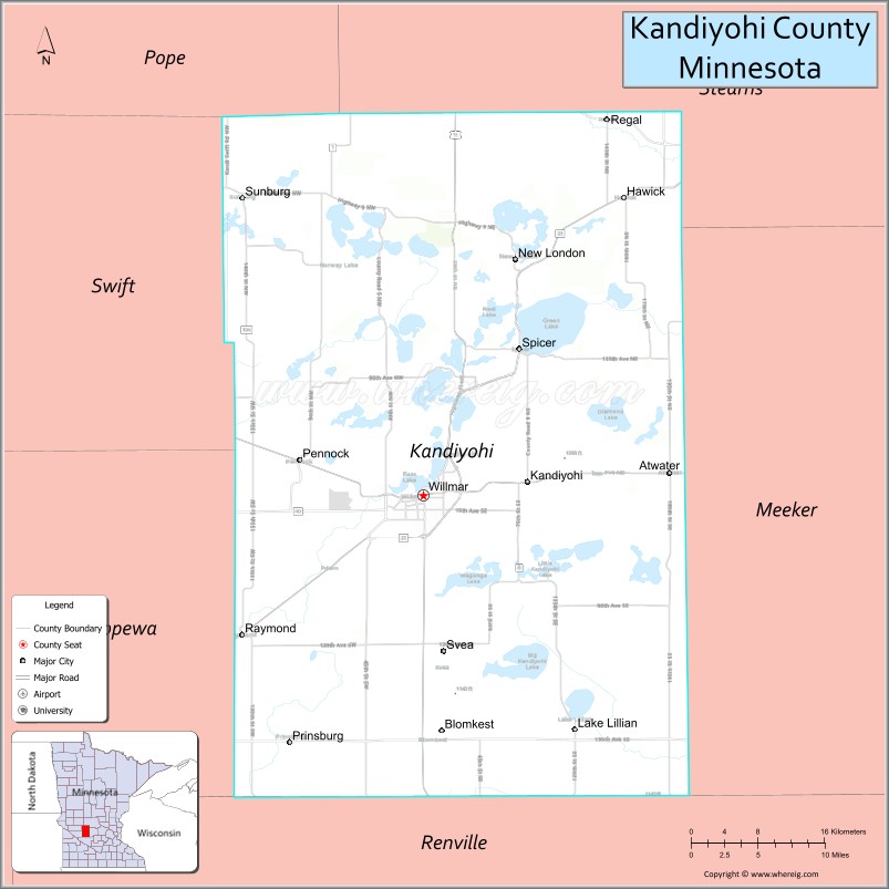
Adjacent counties
- Stearns County (north)
- Meeker County (east)
- Renville County (south)
- Chippewa County (southwest)
- Swift County (west)
- Pope County (northwest)
Protected areas
- Burbank State Wildlife Management Area
- Dietrich Lange State Wildlife Management Area
- Oleander State Wildlife Management Area
- Ringo-Nest State Wildlife Management Area
- Roseville State Wildlife Management Area
- Sibley State Park
- Sunburg State Wildlife Management Area
- Yohi State Wildlife Management Area
Kandiyohi County Topographic Map
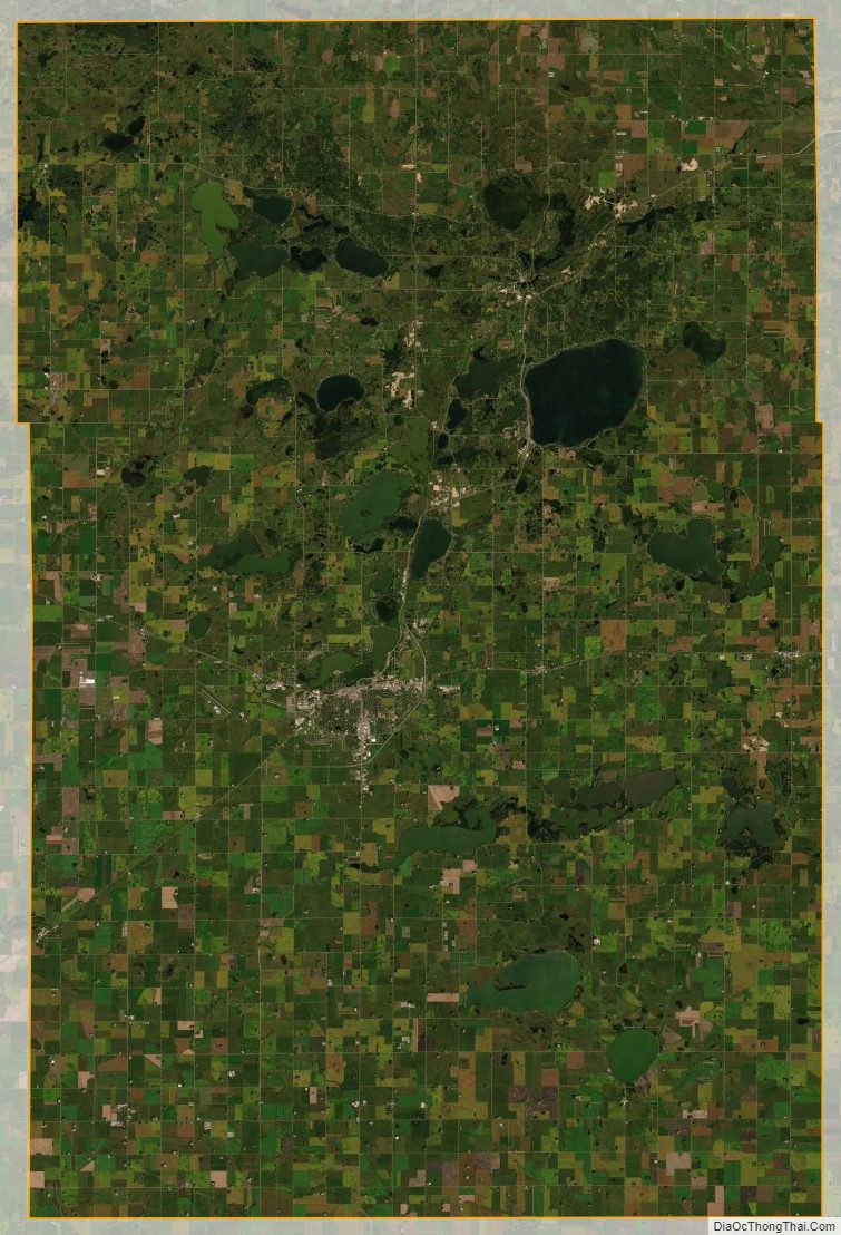
Kandiyohi County Satellite Map
Kandiyohi County Outline Map

See also
Map of Minnesota State and its subdivision:- Aitkin
- Anoka
- Becker
- Beltrami
- Benton
- Big Stone
- Blue Earth
- Brown
- Carlton
- Carver
- Cass
- Chippewa
- Chisago
- Clay
- Clearwater
- Cook
- Cottonwood
- Crow Wing
- Dakota
- Dodge
- Douglas
- Faribault
- Fillmore
- Freeborn
- Goodhue
- Grant
- Hennepin
- Houston
- Hubbard
- Isanti
- Itasca
- Jackson
- Kanabec
- Kandiyohi
- Kittson
- Koochiching
- Lac qui Parle
- Lake
- Lake of the Woods
- Lake Superior
- Le Sueur
- Lincoln
- Lyon
- Mahnomen
- Marshall
- Martin
- McLeod
- Meeker
- Mille Lacs
- Morrison
- Mower
- Murray
- Nicollet
- Nobles
- Norman
- Olmsted
- Otter Tail
- Pennington
- Pine
- Pipestone
- Polk
- Pope
- Ramsey
- Red Lake
- Redwood
- Renville
- Rice
- Rock
- Roseau
- Saint Louis
- Scott
- Sherburne
- Sibley
- Stearns
- Steele
- Stevens
- Swift
- Todd
- Traverse
- Wabasha
- Wadena
- Waseca
- Washington
- Watonwan
- Wilkin
- Winona
- Wright
- Yellow Medicine
- Alabama
- Alaska
- Arizona
- Arkansas
- California
- Colorado
- Connecticut
- Delaware
- District of Columbia
- Florida
- Georgia
- Hawaii
- Idaho
- Illinois
- Indiana
- Iowa
- Kansas
- Kentucky
- Louisiana
- Maine
- Maryland
- Massachusetts
- Michigan
- Minnesota
- Mississippi
- Missouri
- Montana
- Nebraska
- Nevada
- New Hampshire
- New Jersey
- New Mexico
- New York
- North Carolina
- North Dakota
- Ohio
- Oklahoma
- Oregon
- Pennsylvania
- Rhode Island
- South Carolina
- South Dakota
- Tennessee
- Texas
- Utah
- Vermont
- Virginia
- Washington
- West Virginia
- Wisconsin
- Wyoming