Keith County is a county in the U.S. state of Nebraska. As of the 2010 United States Census, the population was 8,368. Its county seat is Ogallala.
In the Nebraska license plate system, Keith County is represented by the prefix 68 (it had the sixty-eighth-largest number of vehicles registered in the county when the license plate system was established in 1922).
| Name: | Keith County |
|---|---|
| FIPS code: | 31-101 |
| State: | Nebraska |
| Founded: | 1873 |
| Named for: | M.C. Keith or John Keith |
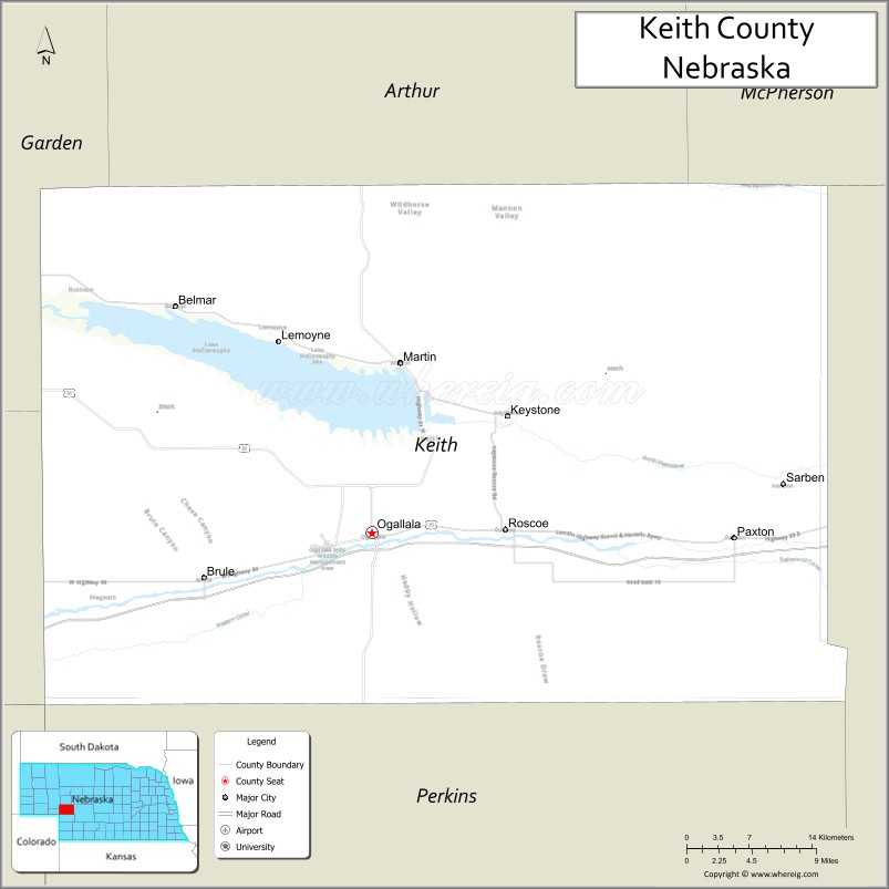
| Seat: | Ogallala |
| Largest city: | Ogallala |
| Total Area: | 1,110 sq mi (2,900 km²) |
| Land Area: | 1,062 sq mi (2,750 km²) |
| Total Population: | 8,279 |
| Population Density: | 7.6/sq mi (2.9/km²) |
| Time zone: | UTC−7 (Mountain) |
| Summer Time Zone (DST): | UTC−6 (MDT) |
| Website: | www.keithcountyne.gov |
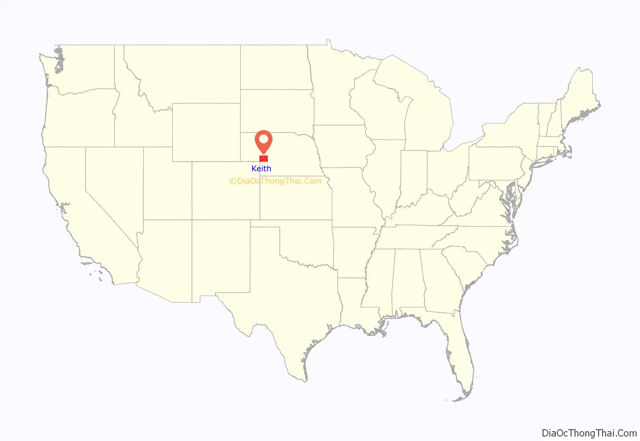
Keith County location map. Where is Keith County?
History
Keith County was formed in 1873. Sources differ on the Keith after whom it was named: either M. C. Keith of North Platte, whose grandson Keith Neville became Nebraska’s 18th governor in 1917; or John Keith, also of North Platte.
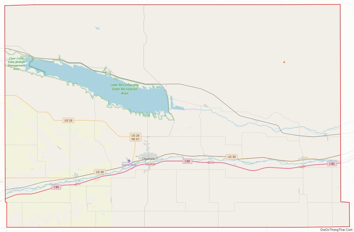
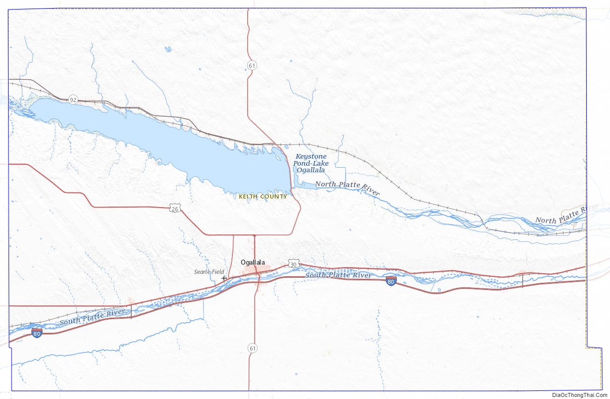
Keith County Road Map
Geography
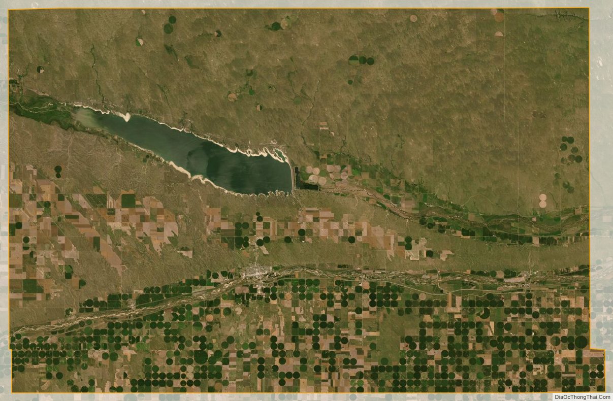
The terrain of Keith County consists of low rolling hills. The level areas are used for agriculture, mainly in the lower part of the county. The North Platte River flows eastward into the northwest end of the county, feeding Lake McConaughy, then exiting the county’s east line near its midpoint. The South Platte River flows eastward into the southwest end of the county, and crosses the lower central part of the county before exiting to the east, headed for its junction with the North Platte River well to the east of Keith County.
The county has an area of 1,110 square miles (2,900 km), of which 1,062 square miles (2,750 km) is land and 48 square miles (120 km) (4.3%) is water.
Most of Nebraska’s 93 counties (the eastern 2/3) observe Central Time; the western counties observe Mountain Time. Keith County is the easternmost of the Nebraska counties to observe Mountain Time.
Major highways
- Interstate 80
- U.S. Highway 26
- U.S. Highway 30
- Nebraska Highway 61
- Nebraska Highway 92
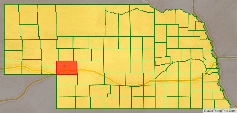
Adjacent counties
- Arthur County – north
- McPherson County – northeast (boundary of Central Time)
- Lincoln County – east (boundary of Central Time)
- Perkins County – south
- Deuel County – west
- Garden County – northwest
Protected areas
- Clear Creek State Waterfowl Management Area (partial)
- Lake McConaughy State Recreation Area
Keith County Topographic Map
Keith County Satellite Map
Keith County Outline Map

See also
Map of Nebraska State and its subdivision:- Adams
- Antelope
- Arthur
- Banner
- Blaine
- Boone
- Box Butte
- Boyd
- Brown
- Buffalo
- Burt
- Butler
- Cass
- Cedar
- Chase
- Cherry
- Cheyenne
- Clay
- Colfax
- Cuming
- Custer
- Dakota
- Dawes
- Dawson
- Deuel
- Dixon
- Dodge
- Douglas
- Dundy
- Fillmore
- Franklin
- Frontier
- Furnas
- Gage
- Garden
- Garfield
- Gosper
- Grant
- Greeley
- Hall
- Hamilton
- Harlan
- Hayes
- Hitchcock
- Holt
- Hooker
- Howard
- Jefferson
- Johnson
- Kearney
- Keith
- Keya Paha
- Kimball
- Knox
- Lancaster
- Lincoln
- Logan
- Loup
- Madison
- McPherson
- Merrick
- Morrill
- Nance
- Nemaha
- Nuckolls
- Otoe
- Pawnee
- Perkins
- Phelps
- Pierce
- Platte
- Polk
- Red Willow
- Richardson
- Rock
- Saline
- Sarpy
- Saunders
- Scotts Bluff
- Seward
- Sheridan
- Sherman
- Sioux
- Stanton
- Thayer
- Thomas
- Thurston
- Valley
- Washington
- Wayne
- Webster
- Wheeler
- York
- Alabama
- Alaska
- Arizona
- Arkansas
- California
- Colorado
- Connecticut
- Delaware
- District of Columbia
- Florida
- Georgia
- Hawaii
- Idaho
- Illinois
- Indiana
- Iowa
- Kansas
- Kentucky
- Louisiana
- Maine
- Maryland
- Massachusetts
- Michigan
- Minnesota
- Mississippi
- Missouri
- Montana
- Nebraska
- Nevada
- New Hampshire
- New Jersey
- New Mexico
- New York
- North Carolina
- North Dakota
- Ohio
- Oklahoma
- Oregon
- Pennsylvania
- Rhode Island
- South Carolina
- South Dakota
- Tennessee
- Texas
- Utah
- Vermont
- Virginia
- Washington
- West Virginia
- Wisconsin
- Wyoming