Kent County is a county located in the U.S. state of Rhode Island. As of the 2020 census, the population was 170,363, making it the second-most populous county in Rhode Island. The county was formed in 1750 from the southern third of Providence County. It was named after the county of Kent, England. Kent County, like other counties in Rhode Island, no longer has governmental functions (other than as court administrative and sheriff corrections boundaries). Kent County is included in the Providence–Warwick, RI-MA Metropolitan Statistical Area, which in turn constitutes a portion of the greater Boston-Worcester-Providence, MA-RI-NH–CT Combined Statistical Area.
| Name: | Kent County |
|---|---|
| FIPS code: | 44-003 |
| State: | Rhode Island |
| Founded: | June 11, 1750 |
| Named for: | Kent, England |
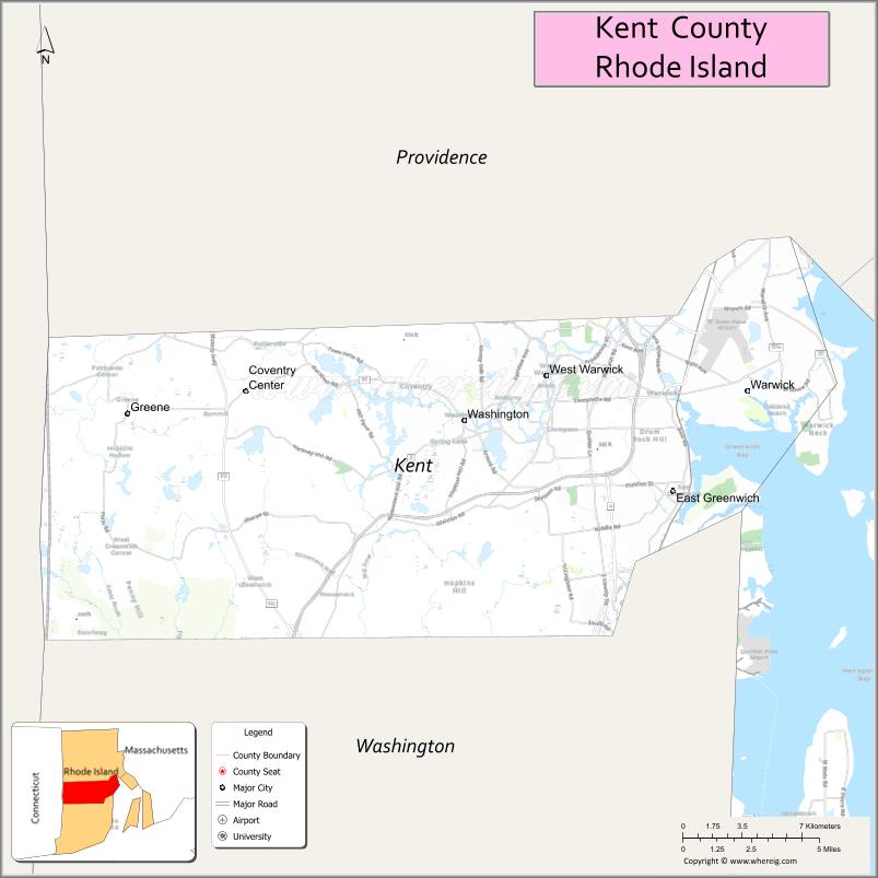
| Seat: | East Greenwich |
| Largest city: | Warwick |
| Total Area: | 188 sq mi (490 km²) |
| Land Area: | 169 sq mi (440 km²) |
| Total Population: | 170,363 |
| Population Density: | 910/sq mi (350/km²) |
| Time zone: | UTC−5 (Eastern) |
| Summer Time Zone (DST): | UTC−4 (EDT) |
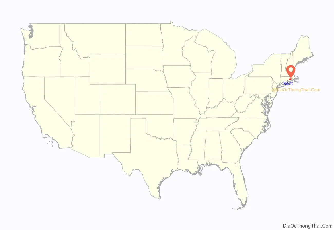
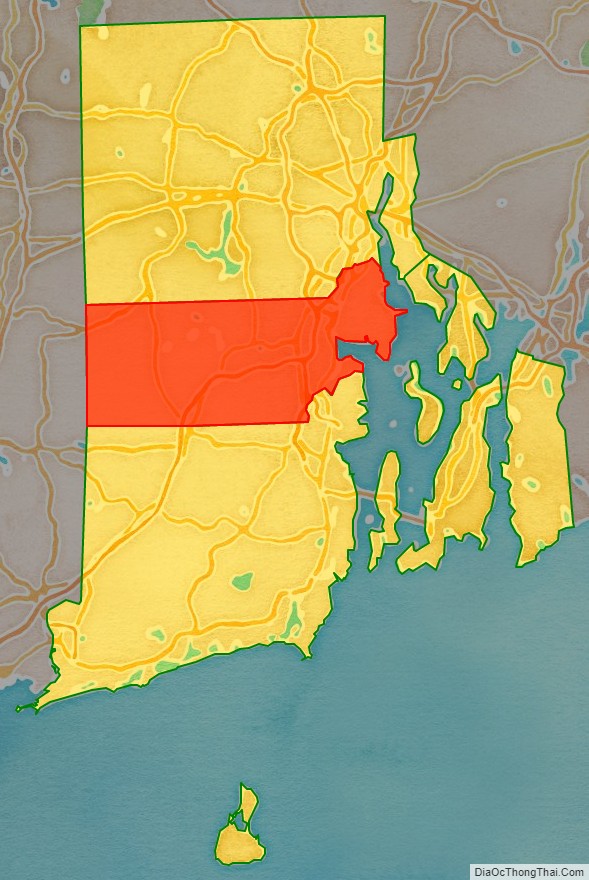
Kent County location map. Where is Kent County?
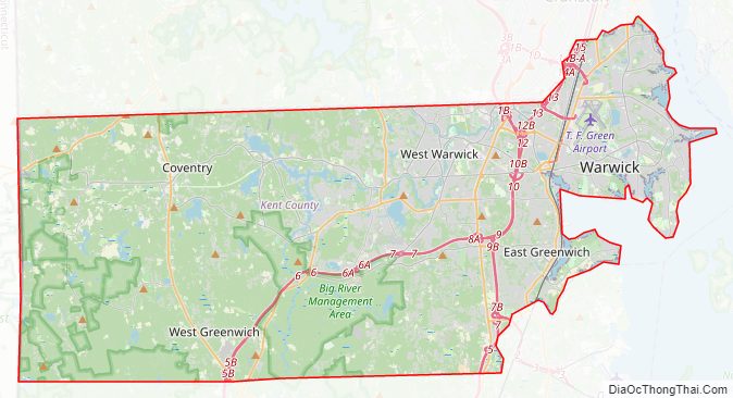
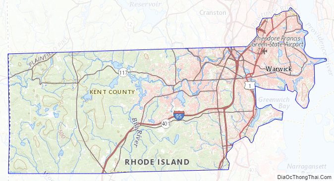
Kent County Road Map
Geography
According to the U.S. Census Bureau, the county has a total area of 188 square miles (490 km), of which 169 square miles (440 km) is land and 20 square miles (52 km) (10%) is water.
Adjacent counties
- Providence County – north
- Bristol County – east
- Washington County – south
- New London County, Connecticut – southwest
- Windham County, Connecticut – west
- Newport County – southeast
Major highways
- I-95
- I-295
- US 1
- US 1A
- Route 2
- Route 3
- Route 4
- Route 5
- Route 14
- Route 33
- Route 37
- Route 51
- Route 102
- Route 113
- Route 115
- Route 116
- Route 117
- Route 117A
- Route 118
- Route 401
- Route 402
- Route 403
Kent County Topographic Map
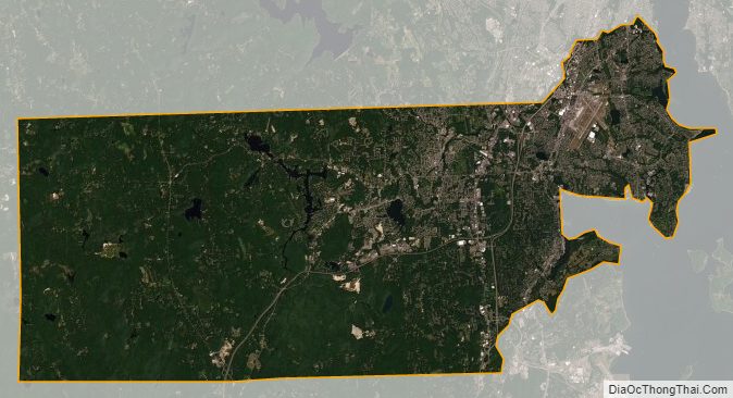
Kent County Satellite Map
Kent County Outline Map

See also
Map of Rhode Island State and its subdivision: Map of other states:- Alabama
- Alaska
- Arizona
- Arkansas
- California
- Colorado
- Connecticut
- Delaware
- District of Columbia
- Florida
- Georgia
- Hawaii
- Idaho
- Illinois
- Indiana
- Iowa
- Kansas
- Kentucky
- Louisiana
- Maine
- Maryland
- Massachusetts
- Michigan
- Minnesota
- Mississippi
- Missouri
- Montana
- Nebraska
- Nevada
- New Hampshire
- New Jersey
- New Mexico
- New York
- North Carolina
- North Dakota
- Ohio
- Oklahoma
- Oregon
- Pennsylvania
- Rhode Island
- South Carolina
- South Dakota
- Tennessee
- Texas
- Utah
- Vermont
- Virginia
- Washington
- West Virginia
- Wisconsin
- Wyoming