Kent County is a county located in the U.S. state of Texas. As of the 2020 census, its population was 753, making it the sixth-least populous county in Texas. Its county seat is Jayton. The county was created in 1876 and later organized in 1892. It is named for Andrew Kent, who died at the Battle of the Alamo. Kent County is a prohibition or entirely dry county, one of five remaining in the state.
| Name: | Kent County |
|---|---|
| FIPS code: | 48-263 |
| State: | Texas |
| Founded: | 1892 |
| Named for: | Andrew Kent |
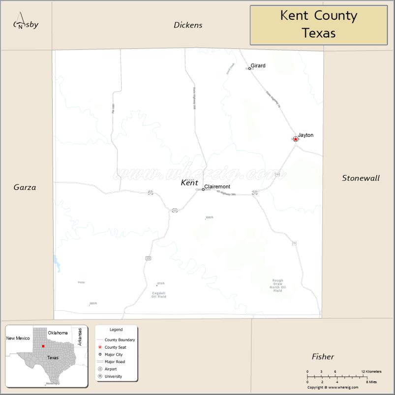
| Seat: | Jayton |
| Largest city: | Jayton |
| Total Area: | 903 sq mi (2,340 km²) |
| Land Area: | 903 sq mi (2,340 km²) |
| Total Population: | 753 |
| Population Density: | 0.83/sq mi (0.32/km²) |
| Time zone: | UTC−6 (Central) |
| Summer Time Zone (DST): | UTC−5 (CDT) |
| Website: | www.co.kent.tx.us |
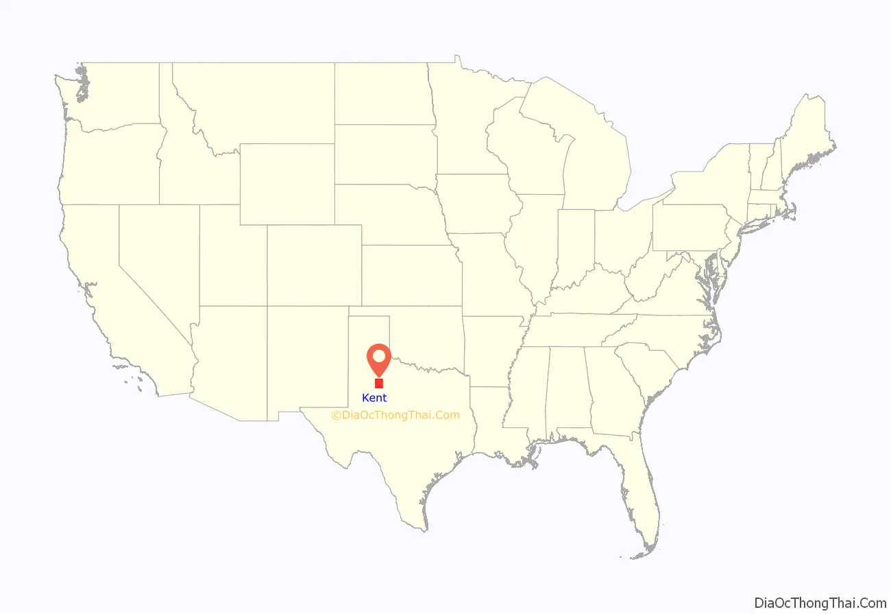
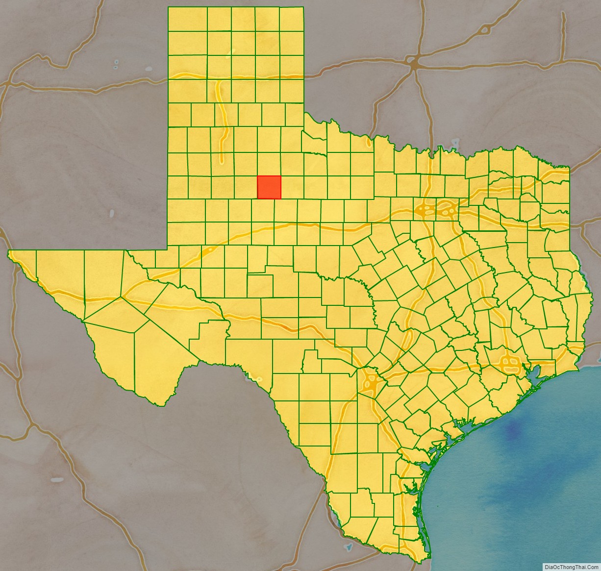
Kent County location map. Where is Kent County?
History
- 8000 BC Paleo-Indians were the first inhabitants. Later Native American inhabitants included the Wanderers band of Comanche.
- 1872 Ranald S. Mackenzie and his soldiers trounced the Comanches at Treasure Butte, southeast of Clairemont.
- 1876 The Texas legislature formed Kent County from Young and Bexar districts. The new county is named after Alamo defender Andrew Kent.
- 1888 Cattleman R. L. Rhomberg settled in the new county and named a settlement Clairemont for his daughter, Claire.
- 1890 The county census recorded 324 residents.
- 1891 A conflict arose between cattle ranchers and farmers who tried to fence their farms against cattle.
- 1892 Kent County was organized, with Clairemont as the county seat.
- 1900 The county population was 899.
- 1909 The Stamford and Northeastern Railway built a line across the county’s northeast corner. The railroad, which connected Stamford and Spur, later became part of the Wichita Valley Railroad. The Jayton community was founded.
- 1930 The county’s population peaked at 3,851.
- 1946-1991 Oil was discovered in Kent County in 1946. By 1991, more than 448,448,000 barrels (71,297,500 m) of oil have been produced in the county since 1946.
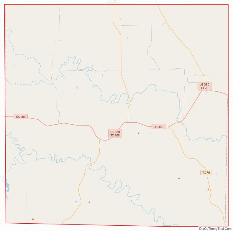
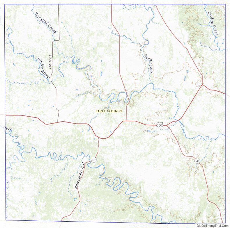
Kent County Road Map
Geography
According to the U.S. Census Bureau, the county has a total area of 903 square miles (2,340 km), of which 903 square miles (2,340 km) are land and 0.4 square miles (1.0 km) (0.05%) is covered by water.
Major highways
- U.S. Highway 380
- State Highway 70
- State Highway 208
Adjacent counties
- Dickens County (north)
- Stonewall County (east)
- Fisher County (southeast)
- Scurry County (south)
- Garza County (west)
- King County (northeast)
- Crosby County (northwest)
Kent County Topographic Map
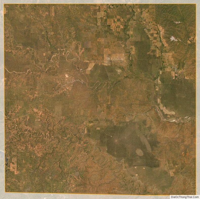
Kent County Satellite Map
Kent County Outline Map

See also
Map of Texas State and its subdivision:- Anderson
- Andrews
- Angelina
- Aransas
- Archer
- Armstrong
- Atascosa
- Austin
- Bailey
- Bandera
- Bastrop
- Baylor
- Bee
- Bell
- Bexar
- Blanco
- Borden
- Bosque
- Bowie
- Brazoria
- Brazos
- Brewster
- Briscoe
- Brooks
- Brown
- Burleson
- Burnet
- Caldwell
- Calhoun
- Callahan
- Cameron
- Camp
- Carson
- Cass
- Castro
- Chambers
- Cherokee
- Childress
- Clay
- Cochran
- Coke
- Coleman
- Collin
- Collingsworth
- Colorado
- Comal
- Comanche
- Concho
- Cooke
- Coryell
- Cottle
- Crane
- Crockett
- Crosby
- Culberson
- Dallam
- Dallas
- Dawson
- Deaf Smith
- Delta
- Denton
- Dewitt
- Dickens
- Dimmit
- Donley
- Duval
- Eastland
- Ector
- Edwards
- El Paso
- Ellis
- Erath
- Falls
- Fannin
- Fayette
- Fisher
- Floyd
- Foard
- Fort Bend
- Franklin
- Freestone
- Frio
- Gaines
- Galveston
- Garza
- Gillespie
- Glasscock
- Goliad
- Gonzales
- Gray
- Grayson
- Gregg
- Grimes
- Guadalupe
- Hale
- Hall
- Hamilton
- Hansford
- Hardeman
- Hardin
- Harris
- Harrison
- Hartley
- Haskell
- Hays
- Hemphill
- Henderson
- Hidalgo
- Hill
- Hockley
- Hood
- Hopkins
- Houston
- Howard
- Hudspeth
- Hunt
- Hutchinson
- Irion
- Jack
- Jackson
- Jasper
- Jeff Davis
- Jefferson
- Jim Hogg
- Jim Wells
- Johnson
- Jones
- Karnes
- Kaufman
- Kendall
- Kenedy
- Kent
- Kerr
- Kimble
- King
- Kinney
- Kleberg
- Knox
- La Salle
- Lamar
- Lamb
- Lampasas
- Lavaca
- Lee
- Leon
- Liberty
- Limestone
- Lipscomb
- Live Oak
- Llano
- Loving
- Lubbock
- Lynn
- Madison
- Marion
- Martin
- Mason
- Matagorda
- Maverick
- McCulloch
- McLennan
- McMullen
- Medina
- Menard
- Midland
- Milam
- Mills
- Mitchell
- Montague
- Montgomery
- Moore
- Morris
- Motley
- Nacogdoches
- Navarro
- Newton
- Nolan
- Nueces
- Ochiltree
- Oldham
- Orange
- Palo Pinto
- Panola
- Parker
- Parmer
- Pecos
- Polk
- Potter
- Presidio
- Rains
- Randall
- Reagan
- Real
- Red River
- Reeves
- Refugio
- Roberts
- Robertson
- Rockwall
- Runnels
- Rusk
- Sabine
- San Augustine
- San Jacinto
- San Patricio
- San Saba
- Schleicher
- Scurry
- Shackelford
- Shelby
- Sherman
- Smith
- Somervell
- Starr
- Stephens
- Sterling
- Stonewall
- Sutton
- Swisher
- Tarrant
- Taylor
- Terrell
- Terry
- Throckmorton
- Titus
- Tom Green
- Travis
- Trinity
- Tyler
- Upshur
- Upton
- Uvalde
- Val Verde
- Van Zandt
- Victoria
- Walker
- Waller
- Ward
- Washington
- Webb
- Wharton
- Wheeler
- Wichita
- Wilbarger
- Willacy
- Williamson
- Wilson
- Winkler
- Wise
- Wood
- Yoakum
- Young
- Zapata
- Zavala
- Alabama
- Alaska
- Arizona
- Arkansas
- California
- Colorado
- Connecticut
- Delaware
- District of Columbia
- Florida
- Georgia
- Hawaii
- Idaho
- Illinois
- Indiana
- Iowa
- Kansas
- Kentucky
- Louisiana
- Maine
- Maryland
- Massachusetts
- Michigan
- Minnesota
- Mississippi
- Missouri
- Montana
- Nebraska
- Nevada
- New Hampshire
- New Jersey
- New Mexico
- New York
- North Carolina
- North Dakota
- Ohio
- Oklahoma
- Oregon
- Pennsylvania
- Rhode Island
- South Carolina
- South Dakota
- Tennessee
- Texas
- Utah
- Vermont
- Virginia
- Washington
- West Virginia
- Wisconsin
- Wyoming