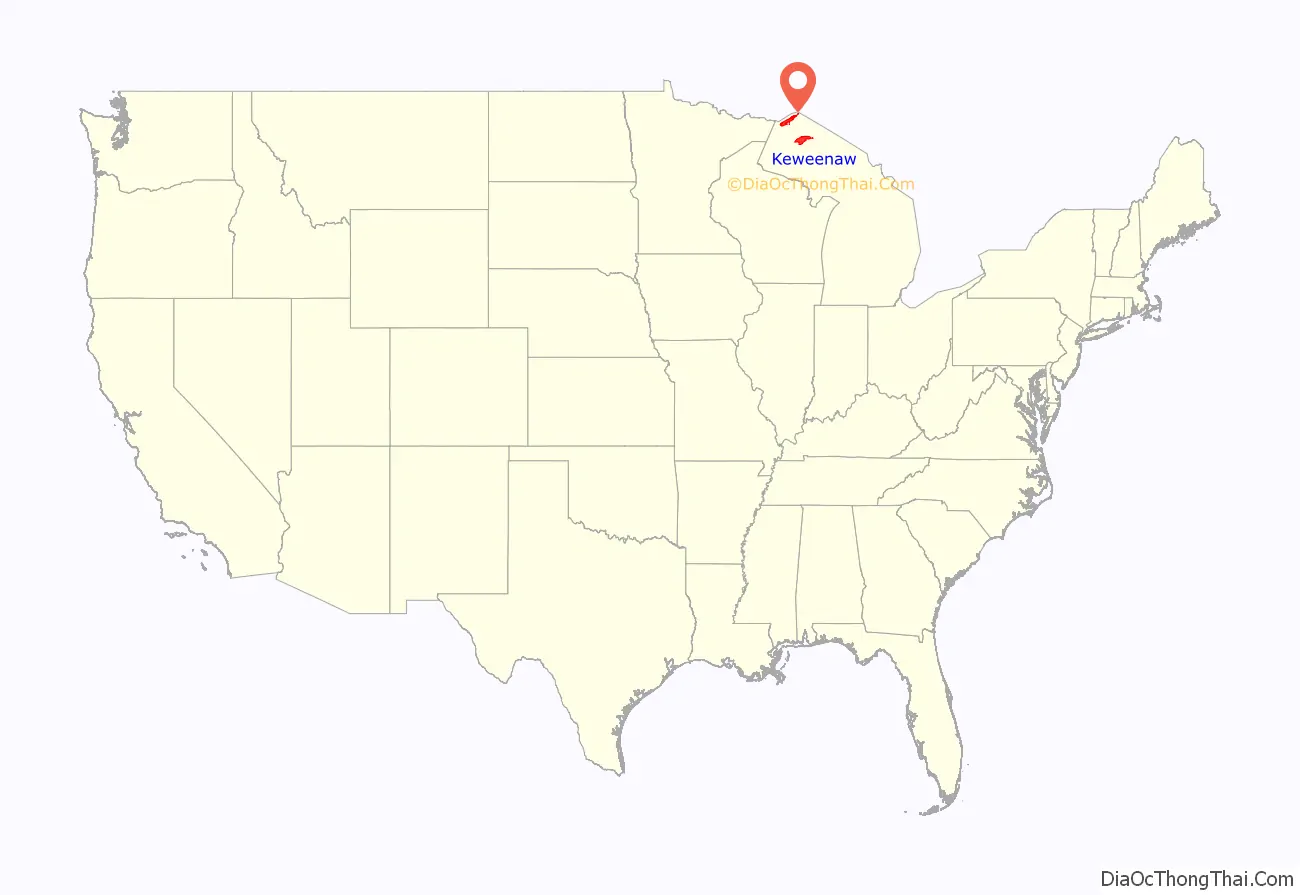
Keweenaw County (/ˈkiːwənɔː/, KEE-wə-naw; locally /ˈkjəwənɔː/, kyə-wə-naw) is a county in the western Upper Peninsula of the U.S. state of Michigan. As of the 2020 census, the county’s population was 2,046, making it Michigan’s least populous county. It is also the state’s largest county by total area, including the waters of Lake Superior, as well as the state’s northernmost county. The county seat is Eagle River.
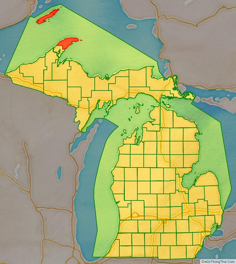
Located at the northeastern end of the Keweenaw Peninsula, Keweenaw County is part of the Houghton, Michigan micropolitan area. Keweenaw County also contains two National Park Service units: Isle Royale National Park and Keweenaw National Historical Park.
| Name: | Keweenaw County |
|---|---|
| FIPS code: | 26-083 |
| State: | Michigan |
| Founded: | March 11, 1861 |
| Named for: | Keweenaw Bay |
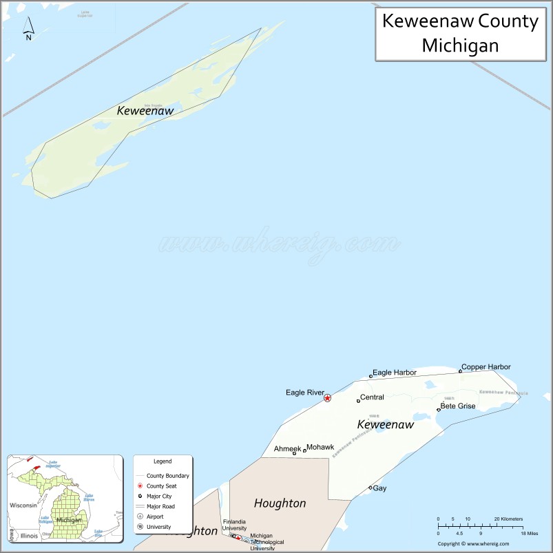
| Seat: | Eagle River |
| Total Area: | 5,966 sq mi (15,450 km²) |
| Land Area: | 540 sq mi (1,400 km²) |
| Total Population: | 2,046 |
| Population Density: | 4.0/sq mi (1.5/km²) |
| Time zone: | UTC−5 (Eastern) |
| Summer Time Zone (DST): | UTC−4 (EDT) |
| Website: | www.keweenawcountyonline.org |
Keweenaw County location map. Where is Keweenaw County?
History
The county was set off and organized in 1861. It is believed “Keweenaw” is a corruption of an Ojibwe word that means “portage” or “place where portage is made”; compare the names of the nearby Portage Lake and Portage River which together make up the Keweenaw Waterway.
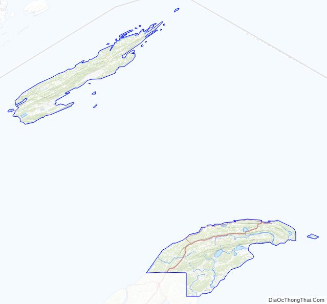
Keweenaw County Road Map
Geography
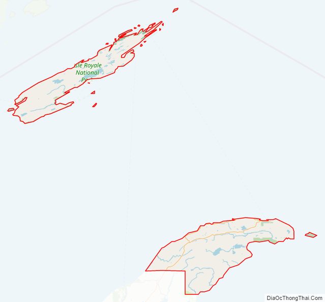
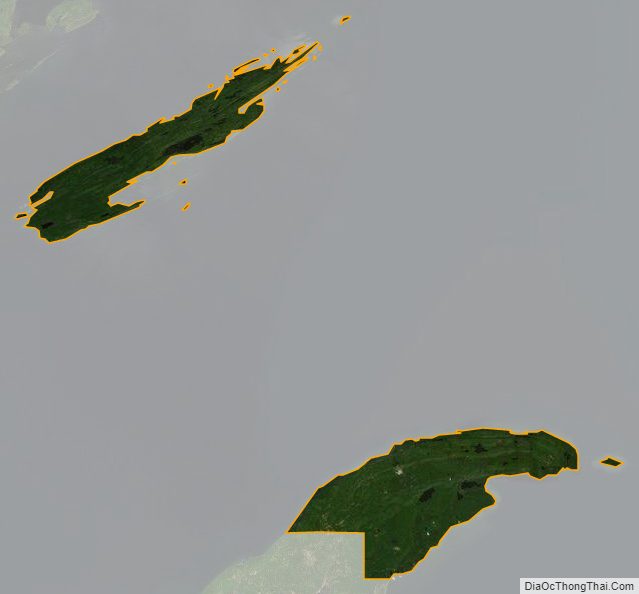
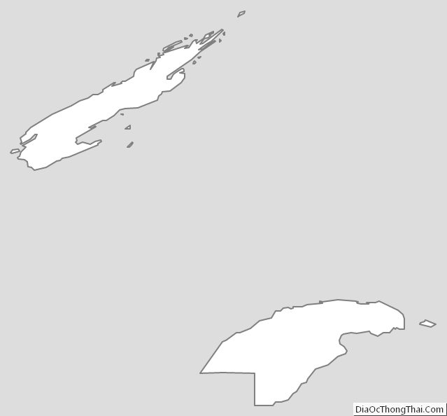
Two land masses comprise most of the land portion of the county: Isle Royale and the northeastern half of the Keweenaw Peninsula. The county also includes the waters of Lake Superior between the two, extending to the state’s water borders with Ontario and Minnesota. It is thus the largest county in Michigan by total area, at 5,966 square miles (15,450 km), of which just 540 square miles (1,400 km) is land and 5,426 square miles (14,050 km) (91%) is water. Of all counties (or equivalents) in the United States, Keweenaw County has the highest proportion of water area to total area.
The largest lake entirely within the county is Gratiot Lake at 1,438 acres (5.82 km), located at the base of the county’s two highest peaks: Mt. Horace Greeley at 1,550 feet (470 m) and Mt. Gratiot at 1,490 feet (450 m). Other lakes include Lac La Belle near Bete Grise Bay, Lake Medora, Lake Fanny Hooe near Copper Harbor, Lake Bailey at the base of Mt. Baldy, and Schlatter Lake at the tip of the peninsula.
By land, one can only access mainland Keweenaw County via Houghton County.
National protected area
- Isle Royale National Park
- Keweenaw National Historical Park (part)
Major highways
- US 41 runs northeast–southwest through the upper center part of the mainland portion of the county. It enters the southern area of the county at Bumbletown passes Phoenix, Delaware, Mandan, Copper Harbor and terminates north of Lake Fanny Hooe.
- M-26 loops from Phoenix to the shoreline of Lake Superior, then runs northeasterly along the shoreline to the intersection with US 41 at Copper Harbor.
Adjacent counties and district
Keweenaw County is the only county in Michigan to connect to the U.S. state of Minnesota via ferry service from Grand Portage to Windigo and Rock Harbor on Isle Royale.
By land
- Houghton County, south
By water
- Thunder Bay District, Ontario, Canada, north
- Alger County, east
- Marquette County, southeast
- Ontonagon County, southwest
- Cook County, Minnesota, northwest
Keweenaw County Topographic Map
Keweenaw County Satellite Map
Keweenaw County Outline Map
See also
Map of Michigan State and its subdivision:- Alcona
- Alger
- Allegan
- Alpena
- Antrim
- Arenac
- Baraga
- Barry
- Bay
- Benzie
- Berrien
- Branch
- Calhoun
- Cass
- Charlevoix
- Cheboygan
- Chippewa
- Clare
- Clinton
- Crawford
- Delta
- Dickinson
- Eaton
- Emmet
- Genesee
- Gladwin
- Gogebic
- Grand Traverse
- Gratiot
- Hillsdale
- Houghton
- Huron
- Ingham
- Ionia
- Iosco
- Iron
- Isabella
- Jackson
- Kalamazoo
- Kalkaska
- Kent
- Keweenaw
- Lake
- Lake Hurron
- Lake Michigan
- Lake St. Clair
- Lake Superior
- Lapeer
- Leelanau
- Lenawee
- Livingston
- Luce
- Mackinac
- Macomb
- Manistee
- Marquette
- Mason
- Mecosta
- Menominee
- Midland
- Missaukee
- Monroe
- Montcalm
- Montmorency
- Muskegon
- Newaygo
- Oakland
- Oceana
- Ogemaw
- Ontonagon
- Osceola
- Oscoda
- Otsego
- Ottawa
- Presque Isle
- Roscommon
- Saginaw
- Saint Clair
- Saint Joseph
- Sanilac
- Schoolcraft
- Shiawassee
- Tuscola
- Van Buren
- Washtenaw
- Wayne
- Wexford
- Alabama
- Alaska
- Arizona
- Arkansas
- California
- Colorado
- Connecticut
- Delaware
- District of Columbia
- Florida
- Georgia
- Hawaii
- Idaho
- Illinois
- Indiana
- Iowa
- Kansas
- Kentucky
- Louisiana
- Maine
- Maryland
- Massachusetts
- Michigan
- Minnesota
- Mississippi
- Missouri
- Montana
- Nebraska
- Nevada
- New Hampshire
- New Jersey
- New Mexico
- New York
- North Carolina
- North Dakota
- Ohio
- Oklahoma
- Oregon
- Pennsylvania
- Rhode Island
- South Carolina
- South Dakota
- Tennessee
- Texas
- Utah
- Vermont
- Virginia
- Washington
- West Virginia
- Wisconsin
- Wyoming