Kittson County is a county in the northwestern corner of the U.S. state of Minnesota along the Canada–US border, south of the Canadian province of Manitoba. As of the 2020 census, the population was 4,207. Its county seat is Hallock.
| Name: | Kittson County |
|---|---|
| FIPS code: | 27-069 |
| State: | Minnesota |
| Founded: | 1879 |
| Named for: | Norman Wolfred Kittson |
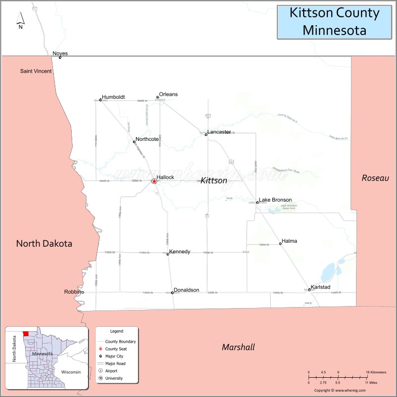
| Seat: | Hallock |
| Largest city: | Hallock |
| Total Area: | 1,104 sq mi (2,860 km²) |
| Land Area: | 1,099 sq mi (2,850 km²) |
| Total Population: | 4,207 |
| Population Density: | 3.8/sq mi (1.5/km²) |
| Time zone: | UTC−6 (Central) |
| Summer Time Zone (DST): | UTC−5 (CDT) |
| Website: | www.co.kittson.mn.us |
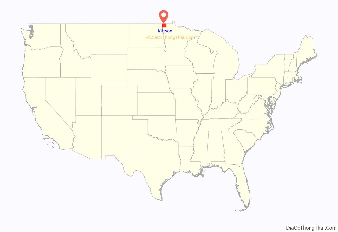
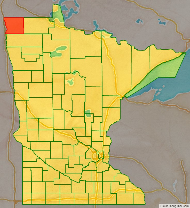
Kittson County location map. Where is Kittson County?
History
Evidence of occupation dating back 1800 years has been confirmed through archaeological expeditions done in the 1930s and 1970s around the burial mounds on the sand ridges in the eastern part of the county, which date to the Woodland Period. Evidence has been found that the Laurel, Arvilla, St. Croix, and Blackduck complexes were the area’s early occupants. About 400 years ago, the Cree, Assiniboine, Sioux and Ojibway inhabited the county.
The early explorers of the region were fur traders. Pembina, North Dakota’s oldest settlement, across the Red River from Kittson County, dates from 1797, when the first trading post was established by Charles Baptiste Chaboillez of the Northwest Fur Company. The Hudson Bay and American Fur Companies were also in Pembina as the fur trading industry increased. The fur traders and voyageurs traveled on the eastern side of the Red. Alexander Henry the younger, who erected a fort for the North West Company in Pembina, is thought to be the first white man to test agriculture in the valley. Joe Rolette, who started a fur post for the American Fur Company in Pembina, and Norman W. Kittson (for whom the county is named), were two early entrepreneurs who opened this area by developing the Red River Ox Cart trails and broadening the use of oxcarts. The need for oxcarts diminished as steamboats became the new mode for transporting furs and supplies. The railroad eventually replaced the steamboats.
Pembina County was one of five large counties the Minnesota Territory legislature established on October 27, 1849. It was not organized at that time. On March 9, 1878, the legislature renamed Pembina County Kittson County. On February 25, 1879, Kittson County was divided, creating Marshall County. The county seat, Hallock, was organized in 1880. Kittson County was further diminished in 1894 when Roseau County was partitioned off. Kittson County has retained its present boundaries since 1894.
St. Vincent, which is directly across the Red River from Pembina, was incorporated in 1857, just before statehood. In 1878, the St. Paul & Pacific Railroad line reached St. Vincent and opened the area to settlement. With the railroad coming through, settlers began arriving to stake their claims. Many of the earliest settlers in what became Pembina and St. Vincent were Métis, going back to the late 18th century. The railway extended through the western part of the county, with Donaldson, Kennedy, Hallock, Northcote, Humboldt and St. Vincent along the line. The eastern part of the county was settled in the early 1900s. The Soo Line railroad was completed in 1904 and the communities of Karlstad, Halma, Bronson, Lancaster, Orleans and Noyes were established. Scandinavians, Ukrainians, Polish, Scottish, Irish, English, Germans, French Canadians, Canadian Gaelic speakers from New Brunswick, and Métis all contributed to the county’s melting pot.
Once home to over 10,000 people, the county population declined below 5,000 in 2006.
Historic sites
Three sites in the county are listed in the National Register of Historic Places: the St. Nicholas Orthodox Church, in Caribou Township; the burial mounds known as the “Lake Bronson Site”, in Norway and Percy Townships; and the Lake Bronson State Park WPA/Rustic Style Historic Resources, which include an observation tower and several buildings. Lake Bronson State Park also has interpretive sites for the tower, a pioneer cemetery and the WPA camp.
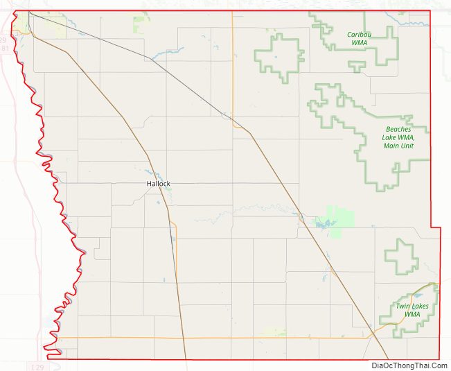
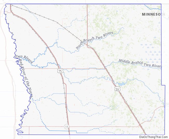
Kittson County Road Map
Geography
Kittson County is in Minnesota’s northwest corner, on the borders of North Dakota and Canada. The Red River flows north along the county’s western border. The South Fork of Two Rivers flows east through the central part of the county on its way to discharge into the Red; it meets the Middle Fork at Hallock, and the combined flow meets the North Fork a few miles east of the Red. The Joe River flows northwest out of the county into Canada, to discharge into the Red a few miles past the international border.
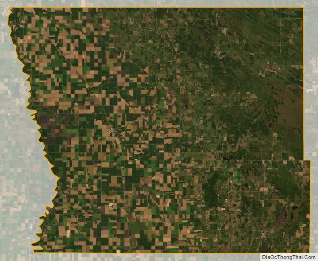
The county’s terrain consists of low rolling hills, devoted to agriculture. The terrain slopes to the north and west, with its highest point near the southeast corner at 1,079′ (329m) ASL. The county has an area of 1,104 square miles (2,860 km), of which 1,099 square miles (2,850 km) is land and 4.8 square miles (12 km) (0.4%) is water.
Kittson County was once part of glacial Lake Agassiz. Evidence of this prehistoric lake can still be seen in the county’s topography. Remnants of McCauleyville Beach can be found in the eastern part of the county, an area of sandy soil and sand ridges. Other evidence of the glacier and Lake Agassiz is the approximately 140′ drop in elevation from the eastern part of the county to the western part, near the Red River Valley, with its proliferation of black rich soil. Lake Bronson is a manmade reservoir, completed in 1937.
Major highways
- U.S. Highway 59
- U.S. Highway 75
- Minnesota State Highway 11
- Minnesota State Highway 171
- Minnesota State Highway 175
- Minnesota State Highway 220
Adjacent counties and rural municipalities
- Town of Emerson, Manitoba (north)
- Rural Municipality of Franklin, Manitoba (north)
- Rural Municipality of Stuartburn, Manitoba (north)
- Roseau County, Minnesota (east)
- Marshall County, Minnesota (south)
- Walsh County, North Dakota (southwest)
- Pembina County, North Dakota (west)
Protected areas
- Beaches State Wildlife Management Area
- Lake Bronson Parklands Scientific and Natural Area
- Lake Bronson State Park
Lakes
- Lake Bronson
- Lake Stella
- Twin Lakes
Kittson County Topographic Map
Kittson County Satellite Map
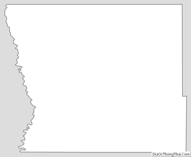
Kittson County Outline Map
See also
Map of Minnesota State and its subdivision:- Aitkin
- Anoka
- Becker
- Beltrami
- Benton
- Big Stone
- Blue Earth
- Brown
- Carlton
- Carver
- Cass
- Chippewa
- Chisago
- Clay
- Clearwater
- Cook
- Cottonwood
- Crow Wing
- Dakota
- Dodge
- Douglas
- Faribault
- Fillmore
- Freeborn
- Goodhue
- Grant
- Hennepin
- Houston
- Hubbard
- Isanti
- Itasca
- Jackson
- Kanabec
- Kandiyohi
- Kittson
- Koochiching
- Lac qui Parle
- Lake
- Lake of the Woods
- Lake Superior
- Le Sueur
- Lincoln
- Lyon
- Mahnomen
- Marshall
- Martin
- McLeod
- Meeker
- Mille Lacs
- Morrison
- Mower
- Murray
- Nicollet
- Nobles
- Norman
- Olmsted
- Otter Tail
- Pennington
- Pine
- Pipestone
- Polk
- Pope
- Ramsey
- Red Lake
- Redwood
- Renville
- Rice
- Rock
- Roseau
- Saint Louis
- Scott
- Sherburne
- Sibley
- Stearns
- Steele
- Stevens
- Swift
- Todd
- Traverse
- Wabasha
- Wadena
- Waseca
- Washington
- Watonwan
- Wilkin
- Winona
- Wright
- Yellow Medicine
- Alabama
- Alaska
- Arizona
- Arkansas
- California
- Colorado
- Connecticut
- Delaware
- District of Columbia
- Florida
- Georgia
- Hawaii
- Idaho
- Illinois
- Indiana
- Iowa
- Kansas
- Kentucky
- Louisiana
- Maine
- Maryland
- Massachusetts
- Michigan
- Minnesota
- Mississippi
- Missouri
- Montana
- Nebraska
- Nevada
- New Hampshire
- New Jersey
- New Mexico
- New York
- North Carolina
- North Dakota
- Ohio
- Oklahoma
- Oregon
- Pennsylvania
- Rhode Island
- South Carolina
- South Dakota
- Tennessee
- Texas
- Utah
- Vermont
- Virginia
- Washington
- West Virginia
- Wisconsin
- Wyoming