Lafayette County /lɑːˈfeɪɛt/ is a county located in the U.S. state of Arkansas. As of the 2020 census, the population was 6,308, making it the third-least populous county in Arkansas. The county seat is Lewisville. Lafayette County was formed on October 15, 1827, and named in honor of the Marquis de Lafayette, a French military hero of the American Revolutionary War. It is a dry county; therefore, the sale of alcohol is prohibited.
| Name: | Lafayette County |
|---|---|
| FIPS code: | 05-073 |
| State: | Arkansas |
| Founded: | October 15, 1827 |
| Named for: | Marquis de Lafayette |
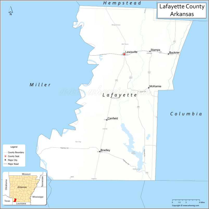
| Seat: | Lewisville |
| Largest town: | Stamps |
| Total Area: | 545 sq mi (1,410 km²) |
| Land Area: | 528 sq mi (1,370 km²) |
| Total Population: | 6,308 |
| Population Density: | 12/sq mi (4.5/km²) |
| Time zone: | UTC−6 (Central) |
| Summer Time Zone (DST): | UTC−5 (CDT) |
| Website: | www.lafayettecounty.arkansas.gov |
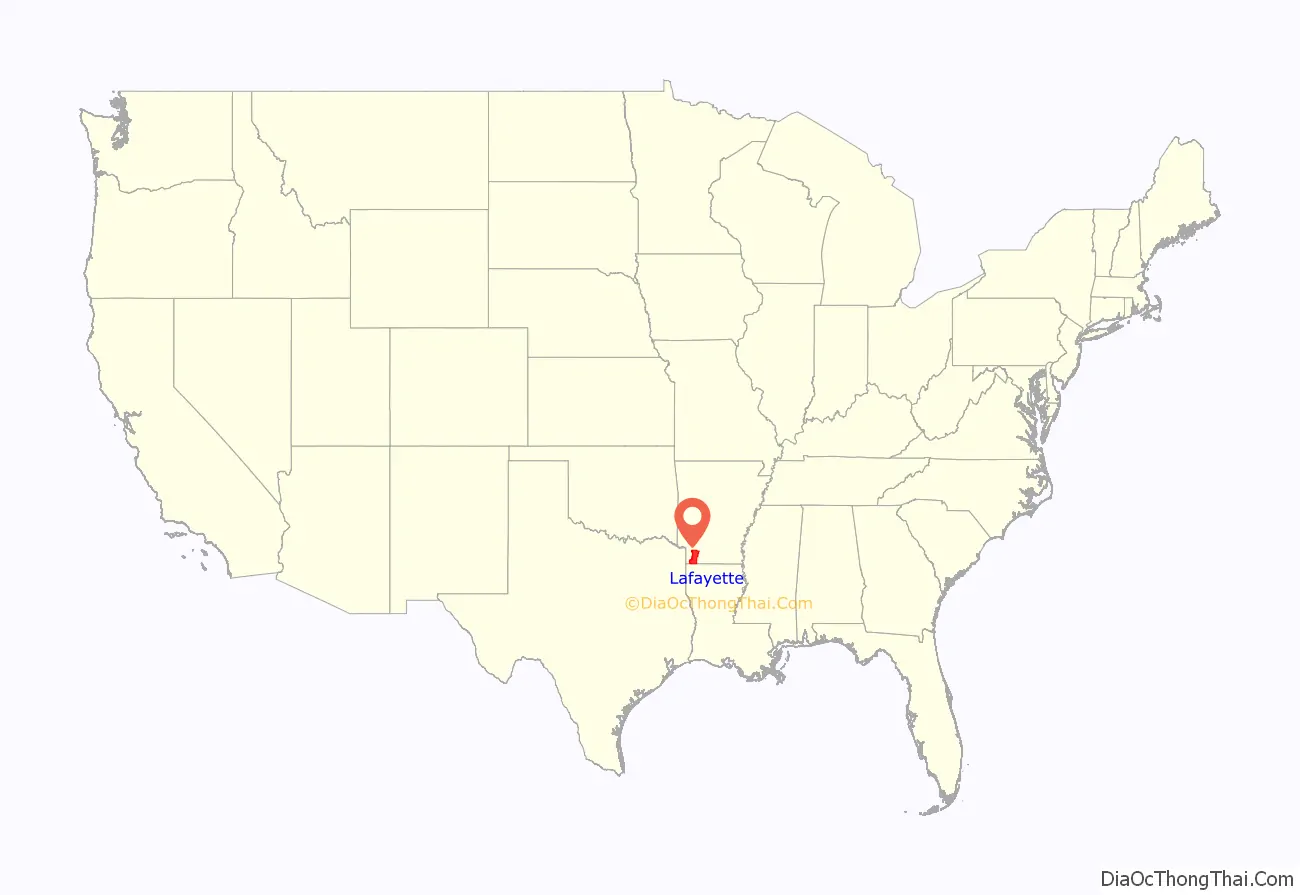
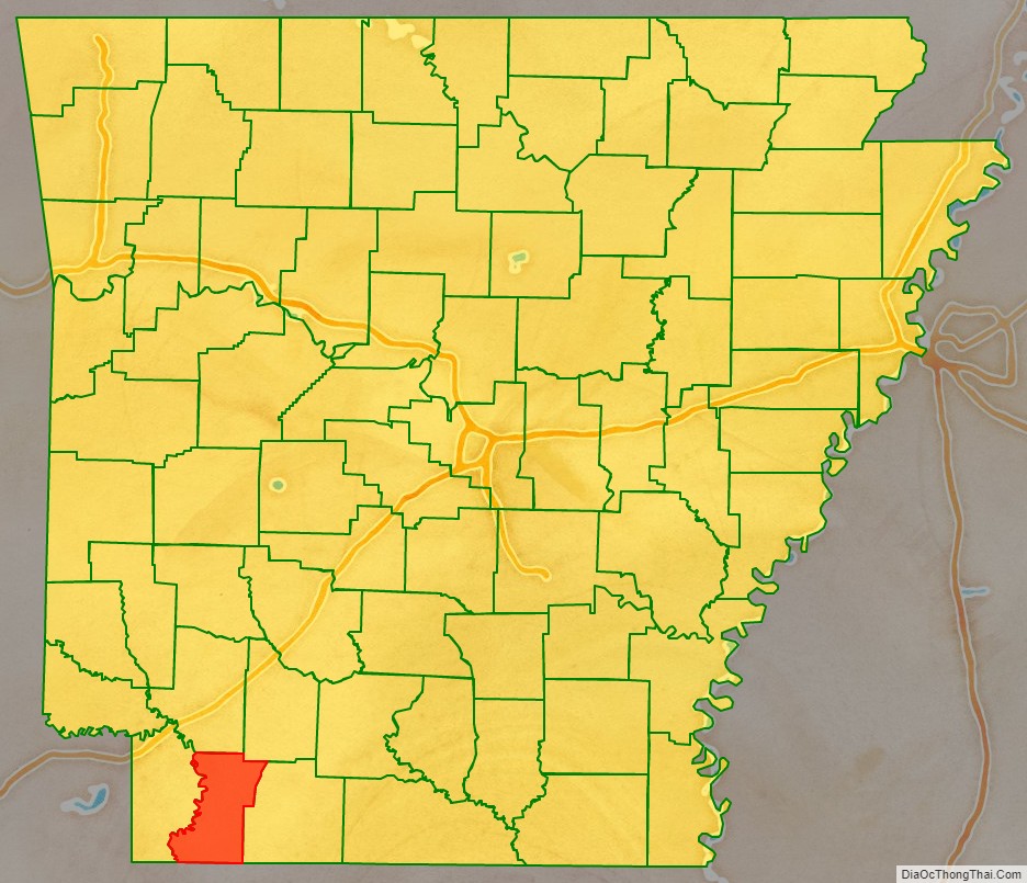
Lafayette County location map. Where is Lafayette County?
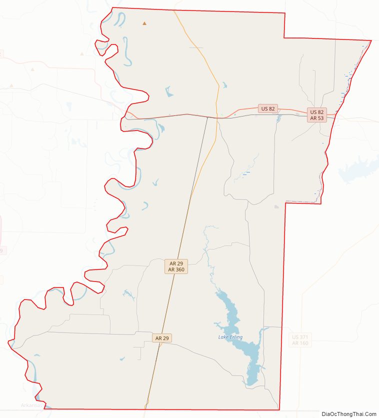
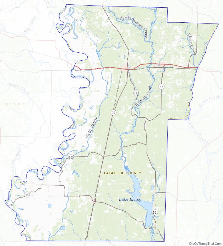
Lafayette County Road Map
Geography
According to the U.S. Census Bureau, the county has a total area of 545 square miles (1,410 km), of which 528 square miles (1,370 km) is land and 17 square miles (44 km) (3.1%) is water. It is the smallest county in Arkansas by area.
Major highways
- U.S. Highway 82
- Highway 29
- Highway 53
- Highway 160
Adjacent counties
- Hempstead County (north)
- Nevada County (northeast)
- Columbia County (east)
- Webster Parish, Louisiana (southeast)
- Bossier Parish, Louisiana (south)
- Caddo Parish, Louisiana (southwest)
- Miller County (west)
Lafayette County Topographic Map
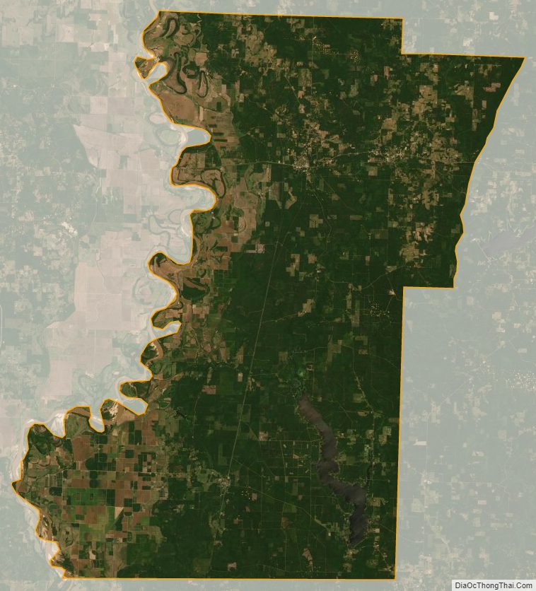
Lafayette County Satellite Map
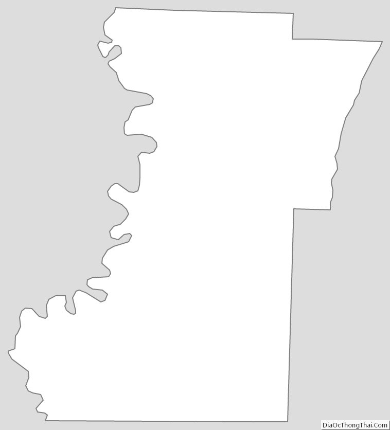
Lafayette County Outline Map
See also
Map of Arkansas State and its subdivision:- Arkansas
- Ashley
- Baxter
- Benton
- Boone
- Bradley
- Calhoun
- Carroll
- Chicot
- Clark
- Clay
- Cleburne
- Cleveland
- Columbia
- Conway
- Craighead
- Crawford
- Crittenden
- Cross
- Dallas
- Desha
- Drew
- Faulkner
- Franklin
- Fulton
- Garland
- Grant
- Greene
- Hempstead
- Hot Spring
- Howard
- Independence
- Izard
- Jackson
- Jefferson
- Johnson
- Lafayette
- Lawrence
- Lee
- Lincoln
- Little River
- Logan
- Lonoke
- Madison
- Marion
- Miller
- Mississippi
- Monroe
- Montgomery
- Nevada
- Newton
- Ouachita
- Perry
- Phillips
- Pike
- Poinsett
- Polk
- Pope
- Prairie
- Pulaski
- Randolph
- Saint Francis
- Saline
- Scott
- Searcy
- Sebastian
- Sevier
- Sharp
- Stone
- Union
- Van Buren
- Washington
- White
- Woodruff
- Yell
- Alabama
- Alaska
- Arizona
- Arkansas
- California
- Colorado
- Connecticut
- Delaware
- District of Columbia
- Florida
- Georgia
- Hawaii
- Idaho
- Illinois
- Indiana
- Iowa
- Kansas
- Kentucky
- Louisiana
- Maine
- Maryland
- Massachusetts
- Michigan
- Minnesota
- Mississippi
- Missouri
- Montana
- Nebraska
- Nevada
- New Hampshire
- New Jersey
- New Mexico
- New York
- North Carolina
- North Dakota
- Ohio
- Oklahoma
- Oregon
- Pennsylvania
- Rhode Island
- South Carolina
- South Dakota
- Tennessee
- Texas
- Utah
- Vermont
- Virginia
- Washington
- West Virginia
- Wisconsin
- Wyoming