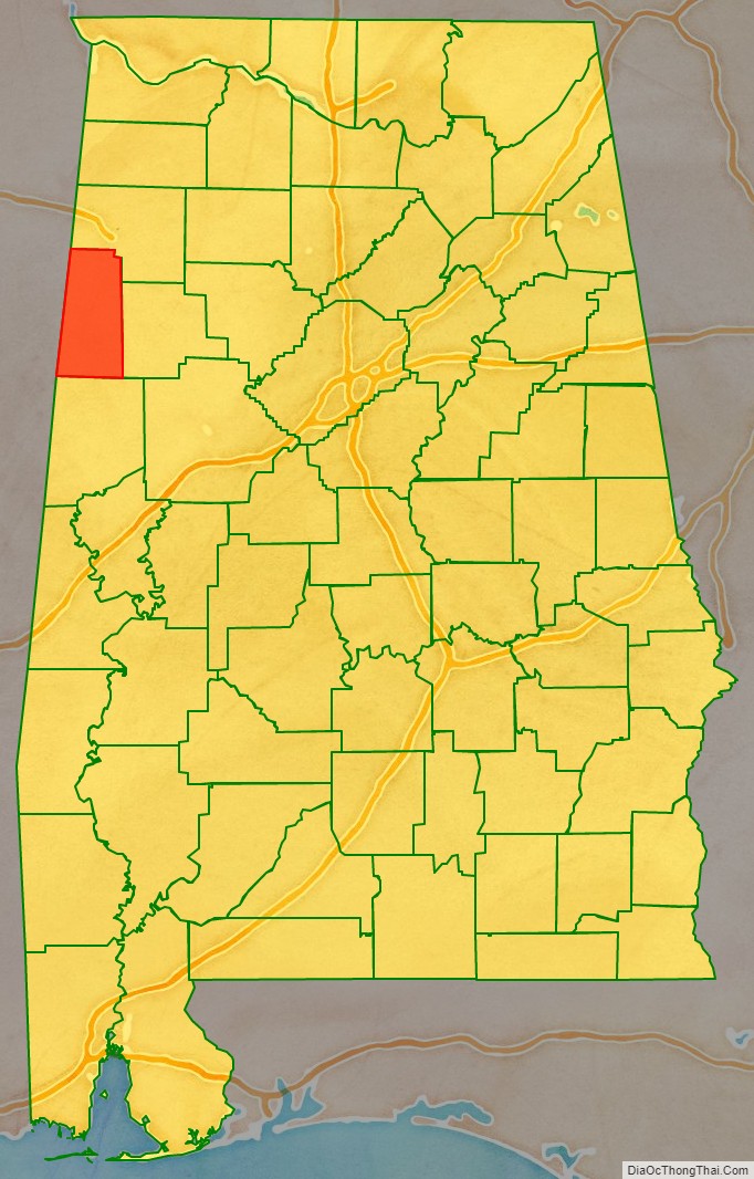
Lamar County (formerly Jones County and Sanford County) is a county in the U.S. state of Alabama. As of the 2020 census, the population was 13,972. Its county seat is Vernon and it is a dry county. It is named in honor of Lucius Quintus Cincinnatus Lamar, a former member of both houses of the United States Congress from Mississippi.
| Name: | Lamar County |
|---|---|
| FIPS code: | 01-075 |
| State: | Alabama |
| Founded: | February 8, 1877 |
| Named for: | Lucius Quintus Cincinnatus Lamar |
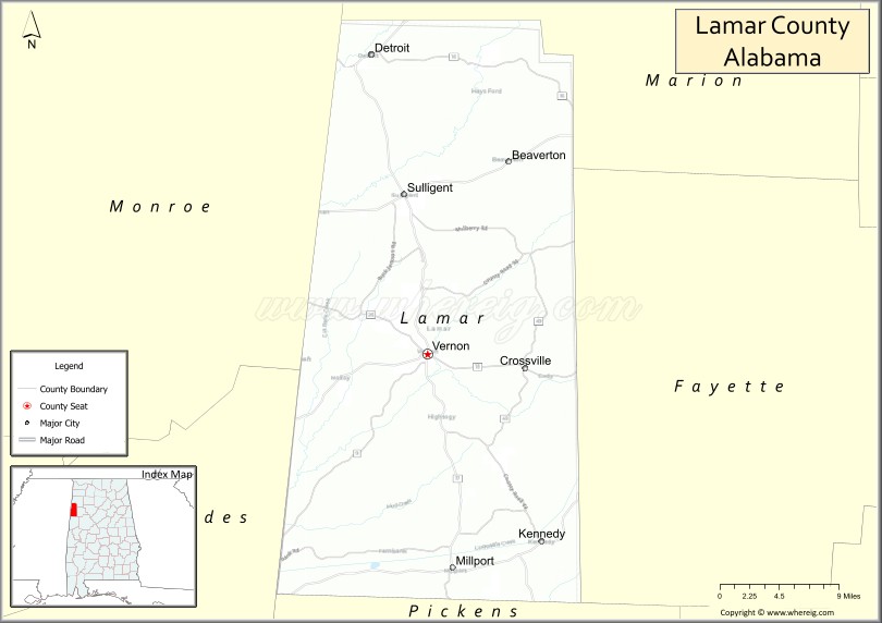
| Seat: | Vernon |
| Largest city: | Vernon |
| Total Area: | 605 sq mi (1,570 km²) |
| Land Area: | 605 sq mi (1,570 km²) |
| Total Population: | 13,972 |
| Population Density: | 23/sq mi (8.9/km²) |
| Time zone: | UTC−6 (Central) |
| Summer Time Zone (DST): | UTC−5 (CDT) |
| Website: | www.lamarcounty.us |
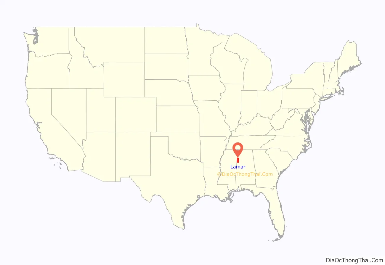
Lamar County location map. Where is Lamar County?
History
Jones County, Alabama was established on February 4, 1867, with land taken from the southern part of Marion County and the western part of Fayette County. It was named for E. P. Jones of Fayette County, with its county seat in Vernon. This county was abolished on November 13, 1867. On October 8, 1868, the area was again organized into a county, but as Covington County had been renamed “Jones County” the same year (a change that lasted only a few months), the new county was named Sanford, in honor of H. C. Sanford of Cherokee County. On February 8, 1877, the county was renamed Lamar in honor of Congressman and Senator L.Q.C. Lamar of Mississippi.
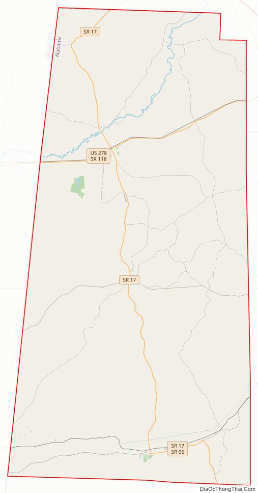
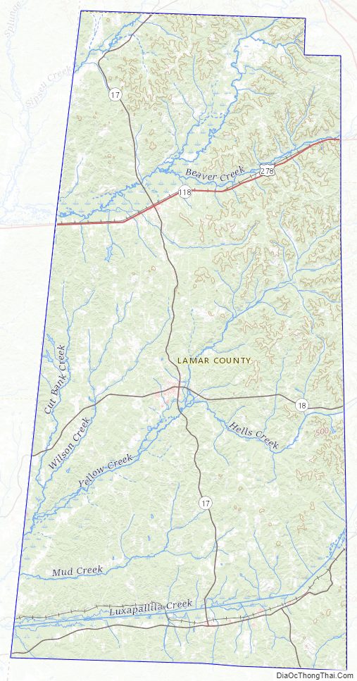
Lamar County Road Map
Geography
According to the United States Census Bureau, the county has a total area of 605 square miles (1,570 km), of which 605 square miles (1,570 km) is land and 0.6 square miles (1.6 km) (0.1%) is water.
Adjacent counties
- Marion County (north)
- Fayette County (east)
- Pickens County (south)
- Lowndes County, Mississippi (southwest)
- Monroe County, Mississippi (west)
Cemeteries
- Asbury Methodist Church (2)
- Pine Springs Cemetery
- Blooming Grove Baptist Church Cemetery
- Christian Chapel Church of Christ Cemetery
- Fellowship Baptist Church Cemetery
- Furnace Hill Cemetery
- Kennedy Town Cemetery
- Liberty Baptist Church Cemetery
- Macedonia Baptist Church Cemetery
- Meadow Branch Baptist Church Cemetery
- Mount Olive Church of Christ Cemetery
- Mt. Pisgah Baptist Church Cemetery
- Old Mount Nebo Cemetery
- Shiloh (Pinhook) United Methodist Church Cemetery
- Sulligent City Cemetery
- Vernon City Cemetery
- Providence United Methodist Cemetery
- Union Chapel Church Cemetery near Crossville
- Morton Chapel Methodist Church Cemetery near Vernon
- Fairview Church Cemetery
- Lebanon United Methodist Church Cemetery
- Shiloh Baptist Church Cemetery
- Old Liberty Church Cemetery
- South Carolina Church Cemetery near Hightogy
- Springhill Cemetery near Millport
- Walnut Grove Cemetery
- Wesley Chapel Cemetery
- Glimer Addition to Sulligent City Cemetery
- Sandlin Cemetery (just north of Sulligent on Hwy 17)
Lamar County Topographic Map
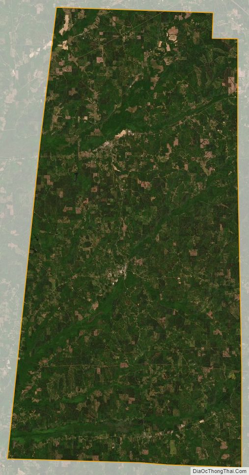
Lamar County Satellite Map
Lamar County Outline Map

See also
Map of Alabama State and its subdivision:- Autauga
- Baldwin
- Barbour
- Bibb
- Blount
- Bullock
- Butler
- Calhoun
- Chambers
- Cherokee
- Chilton
- Choctaw
- Clarke
- Clay
- Cleburne
- Coffee
- Colbert
- Conecuh
- Coosa
- Covington
- Crenshaw
- Cullman
- Dale
- Dallas
- De Kalb
- Elmore
- Escambia
- Etowah
- Fayette
- Franklin
- Geneva
- Greene
- Hale
- Henry
- Houston
- Jackson
- Jefferson
- Lamar
- Lauderdale
- Lawrence
- Lee
- Limestone
- Lowndes
- Macon
- Madison
- Marengo
- Marion
- Marshall
- Mobile
- Monroe
- Montgomery
- Morgan
- Perry
- Pickens
- Pike
- Randolph
- Russell
- Saint Clair
- Shelby
- Sumter
- Talladega
- Tallapoosa
- Tuscaloosa
- Walker
- Washington
- Wilcox
- Winston
- Alabama
- Alaska
- Arizona
- Arkansas
- California
- Colorado
- Connecticut
- Delaware
- District of Columbia
- Florida
- Georgia
- Hawaii
- Idaho
- Illinois
- Indiana
- Iowa
- Kansas
- Kentucky
- Louisiana
- Maine
- Maryland
- Massachusetts
- Michigan
- Minnesota
- Mississippi
- Missouri
- Montana
- Nebraska
- Nevada
- New Hampshire
- New Jersey
- New Mexico
- New York
- North Carolina
- North Dakota
- Ohio
- Oklahoma
- Oregon
- Pennsylvania
- Rhode Island
- South Carolina
- South Dakota
- Tennessee
- Texas
- Utah
- Vermont
- Virginia
- Washington
- West Virginia
- Wisconsin
- Wyoming