Lauderdale County is a county located on the western edge of the U.S. state of Tennessee, with its border the Mississippi River. As of the 2020 census, the population was 25,143. Its county seat is Ripley. Since the antebellum years, it has been developed for cotton as a major commodity crop.
| Name: | Lauderdale County |
|---|---|
| FIPS code: | 47-097 |
| State: | Tennessee |
| Founded: | 1835 |
| Named for: | James Lauderdale |
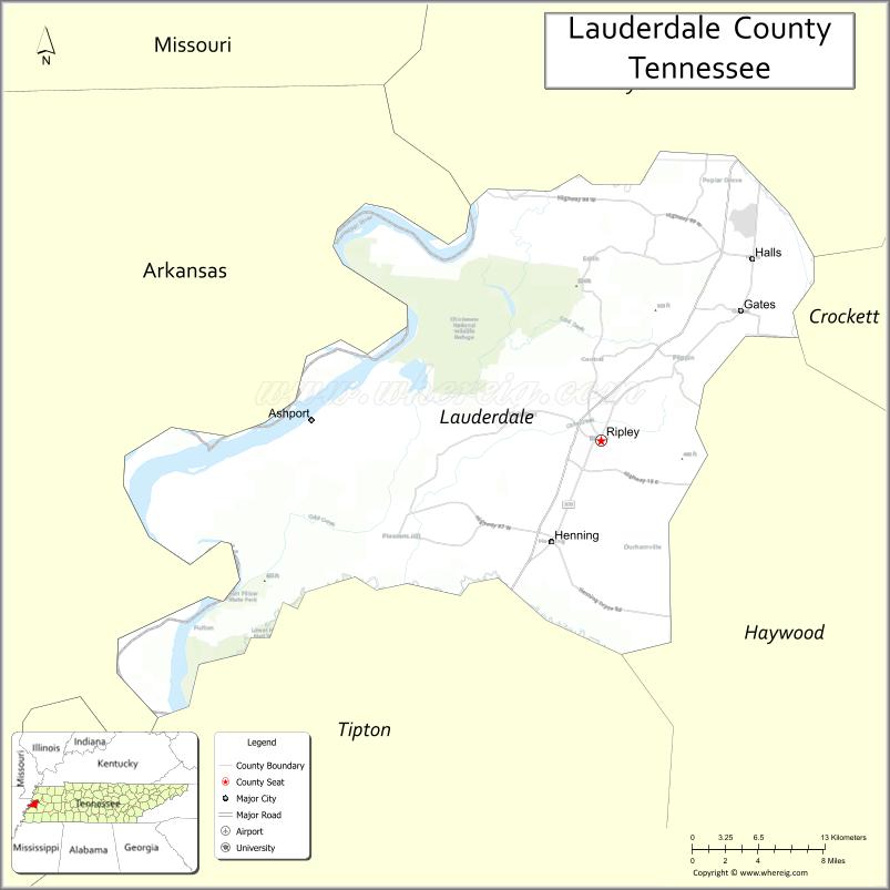
| Seat: | Ripley |
| Largest city: | Ripley |
| Total Area: | 508 sq mi (1,320 km²) |
| Land Area: | 472 sq mi (1,220 km²) |
| Total Population: | 25,143 |
| Population Density: | 59/sq mi (23/km²) |
| Time zone: | UTC−6 (Central) |
| Summer Time Zone (DST): | UTC−5 (CDT) |
| Website: | lauderdalecountytn.org |
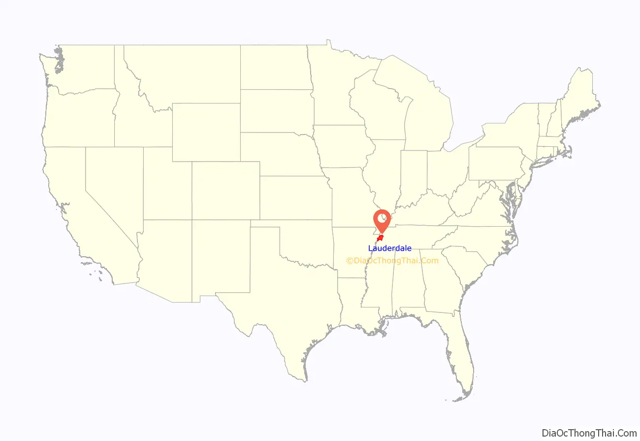
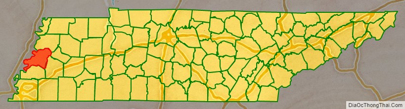
Lauderdale County location map. Where is Lauderdale County?
History
Lauderdale County was created in 1835 from parts of Tipton, Dyer and Haywood counties. It was named for Lieutenant Colonel James Lauderdale, who was killed at the Battle of New Orleans in the War of 1812. Planters developed large cotton plantations along the waterways, and used enslaved African Americans in gangs to work and process this commodity crop. After the American Civil War, many freedmen initially stayed in the area, working the land as sharecroppers or tenant farmers. Whites used violence to enforce white supremacy after the war, continuing after Reconstruction. In the period after Reconstruction and into the early 20th century, whites in Lauderdale County committed eight lynchings of blacks. This was the fifth-highest total of any county in the state, but three other counties also had eight lynchings each in this period.
Battle of Fort Pillow
In 1861, the Confederate States Army built extensive defensive fortifications in Lauderdale County along the Mississippi River and named the site for General Gideon J. Pillow. Because of its strategic location, the fort was taken over by the Union Army in 1864, which had occupied the state since 1862.
In 1864, Confederates attacked and overran the fort’s Union defenders, who were about evenly split between white and black soldiers. They were reported to have refused to surrender, but historians have disputed this account. The Confederates gave the soldiers no quarter, and killed black soldiers in twice the proportion of white ones. After the Union Army established the United States Colored Troops (USCT), made up of numerous recruits who were escaped slaves, Southern military officials vowed to kill them rather than take them prisoner. People in the North considered this event to be a massacre, and blacks in the Union Army used the cry, “Remember Fort Pillow!” to rally during the remainder of the war.
Fort Pillow State Park has a museum to interpret the battle and also has reconstructed fortifications on the original site of the fort.
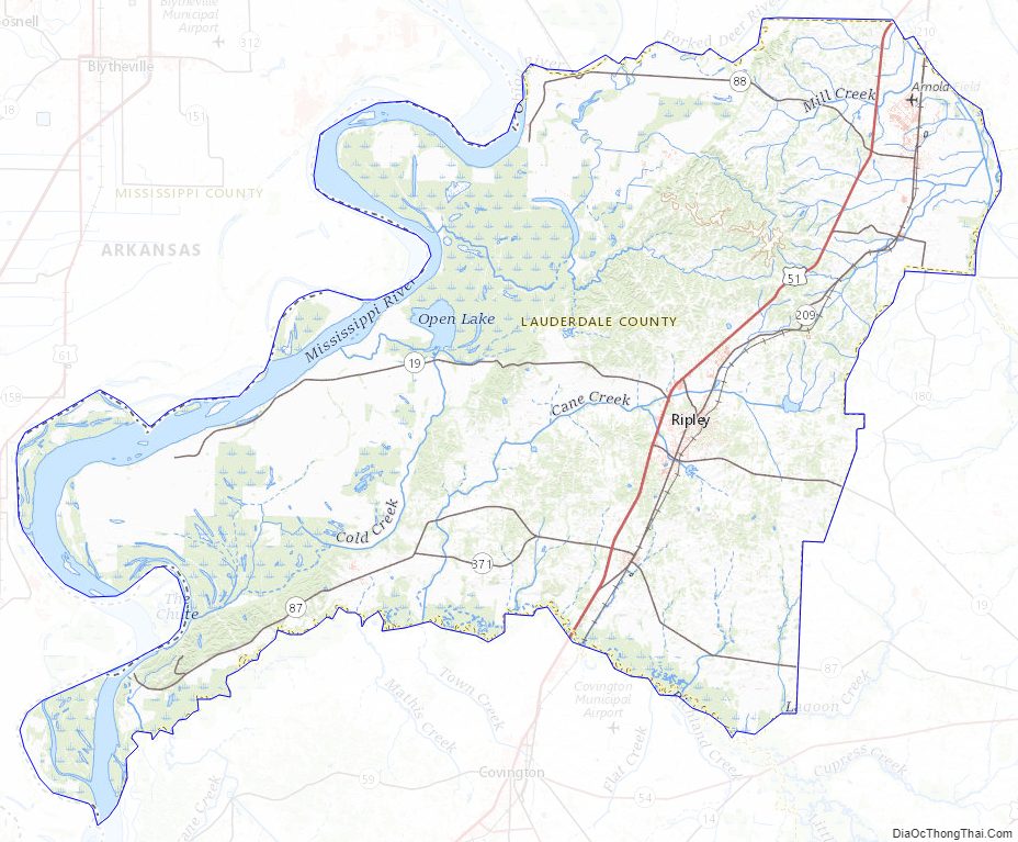
Lauderdale County Road Map
Geography
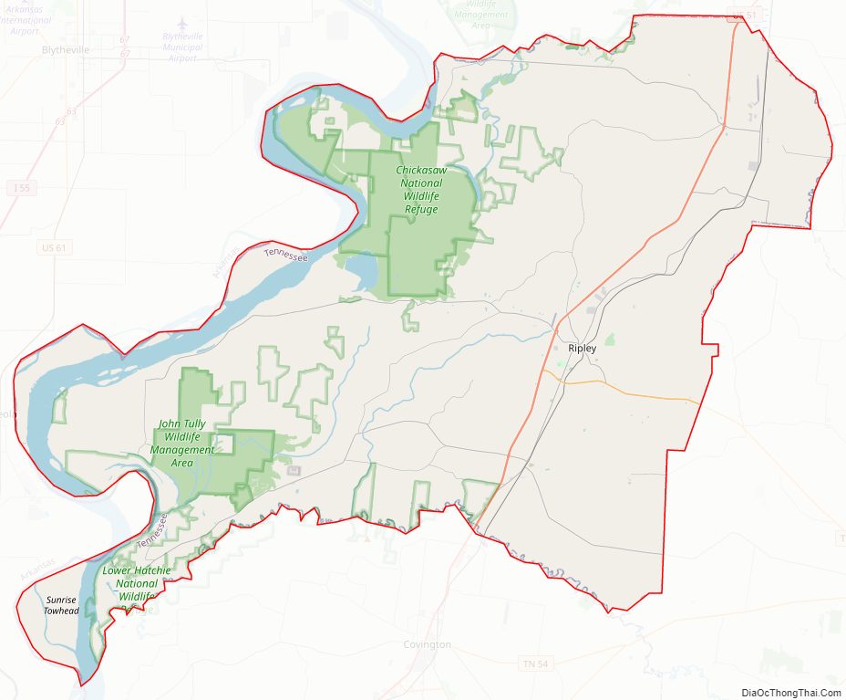
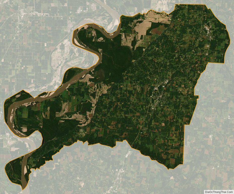
According to the U.S. Census Bureau, the county has a total area of 508 square miles (1,320 km), of which 472 square miles (1,220 km) is land and 36 square miles (93 km) (7.0%) is water. The county’s western boundary is formed by the Mississippi River, its northern boundary with Dyer County is formed by the Forked Deer River, and its southern boundary with Haywood County is formed by the Hatchie River.
Lauderdale County is situated on the southeastern edge of the New Madrid Seismic Zone, an area with a high earthquake risk.
Adjacent counties
- Dyer County (north)
- Crockett County (east)
- Haywood County (southeast)
- Tipton County (south)
- Mississippi County, Arkansas (west)
National protected areas
- Chickasaw National Wildlife Refuge
- Lower Hatchie National Wildlife Refuge (part)
State protected areas
- Cold Creek Wildlife Management Area
- Fort Pillow State Park
- Alex Haley House and Museum (state historic site)
- Sunk Lake State Natural Area
- John Tully State Forest
- John Tully Wildlife Management Area
Major roads
- Future Interstate 69
- U.S. Highway 51
- Tennessee State Route 19 (Tina Turner Highway)
- Tennessee State Route 87
- Tennessee State Route 88
- Tennessee State Route 180
- Tennessee State Route 181
- Tennessee State Route 371
Lauderdale County Topographic Map
Lauderdale County Satellite Map
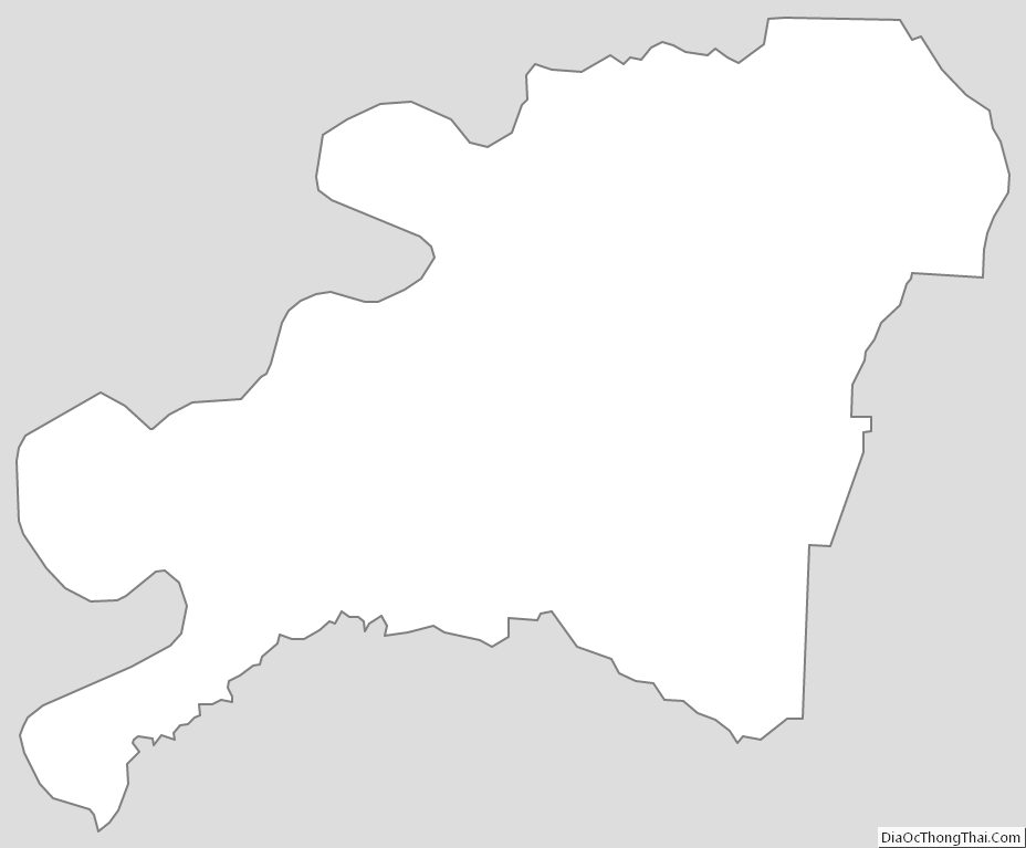
Lauderdale County Outline Map
See also
Map of Tennessee State and its subdivision:- Anderson
- Bedford
- Benton
- Bledsoe
- Blount
- Bradley
- Campbell
- Cannon
- Carroll
- Carter
- Cheatham
- Chester
- Claiborne
- Clay
- Cocke
- Coffee
- Crockett
- Cumberland
- Davidson
- Decatur
- DeKalb
- Dickson
- Dyer
- Fayette
- Fentress
- Franklin
- Gibson
- Giles
- Grainger
- Greene
- Grundy
- Hamblen
- Hamilton
- Hancock
- Hardeman
- Hardin
- Hawkins
- Haywood
- Henderson
- Henry
- Hickman
- Houston
- Humphreys
- Jackson
- Jefferson
- Johnson
- Knox
- Lake
- Lauderdale
- Lawrence
- Lewis
- Lincoln
- Loudon
- Macon
- Madison
- Marion
- Marshall
- Maury
- McMinn
- McNairy
- Meigs
- Monroe
- Montgomery
- Moore
- Morgan
- Obion
- Overton
- Perry
- Pickett
- Polk
- Putnam
- Rhea
- Roane
- Robertson
- Rutherford
- Scott
- Sequatchie
- Sevier
- Shelby
- Smith
- Stewart
- Sullivan
- Sumner
- Tipton
- Trousdale
- Unicoi
- Union
- Van Buren
- Warren
- Washington
- Wayne
- Weakley
- White
- Williamson
- Wilson
- Alabama
- Alaska
- Arizona
- Arkansas
- California
- Colorado
- Connecticut
- Delaware
- District of Columbia
- Florida
- Georgia
- Hawaii
- Idaho
- Illinois
- Indiana
- Iowa
- Kansas
- Kentucky
- Louisiana
- Maine
- Maryland
- Massachusetts
- Michigan
- Minnesota
- Mississippi
- Missouri
- Montana
- Nebraska
- Nevada
- New Hampshire
- New Jersey
- New Mexico
- New York
- North Carolina
- North Dakota
- Ohio
- Oklahoma
- Oregon
- Pennsylvania
- Rhode Island
- South Carolina
- South Dakota
- Tennessee
- Texas
- Utah
- Vermont
- Virginia
- Washington
- West Virginia
- Wisconsin
- Wyoming