Lee County is a county located in the U.S. state of Illinois. According to the 2010 census, it has a population of 36,031. Its county seat is Dixon.
The Dixon, IL Micropolitan Statistical Area includes all of Lee County.
| Name: | Lee County |
|---|---|
| FIPS code: | 17-103 |
| State: | Illinois |
| Founded: | February 27, 1839 |
| Named for: | Henry Lee III |
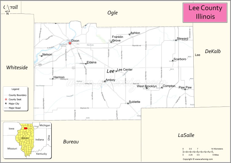
| Seat: | Dixon |
| Largest city: | Dixon |
| Total Area: | 729 sq mi (1,890 km²) |
| Land Area: | 725 sq mi (1,880 km²) |
| Total Population: | 36,031 |
| Population Density: | 49/sq mi (19/km²) |
| Time zone: | UTC−6 (Central) |
| Summer Time Zone (DST): | UTC−5 (CDT) |
| Website: | www.leecountyil.com |
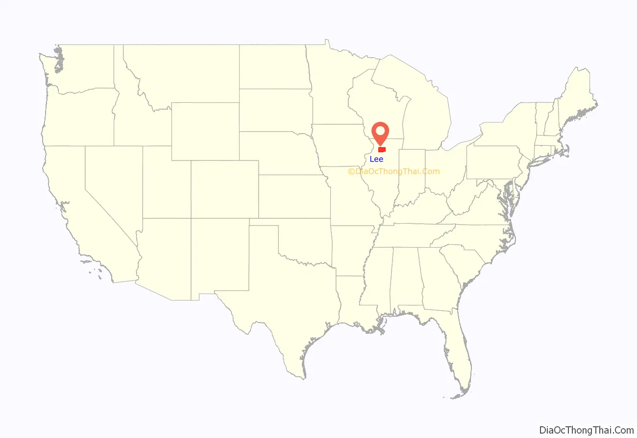
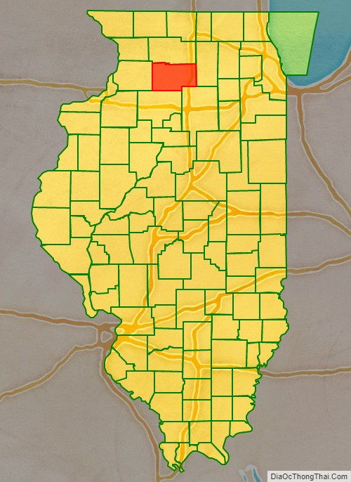
Lee County location map. Where is Lee County?
History
The area’s first non-native settlers were mostly from the six New England states. The early nineteenth century saw a wave of westward movement from New England, due largely to completion of the Erie Canal and the end of the Black Hawk War.
The area that included present-day Lee County was delineated as St. Clair County in 1809. In 1823, a large section of northern St. Clair County was partitioned off as Fulton County. In 1825, the northwestern portion of that county was partitioned off as Putnam County. In 1831, the area was further partitioned into Jo Daviess County. A section of that county was partitioned off in 1836 as Ogle County, and in 1839 the bottom half of Ogle County was split off as Lee County. It is largely understood that the county’s name honors “Lighthorse Harry” Lee, an officer in the American Revolutionary War. An alternative theory suggests the name honors Richard Henry Lee, a member of the Continental Congress (the Declaration of Independence was adopted pursuant to the Lee Resolution).
President Ronald Reagan lived in Dixon as a boy and attended Dixon High School.
Lee County’s boundaries have remained unchanged since its creation in 1839.
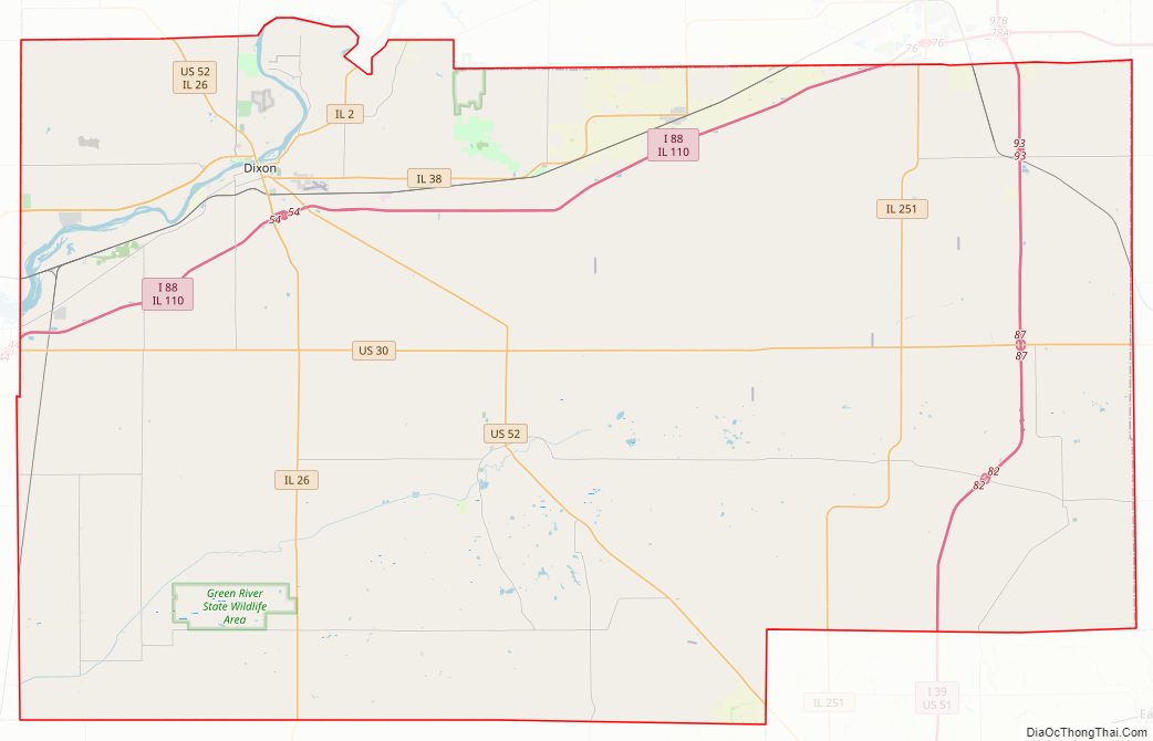
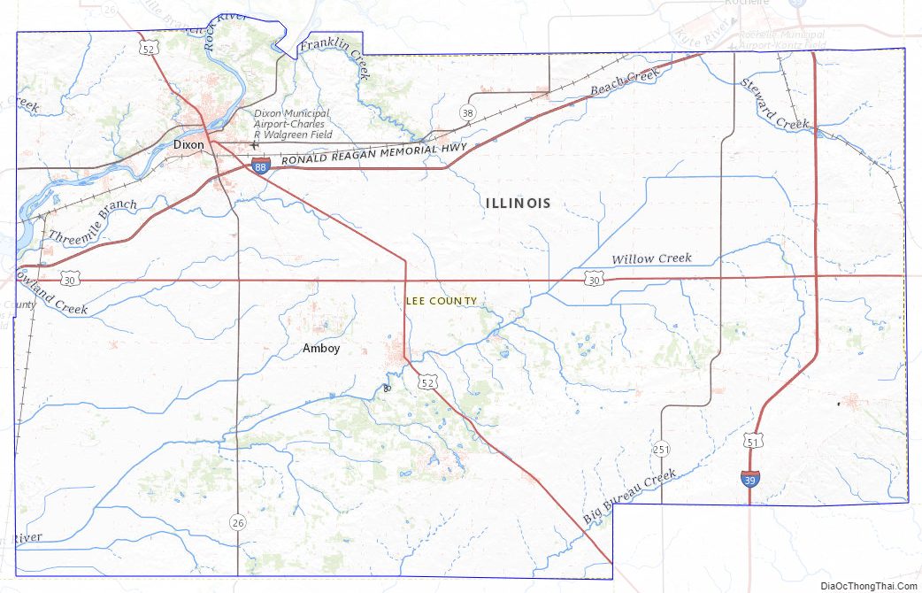
Lee County Road Map
Geography
According to the US Census Bureau, the county has a total area of 729 square miles (1,890 km), of which 725 square miles (1,880 km) is land and 4.1 square miles (11 km) (0.6%) is water.
Adjacent counties
- Ogle County – north
- DeKalb County – east
- LaSalle County – southeast, south
- Bureau County – south, southwest
- Whiteside County – west
Climate and weather
In recent years, average temperatures in the county seat of Dixon have ranged from a low of 10 °F (−12 °C) in January to a high of 82 °F (28 °C) in July, although a record low of −27 °F (−33 °C) was recorded in January 1999 and a record high of 110 °F (43 °C) was recorded in July 1936. Average monthly precipitation ranges from 1.43 inches (36 mm) in February to 4.88 inches (124 mm) in June.
Major highways
- Interstate 39
- Interstate 88
- U.S. Highway 30
- U.S. Highway 51
- U.S. Highway 52
- Illinois Route 2
- Illinois Route 26
- Illinois Route 38
- Illinois Route 110
- Illinois Route 251
Other features
- Green River Ordnance Plant
- Mendota Hills Wind Farm
Lee County Topographic Map
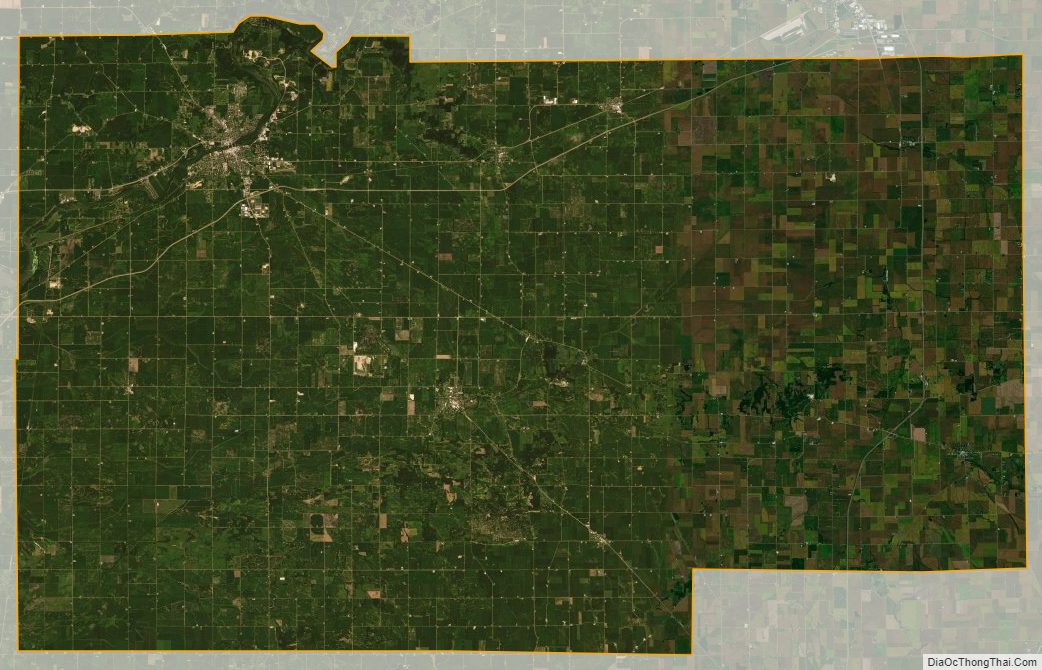
Lee County Satellite Map
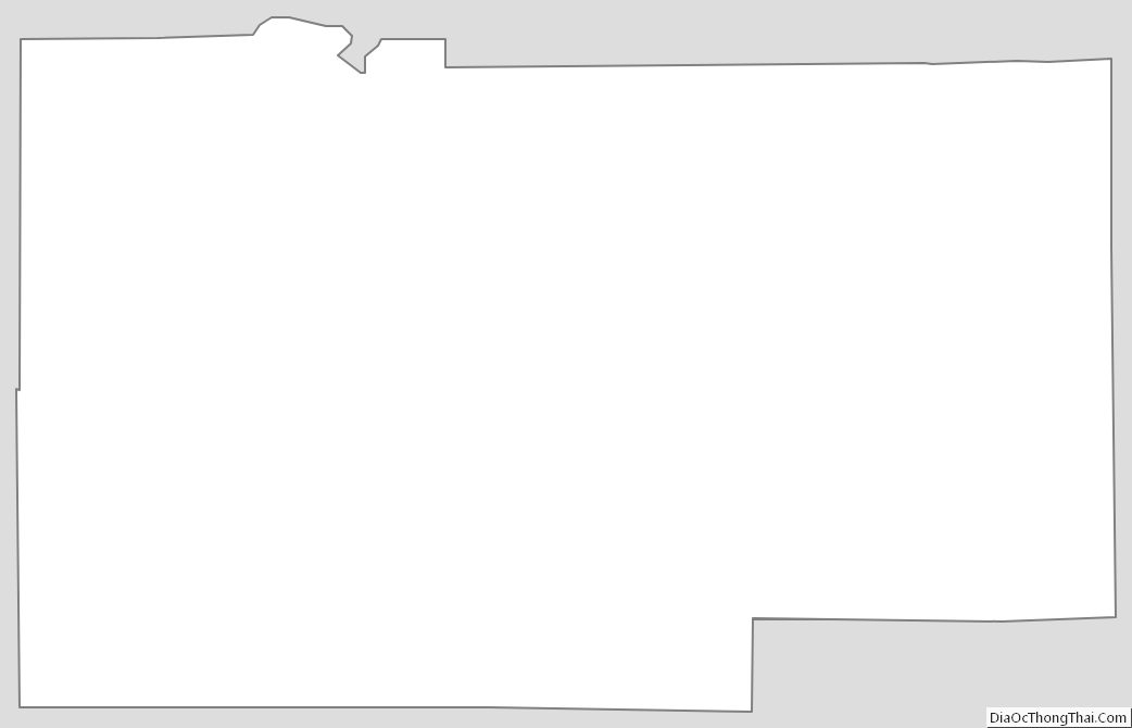
Lee County Outline Map
See also
Map of Illinois State and its subdivision:- Adams
- Alexander
- Bond
- Boone
- Brown
- Bureau
- Calhoun
- Carroll
- Cass
- Champaign
- Christian
- Clark
- Clay
- Clinton
- Coles
- Cook
- Crawford
- Cumberland
- De Kalb
- De Witt
- Douglas
- Dupage
- Edgar
- Edwards
- Effingham
- Fayette
- Ford
- Franklin
- Fulton
- Gallatin
- Greene
- Grundy
- Hamilton
- Hancock
- Hardin
- Henderson
- Henry
- Iroquois
- Jackson
- Jasper
- Jefferson
- Jersey
- Jo Daviess
- Johnson
- Kane
- Kankakee
- Kendall
- Knox
- La Salle
- Lake
- Lake Michigan
- Lawrence
- Lee
- Livingston
- Logan
- Macon
- Macoupin
- Madison
- Marion
- Marshall
- Mason
- Massac
- McDonough
- McHenry
- McLean
- Menard
- Mercer
- Monroe
- Montgomery
- Morgan
- Moultrie
- Ogle
- Peoria
- Perry
- Piatt
- Pike
- Pope
- Pulaski
- Putnam
- Randolph
- Richland
- Rock Island
- Saint Clair
- Saline
- Sangamon
- Schuyler
- Scott
- Shelby
- Stark
- Stephenson
- Tazewell
- Union
- Vermilion
- Wabash
- Warren
- Washington
- Wayne
- White
- Whiteside
- Will
- Williamson
- Winnebago
- Woodford
- Alabama
- Alaska
- Arizona
- Arkansas
- California
- Colorado
- Connecticut
- Delaware
- District of Columbia
- Florida
- Georgia
- Hawaii
- Idaho
- Illinois
- Indiana
- Iowa
- Kansas
- Kentucky
- Louisiana
- Maine
- Maryland
- Massachusetts
- Michigan
- Minnesota
- Mississippi
- Missouri
- Montana
- Nebraska
- Nevada
- New Hampshire
- New Jersey
- New Mexico
- New York
- North Carolina
- North Dakota
- Ohio
- Oklahoma
- Oregon
- Pennsylvania
- Rhode Island
- South Carolina
- South Dakota
- Tennessee
- Texas
- Utah
- Vermont
- Virginia
- Washington
- West Virginia
- Wisconsin
- Wyoming