Lehigh County (Pennsylvania Dutch: Lechaa Kaundi) is a county in the Commonwealth of Pennsylvania. As of the 2020 census, the county’s population was 374,557. Its county seat is Allentown, the state’s third largest city after Philadelphia and Pittsburgh.
Lehigh County and Northampton County to its east combine to form the Lehigh Valley region of eastern Pennsylvania. Lehigh County is one of the fastest-growing counties in Pennsylvania and the more highly populated of the two counties. Both counties are part of the Philadelphia television market, the fourth largest television market in the nation.
The county is named for the Lehigh River, a 109-mile-long (175 km) tributary of the Delaware River, which flows through Lehigh County. The Lehigh River served a vital role in the county’s development by offering a transportation and trading route for its mining products, including iron, manganese, limestone, and ultimately manufactured steel products.
Lehigh County falls geographically between two Pennsylvania Appalachian mountain ridges, Blue Mountain to the county’s north and South Mountain to its south. The county is located 61 miles (98 km) northwest of Philadelphia and 99 miles (159 km) west of New York City.
| Name: | Lehigh County |
|---|---|
| FIPS code: | 42-077 |
| State: | Pennsylvania |
| Founded: | March 6, 1812 |
| Named for: | Lehigh River |
| Seat: | Allentown |
| Largest city: | Allentown |
| Total Area: | 348 sq mi (900 km²) |
| Land Area: | 345 sq mi (890 km²) |
| Total Population: | 374,557 |
| Population Density: | 1,046/sq mi (404/km²) |
| Time zone: | UTC−5 (Eastern) |
| Summer Time Zone (DST): | UTC−4 (EDT) |
| Website: | www.lehighcounty.org |
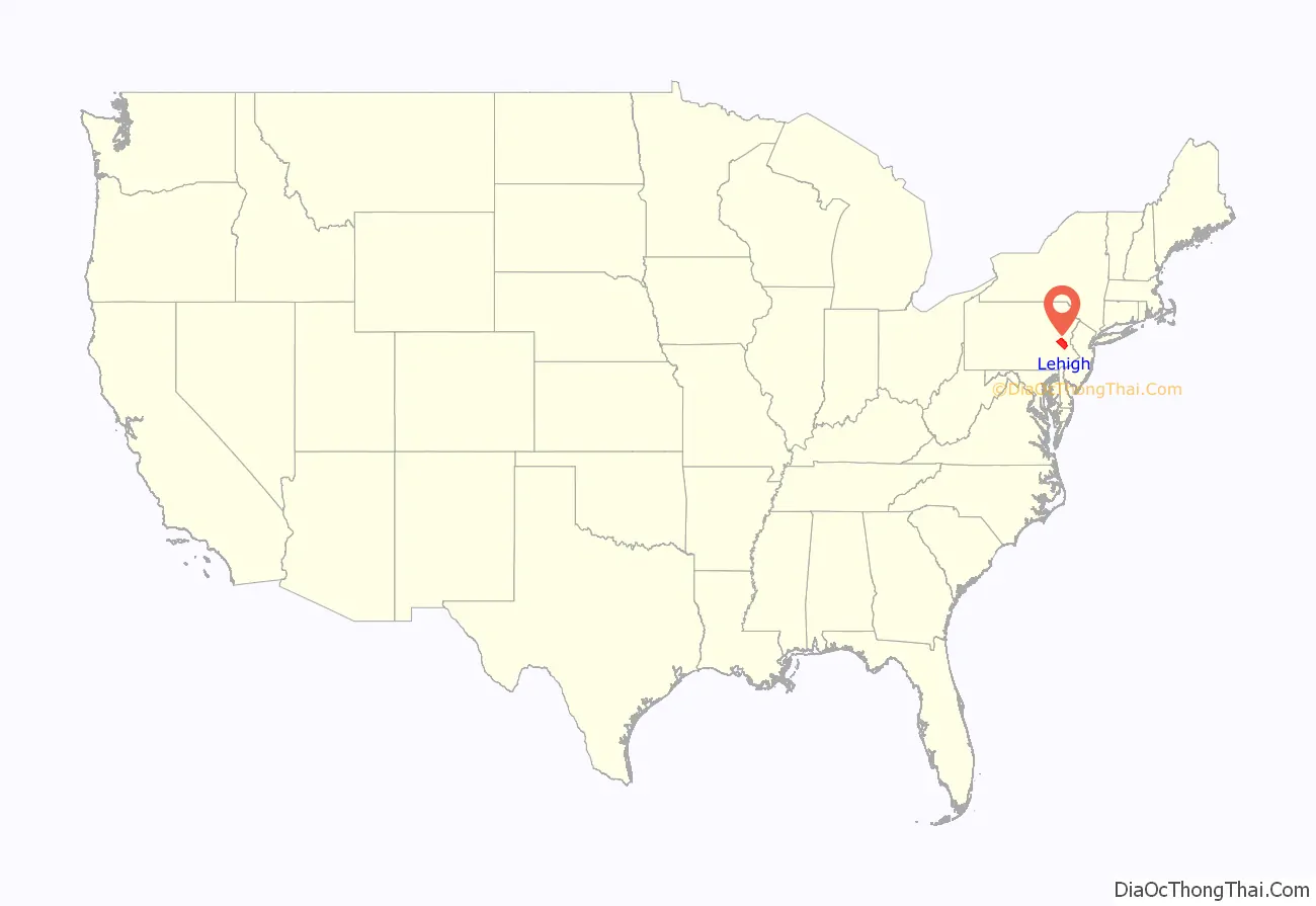
Lehigh County location map. Where is Lehigh County?
History
Settlement and founding
Lehigh County was first settled around 1730 and was formed in 1812 when Northampton County was divided into two counties. The county is named after the Lehigh River, a 109-mile-long (175 km) river that runs through the county and whose name is derived from the Lenape Indian term Lechauweki or Lechauwekink, meaning “where there are forks.” Shelter House, constructed in Emmaus in 1734 by Pennsylvania German settlers, is the oldest continuously occupied structure in both Lehigh County and Lehigh Valley and among the oldest still-standing building structures in the U.S. state of Pennsylvania.
American Revolution
Some of the first resistance to British colonialism, which led ultimately to the American Revolutionary War, began in present day Lehigh County. On December 21, 1774, patriots in the area formed one of the colonies’ first Committee of Observations. Following the Declaration of Independence, patriot militas pressured Tories out of Allentown and the surrounding area, and the colonial government in the area began to break down.
After Washington and the Continental Army were defeated at the Battle of Brandywine on September 11, 1777, the revolutionary capital of Philadelphia was left defenseless and Pennsylvania’s Supreme Executive Council ordered that eleven Philadelphia bells, including the Liberty Bell (then known as the State House Bell), be taken down and moved to present day Allentown (then called Northampton Towne) and hidden in the basement of Zion Reformed Church on present day West Hamilton Street to protect them from being melting down by the British Army for use as munitions. The Liberty Bell’s successful protection in Allentown is commemorated in the Liberty Bell Museum, located in Zion Reformed Church in Allentown.
Industrial Revolution
The opening of the Lehigh Canal beginning in 1827 transformed Allentown and Lehigh County from a rural agricultural area dominated by German-speaking people into an urbanized industrialized area and expanded the city’s commercial and industrial capacity greatly. With this, Lehigh County underwent significant industrialization, ultimately becoming a major 20th century center for heavy industry and manufacturing and one of several hubs for the Industrial Revolution.
American Civil War
Following the Union Army’s defeat at the Battle of Fort Sumter and Lincoln’s April 15, 1861 proclamation calling for state militia to provide 75,000 volunteer troops to defend the nation’s capital of Washington, D.C., Allentown deployed the Allen Infantry, also known as the Allen Guards and composed of volunteers from Allentown and its surrounding suburbs. The unit mustered in for duty on April 18, 1861. As the Civil War progressed, multiple Union Army units were drawn from Lehigh County, including roughly seventy percent of the 47th Pennsylvania Infantry Regiment.
On October 19, 1899, a monument in honor of the Lehigh County men killed in their volunteer service to preservation of the Union, the Soldiers and Sailors Monument, was erected at Seventh and Hamilton Streets in Center City Allentown where it still stands.
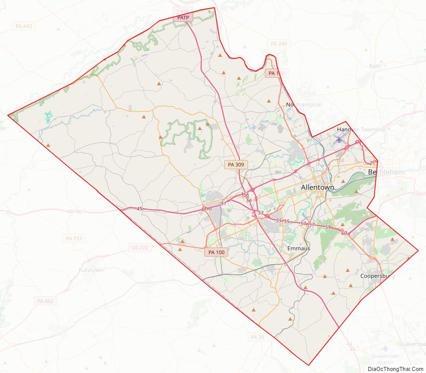
Lehigh County Road Map
Geography
Lehigh County has a total area of 348 square miles (900 km), 345 square miles (890 km) of which is land and 3.1 square miles (8.0 km) (0.9%) of which is water.
Topography
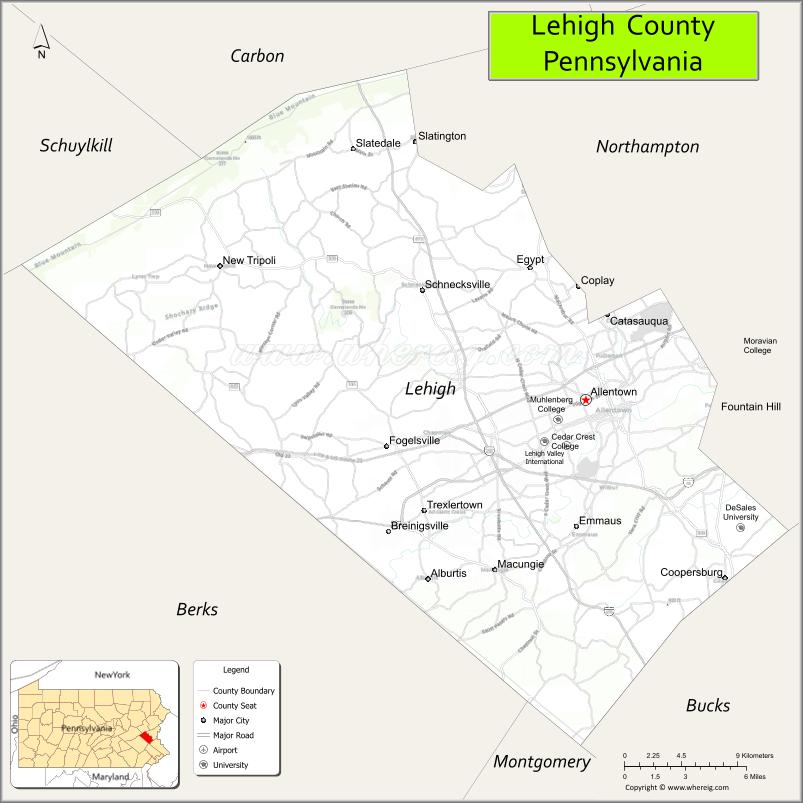
Lehigh County borders two Appalachian mountain ridges. To the north, the county borders Blue Mountain, which has an altitude of 1,300 to 1,604 feet (396 to 489 m). To the south, it is bordered by South Mountain, which has an altitude of 700 to 1,100 feet (210 to 340 m) and cuts through the southern portions of both Lehigh and Northampton counties. The Lehigh County’s highest point is near Germansville at Bake Oven Knob, a mass of Tuscarora conglomeratic rocks that rise about 100 feet (30 m) above the main Blue Mountain ridge in northwestern Heidelberg Township.
Lehigh County is part of the Delaware River watershed. Most of the county is drained by the Lehigh River and its tributaries, though the Schuylkill River also drains regions in the county’s south through Perkiomen Creek and (in the county’s northwest) through Maiden Creek.
Adjacent counties
- Berks County (west)
- Bucks County (southeast)
- Carbon County (north)
- Montgomery County (south)
- Northampton County (northeast)
- Schuylkill County (northwest)
Climate
Lehigh County’s climate falls in the humid continental climate zone. The variety is hot-summer (Dfa) except in the county’s higher elevation areas, where it is warm-summer (Dfb). Summers are typically hot and muggy, fall and spring are generally mild, and winter is cold. Precipitation is almost uniformly distributed throughout the year.
In Allentown, January lows average −6 °C (21 °F) and highs average 1.3 °C (34.3 °F). The lowest officially recorded temperature was −26.7 °C (−16.1 °F) in 1912. July lows average 17.6 °C (63.7 °F) and highs average 29.2 °C (84.6 °F) with an average relative humidity of 82%. The highest temperature on record was 40.6 °C (105.1 °F) in 1966. Early fall and mid-winter are generally driest with October being the driest month with only 74.7 mm of average precipitation.
Snowfall is variable with some winters bringing light snow and others bringing numerous significant snowstorms. Average snowfall is 82.3 centimetres (32.4 in) per year, with the months of January and February receiving the most now with just over 22.86 centimetres (9.00 in) in each of these months. Rainfall is generally spread throughout the year with eight to twelve wet days per month, at an average annual rate of 110.54 centimetres (43.52 in).
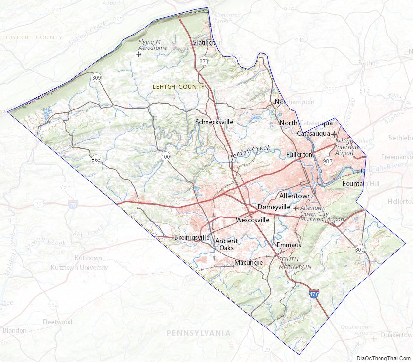
Lehigh County Topographic Map
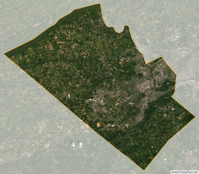
Lehigh County Satellite Map
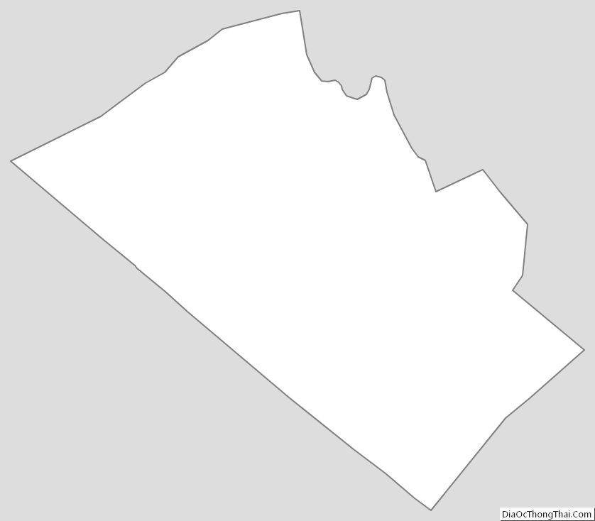
Lehigh County Outline Map
See also
Map of Pennsylvania State and its subdivision:- Adams
- Allegheny
- Armstrong
- Beaver
- Bedford
- Berks
- Blair
- Bradford
- Bucks
- Butler
- Cambria
- Cameron
- Carbon
- Centre
- Chester
- Clarion
- Clearfield
- Clinton
- Columbia
- Crawford
- Cumberland
- Dauphin
- Delaware
- Elk
- Erie
- Fayette
- Forest
- Franklin
- Fulton
- Greene
- Huntingdon
- Indiana
- Jefferson
- Juniata
- Lackawanna
- Lancaster
- Lawrence
- Lebanon
- Lehigh
- Luzerne
- Lycoming
- Mc Kean
- Mercer
- Mifflin
- Monroe
- Montgomery
- Montour
- Northampton
- Northumberland
- Perry
- Philadelphia
- Pike
- Potter
- Schuylkill
- Snyder
- Somerset
- Sullivan
- Susquehanna
- Tioga
- Union
- Venango
- Warren
- Washington
- Wayne
- Westmoreland
- Wyoming
- York
- Alabama
- Alaska
- Arizona
- Arkansas
- California
- Colorado
- Connecticut
- Delaware
- District of Columbia
- Florida
- Georgia
- Hawaii
- Idaho
- Illinois
- Indiana
- Iowa
- Kansas
- Kentucky
- Louisiana
- Maine
- Maryland
- Massachusetts
- Michigan
- Minnesota
- Mississippi
- Missouri
- Montana
- Nebraska
- Nevada
- New Hampshire
- New Jersey
- New Mexico
- New York
- North Carolina
- North Dakota
- Ohio
- Oklahoma
- Oregon
- Pennsylvania
- Rhode Island
- South Carolina
- South Dakota
- Tennessee
- Texas
- Utah
- Vermont
- Virginia
- Washington
- West Virginia
- Wisconsin
- Wyoming