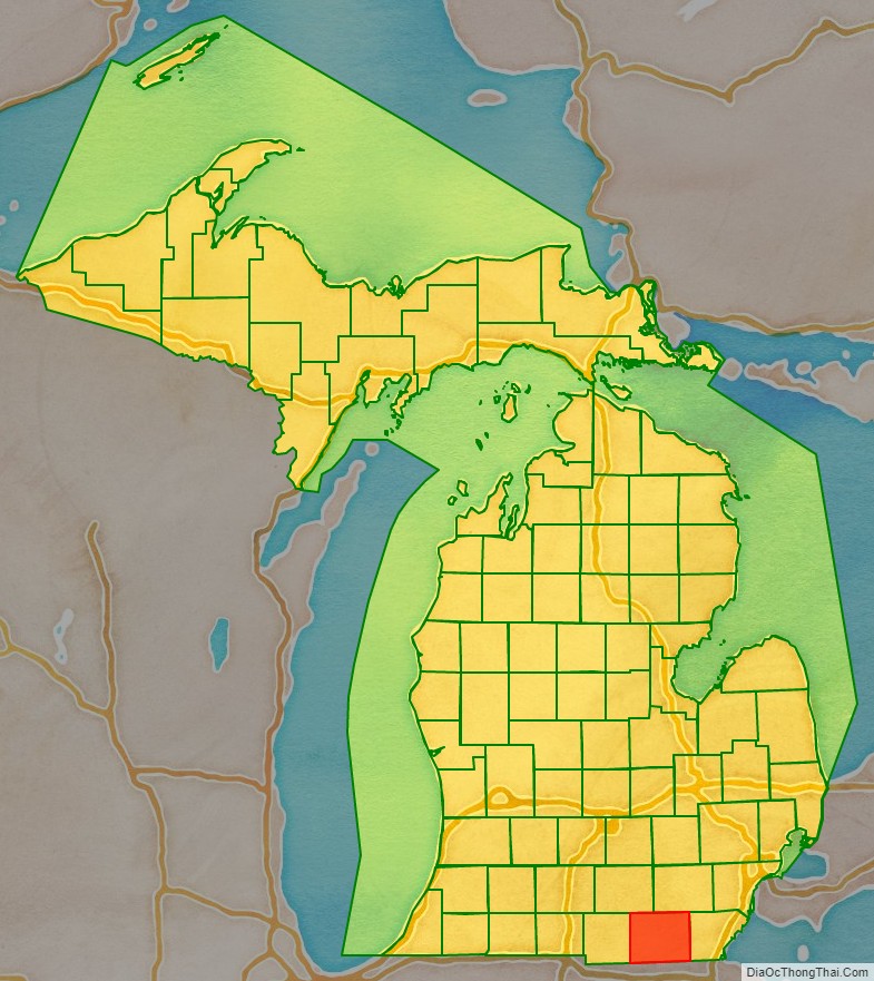
Lenawee County (/ˈlɛnəweɪ/ LEN-ə-way) is a county located in the U.S. state of Michigan. As of the 2020 United States Census, the population was 99,423. The county seat is Adrian. The county was created in 1822, from territory partitioned from Monroe County. Its governing structure was organized in 1826.
Lenawee County comprises the Adrian, MI Micropolitan Statistical Area. It is served by the Toledo Media market.
Lenawee County is home to the Potawatomi, Ottawa, Chippewa, Iroquois, Miami, Sauk, Fox, Mascoutens and Huron tribes.
| Name: | Lenawee County |
|---|---|
| FIPS code: | 26-091 |
| State: | Michigan |
| Founded: | 1822 |
| Seat: | Adrian |
| Largest city: | Adrian |
| Total Area: | 761 sq mi (1,970 km²) |
| Land Area: | 750 sq mi (1,900 km²) |
| Total Population: | 99,423 |
| Population Density: | 130/sq mi (51/km²) |
| Time zone: | UTC−5 (Eastern) |
| Summer Time Zone (DST): | UTC−4 (EDT) |
| Website: | www.lenawee.mi.us |
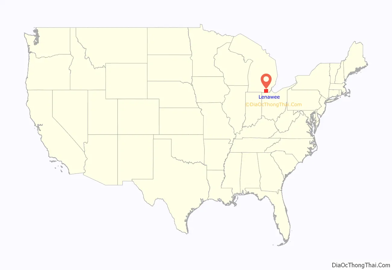
Lenawee County location map. Where is Lenawee County?
History
The county owes its formation to the 1807 Treaty of Detroit, by which the Ottawa, Ojibwe (called Chippewa by the Americans); Wyandot and Potawatomi nations ceded their claims to the United States of their traditional territories in today’s southeast Michigan. However, many leaders of these tribes believed that the treaty was coercive and opposed it. They began to collaborate and organize a confederacy of resistance, led by Chief Tecumseh (Shawnee). They wanted through warfare and alliance with Great Britain to force the US from their territory. This was the period of the US War of 1812 with Great Britain. During this time, the US fought the Battle of Tippecanoe, the Battle of Lake Erie, and the Battle of Thames in this area, against both British and indigenous forces.
The United States won the Battle of the Thames in 1813, defeating the British and their allies. Tecumseh died in the battle and his confederacy dissolved. (He became the namesake for the city of the same name in Lenawee County.) As a result of this defeat, the confederacy leaders agreed to a peace treaty, the Treaty of Ghent, which ended the war with the indigenous peoples. It affirmed US control of the land demarcated in the Treaty of Detroit, comprising much of the future state of Michigan, including what became organized as Lenawee County in the United States.
The US continued efforts to force the tribes from these western territories. In 1830, President Andrew Jackson signed the Indian Removal Act to authorize the government to relocate Indigenous peoples from territories east of the Mississippi River and move them west, to what became known as Indian Territory (and later Oklahoma). While Indian Removal was directed specifically at Southeast Indian tribes, it was also applied to those further north in the Midwest.
Lenawee County was organized in 1826, after being authorized and described by the Michigan legislature in 1822. It was taken from Monroe County, Michigan.
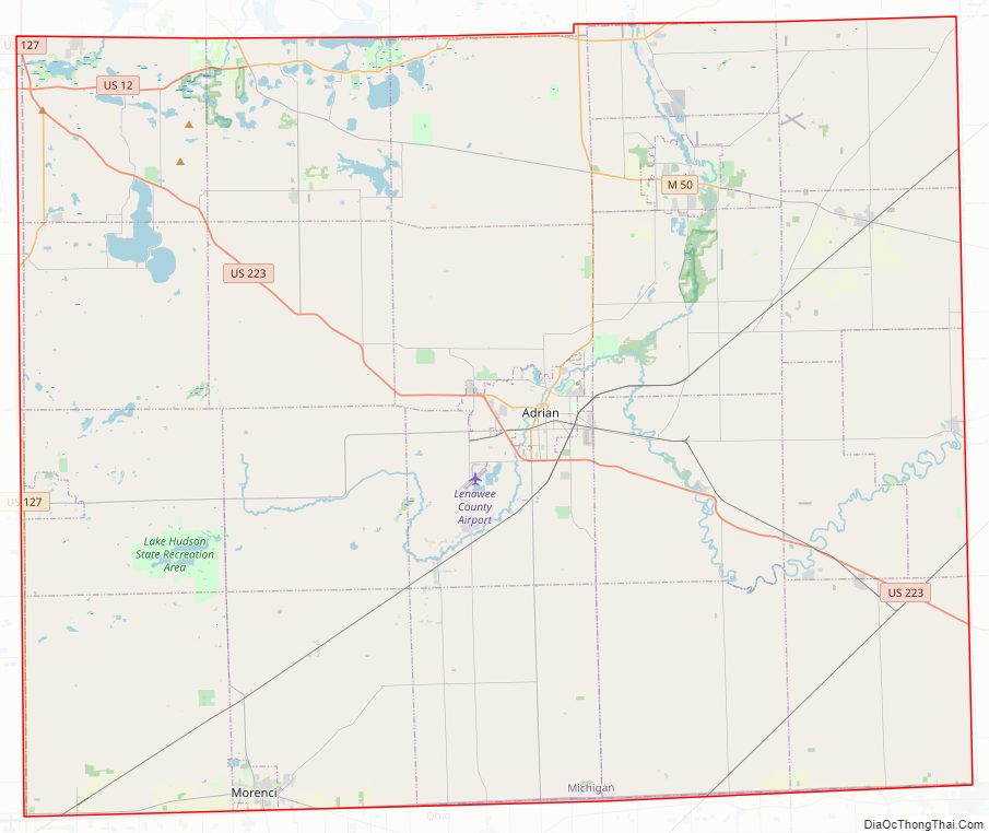
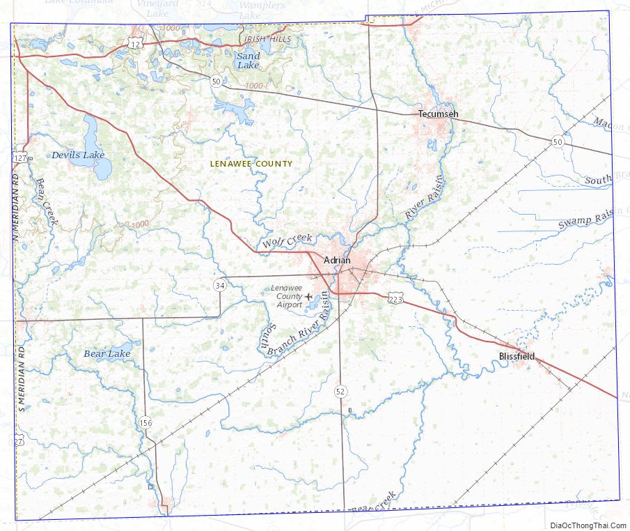
Lenawee County Road Map
Geography
According to the US Census Bureau, the county has a total area of 761 square miles (1,970 km), of which 750 square miles (1,900 km) is land and 12 square miles (31 km) (1.6%) is water. Lenawee County is considered to be part of Southeastern Michigan.
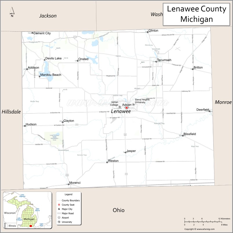
Adjacent counties
- Jackson County, northwest
- Washtenaw County, northeast
- Monroe County, east
- Lucas County, Ohio, southeast
- Fulton County, Ohio, southwest
- Hillsdale County, west
Major highways
- I-73 (future)
- US 12
- US 127
- US 223
- M-34
- M-50
- M-52
- M-124
- M-156
Within Lenawee County’s townships, north–south roads are referred to as “highways”, while east–west roads are referred to as “roads”.
Lenawee County Topographic Map
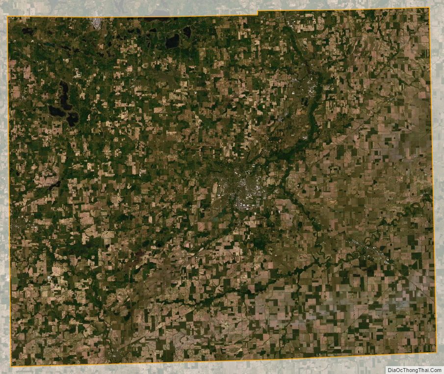
Lenawee County Satellite Map
Lenawee County Outline Map

See also
Map of Michigan State and its subdivision:- Alcona
- Alger
- Allegan
- Alpena
- Antrim
- Arenac
- Baraga
- Barry
- Bay
- Benzie
- Berrien
- Branch
- Calhoun
- Cass
- Charlevoix
- Cheboygan
- Chippewa
- Clare
- Clinton
- Crawford
- Delta
- Dickinson
- Eaton
- Emmet
- Genesee
- Gladwin
- Gogebic
- Grand Traverse
- Gratiot
- Hillsdale
- Houghton
- Huron
- Ingham
- Ionia
- Iosco
- Iron
- Isabella
- Jackson
- Kalamazoo
- Kalkaska
- Kent
- Keweenaw
- Lake
- Lake Hurron
- Lake Michigan
- Lake St. Clair
- Lake Superior
- Lapeer
- Leelanau
- Lenawee
- Livingston
- Luce
- Mackinac
- Macomb
- Manistee
- Marquette
- Mason
- Mecosta
- Menominee
- Midland
- Missaukee
- Monroe
- Montcalm
- Montmorency
- Muskegon
- Newaygo
- Oakland
- Oceana
- Ogemaw
- Ontonagon
- Osceola
- Oscoda
- Otsego
- Ottawa
- Presque Isle
- Roscommon
- Saginaw
- Saint Clair
- Saint Joseph
- Sanilac
- Schoolcraft
- Shiawassee
- Tuscola
- Van Buren
- Washtenaw
- Wayne
- Wexford
- Alabama
- Alaska
- Arizona
- Arkansas
- California
- Colorado
- Connecticut
- Delaware
- District of Columbia
- Florida
- Georgia
- Hawaii
- Idaho
- Illinois
- Indiana
- Iowa
- Kansas
- Kentucky
- Louisiana
- Maine
- Maryland
- Massachusetts
- Michigan
- Minnesota
- Mississippi
- Missouri
- Montana
- Nebraska
- Nevada
- New Hampshire
- New Jersey
- New Mexico
- New York
- North Carolina
- North Dakota
- Ohio
- Oklahoma
- Oregon
- Pennsylvania
- Rhode Island
- South Carolina
- South Dakota
- Tennessee
- Texas
- Utah
- Vermont
- Virginia
- Washington
- West Virginia
- Wisconsin
- Wyoming