Lewis County is a county located in the U.S. state of Tennessee. As of the 2020 census, the population was 12,582. Its county seat is Hohenwald. The county is named for explorer Meriwether Lewis, who died and was buried at Grinder’s Stand near Hohenwald in 1809.
| Name: | Lewis County |
|---|---|
| FIPS code: | 47-101 |
| State: | Tennessee |
| Founded: | December 23, 1843 |
| Named for: | Meriwether Lewis |
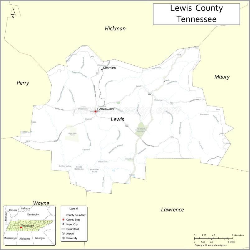
| Seat: | Hohenwald |
| Largest city: | Hohenwald |
| Total Area: | 282 sq mi (730 km²) |
| Land Area: | 282 sq mi (730 km²) |
| Total Population: | 12,582 |
| Population Density: | 43/sq mi (17/km²) |
| Time zone: | UTC−6 (Central) |
| Summer Time Zone (DST): | UTC−5 (CDT) |
| Website: | www.lewiscountytn.com |
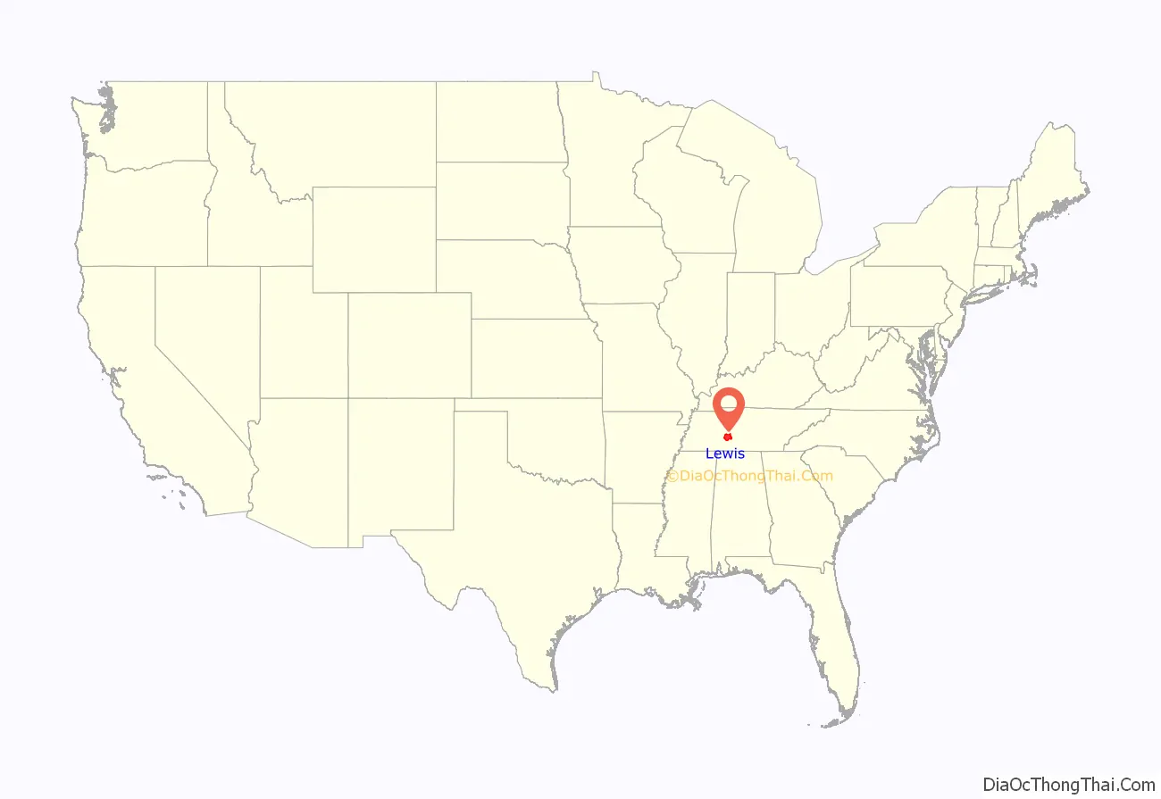
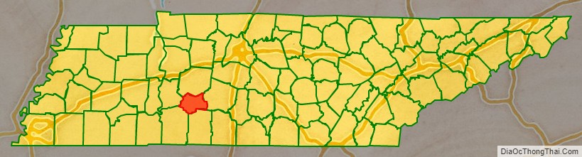
Lewis County location map. Where is Lewis County?
History
Lewis County was formed in 1843 from parts of Perry, Hickman, Lawrence, Maury and Wayne counties. It was named for explorer Meriwether Lewis of the Lewis and Clark Expedition. Lewis’s grave is located at the geographic center of the county. The bill for its creation was proposed by Powhatan Gordon in the Tennessee State Senate.
On October 7, 2009, a ceremony was held at the cemetery to commemorate the bicentennial of Lewis’s death. A bust of Lewis was presented to the National Park Service, which manages the site.
Lewis County was the site of the Cane Creek Massacre.
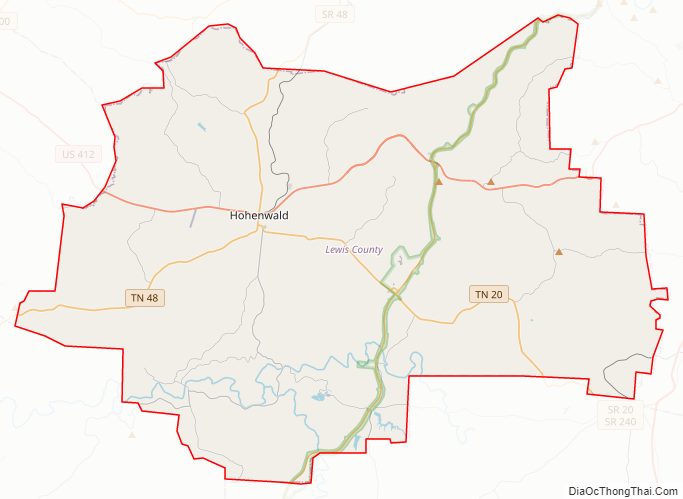
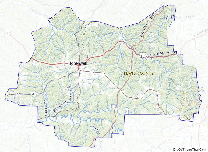
Lewis County Road Map
Geography
According to the U.S. Census Bureau, the county has a total area of 282 square miles (730 km), of which 282 square miles (730 km) is land and 0.4 square miles (1.0 km) (0.1%) is water.
Adjacent counties
- Hickman County (north)
- Maury County (east)
- Lawrence County (south)
- Wayne County (southwest)
- Perry County (west)
National protected area
- Natchez Trace Parkway (part)
State protected areas
- Auntney Hollow State Natural Area
- Devil’s Backbone State Natural Area
- Dry Branch State Natural Area
- Hick Hill Wildlife Management Area
- Langford Branch State Natural Area
- Laurel Hill Wildlife Management Area
- Lewis State Forest
Major highways
- US 412
- SR 20
- SR 48
- SR 99
Lewis County Topographic Map
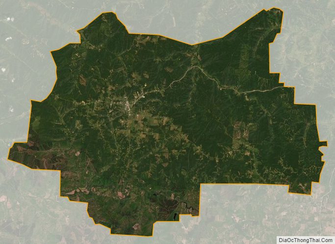
Lewis County Satellite Map
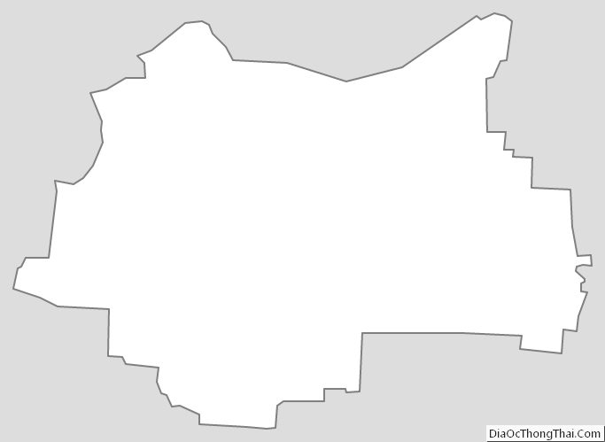
Lewis County Outline Map
See also
Map of Tennessee State and its subdivision:- Anderson
- Bedford
- Benton
- Bledsoe
- Blount
- Bradley
- Campbell
- Cannon
- Carroll
- Carter
- Cheatham
- Chester
- Claiborne
- Clay
- Cocke
- Coffee
- Crockett
- Cumberland
- Davidson
- Decatur
- DeKalb
- Dickson
- Dyer
- Fayette
- Fentress
- Franklin
- Gibson
- Giles
- Grainger
- Greene
- Grundy
- Hamblen
- Hamilton
- Hancock
- Hardeman
- Hardin
- Hawkins
- Haywood
- Henderson
- Henry
- Hickman
- Houston
- Humphreys
- Jackson
- Jefferson
- Johnson
- Knox
- Lake
- Lauderdale
- Lawrence
- Lewis
- Lincoln
- Loudon
- Macon
- Madison
- Marion
- Marshall
- Maury
- McMinn
- McNairy
- Meigs
- Monroe
- Montgomery
- Moore
- Morgan
- Obion
- Overton
- Perry
- Pickett
- Polk
- Putnam
- Rhea
- Roane
- Robertson
- Rutherford
- Scott
- Sequatchie
- Sevier
- Shelby
- Smith
- Stewart
- Sullivan
- Sumner
- Tipton
- Trousdale
- Unicoi
- Union
- Van Buren
- Warren
- Washington
- Wayne
- Weakley
- White
- Williamson
- Wilson
- Alabama
- Alaska
- Arizona
- Arkansas
- California
- Colorado
- Connecticut
- Delaware
- District of Columbia
- Florida
- Georgia
- Hawaii
- Idaho
- Illinois
- Indiana
- Iowa
- Kansas
- Kentucky
- Louisiana
- Maine
- Maryland
- Massachusetts
- Michigan
- Minnesota
- Mississippi
- Missouri
- Montana
- Nebraska
- Nevada
- New Hampshire
- New Jersey
- New Mexico
- New York
- North Carolina
- North Dakota
- Ohio
- Oklahoma
- Oregon
- Pennsylvania
- Rhode Island
- South Carolina
- South Dakota
- Tennessee
- Texas
- Utah
- Vermont
- Virginia
- Washington
- West Virginia
- Wisconsin
- Wyoming