Liberty County is a county in the U.S. state of Texas. As of the 2020 census, its population was 91,628. The county seat is Liberty. The county was created in 1831 as a municipality in Mexico as Villa de la Santísima Trinidad de la Libertad by commissioner José Francisco Madero and organized as a county of the Republic of Texas in 1837. Its name was anglisized as Liberty based on the ideal of American liberty.
Liberty County is included in the Houston-The Woodlands–Sugar Land, TX metropolitan statistical area.
| Name: | Liberty County |
|---|---|
| FIPS code: | 48-291 |
| State: | Texas |
| Founded: | 1837 |
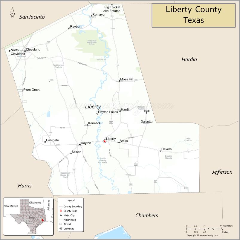
| Seat: | Liberty |
| Largest city: | Liberty |
| Total Area: | 1,176 sq mi (3,050 km²) |
| Land Area: | 1,158 sq mi (3,000 km²) |
| Total Population: | 91,628 |
| Population Density: | 78/sq mi (30/km²) |
| Time zone: | UTC−6 (Central) |
| Summer Time Zone (DST): | UTC−5 (CDT) |
| Website: | www.co.liberty.tx.us |
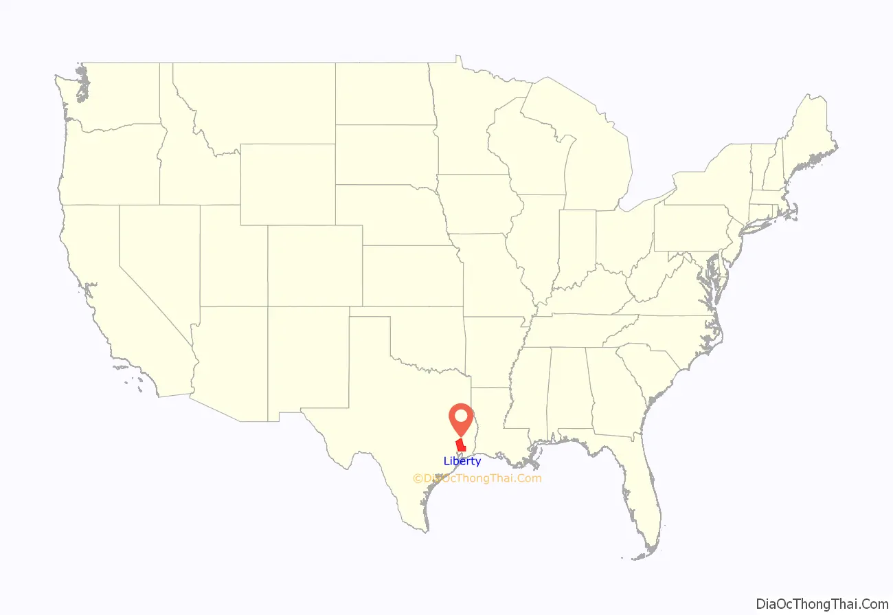
Liberty County location map. Where is Liberty County?
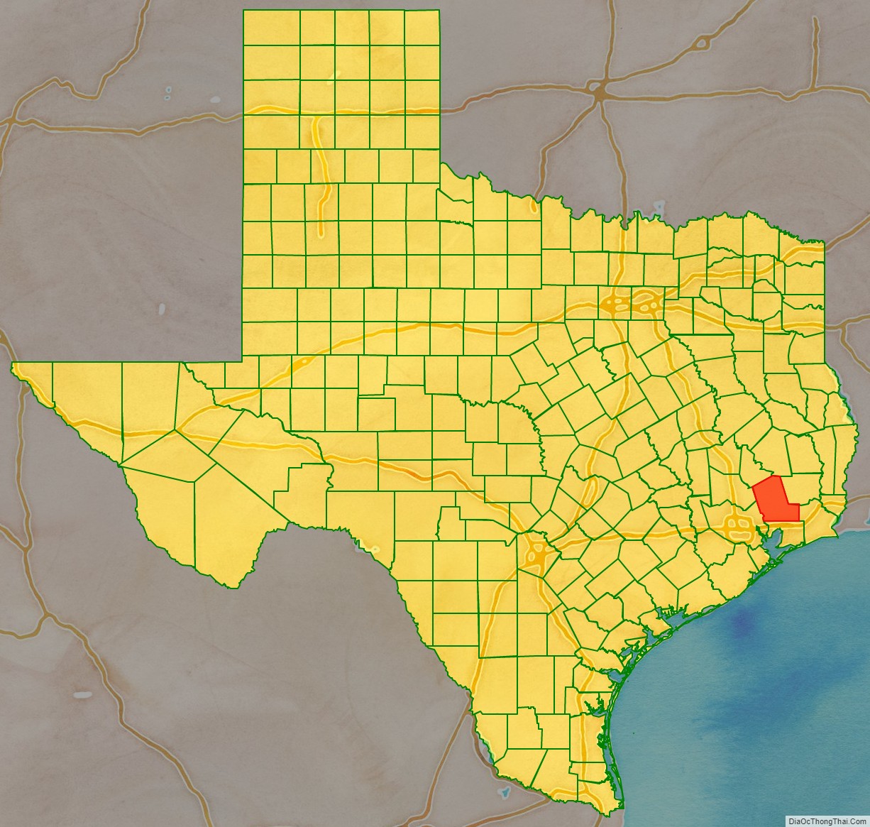
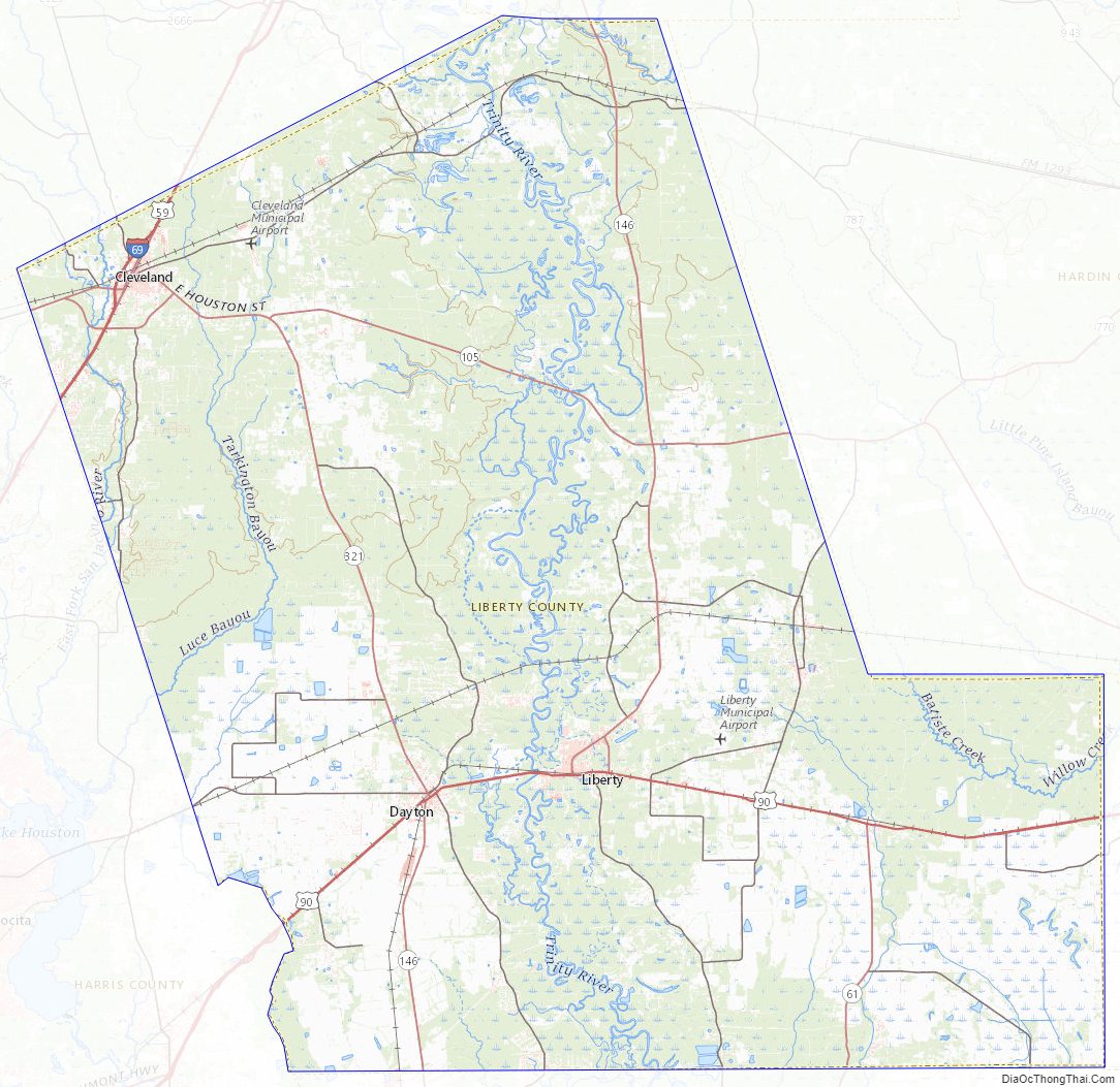
Liberty County Road Map
Geography
According to the U.S. Census Bureau, the county has a total area of 1,176 sq mi (3,050 km), of which 18 sq mi (47 km) (1.5%) are covered by water.
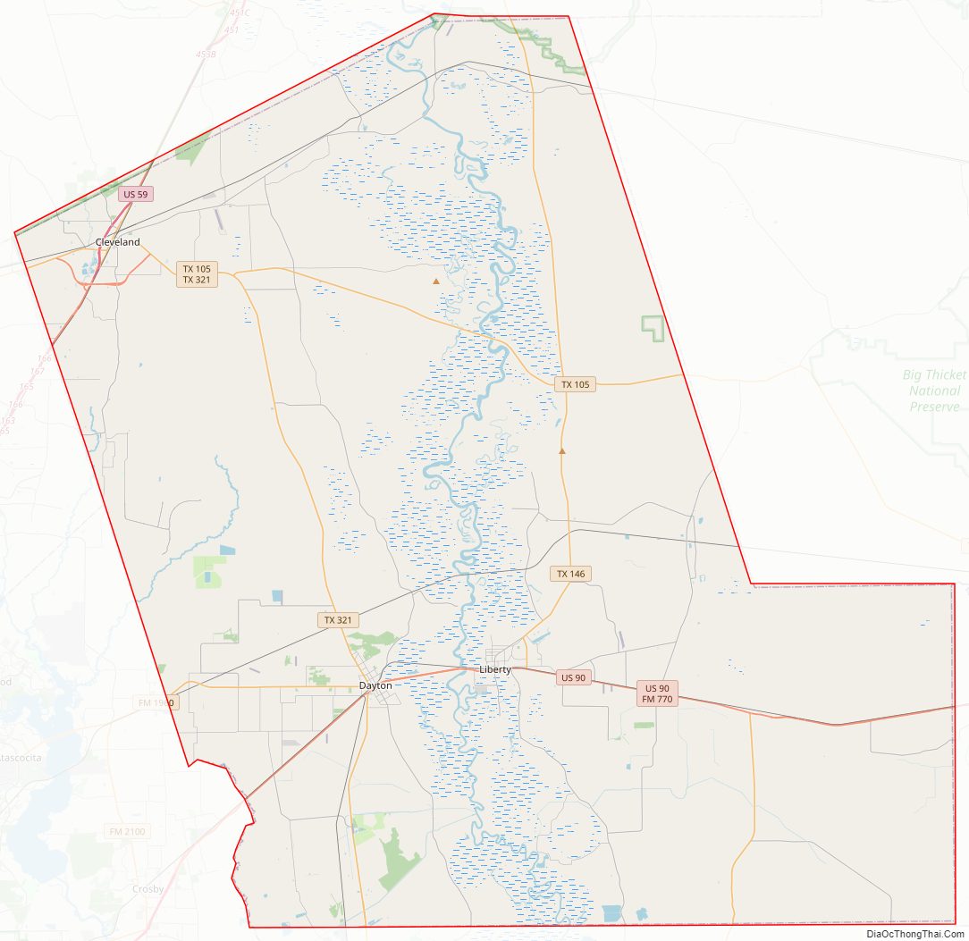
The Trinity River flows through this county, dividing the county roughly in half. The river begins on the northern border of Liberty County, forming the San Jacinto – Polk County line through the Liberty County line. The east fork of the San Jacinto River flows through far northeast parts of the county, flowing through Cleveland. Tarkington Bayou begins in the Sam Houston National Forest in San Jacinto County, working its way south through northeast and east Liberty County and joining other feeders, before traveling into Harris County and emptying into Galveston Bay. The highest point in Liberty County is “Davis Hill”, the roof of a salt dome in the northern part of the county.
Adjacent counties
- Polk County (north)
- Hardin County (east)
- Jefferson County (southeast)
- Chambers County (south)
- Harris County (southwest)
- Montgomery County (west)
- San Jacinto County (northwest)
National protected areas
- Big Thicket National Preserve (part)
- Trinity River National Wildlife Refuge
Liberty County Topographic Map
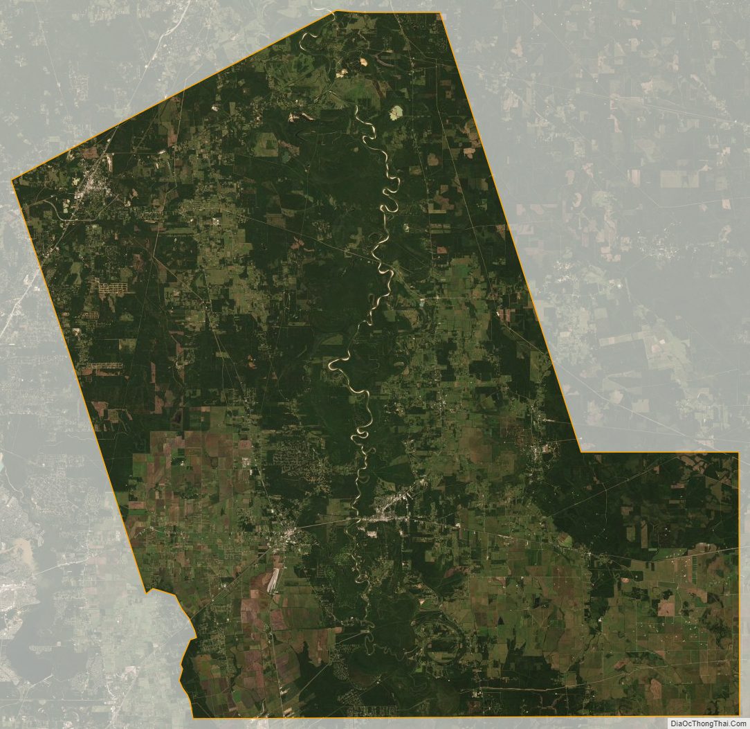
Liberty County Satellite Map
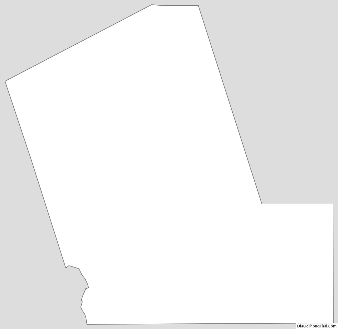
Liberty County Outline Map
See also
Map of Texas State and its subdivision:- Anderson
- Andrews
- Angelina
- Aransas
- Archer
- Armstrong
- Atascosa
- Austin
- Bailey
- Bandera
- Bastrop
- Baylor
- Bee
- Bell
- Bexar
- Blanco
- Borden
- Bosque
- Bowie
- Brazoria
- Brazos
- Brewster
- Briscoe
- Brooks
- Brown
- Burleson
- Burnet
- Caldwell
- Calhoun
- Callahan
- Cameron
- Camp
- Carson
- Cass
- Castro
- Chambers
- Cherokee
- Childress
- Clay
- Cochran
- Coke
- Coleman
- Collin
- Collingsworth
- Colorado
- Comal
- Comanche
- Concho
- Cooke
- Coryell
- Cottle
- Crane
- Crockett
- Crosby
- Culberson
- Dallam
- Dallas
- Dawson
- Deaf Smith
- Delta
- Denton
- Dewitt
- Dickens
- Dimmit
- Donley
- Duval
- Eastland
- Ector
- Edwards
- El Paso
- Ellis
- Erath
- Falls
- Fannin
- Fayette
- Fisher
- Floyd
- Foard
- Fort Bend
- Franklin
- Freestone
- Frio
- Gaines
- Galveston
- Garza
- Gillespie
- Glasscock
- Goliad
- Gonzales
- Gray
- Grayson
- Gregg
- Grimes
- Guadalupe
- Hale
- Hall
- Hamilton
- Hansford
- Hardeman
- Hardin
- Harris
- Harrison
- Hartley
- Haskell
- Hays
- Hemphill
- Henderson
- Hidalgo
- Hill
- Hockley
- Hood
- Hopkins
- Houston
- Howard
- Hudspeth
- Hunt
- Hutchinson
- Irion
- Jack
- Jackson
- Jasper
- Jeff Davis
- Jefferson
- Jim Hogg
- Jim Wells
- Johnson
- Jones
- Karnes
- Kaufman
- Kendall
- Kenedy
- Kent
- Kerr
- Kimble
- King
- Kinney
- Kleberg
- Knox
- La Salle
- Lamar
- Lamb
- Lampasas
- Lavaca
- Lee
- Leon
- Liberty
- Limestone
- Lipscomb
- Live Oak
- Llano
- Loving
- Lubbock
- Lynn
- Madison
- Marion
- Martin
- Mason
- Matagorda
- Maverick
- McCulloch
- McLennan
- McMullen
- Medina
- Menard
- Midland
- Milam
- Mills
- Mitchell
- Montague
- Montgomery
- Moore
- Morris
- Motley
- Nacogdoches
- Navarro
- Newton
- Nolan
- Nueces
- Ochiltree
- Oldham
- Orange
- Palo Pinto
- Panola
- Parker
- Parmer
- Pecos
- Polk
- Potter
- Presidio
- Rains
- Randall
- Reagan
- Real
- Red River
- Reeves
- Refugio
- Roberts
- Robertson
- Rockwall
- Runnels
- Rusk
- Sabine
- San Augustine
- San Jacinto
- San Patricio
- San Saba
- Schleicher
- Scurry
- Shackelford
- Shelby
- Sherman
- Smith
- Somervell
- Starr
- Stephens
- Sterling
- Stonewall
- Sutton
- Swisher
- Tarrant
- Taylor
- Terrell
- Terry
- Throckmorton
- Titus
- Tom Green
- Travis
- Trinity
- Tyler
- Upshur
- Upton
- Uvalde
- Val Verde
- Van Zandt
- Victoria
- Walker
- Waller
- Ward
- Washington
- Webb
- Wharton
- Wheeler
- Wichita
- Wilbarger
- Willacy
- Williamson
- Wilson
- Winkler
- Wise
- Wood
- Yoakum
- Young
- Zapata
- Zavala
- Alabama
- Alaska
- Arizona
- Arkansas
- California
- Colorado
- Connecticut
- Delaware
- District of Columbia
- Florida
- Georgia
- Hawaii
- Idaho
- Illinois
- Indiana
- Iowa
- Kansas
- Kentucky
- Louisiana
- Maine
- Maryland
- Massachusetts
- Michigan
- Minnesota
- Mississippi
- Missouri
- Montana
- Nebraska
- Nevada
- New Hampshire
- New Jersey
- New Mexico
- New York
- North Carolina
- North Dakota
- Ohio
- Oklahoma
- Oregon
- Pennsylvania
- Rhode Island
- South Carolina
- South Dakota
- Tennessee
- Texas
- Utah
- Vermont
- Virginia
- Washington
- West Virginia
- Wisconsin
- Wyoming