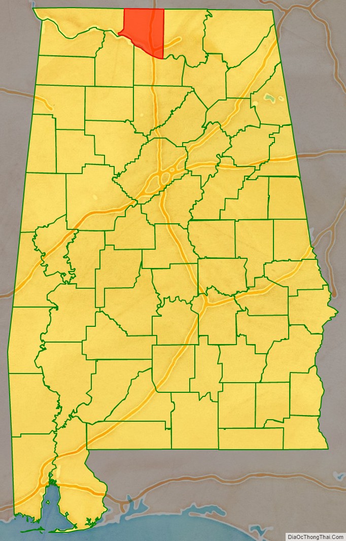
Limestone County is a county of the U.S. state of Alabama. As of the 2020 census, the county’s population was 103,570. Its county seat is Athens. The county is named after Limestone Creek. Limestone County is included in the Huntsville, AL Metropolitan Statistical Area.
| Name: | Limestone County |
|---|---|
| FIPS code: | 01-083 |
| State: | Alabama |
| Founded: | February 6, 1818 |
| Named for: | Limestone Creek |
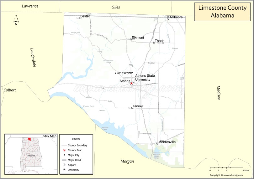
| Seat: | Athens |
| Largest city: | Athens |
| Total Area: | 607 sq mi (1,570 km²) |
| Land Area: | 560 sq mi (1,500 km²) |
| Total Population: | 103,570 |
| Population Density: | 170/sq mi (66/km²) |
| Time zone: | UTC−6 (Central) |
| Summer Time Zone (DST): | UTC−5 (CDT) |
| Website: | limestonecounty-al.gov |
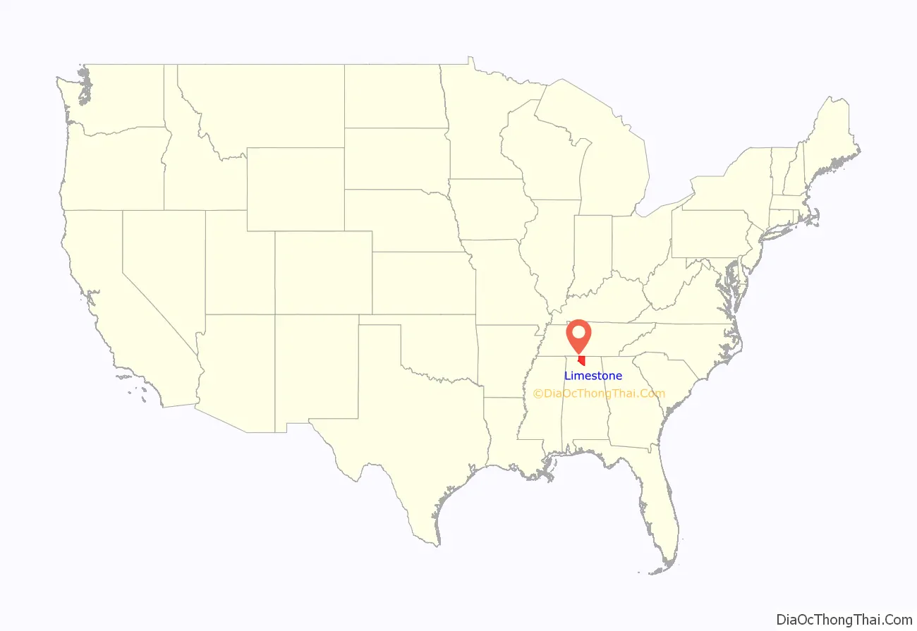
Limestone County location map. Where is Limestone County?
History
Limestone County was established by the Alabama Territorial legislature on February 6, 1818. On November 27, 1821, the Alabama State legislature passed an Act that altered the boundary of Limestone County to include the area east of the mouth of the Elk River with the Tennessee River. At the time, that area was a part of Lauderdale County.
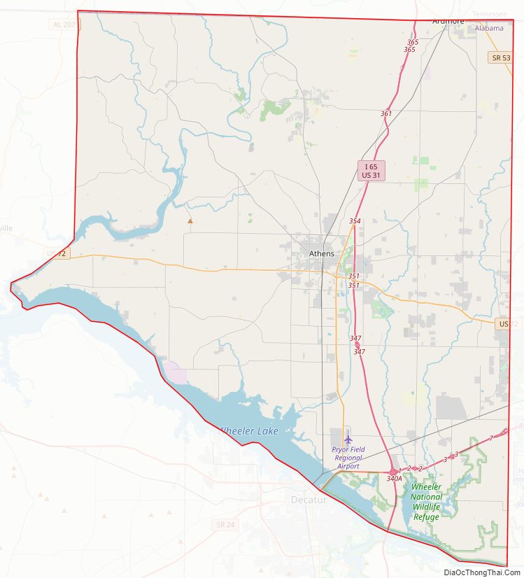
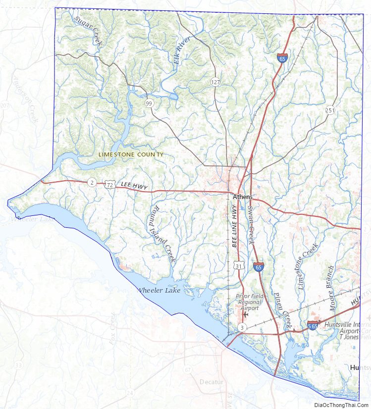
Limestone County Road Map
Geography
According to the United States Census Bureau, the county has a total area of 607 square miles (1,570 km), of which 560 square miles (1,500 km) is land and 47 square miles (120 km) (7.8%) is water. It is the third smallest county in Alabama by land area.
River
- Tennessee River
- Elk River
Adjacent counties
- Giles County, Tennessee – north
- Lincoln County, Tennessee – northeast
- Madison County, Alabama – east
- Morgan County, Alabama – southeast
- Lawrence County, Alabama – southwest
- Lauderdale County, Alabama – west
National protected area
- Wheeler National Wildlife Refuge (part)
Limestone County Topographic Map
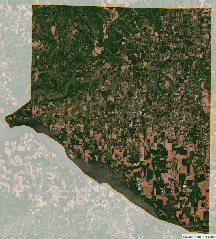
Limestone County Satellite Map
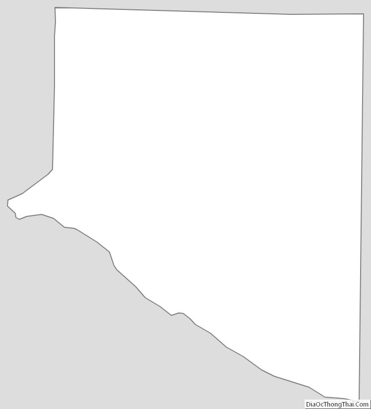
Limestone County Outline Map
See also
Map of Alabama State and its subdivision:- Autauga
- Baldwin
- Barbour
- Bibb
- Blount
- Bullock
- Butler
- Calhoun
- Chambers
- Cherokee
- Chilton
- Choctaw
- Clarke
- Clay
- Cleburne
- Coffee
- Colbert
- Conecuh
- Coosa
- Covington
- Crenshaw
- Cullman
- Dale
- Dallas
- De Kalb
- Elmore
- Escambia
- Etowah
- Fayette
- Franklin
- Geneva
- Greene
- Hale
- Henry
- Houston
- Jackson
- Jefferson
- Lamar
- Lauderdale
- Lawrence
- Lee
- Limestone
- Lowndes
- Macon
- Madison
- Marengo
- Marion
- Marshall
- Mobile
- Monroe
- Montgomery
- Morgan
- Perry
- Pickens
- Pike
- Randolph
- Russell
- Saint Clair
- Shelby
- Sumter
- Talladega
- Tallapoosa
- Tuscaloosa
- Walker
- Washington
- Wilcox
- Winston
- Alabama
- Alaska
- Arizona
- Arkansas
- California
- Colorado
- Connecticut
- Delaware
- District of Columbia
- Florida
- Georgia
- Hawaii
- Idaho
- Illinois
- Indiana
- Iowa
- Kansas
- Kentucky
- Louisiana
- Maine
- Maryland
- Massachusetts
- Michigan
- Minnesota
- Mississippi
- Missouri
- Montana
- Nebraska
- Nevada
- New Hampshire
- New Jersey
- New Mexico
- New York
- North Carolina
- North Dakota
- Ohio
- Oklahoma
- Oregon
- Pennsylvania
- Rhode Island
- South Carolina
- South Dakota
- Tennessee
- Texas
- Utah
- Vermont
- Virginia
- Washington
- West Virginia
- Wisconsin
- Wyoming