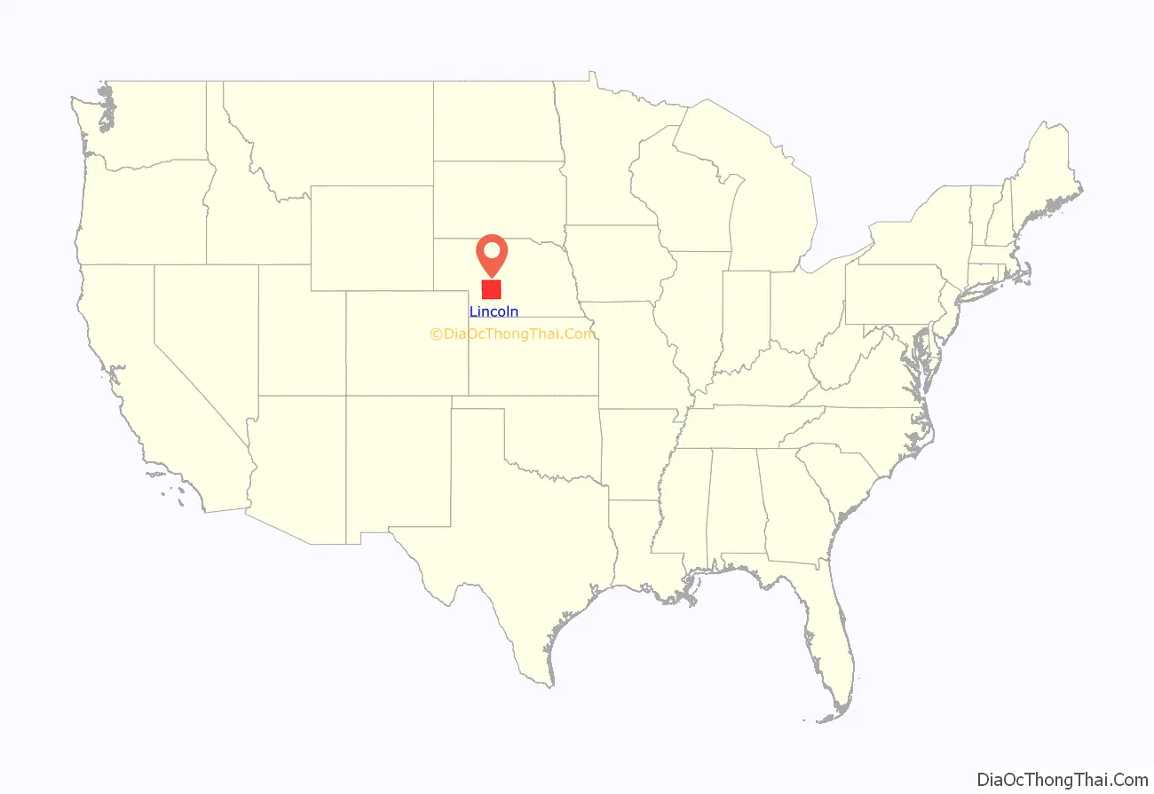
Lincoln County is a county located in the U.S. state of Nebraska. As of the 2020 census, the population was 34,676. Its county seat is North Platte. Despite the county’s name, the state capital city of Lincoln is not in or near Lincoln County. The city of Lincoln is, instead, located more than 200 miles further to the east in Lancaster County.
Lincoln County is part of the North Platte, Nebraska Micropolitan Statistical Area.
In the Nebraska license plate system, Lincoln County is represented by the prefix 15 (it had the fifteenth-largest number of vehicles registered for a state county when the license plate system was established in 1922).
| Name: | Lincoln County |
|---|---|
| FIPS code: | 31-111 |
| State: | Nebraska |
| Founded: | 1866 |
| Named for: | Abraham Lincoln |
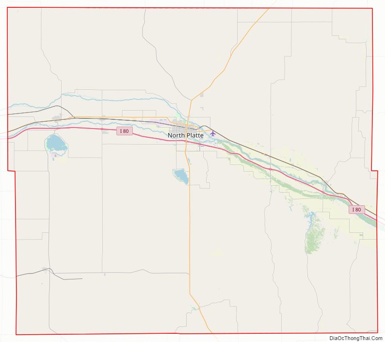
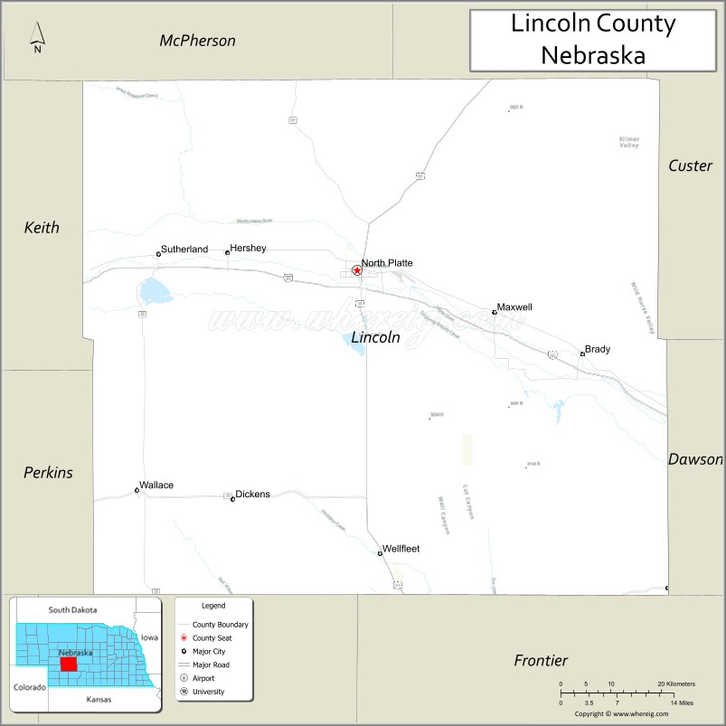
| Seat: | North Platte |
| Largest city: | North Platte |
| Total Area: | 2,575 sq mi (6,670 km²) |
| Land Area: | 2,564 sq mi (6,640 km²) |
| Total Population: | 34,676 |
| Population Density: | 14.1/sq mi (5.4/km²) |
| Time zone: | UTC−6 (Central) |
| Summer Time Zone (DST): | UTC−5 (CDT) |
| Website: | www.co.lincoln.ne.us |
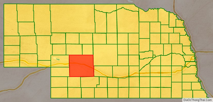
Lincoln County location map. Where is Lincoln County?
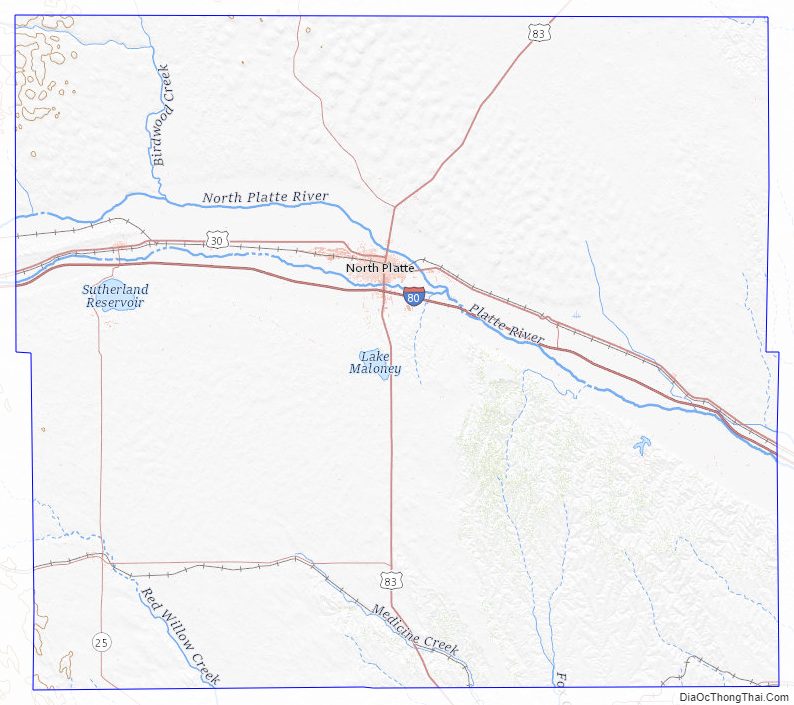
Lincoln County Road Map
Geography
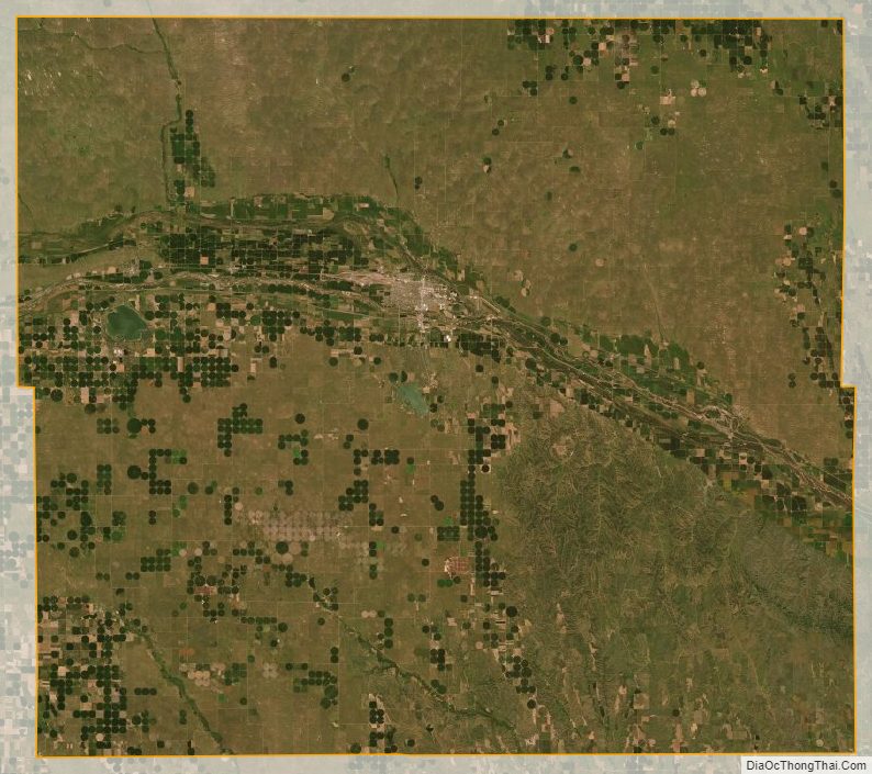
The terrain of Lincoln County consists of low rolling hills cut by gullies, sloping to the east-southeast. The land is generally given to agriculture, with considerable center pivot irrigation employed. The North Platte River flows eastward through the upper center of the county. Likewise, the South Platte River flows eastward through the lower center of the county to its junction with North Platte in eastern Lincoln County, to form the Platte River which flows ESE out of the county. The county has a total area of 2,575 square miles (6,670 km), of which 2,564 square miles (6,640 km) is land and 11 square miles (28 km) (0.4%) is water. It is the third-largest county in Nebraska by area.
Most of Nebraska’s 93 counties (the eastern 2/3, including Lincoln County) observe Central Time; the western counties observe Mountain Time. Lincoln County is the westernmost of the Nebraska counties to observe Central Time.
Major highways
- Interstate 80
- U.S. Highway 30
- U.S. Highway 83
- Nebraska Highway 23
- Nebraska Highway 25
- Nebraska Highway 97
Adjacent counties
- McPherson County – northwest
- Logan County – northeast
- Custer County – east
- Dawson County – east
- Frontier County – southeast
- Hayes County – southwest
- Perkins County – west (boundary of Mountain Time)
- Keith County – west (boundary of Mountain Time)
Protected areas
- Birdwood Lake State Wildlife Management Area
- East Hershey State Wildlife Management Area
- East Sutherland State Wildlife Management Area
- Fort McPherson National Cemetery
- Jeffrey Canyon State Wildlife Management Area
- Maloney Reservoir State Recreation Area
- Muskrat Run State Wildlife Management Area
- Platte State Wildlife Management Area
- Sutherland Reservoir State Recreation Area
Lincoln County Topographic Map
Lincoln County Satellite Map
Lincoln County Outline Map

See also
Map of Nebraska State and its subdivision:- Adams
- Antelope
- Arthur
- Banner
- Blaine
- Boone
- Box Butte
- Boyd
- Brown
- Buffalo
- Burt
- Butler
- Cass
- Cedar
- Chase
- Cherry
- Cheyenne
- Clay
- Colfax
- Cuming
- Custer
- Dakota
- Dawes
- Dawson
- Deuel
- Dixon
- Dodge
- Douglas
- Dundy
- Fillmore
- Franklin
- Frontier
- Furnas
- Gage
- Garden
- Garfield
- Gosper
- Grant
- Greeley
- Hall
- Hamilton
- Harlan
- Hayes
- Hitchcock
- Holt
- Hooker
- Howard
- Jefferson
- Johnson
- Kearney
- Keith
- Keya Paha
- Kimball
- Knox
- Lancaster
- Lincoln
- Logan
- Loup
- Madison
- McPherson
- Merrick
- Morrill
- Nance
- Nemaha
- Nuckolls
- Otoe
- Pawnee
- Perkins
- Phelps
- Pierce
- Platte
- Polk
- Red Willow
- Richardson
- Rock
- Saline
- Sarpy
- Saunders
- Scotts Bluff
- Seward
- Sheridan
- Sherman
- Sioux
- Stanton
- Thayer
- Thomas
- Thurston
- Valley
- Washington
- Wayne
- Webster
- Wheeler
- York
- Alabama
- Alaska
- Arizona
- Arkansas
- California
- Colorado
- Connecticut
- Delaware
- District of Columbia
- Florida
- Georgia
- Hawaii
- Idaho
- Illinois
- Indiana
- Iowa
- Kansas
- Kentucky
- Louisiana
- Maine
- Maryland
- Massachusetts
- Michigan
- Minnesota
- Mississippi
- Missouri
- Montana
- Nebraska
- Nevada
- New Hampshire
- New Jersey
- New Mexico
- New York
- North Carolina
- North Dakota
- Ohio
- Oklahoma
- Oregon
- Pennsylvania
- Rhode Island
- South Carolina
- South Dakota
- Tennessee
- Texas
- Utah
- Vermont
- Virginia
- Washington
- West Virginia
- Wisconsin
- Wyoming