Lincoln County is a county in the U.S. state of New Mexico. As of the 2010 census, the population was 20,497. Its county seat is Carrizozo, while its largest community is Ruidoso.
| Name: | Lincoln County |
|---|---|
| FIPS code: | 35-027 |
| State: | New Mexico |
| Founded: | 1869 |
| Named for: | Abraham Lincoln |
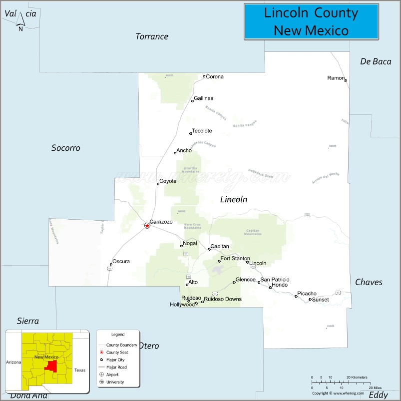
| Seat: | Carrizozo |
| Total Area: | 4,831 sq mi (12,510 km²) |
| Land Area: | 4,831 sq mi (12,510 km²) |
| Total Population: | 20,436 |
| Population Density: | 4.2/sq mi (1.6/km²) |
| Time zone: | UTC−7 (Mountain) |
| Summer Time Zone (DST): | UTC−6 (MDT) |
| Website: | www.lincolncountynm.gov |
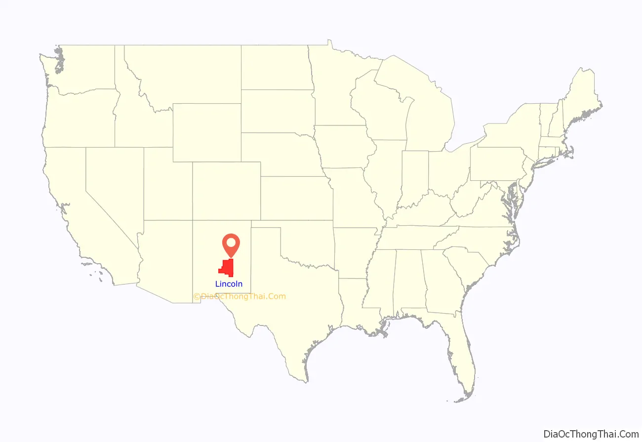
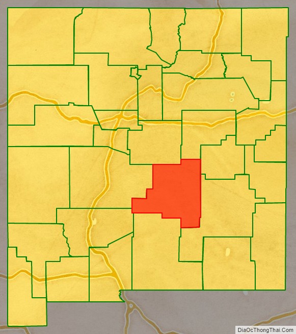
Lincoln County location map. Where is Lincoln County?
History
Lincoln County was named in honor of President Abraham Lincoln. It was once the largest county in the United States. In the late 1870s the Lincoln County War began between ranchers and the owners of the county’s largest general store. William Bonney, better known as Billy the Kid, became involved on the side of the ranchers after his friend and employer was killed. In the end, Bonney killed the county sheriff, a deputy, and the deputy that killed his friend. Several other people were slain in the conflict, which included the other leader of the rancher faction. His death ended the conflict. In 1878, the new territorial governor, retired Union General Lew Wallace, offered amnesty to the combatants to bring a long-lasting truce between the factions.
Most of the population is in the Greater Ruidoso Area. The town of Carrizozo serves as the county seat and is in the Tularosa Basin northwest of Ruidoso. Ruidoso boasts several small suburbs and neighbor communities including Ruidoso Downs, Hollywood, Mescalero, and Alto which contribute to the Ruidoso Micropolitan Statistical Area’s population of 21,224. Ruidoso serves as the second largest city in south central New Mexico behind Alamogordo which is 46 miles southwest of the village. Ruidoso Downs on the southern end of the county and southeast of Ruidoso operates the Ruidoso Downs Racetrack and Casino. The track hosts both thoroughbred and quarter horse racing, notably the All American Futurity, the richest in quarter horse racing. Historical figures from Lincoln County include Billy the Kid and Smokey Bear, whose names help drive the tourism trade that is heavily popularized within the county.
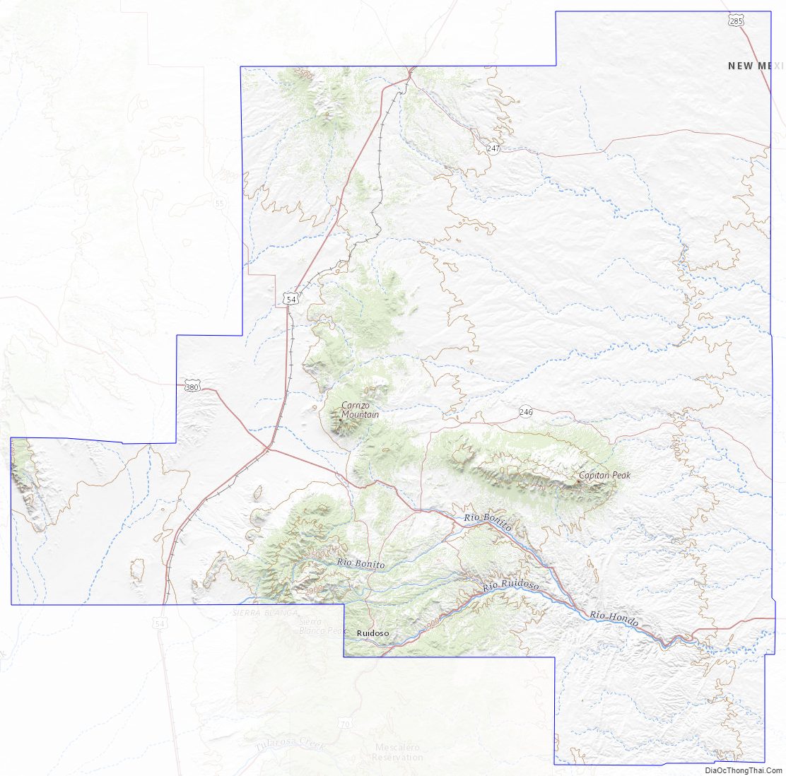
Lincoln County Road Map
Geography
According to the U.S. Census Bureau, the county has a total area of 4,831 square miles (12,510 km), virtually all of which is land.
Adjacent counties
- Torrance County – north
- Guadalupe County – north
- De Baca County – northeast
- Chaves County – east
- Otero County – south
- Sierra County – southwest
- Socorro County – west
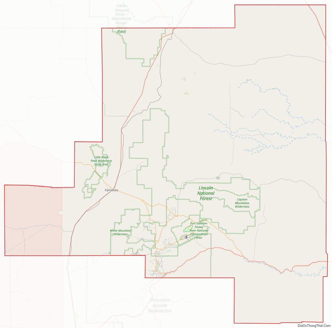
National protected areas
- Cibola National Forest (part)
- Fort Stanton – Snowy River Cave National Conservation Area
- Lincoln National Forest (part)
Lincoln County Topographic Map
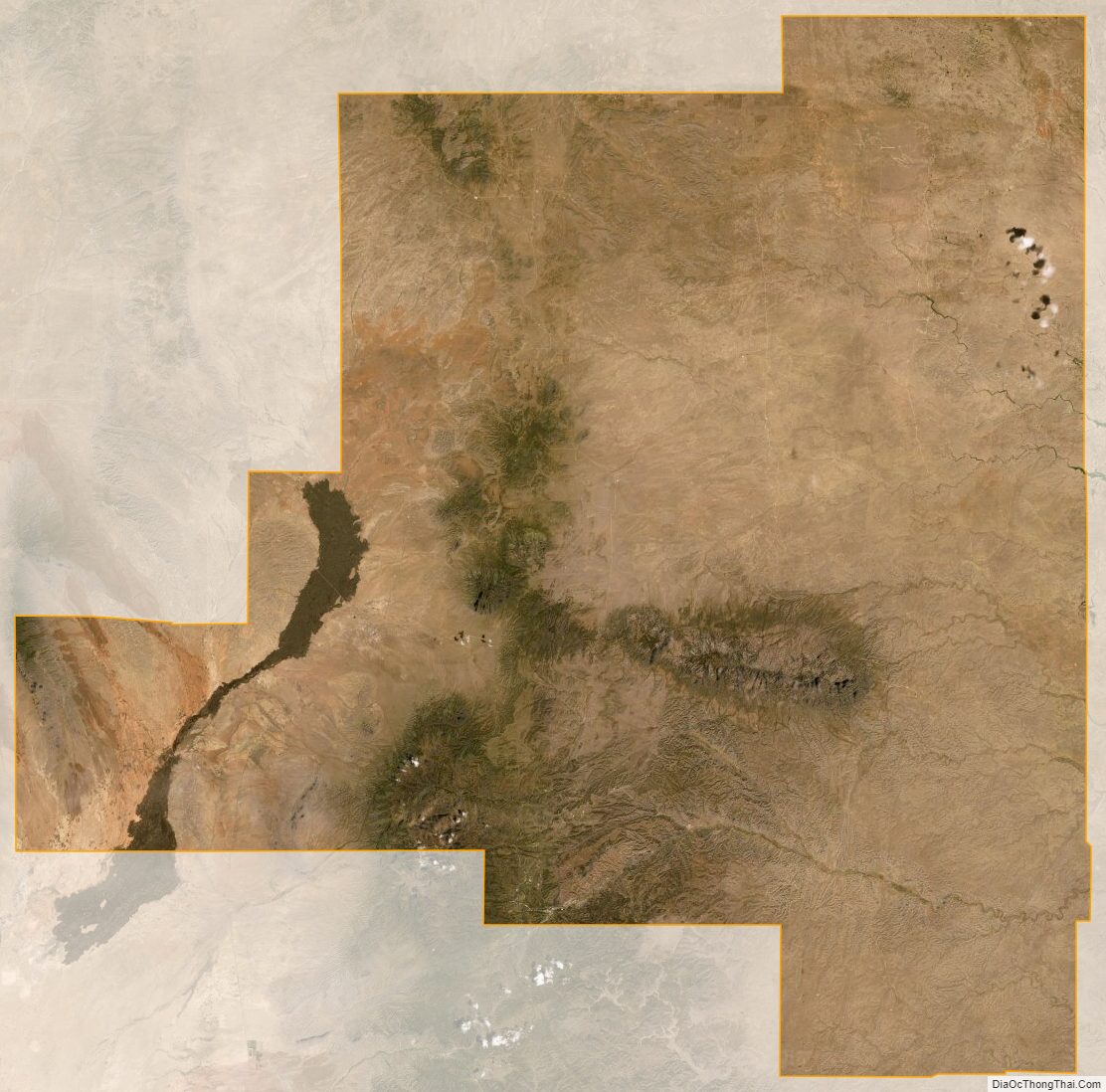
Lincoln County Satellite Map
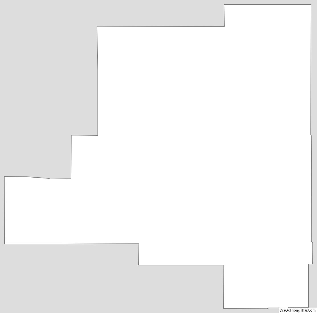
Lincoln County Outline Map
See also
Map of New Mexico State and its subdivision: Map of other states:- Alabama
- Alaska
- Arizona
- Arkansas
- California
- Colorado
- Connecticut
- Delaware
- District of Columbia
- Florida
- Georgia
- Hawaii
- Idaho
- Illinois
- Indiana
- Iowa
- Kansas
- Kentucky
- Louisiana
- Maine
- Maryland
- Massachusetts
- Michigan
- Minnesota
- Mississippi
- Missouri
- Montana
- Nebraska
- Nevada
- New Hampshire
- New Jersey
- New Mexico
- New York
- North Carolina
- North Dakota
- Ohio
- Oklahoma
- Oregon
- Pennsylvania
- Rhode Island
- South Carolina
- South Dakota
- Tennessee
- Texas
- Utah
- Vermont
- Virginia
- Washington
- West Virginia
- Wisconsin
- Wyoming