Logan County (formerly Sarber County) is a county located in the U.S. state of Arkansas. As of the 2020 census, the population was 21,131. Its two county seats are Booneville and Paris.
| Name: | Logan County |
|---|---|
| FIPS code: | 05-083 |
| State: | Arkansas |
| Founded: | March 22, 1871 |
| Named for: | James Logan |
| Seat: | Paris (northern district); Booneville (southern district) |
| Largest city: | Booneville |
| Total Area: | 732 sq mi (1,900 km²) |
| Land Area: | 708 sq mi (1,830 km²) |
| Total Population: | 21,131 |
| Population Density: | 29/sq mi (11/km²) |
| Time zone: | UTC−6 (Central) |
| Summer Time Zone (DST): | UTC−5 (CDT) |
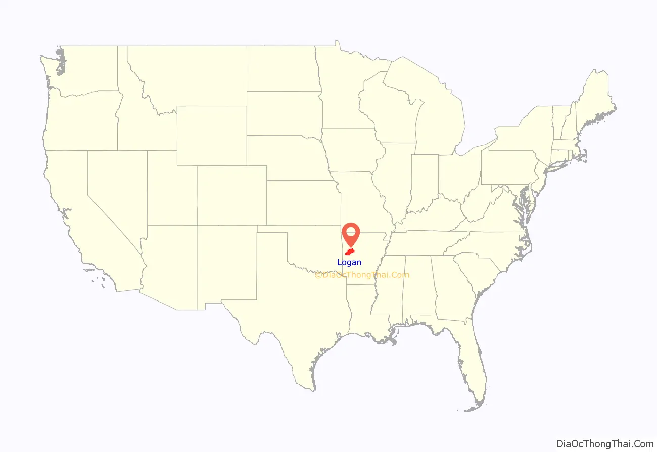
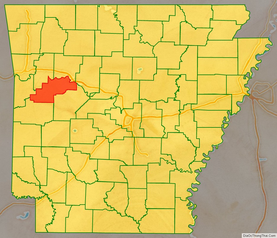
Logan County location map. Where is Logan County?
History
The Arkansas General Assembly defined the state’s 64th county on March 22, 1871, incorporating parts of Scott, Yell, and Pope counties (later adding part of Franklin County). They named it Sarber County for John Newton Sarber (1837–1905), an attorney and Republican state senator from Yell County. He had introduced the resolution to organize the county. Born and reared in Pittsburgh, Pennsylvania, he had moved with his widowed father and family to Kansas in 1855. Sarber became influential in the Arkansas legislature, introducing bills to establish a public school system for the first time, and what developed as the University of Arkansas. In 1873, Sarber was appointed U.S. marshal of the U.S. Western District Court at Fort Smith.
Conservative white Democrats viewed Sarber as a carpetbagger because he was a Union Army veteran who had decided to settle in Arkansas. There he had married Susan Rebecca Rose in 1867. She was the daughter of Moreau Rose, an early pioneer and a Confederate supporter, and his wife. The Sarber couple had six children together; five survived to adulthood.
After white Democrats regained control of the state legislature in 1875, they renamed Sarber County for James Logan (1792-1859), a Kentucky-born early settler in the area who had served in the territorial legislature, from Crawford County, and the first state legislature, from Scott County (part of the latter was absorbed into Logan County).
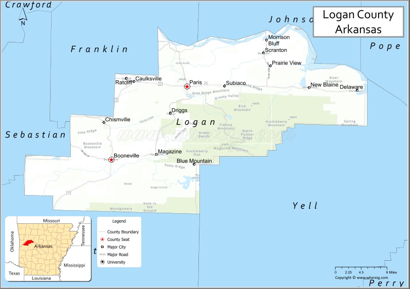
Logan County Road Map

Geography
According to the U.S. Census Bureau, the county has a total area of 732 square miles (1,900 km), of which 708 square miles (1,830 km) are land and 23 square miles (60 km) (3.2%) are water. The highest natural point in Arkansas, Magazine Mountain at 2,753 feet (839 m), is located in Logan County.
Major highways
- Highway 10
- Highway 22
- Highway 23
- Highway 60
- Highway 309
Adjacent counties
- Johnson County (north)
- Pope County (northeast)
- Yell County (southeast)
- Scott County (south)
- Sebastian County (west)
- Franklin County (northwest)
Logan County Topographic Map
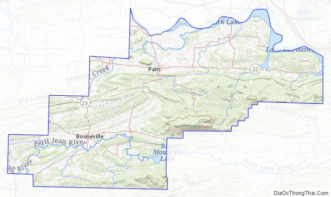
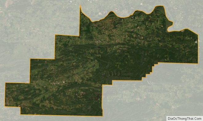
Logan County Satellite Map
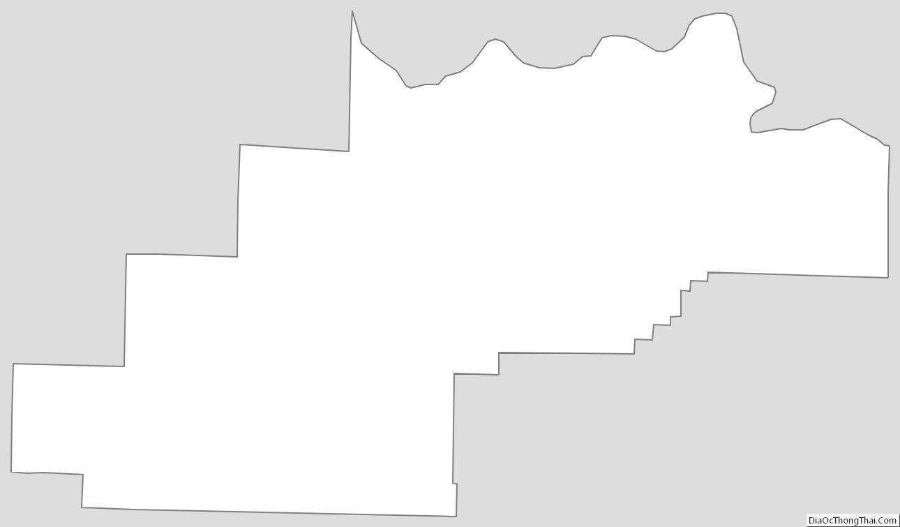
Logan County Outline Map
See also
Map of Arkansas State and its subdivision:- Arkansas
- Ashley
- Baxter
- Benton
- Boone
- Bradley
- Calhoun
- Carroll
- Chicot
- Clark
- Clay
- Cleburne
- Cleveland
- Columbia
- Conway
- Craighead
- Crawford
- Crittenden
- Cross
- Dallas
- Desha
- Drew
- Faulkner
- Franklin
- Fulton
- Garland
- Grant
- Greene
- Hempstead
- Hot Spring
- Howard
- Independence
- Izard
- Jackson
- Jefferson
- Johnson
- Lafayette
- Lawrence
- Lee
- Lincoln
- Little River
- Logan
- Lonoke
- Madison
- Marion
- Miller
- Mississippi
- Monroe
- Montgomery
- Nevada
- Newton
- Ouachita
- Perry
- Phillips
- Pike
- Poinsett
- Polk
- Pope
- Prairie
- Pulaski
- Randolph
- Saint Francis
- Saline
- Scott
- Searcy
- Sebastian
- Sevier
- Sharp
- Stone
- Union
- Van Buren
- Washington
- White
- Woodruff
- Yell
- Alabama
- Alaska
- Arizona
- Arkansas
- California
- Colorado
- Connecticut
- Delaware
- District of Columbia
- Florida
- Georgia
- Hawaii
- Idaho
- Illinois
- Indiana
- Iowa
- Kansas
- Kentucky
- Louisiana
- Maine
- Maryland
- Massachusetts
- Michigan
- Minnesota
- Mississippi
- Missouri
- Montana
- Nebraska
- Nevada
- New Hampshire
- New Jersey
- New Mexico
- New York
- North Carolina
- North Dakota
- Ohio
- Oklahoma
- Oregon
- Pennsylvania
- Rhode Island
- South Carolina
- South Dakota
- Tennessee
- Texas
- Utah
- Vermont
- Virginia
- Washington
- West Virginia
- Wisconsin
- Wyoming