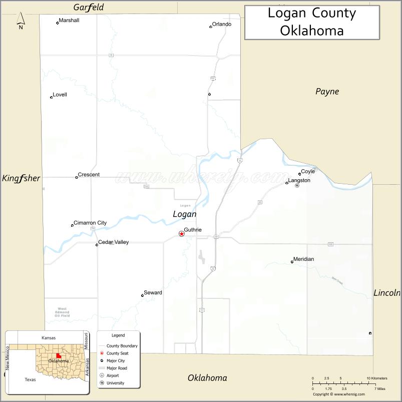
Logan County is a county located in the U.S. state of Oklahoma. As of the 2010 census, the population was 41,848. Its county seat is Guthrie.
Logan County is part of the Oklahoma City, OK Metropolitan Statistical Area. Guthrie served as the capital of Oklahoma Territory from 1890 until 1907 and of the state of Oklahoma from 1907 until 1910.
| Name: | Logan County |
|---|---|
| FIPS code: | 40-083 |
| State: | Oklahoma |
| Founded: | 1890 |
| Named for: | John A. Logan |
| Seat: | Guthrie |
| Largest city: | Guthrie |
| Total Area: | 749 sq mi (1,940 km²) |
| Land Area: | 744 sq mi (1,930 km²) |
| Total Population: | 41,848 |
| Population Density: | 56/sq mi (22/km²) |
| Time zone: | UTC−6 (Central) |
| Summer Time Zone (DST): | UTC−5 (CDT) |
| Website: | www.logancountyok.com |
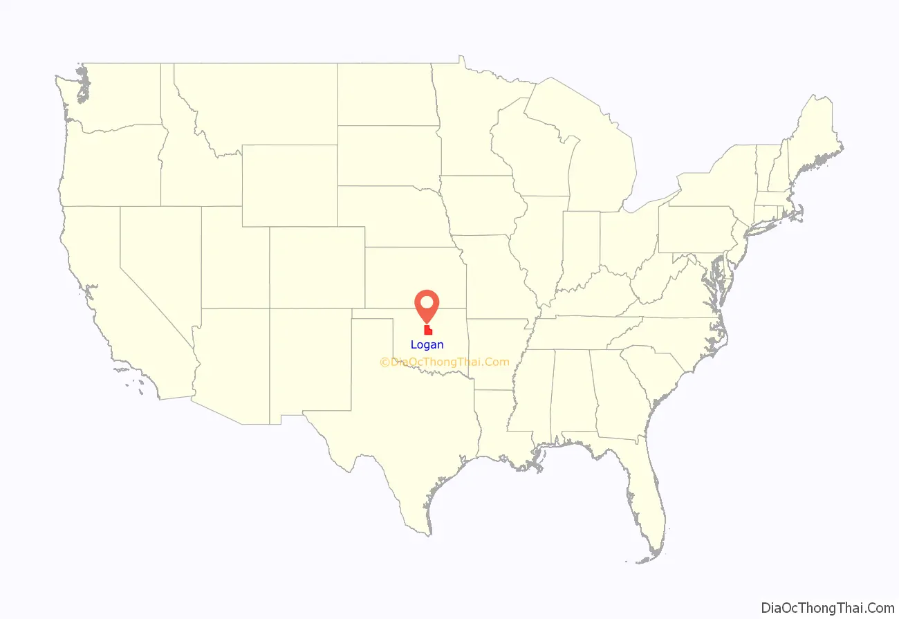
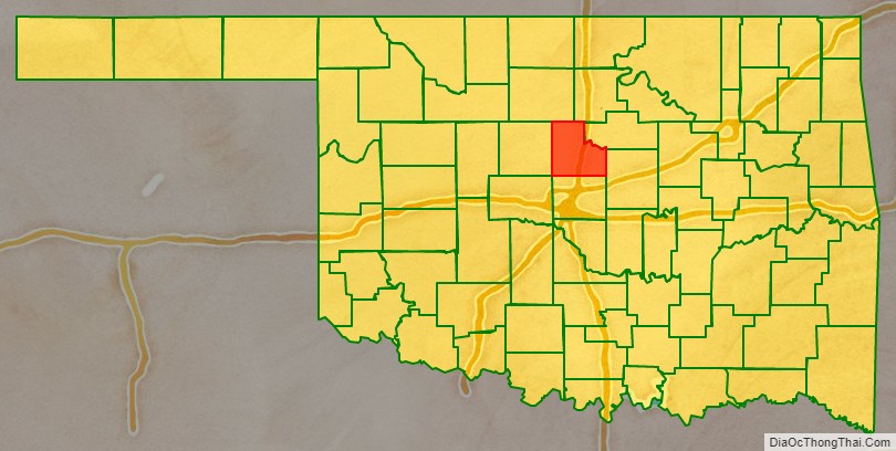
Logan County location map. Where is Logan County?
History
Following the Oklahoma Organic Act of 1890, which established the Oklahoma Territory, Logan County was designated as County One, of the six counties created out of Unassigned Lands. The town of Guthrie was designated as the county seat and the capital of Oklahoma Territory. The county was named on August 5, 1890, for U. S. Senator, John A. Logan, of Illinois.
The land in what became Logan County had been settled during the 1820s and 1830s by the Creek and Seminole tribes after the forced Indian Removal by the federal government from their traditional historic territories in the American Southeast. These tribes supported the Confederate States of America during the Civil War, in part based on the CSA promise of an American Indian state if they won. The United States required the tribes that supported the Confederacy to make new Reconstruction Treaties in 1866.
As part of the treaties, the US reduced the lands of these tribes, designating certain areas as Unassigned Lands. This 2 million-acre area was reserved for years after the war as potential reservation lands for the Plains tribes, who were mostly settled in other areas. Congress passed a law in 1889, after the Indian Wars, to open the land to non-Indian settlement under terms of the 1862 Homestead Act. The land rush (or run) took place on April 22, 1889, whereby people rushed to establish homestead plots.
The three easternmost townships were added to the county in 1891, after areas of the Sac and Fox lands were also opened to non-Indian settlement, following allotment of communal lands to individual tribal households under implementation of the Dawes Act. This law resulted in massive losses of Indian land. The US classified lands remaining after allotment as “surplus” and allowed them to be sold to non-Natives.
Before 1889, the Kansas Southern Railway (later the Atchison, Topeka and Santa Fe Railway) had built a line from the Kansas-Oklahoma border to Purcell in Indian Territory. Stations built in the present Logan County were Beaver Creek (now Mulhall, Oklahoma) and Deer Creek (now Guthrie). After the land run, Guthrie, Oklahoma developed into a center of trade for the county and region, connected by railroads to other markets.
The Denver, Enid and Gulf Railroad (later the Atchison, Topeka and Santa Fe) ran from Guthrie to Enid, Oklahoma. The Choctaw, Oklahoma and Western Railroad (later the Chicago, Rock Island and Pacific Railway) ran between Guthrie and Chandler, Oklahoma, while the Missouri, Kansas and Texas Railroad ran east from Guthrie to Fallis, Oklahoma. From 1916 to 1944, the Oklahoma Railway Company interurban line ran between Guthrie and Oklahoma City.
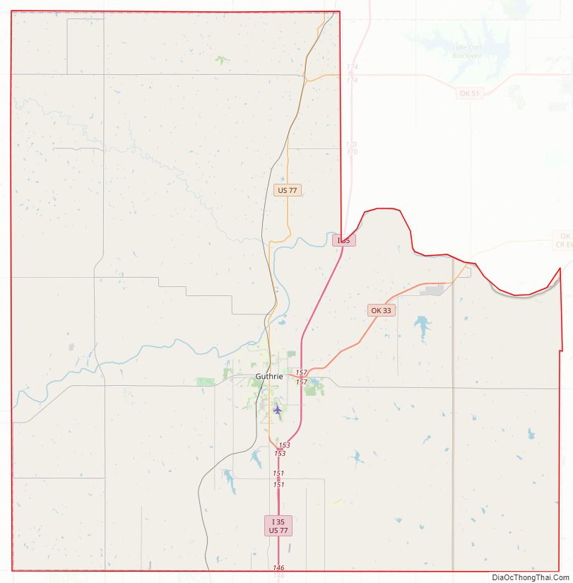
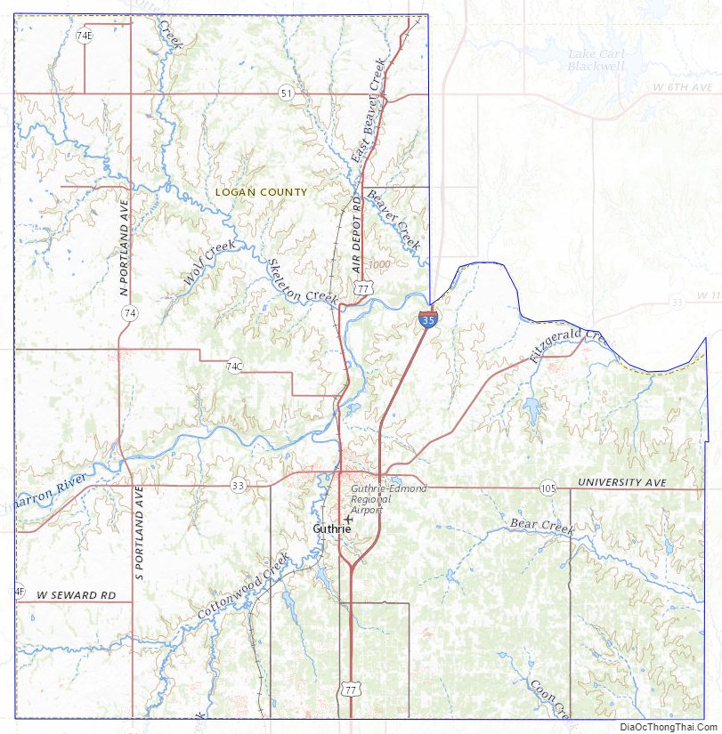
Logan County Road Map
Geography
According to the U.S. Census Bureau, the county has a total area of 749 square miles (1,940 km), of which 744 square miles (1,930 km) is land and 5.0 square miles (13 km) (0.7%) is water. The county lies in the Red Bed Plains physiographic area. It is drained by the Cimarron River and the smaller streams Cottonwood Creek and Ephraim Creek.
Major highways
- Interstate 35
- U.S. Highway 77
- State Highway 33
- State Highway 51
- State Highway 74
- State Highway 74C
- State Highway 105
Adjacent counties
- Garfield County (north)
- Noble County (north)
- Payne County (northeast)
- Lincoln County (east)
- Oklahoma County (south)
- Kingfisher County (west)
Logan County Topographic Map
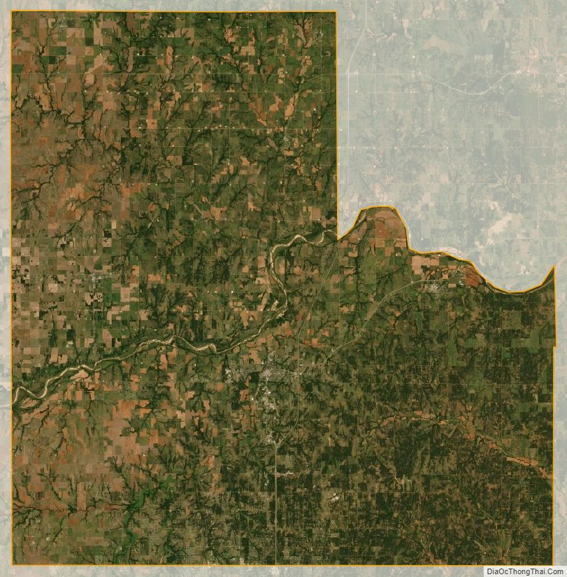
Logan County Satellite Map
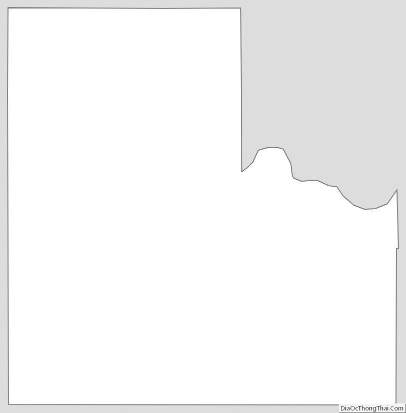
Logan County Outline Map
See also
Map of Oklahoma State and its subdivision:- Adair
- Alfalfa
- Atoka
- Beaver
- Beckham
- Blaine
- Bryan
- Caddo
- Canadian
- Carter
- Cherokee
- Choctaw
- Cimarron
- Cleveland
- Coal
- Comanche
- Cotton
- Craig
- Creek
- Custer
- Delaware
- Dewey
- Ellis
- Garfield
- Garvin
- Grady
- Grant
- Greer
- Harmon
- Harper
- Haskell
- Hughes
- Jackson
- Jefferson
- Johnston
- Kay
- Kingfisher
- Kiowa
- Latimer
- Le Flore
- Lincoln
- Logan
- Love
- Major
- Marshall
- Mayes
- McClain
- McCurtain
- McIntosh
- Murray
- Muskogee
- Noble
- Nowata
- Okfuskee
- Oklahoma
- Okmulgee
- Osage
- Ottawa
- Pawnee
- Payne
- Pittsburg
- Pontotoc
- Pottawatomie
- Pushmataha
- Roger Mills
- Rogers
- Seminole
- Sequoyah
- Stephens
- Texas
- Tillman
- Tulsa
- Wagoner
- Washington
- Washita
- Woods
- Woodward
- Alabama
- Alaska
- Arizona
- Arkansas
- California
- Colorado
- Connecticut
- Delaware
- District of Columbia
- Florida
- Georgia
- Hawaii
- Idaho
- Illinois
- Indiana
- Iowa
- Kansas
- Kentucky
- Louisiana
- Maine
- Maryland
- Massachusetts
- Michigan
- Minnesota
- Mississippi
- Missouri
- Montana
- Nebraska
- Nevada
- New Hampshire
- New Jersey
- New Mexico
- New York
- North Carolina
- North Dakota
- Ohio
- Oklahoma
- Oregon
- Pennsylvania
- Rhode Island
- South Carolina
- South Dakota
- Tennessee
- Texas
- Utah
- Vermont
- Virginia
- Washington
- West Virginia
- Wisconsin
- Wyoming